Visit Logged
  • Select Region
    • All Regions
    • VA to NC Line
    • North Carolina
    • South Carolina
    • Georgia
    • Eastern Florida
    • Western Florida
    • Florida Keys
    • Okeechobee Waterway
    • Northern Gulf
    • Bahamas
    • New York
    • Ohio
    • Pennsylvania
    • Washington
    • Puerto Rico
    • Minnesota
    • Maryland
    Order by:
    • LNM: near AICW MM 293 Inlet Buoys 3 and 4 relocated, Carolina Beach Inlet, NC

      united states coast guard

      1. THE FOLLOWING AIDS TO NAVIGATION HAVE BEEN RELOCATED.
      A. CAROLINA BEACH INLET BUOY 3 (LLNR 30275 [34°4.9404N / 077°51.9389W, 34.082340 / -77.865649]) RELOCATED TO APPROXIMATE POSITION: 34-04-52.151N, 077-52-03.792W (34°4.8692N / 077°52.0632W, 34.081153 / -77.867720) .
      B. CAROLINA BEACH INLET BUOY 4 (LLNR 30280 [34°4.9428N / 077°51.9928W, 34.082380 / -77.866546]) RELOCATED TO APPROXIMATE POSITION: 34-04-52.707N 077-52-01.290W (34°4.8785N / 077°52.0215W, 34.081308 / -77.867025) .

      Be the first to comment!

    • LNM: AICW MM 293 ICW Buoys 154, 154A and 155 Relocated Post Dredging, Carolina Beach Inlet, NC


      united states coast guard

      1. THE FOLLOWING AIDS TO NAVIGATION HAVE BEEN RELOCATED POST DREDGE OPERATIONS.
      A. NEW RIVER – CAPE FEAR RIVER BUOY 154 (LLNR 39725 [34°4.8929N / 077°52.9858W, 34.081549 / -77.883097]) RELOCATED TO APPROXIMATE POSITION: 34-04-53.545N 077-52-57.615W (34°4.8924N / 077°52.9603W, 34.081540 / -77.882671) . 
      B. NEW RIVER – CAPE FEAR RIVER BUOY 154A (LLNR 39726 [34°4.6486N / 077°53.0776W, 34.077476 / -77.884626]) RELOCATED TO APPROXIMATE POSITION: 34-04-45.782N 077-53-00.118W (34°4.7630N / 077°53.0020W, 34.079384 / -77.883366) .
      C. NEW RIVER – CAPE FEAR RIVER BUOY 155 (LLNR 39730 [34°4.8279N / 077°52.9620W, 34.080465 / -77.882700]) RELOCATED TO APPROXIMATE POSITION: 34-04-50.760N 077-52-56.341W (34°4.8460N / 077°52.9390W, 34.080767 / -77.882317) .

      Be the first to comment!

    • LNM: near AICW MM 277 Buoys 1 and 2 Discontinued, Bogue Inlet, NC


      united states coast guard

      1. THE FOLLOWING AIDS TO NAVIGATION HAVE BEEN TEMPORALLY DISCONTINUED DUE TO SHOALING CREATING A MISLEADING SIGNAL.
      2. BOGUE INLET LIGHTED BUOY 1 (LLNR 29495 [34°38.1686N / 077°5.8333W, 34.636143 / -77.097222]) TEMPORALLY DISCONTINUED.
      3. BOGUE INLET LIGHTED BUOY 2 (LLNR 29500 [34°38.7637N / 077°6.3683W, 34.646061 / -77.106138]) TEMPORALLY DISCONTINUED.

      Be the first to comment!

    • LNM: near AICW MM 277 Severe Shoaling, Bogue Inlet, NC


      united states coast guard

      BOGUE INLET CHANNEL CURRENTLY UNRELIABLE FROM BOGUE INLET LB 1 (LLNR 29495 [34°38.1686N / 077°5.8333W, 34.636143 / -77.097222]) TO BOGUE INLET LB 6 (LLNR 29585 [34°39.0461N / 077°6.9216W, 34.650768 / -77.115360]). MUTIPLE AIDS TO NAVIGATION IN WATERWAY RPTD MISSING OR OFF STATION DUE TO HEAVY SEAS AND HIGH WINDS. SEVERE AND SHIFTING SHOALING HAS BEEN REPORTED BY STA EMERALD ISLE THROUGHOUT INLET WITH WATER DEPTH AS LOW AS 2′.

      Be the first to comment!

    • LNM: AICW MM 280 ICW ATONS Relocated due to Shoaling, ICW/Mason Inlet Intersection, NC


      united states coast guard

      1. THE FOLLOWING AIDS TO NAVIGATION HAVE BEEN RELOCATED DUE TO SHOALING.
      A. NEW RIVER – CAPE FEAR RIVER BUOY 121 (LLNR 39597 [34°14.9771N / 077°46.9355W, 34.249618 / -77.782258]) RELOCATED TO APPROXIMATE POSITION: 34-15-02.929N, 077-46-52.391W (34°15.0488N / 077°46.8732W, 34.250814 / -77.781220) .
      B. NEW RIVER – CAPE FEAR RIVER BUOY 121A (LLNR 39598 [34°14.9396N / 077°46.9676W, 34.248994 / -77.782794]) RELOCATED TO APPROXIMATE POSITION: 34-14-56.124N, 077-46-58.644W (34°14.9354N / 077°46.9774W, 34.248923 / -77.782957) .
      C. NEW RIVER – CAPE FEAR RIVER BUOY 122 (LLNR 39601 [34°14.9677N / 077°46.9777W, 34.249461 / -77.782961]) RELOCATED TO APPROXIMATE POSITION: 34-15-05.930N, 077-46-50.721W (34°15.0988N / 077°46.8454W, 34.251647 / -77.780756) .

      Be the first to comment!

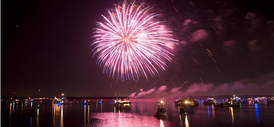
    • Wrightsville Beach Holiday Flotilla and Fireworks, Nov 26, 6:00 PM, AICW NC Statute Mile 283


      The Waterway’s path through Wrightsville Beach is a narrow congested channel, so caution must be exercised during these dark hours, especially in vicinity of spectator boats.


      Click here for  Wrightsville Beach Holiday Flotilla and Fireworks, Nov 26, 6:30-8:30 PM, AICW NC Statute Mile 283
      luminanews.com

      Be the first to comment!

    • Carolina Beach State Park Marina, AICW MM 297, Snows Cut, NC


      The entrance channel to Carolina Beach State Park marina cuts off southward from the AICW, at the western end of Snows Cut, between markers #163 and #165. Our thanks to Dave Rowe,  AboardStinkpot.com, for this review and recommendation.

      For the budget conscious boater, or one who loves a natural park setting, Carolina Beach State Park Marina is for you! Miles of wooded trails and one of the only spots on earth to spot a Venus Fly Trap in the wild. $30 flat fee for dockage includes power and water. This is the perfect place to hole up and relax while waiting for a favorable current on the Cape Fear River or Snow’s Cut. Choice of grocery stores and a pharmacy under a mile and a half away.

      Photos by Dave Rowe, AboardStinkpot.com

      Comments from Cruisers (1)

      1. Phil Barbalace -  October 21, 2022 - 1:17 pm

        I second everything in the article. We live nearby. A great resource for local and visiting boaters. Usually has good fuel prices compared to others in the area but check first.

        Reply to Phil
    • LNM: near AICW MM 294 Inlets ATONs Relocated, Carolina Beach Inlet, NC

      united states coast guard

      1. THE FOLLOWING AIDS TO NAVIGATION HAVE BEEN RELOCATED TO MARK BEST WATER.
      A. CAROLINA BEACH INLET BUOY 1 (LLNR 30265 [34°4.8332N / 077°51.7038W, 34.080553 / -77.861730]) RELOCATED DUE TO APPROXIMATE POSITION 34-04-52.681N 077-51-43.064W (34°4.8780N / 077°51.7177W, 34.081300 / -77.861962) .
      B. CAROLINA BEACH INLET BUOY 2 (LLNR 30270 [34°4.9112N / 077°51.7151W, 34.081854 / -77.861919]) RELOCATED DUE TO APPROXIMATE POSITION 34-04-54.164N 077-51-43.252W (34°4.9027N / 077°51.7208W, 34.081712 / -77.862014) .
      C. CAROLINA BEACH INLET BUOY 3 (LLNR 30275 [34°4.9340N / 077°52.0313W, 34.082233 / -77.867189]) RELOCATED DUE TO APPROXIMATE POSITION 34-04-55.265N 077-51-59.067W (34°4.9211N / 077°51.9844W, 34.082018 / -77.866407) .
      D. CAROLINA BEACH INLET BUOY 5 (LLNR 30285 [34°4.9558N / 077°52.4033W, 34.082597 / -77.873389]) RELOCATED DUE TO APPROXIMATE POSITION 34-04-57.617N 077-52-26.132W (34°4.9603N / 077°52.4356W, 34.082671 / -77.873926) .
      E. CAROLINA BEACH INLET BUOY 6 (LLNR 30290 [34°4.9769N / 077°52.1887W, 34.082949 / -77.869812]) RELOCATED DUE TO APPROXIMATE POSITION 34-04-58.402N 077-52-29.135W (34°4.9733N / 077°52.4856W, 34.082889 / -77.874760) .
      F. CAROLINA BEACH INLET BUOY 7 (LLNR 30295 [34°4.9364N / 077°52.5247W, 34.082273 / -77.875412]) RELOCATED DUE TO APPROXIMATE POSITION 34-04-51.816N 077-52-36.454W (34°4.8636N / 077°52.6076W, 34.081060 / -77.876793) .
      G. CAROLINA BEACH INLET BUOY 8 (LLNR 30300 [34°4.9768N / 077°52.4621W, 34.082946 / -77.874369]) RELOCATED DUE TO APPROXIMATE POSITION 34-04-46.954N 077-52-46.676W (34°4.7825N / 077°52.7779W, 34.079709 / -77.879632) .

      Be the first to comment!

    • Yearlong Upgrades to Wrightsville Beach Bridge, AICW MM 283.1, Wrightsville Beach, NC


      These upgrades are certain to affect navigation at times. Check Cruisers Net Current Local Notices to Mariners for Notices when plotting your float plan. With a closed vertical clearance of 20ft, the Wrightsville Beach Bascule Bridge crosses the AICW at Statute Mile 283, southwest of marker #125.


      Wrightsville Beach bridge to undergo yearlong facelift
      CoastalReview.org


      Click Here To View the Cruisers Net North Carolina Bridge Directory Listing For SR 74 Bridge

      Click Here To Open A Chart View Window, Zoomed To the Location of SR 74 Bridge

      Comments from Cruisers (2)

      1. Todd Reynolds -  November 22, 2021 - 8:24 am

        Please clarify whether this construction affects the C. Heide Trask Memorial Bridge (opening bridge commonly known as the Wrightsville Beach Bridge). It only mentions the fixed portion of the Wrightsville Beach Bridge spanning Banks Channel and shouldn’t affect most Cruisers due to the fixed height at under 8 feet.

        Reply to Todd
        • Larry Dorminy -  November 22, 2021 - 11:35 am

          Todd is correct. This upgrade will be on the Banks Channel Bridge, not the Wrightsville Beach Bridge which crosses the AICW.
          THANK YOU TODD! This posting will be removed shortly.
          Editor Larry

          Reply to Larry
    • LNM: near AICW MM 270 Shoaling, Old Topsail Creek, New Topsail Inlet, NC


      Old Topsail Creek connects New Topsail Inlet with the Waterway at Mile 270. Buoys 1 and 2 are inshore, on the northeast side of the inlet. LLNRs given below are incorrect.


      THE SHOAL ADJACENT TO OLD TOPSAIL CREEK BUOYS 1(LLNR 30032 [34°20.7287N / 077°39.9956W, 34.345478 / -77.666594]) AND 2 (LLNR
      30033) HAS STARTED TO CLOSE OFF THE ENTERANCE TO THE CREEK. DEPTHS BETWEEN THE
      AIDS WAS OBSERVED TO 5 FT AND BELOW ACROSS THE ENTIRE CHANNEL. ALL MARINERS ARE ADVISED TO TRANSIT WITH EXTREME CAUTION.


      Be the first to comment!

    • LNM: AICW MM 270-280 Buoys 99, 99A, 121 and 121A Relocated, Middle Sound, NC


      These ICW buoys are on the southeast shoulder of the Waterway south of its intersection with Howards Creek.


      1. THE FOLLOWING AIDS TO NAVIGATION HAVE BEEN RELOCATED TO MARK BEST WATER.


      1. NEW RIVER – CAPE FEAR RIVER BUOY 99 (LLNR 39547 [34°21.5792N / 077°40.3919W, 34.359653 / -77.673199]) HAS BEEN RELOCATED TO POSITION 34-21-34.718N, 077-40-23.369W (34°21.5786N / 077°40.3895W, 34.359644 / -77.673158) .


      1. NEW RIVER – CAPE FEAR RIVER BUOY 99A (LLNR 39548 [34°21.2979N / 077°40.8884W, 34.354965 / -77.681474]) HAS BEEN RELOCATED TO POSITION 34-21-15.729N, 077-40-54.988W (34°21.2621N / 077°40.9165W, 34.354369 / -77.681941) .


      1. NEW RIVER – CAPE FEAR RIVER BUOY 121 (LLNR 39597 [34°15.0071N / 077°46.9064W, 34.250118 / -77.781774]) HAS BEEN RELOCATED TO POSITION 34-14-58.624N, 077-46-56.130W (34°14.9771N / 077°46.9355W, 34.249618 / -77.782258) .


      1. NEW RIVER – CAPE FEAR RIVER BUOY 121A (LLNR 39598 [34°14.9245N / 077°46.9776W, 34.248742 / -77.782960]) HAS BEEN RELOCATED TO POSITION 34-14-56.380N, 077-46.58(34°14.9396N / 077°46.5800W, 34.248994 / -77.776333) -057W.

      Be the first to comment!

    • NAV ALERT: LNM: AICW MM 280, Extreme Shoaling, Mason Inlet Intersection, NC


      This shoaling between these ICW buoys appears to be in the mouth of the Waterway’s intersection with Mason Inlet. Mid to high tide is recommended for passage in this intersection where shoaling and shifting channels are SOP.


      Mariners are advised that shoaling exists in the Atlantic Intracoastal Waterway in the vicinity of Mason Inlet Crossing between buoys 121 and 122A, to a depth of less than two feet at mean low water. Mariners are advised to use extreme caution while navigating this area.

      Be the first to comment!

    • Report and Photos of Snows Cut by Phil Kent and Karen Barbalace


      Our thanks to Phil and Karen for sharing their AGLCA Forum posting with our readers. Many of you will travel through Snows Cut at some point in your cruising lifetime. Mile long Snows Cut departs the coastal Waterway at the entrance to Carolina Beach and intersects Cape Fear River at Mile 296.


      Living on the ICW, it’s amazing the number of boats we see every day heading south for the winter. 20, 30 a day perhaps, and we only see some of them. Trawlers, sailboats, large yachts and other craft, a few with looper flags but mostly snowbirds. Most loopers know Snow’s Cut, a few miles south of us, as a tricky waterway that connects the Cape Fear River with the ICW at Carolina Beach.

      Though interesting, few good photos of this area exist. It’s difficult to get decent photos as you’re transiting it as you’re busy navigating a narrow, tricky channels with a 2 or 3 knot current. On a recent bike ride over the Snow’s Cut bridge, I took a few photos that might give our captains a good overview of the mile-long man-made cut.

      Phil & Karen Barbalace

      Helms Port

      Wilmington,NC

      Gold Loopers

      Phil Kent and Karen Barbalace

      Phil Kent and Karen Barbalace

      Phil Kent and Karen Barbalace


      Comments from Cruisers (1)

      1. Winston Fowler -  November 6, 2020 - 3:39 pm

        Thanks for the great photos… Pictures are certainly worth a thousand words.

        Reply to Winston

    Social Media Auto Publish Powered By : XYZScripts.com