AIWA March 2022 Newsletter
|


 ️
️
|
IPCC is the United Nations body that looks at climate change science.
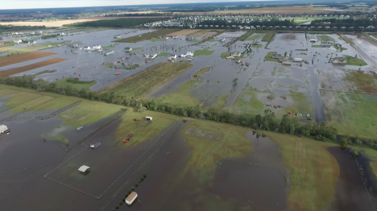
Aerial view of the flooding in Moyock during Hurricane Matthew. Photo: Currituck County
World must act now to slow global warming: report
CoastalReview.org
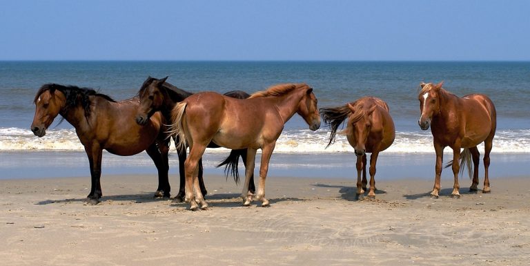
Shackleford Banks is a barrier island running roughly east/west between Cape Lookout and Beaufort Inlet.
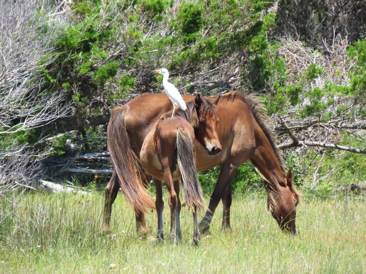
121 horses on Shackleford Banks at end of 2021: report
CoastalReview.org

Pamlico River enters the northwest shore of Pamlico Sound and is home to Washington City Docks, A CRUISERS NET SPONSOR.

Leesa Jones is dressed as an enslaved person of the 19th century as she tells the story of the Underground Railroad and Washington at the museum where she is executive director. Photo: Kip Tabb
Click here for For some, Pamlico River was part of underground railroad by Kip Tabb
CoastalReview.org
Click Here To Open A Chart View Window, Zoomed To the Location of the Washington City Docks

A different perspective of the ICW by friends from across the pond, this report covers the ICW from Albemarle Sound to Virginia, including the Dismal Swamp Canal where the Welcome Center, A CRUISERS NET SPONSOR, keeps watch over cruisers.

Exploring the Atlantic Intracoastal Waterway
Yachting Monthly, Katy Stickland
I don’t have a problem going “outside” when transiting the East Coast. But there is one section I won’t do outside—the Outer Banks. See Grounded Vessel Afloat Again, Ocracoke Island, NC. Our thanks to Peter Swanson for sharing his knowledge.
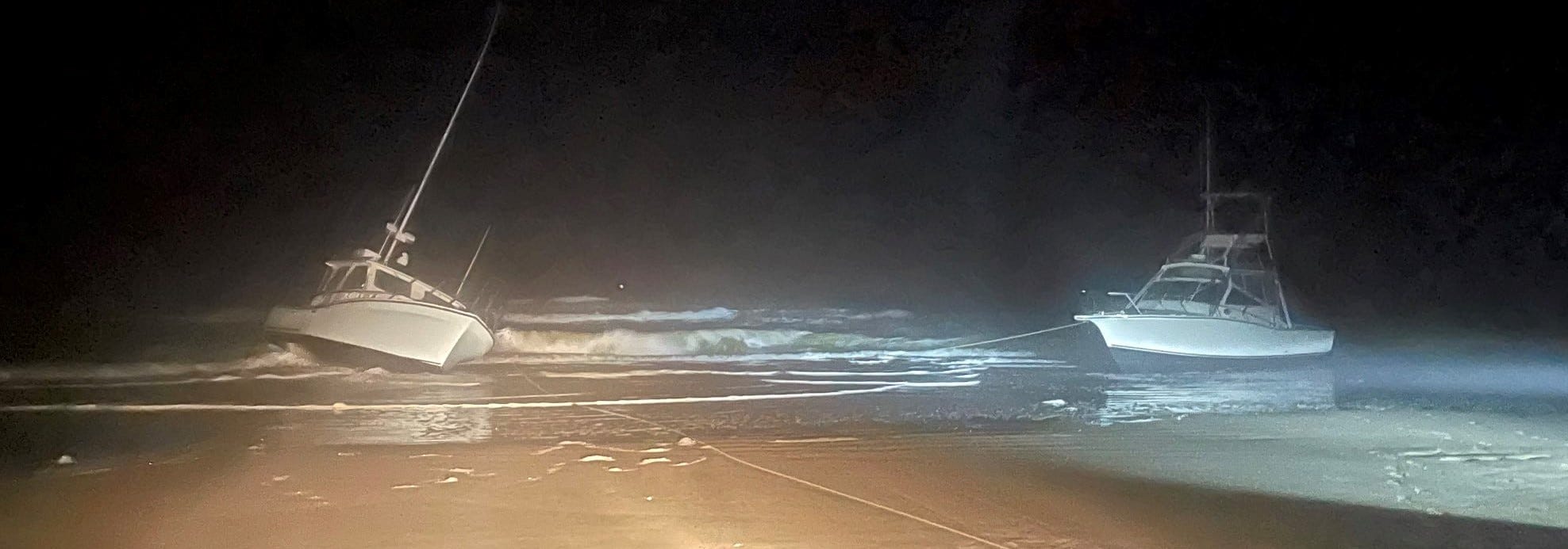
A week after Vivens Aqua went aground, two buddy-boating recreational fishing vessels—Bite Me and Reel Lucky—suffered the same fate on another Outer Banks beach. Their owners had become disoriented in fog.
Whistling Past the Hatteras Graveyard
from Loose Cannon by Peter Swanson
BOTH VESSELS HAVE RADAR MOUNTED.
This channel buoy is the east side of the channel connecting the Inlet with the maintained channel into Hatteras Village.
THE FOLLOWING AID TO NAVIGATION HAS BEEN ESTABLISHED.
Few coastal visitors know that the secluded hammock of Davis Ridge was once home to an extraordinary community founded by liberated slaves.
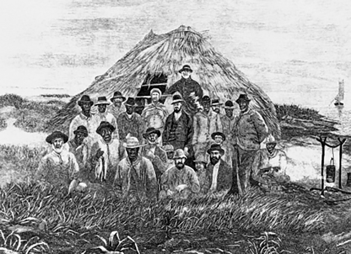
Mullet fishing camp at Shackleford Banks, near Beaufort, circa 1875-80. From George Brown Goode, ed., The Fisheries and Fishery Industries of the United States, (Washington, D.C.: Commission of Fish and Fisheries, 1884-87), sec. 5, vol. 2.
Our coast’s people: Last daughter of Davis Ridge
CoastalReview.org
|
|
|
The Outer Banks county has a rich history of agriculture, political leadership and intriguing people, writes historian Eric Medlin.
Currituck County: More than a vacation destination
CoastalReview.org
The sea robin is one weird-looking fish.
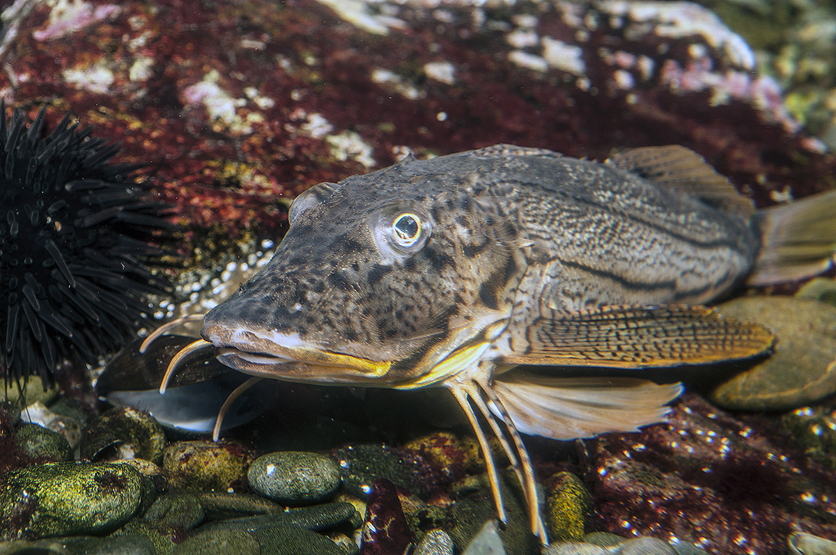
A striped sea robin. Photo: Robert Michelson
What’s on the line? It’s a bird, it’s a plane — it’s a sea robin
CoastalReview.org
Historian David Cecelski illustrates with a series of photographs life in 1930s and 1940s fishing communities as well as the man who took the photos, Charles Farrell.
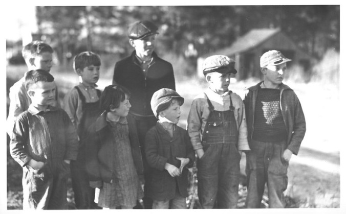
Manns Harbor, 1937-39. Photo: Charles A. Farrell, courtesy, State Archives of North Carolina
Lost photographs: Remembering NC’s fishing communities
This ICW light is on the north side of the Waterway’s passage through Morehead City Harbor.
| BOGUE SOUND LT 2 (LLNR 38630 [34°42.7728N / 076°42.8976W, 34.712880 / -76.714960]) RPTD DESTROYED. |
AREA SPONSORING MARINA
Click Here To Open A Chart View Window, Zoomed To the Location of Morehead City Yacht Basin
Cape Lookout National Seashore has been certified as a Dark Sky Place, the first in the National Park Service on the Atlantic coast to receive this certification. The popular Cape Lookout Bight anchorage is practically in the shadow of Cape Lookout Lighthouse. In rough offshore weather, cruisers with shallow draft may choose to access the anchorage via Taylor Creek and Barden Inlet which separates Shackleford Banks and Core Banks. See Dark Sky Park.
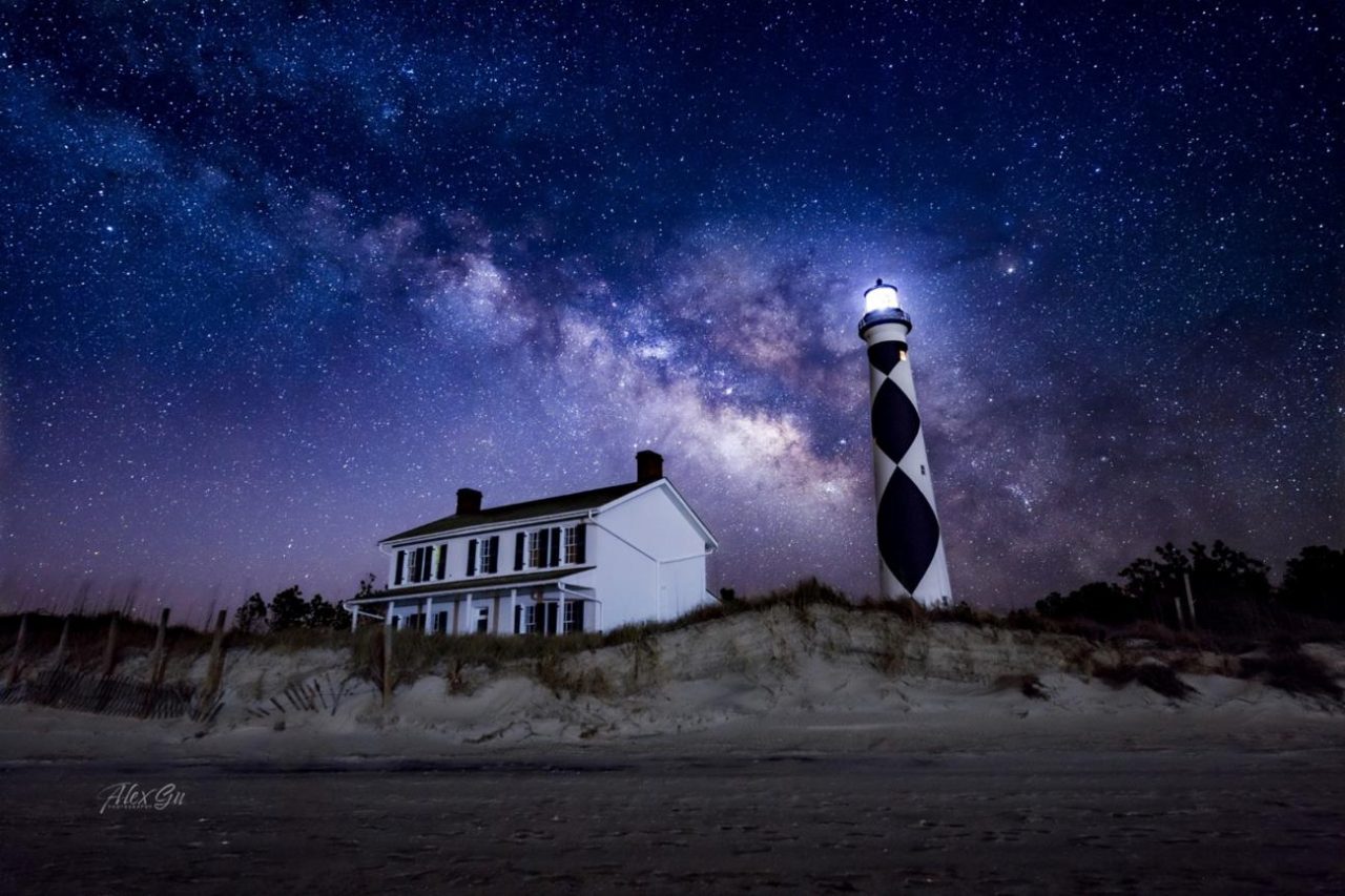
Cape Lookout Lighthouse under the night sky. Photo: Alex Gu/Crystal Coast Stargazers
Cape Lookout is now a certified International Dark Sky Park
CoastalReview.org
Click Here To Open A Chart View Window, Zoomed To the Location of Cape Lookout Bight
David Cecelski found this group of photographs at the State Archives of North Carolina in Raleigh. They were taken in Salter Path, a fishing village on the North Carolina coast, probably in 1938 or 1939.
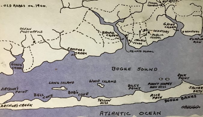
Map of the western end of Bogue Banks and Bogue Sound around 1900. From Kay Holt Robert Stephens 1984 work, “Judgment Land: The Story of Salter Path,” vol. 1.”
Our Coast’s history: The early days of Bogue Banks
CoastalReview.org
On November 30, we celebrated Giving Tuesday, a global day of giving, and the results are in: In just 24 hours you helped us raise $1,500 for our OBX national parks!
| |||||||||||||||||||||||||||||||||||||||||||||||||||||||||||||||||||||||||||||||||

A longtime CRUISERS NET SPONSOR, historic Edenton always has an exciting calendar of events! Edenton is at the mouth of the Chowan River on the northwest shore of Albemarle Sound.
| ||||||||||||||||||||||||||||||||||||||||||||||||
|
Click Here To Open A Chart View Window Zoomed To the Location of Edenton Harbor City Docks
Recreational fishermen in North Carolina harvest, on average, 1.1 million spotted seatrout or over 1.9 million pounds a year, second only to Florida.
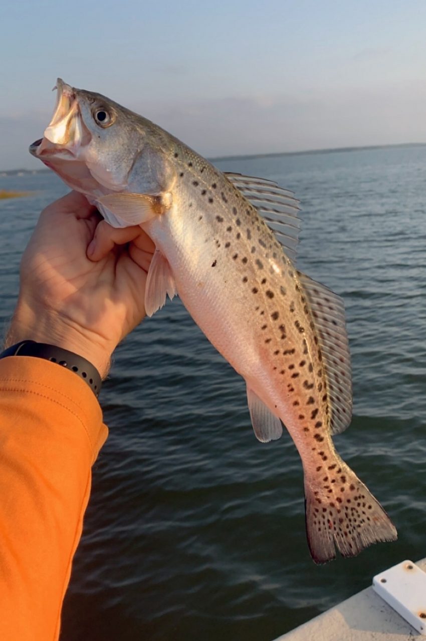
A spotted seatrout freshly caught off of the North Carolina coast. Photo: N.C. Division of Marine Fisheries
What’s on the line? Spotted seatrout, aka ‘speckled trout’
CoastalReview.org

Oriental is home to longtime CRUISERS NET SPONSOR, Oriental Marina and Inn, lying on the eastern banks of inner Oriental Harbor. See Praise for Oriental Marina for a recent review from a fellow cruiser.

Click Here To View the Cruisers’ Net’s North Carolina Marina Directory Listing For Oriental Marina
Click Here To Open A Chart View Window, Zoomed To the Location of Oriental Marina
Whether by Virginia Cut or Dismal Swamp Canal, your Waterway navigation isn’t complete without experiencing the Alligator River Bridge at the foot of your Albemarle Sound crossing. Lots of good memories evoked by just the mention of Alligator River Bridge which is noted for being unable to open in high winds or dense fog. Kudos to the patient bridge tenders, like Mike Myers, who tactfully answer thousands of questions from anxious boaters.

Myers keeps watch over Alligator River Bridge | Tyrrell | dailyadvance.com
The Daily Advance
AREA SPONSORING MARINA
Click Here To Open A Chart View Window Zoomed To the Location of Edenton Harbor City Docks


Be the first to comment!