Visit Logged
  • Select Region
    • All Regions
    • VA to NC Line
    • North Carolina
    • South Carolina
    • Georgia
    • Eastern Florida
    • Western Florida
    • Florida Keys
    • Okeechobee Waterway
    • Northern Gulf
    • Bahamas
    • New York
    • Ohio
    • Pennsylvania
    • Washington
    • Puerto Rico
    • Minnesota
    • Maryland
    • Tennessee
    • NW Waters
    Order by:
    • LNM: REMINDER: Dredging and Marine Construction Cautions

      DREDGING AND MARINE CONSTRUCTION CAUTIONS
      Mariners are cautioned to stay clear of dredge, booster, floating (pontoon) and submerged pipelines, barges, derricks, and operating wires associated with dredging and marine construction operations. Operators of vessels of all types should be aware that dredges and floating pipelines are held in  place by cables, attached to anchors some distance away from the equipment. Buoys are attached to the anchors so that the anchors may be moved as the dredge advances and the location of the submerged pipelines are marked by buoys on each side of the channel. Mariners are cautioned to strictly comply with the Inland Rules of the Road when approaching, passing, and leaving the area of operations, and remain a safe distance away from the dredge, booster, buoys, cables, pipeline, barges, derricks, wires, and related equipment. Dredging projects are usually conducted 24 hours a day, 7 days a week. All fishnets, crab pots and structures in the general area must be removed, prior to commencement of any work. A NO WAKE transit is requested of all vessels passing the dredge and if necessary to clarify a SAFE PASSAGE contact the dredge on the appropriate VHF-FM channels.

      Be the first to comment!

    • Harbormaster Day is October 8th – US Harbors Newsletter

      Here is an informative newsletter to which you may subscribe. Its abundant harbor information will be useful as you travel the East Coast this fall, by boat or by car.

      Harbormaster Day – October 8th

      Thursday, October 8, is National Harbormaster Appreciation Day. When a storm like this recent nor’easter comes through, harbormasters are the ones checking moorings before it arrives, answering calls while it’s here, and sorting out the damage once it’s gone. Most of them won’t ask for thanks. So this October, stop by your harbormaster’s office, or send a note, and share a story about your harbormaster. They’ve earned it.

      — Jamie and the US Harbors Crew


      October 2026


      ​


      Hello,

      Ask any harbormaster and they’ll tell you a storm plan has three distinct phases: preparation, adaptation, and restoration. Making proper preparations while a storm is days away is essential to minimizing damage, but adapting to a changing storm track can be even more important — it’s that resiliency that gets mariners back on course. And swiftly restoring any damaged infrastructure or equipment is what differentiates a major disaster from a minor inconvenience.
      ​
      These three phases were on full display over the weekend of September 25–27, when a rare early-season nor’easter swept up the East Coast and impacted harbors across the Mid-Atlantic and southern New England. US Harbors was there through the storm providing boaters and other coastal residents with the data and resources necessary for managing each of the storm’s three phases. Whether it was NOAA’s marine and onshore forecasts critical for developing a storm plan or the real-time buoy reports that showed those in the path of the storm how reality lined up with the predictions, the data on our coastal intelligence platform helped people make sound decisions. And when the storm passed, the local business members on US Harbors helped get people back on track, whether they needed the nearest TraveLift for an emergency haul-out or a marine electrician to troubleshoot a soggy VHF.

      Walking on the Breakwater, Rockland, Maine with high winds and high tides
      during the September 2026 nor’easter storm. Photo by Stacey Keefer

      In the Pacific, Hurricane Nolo passed south of Hawaii’s Big Island in late September, bringing heavy rain, high surf and wind gusts of 60 to 80 mph to parts of Maui, Hawaii and Honolulu counties. Nolo never made landfall, but schools and government offices closed on the Big Island and Maui, shelters opened, and flights were canceled at Hilo. The Hawaiian Islands often appear on our Monthly High Tide Flooding Outlook, where high tides and low elevation can mean frequent flooding. Knowing those dates ahead of time is part of being ready when a storm like Nolo approaches.

      Hurricane Nolo approaching Hawaii’s Big Island in late September, as seen on the advanced radar map launching later this year with US Harbors Membership. The shaded cone shows the storm’s projected path, and the highlighted areas show where watches and warnings were in effect. Weather map powered by Xweather.

      Send us a note and let us know how our data helped you, and tell us if there’s anything more we can add to our coastal intelligence platform to make it even better for all of us.

      Harbormaster Day – October 8th

      Thursday, October 8, is National Harbormaster Appreciation Day. When a storm like this recent nor’easter comes through, harbormasters are the ones checking moorings before it arrives, answering calls while it’s here, and sorting out the damage once it’s gone. Most of them won’t ask for thanks. So this October, stop by your harbormaster’s office, or send a note, and share a story about your harbormaster. They’ve earned it.

      — Jamie and the US Harbors Crew


      October High Tide Flooding Report: October 2026

      Seasonally higher sea levels carry into October, and this month higher tides can be expected around the new moon on October 10 and the full moon on the night of October 25–26. Expect the elevated water levels to persist for a day or two after each. The full moon window is the one to watch, with most harbors seeing their highest flood likelihood between October 26 and 29. Using the National Ocean Service’s minor flooding threshold, measured against the Mean Higher High Water datum, 43 harbors show some chance of flooding this month, up from 25 in September, and every coastal region in the outlook is represented. Twenty harbors reach a Medium Chance (a 20–60% likelihood), including most of the Mid-Atlantic coast. The Southeast, the upper Texas coast, Hawaii’s Big Island, and western Long Island Sound have the highest individual likelihoods, between 40 and 60% around the full moon. The rest of the Northeast and Gulf Coast see mostly a Slight Chance (5–20%), and the West Coast, quiet in September, has harbors on the list from Southern California to Washington.
      ​
      We use the NOS minor threshold as our benchmark, as we have in previous reports, because its nationally consistent formula makes it the best basis for comparing flooding risk from one harbor to the next. Each harbor is rated by its highest daily flood likelihood for the month, using the National Ocean Service’s threshold levels:

      • Least Chance: below 5%
      • Slight Chance: 5–20%
      • Medium Chance: 20–60%
      • Greatest Chance: over 60%

      The report can also be generated using the NWS minor threshold, which local forecasters and emergency managers calibrate to reflect where flooding causes problems in a specific community. NWS minor is not available at every station.
      ​
      NOAA predicts that flooding is either unlikely in other harbors, or else it does not have a sufficiently validated model to make an accurate prediction (or the local topography makes such a prediction impossible).

      VIEW FLOODING OUTLOOK


      Newport is always a good idea, especially during Boat Show Week

      The Hood 42 LM took the top award, the Hunt 56 made her debut, and we caught the sunset at Castle Hill. Here’s a look at our visit to this year’s Newport Boat Show..…

      Read More
       

      2026 Pacific Coral Surveys Interactive Story

      NOAA scientists returned from American Samoa and the Pacific Islands Heritage Marine National Monument after conducting coral reef monitoring surveys. Check out their interactive story…

      Read More
       

      A Hurricane Season Without Hurricanes, So Far

      For the first time since 1914, the Atlantic reached September 21 without a hurricane…

      Read More
       

      Ocean Indicators That Help Track El Niño’s Arrival on the West Coast

      Changes in ocean conditions and marine life that typically signal the arrival of El Niño’s influence along the West Coast…

      Read More

      Photo credits (top to bottom): Rockland Breakwater, Maine during the September 2026 nor’easter storm. Photos (2) by Stacey Keefer; Palm Beach Yachts display at the 2026 Newport International Boat Show, Photo by Jamie Bloomquist, US Harbors; A scientist capturing digital images to build a 3D reef model. Credit: NOAA Fisheries; A map of the Atlantic Ocean and East Coast of the USA showing no hurricanes by September 21, 2026. Digital illustration created by US Harbors using Claude AI and NOAA hurricane data; Yellowfin tuna are more commonly seen and caught off California during El Niño periods. Credit: Shutterstock


      Copyright (C) 2026. All rights reserved.​
      ​
      Our mailing address is:
      PO Box 251, Rockport, ME 04856
      ​
      Want to change how you receive these emails?
      You can update your preferences or unsubscribe​

      Did someone share this email with you? You can subscribe here.


      Be the first to comment!

    • September Tidal Flooding Report & Autonomous Ocean Vessels To: Winston Fower – US Harbors Newsletter

      Here is an informative newsletter to which you may subscribe. Its abundant harbor information will be useful as you travel the East Coast this fall, by boat or by car.

      https://mailchi.mp/usharbors/flooding-predictions-2025-07-14195525?e=f9fc203d20

      Be the first to comment!

    • February Tidal Flooding & A Fresh Look for US Harbors – US Harbors Newsletter

      Here is an informative newsletter to which you may subscribe. Its abundant harbor information will be useful as you travel the East Coast this fall, by boat or by car.

      Be the first to comment!

    • Explorer Charts “Chatter” Has a New Home! – Explorer Chartbooks

      Explorer Charts - the best charts for the Bahamas and Exumas

      Explorer Chartbooks, A CRUISERS NET PARTNER, has long been the standard navigational supplement for enjoyable, informative, and safe cruising through the beautiful Bahamian waters and island visits.


      Explorer Charts “Chatter” Has a New Home!


      Hello Bahamas Cruisers~~

      We have a quick but exciting update from Explorer Chartbooks!

      Our Bahamas Chatter Forum has now moved to “Groups”—a cleaner, faster, and more interactive space for all of us who love Bahamas cruising and exploration.


      🚀 Why the Move?

      Groups gives us:

      • A smoother, modern interface
      • Better notifications
      • Easier sharing of Bahamas updates and information
      • A more connected community experience

      👉 Visit the New Explorer Chartbooks Chatter Group

      As a member of the original Bahamas Chatter Forum, you’ve automatically been subscribed to the new platform!
      Check it out here:


      A few recent posts:

      • A 30 Year Voyage for Explorer Chartbooks

      • Aids to Navigation Update

      • Changes to 2025 Cruising Permit Customs Fees

      We’d love to have you with us as we continue sharing cruising news and chartbook updates.


      Thanks for being part of the Explorer Chartbooks community. See you in the new Group!


      Best,

      Kate for the Explorer Chartbooks Team


      This email was created with Wix.‌ Discover More
       
      This email was sent from this site.
      If you no longer wish to receive this email, change your email preferences here.


      Be the first to comment!

    • November High Tide Flooding & an Outboard Cruiser – US Harbors Newsletter

      Here is an informative newsletter to which you may subscribe. Its abundant harbor information will be useful as you travel the East Coast this fall, by boat or by car.

      Be the first to comment!

    • Why boat handling skills require constant learning – PassageMaker

      Passagemaker is an excellent resource for cruisers. 

      Be the first to comment!

    • Make Your Cruising Dream Come True – Captain Chris Yacht Services

      Captain Chris, a long-time friend of Cruiser’s Net, offers delivery and training services.  Check out his FREE YouTube Channel containing over 1500 short, real-world videos on boating topics.

      Ask Captain Chris about Virtual Consulting!
      Captain Chris Yacht Services
       
      October 24-25, 2025 – Cruising 101 FUNdamentals
      October 26, 2025 – Boatyard Tour
      October 27-28, 2025 – Introduction to Boat Systems

       
      Join us in Florida this Fall and make it an event!
      772-205-1859 or register here.
       
      Give your Captain the gift of knowledge. Ask Captain Chris Consult!  Click here
       
      Mother’s Day or Father’s Day- Celebrate with a learning vacation in Florida
       
      Spare Parts List – Be prepared and DIY!
       
      Yes, we offer FREE videos on YouTube. As we cruise around the waterways and boatyards we see interesting things to video, narrate and post on YouTube so check out this short article on how to see thousands (yup, thousands) of these little gems….click here for FREE!
       
      CLICK HERE or call 772-205-1859 for a FREE 15 minute Consult to ASK CAPTAIN CHRIS!
       
       
      Tell us what you’d like to learn more about. Chris@CaptainChrisYachtServices.com
       
      Streaming Training Videos – Rent or Own Docking, Anchoring, Navigation, Locking, Fuel Filters to Galley Tips and MORE!
       
       
      Share
      Tweet
      Forward to Friend
      Facebook
      Facebook
      Website
      Website
      YouTube
      YouTube

      Copyright © 2025 Captain Chris Yacht Services, All rights reserved.

      unsubscribe from this list    update subscription preferences 


      Be the first to comment!

    • FOR EARTH DAY! – Explore Teek and Tom’s educational, climate-weather adventures!

      NOAA Ocean Today

      Engage your elementary aged students this Earth Day with “Teek and Tom!” 

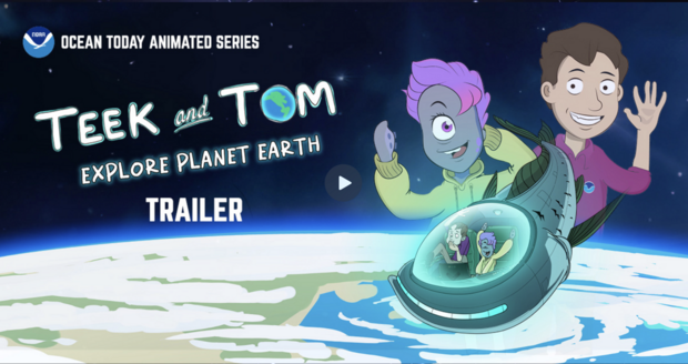
      Watch the Short Trailer

      Teek and Tom Trailer


      Teek and Tom Explore Planet Earth is a five-part animated educational series with ten accompanying lesson plans that takes young viewers on an exploration of the ocean’s influence on Earth’s weather and climate and demonstrates how NOAA uses high tech tools to gather information about our changing planet. 

      If your students love NOAA Ocean Today videos, they’re going to really love this new five-part animated series all about the ocean-weather-climate connection!

      Watch all 5 action and science packed videos!

      Check out all 10 amazing lesson plans! 


      Teek and Tom Educators Guide 

      Download the Educators Guide!

      Note: All five videos(ranging in length from 9 to 16 minutes) and ten lesson plans (available individually and as part of a comprehensive Educator’s Guide) can be freely downloaded from our website for offline use.


      I would recommend these videos to other educators teaching earth science to students. As an educator in a state that has adopted and implemented the Next Generation Science Standards, these videos either directly or implicitly address multiple standards, and they introduce several NOAA tools and data that can be explored further. There are no free resources that I currently know of that address these specific concepts so thoroughly.

      Laura Cummings, M. Ed.: Sunset Beach Elementary School, Haleiwa, HI.                                 


      This (series) will have a big impact on so many kids for a long time! Through the use of the video and the lesson plan, I can see students developing a deep understanding about the difference between weather and climate. I will recommend these videos to other teachers and share them with our district science leadership. 

      Kelley Hodges: Patronis Elementary School
      FLDOE School of Excellence


      Who is the target audience for Teek and Tom?

      Beach experiment

      NOAA created the Teek and Tom collection for an upper elementary to middle school audience, including students, educators, and families. We designed the five videos and ten accompanying lesson plans to align with the Next Generation Science Standards, Common Core Math and Common Core English and Language Arts Standards at the fourth-through-sixth-grade level. The accessibility of these resources ensures that students from diverse socioeconomic backgrounds can benefit equally, bridging gaps in educational resources. 


      NOAA @ NSTA!: Explore the Ocean, Weather, Climate Connection with Teek and Tom

      Teek and Tom Explore Planet Earth investigates the relationship between the ocean, weather and climate on local to global scales. You’ll sample some of the ten hands-on activities for upper ES and MS students to reinforce Earth science concepts related to oceanography, meteorology and climate.

      Friday, March 28 – 9:20 AM – 10:20 AM / Pennsylvania Convention Center – Ballroom III

      For the Love of Science


      For our more than 70,000 subscribers, we say Thank You for supporting NOAA Ocean Today.      We hope that the content we are creating bring value to your work and your community!


      Be the first to comment!

    • Working Lives: The Herring Fisheries at Plymouth 1939 – David Cecelski

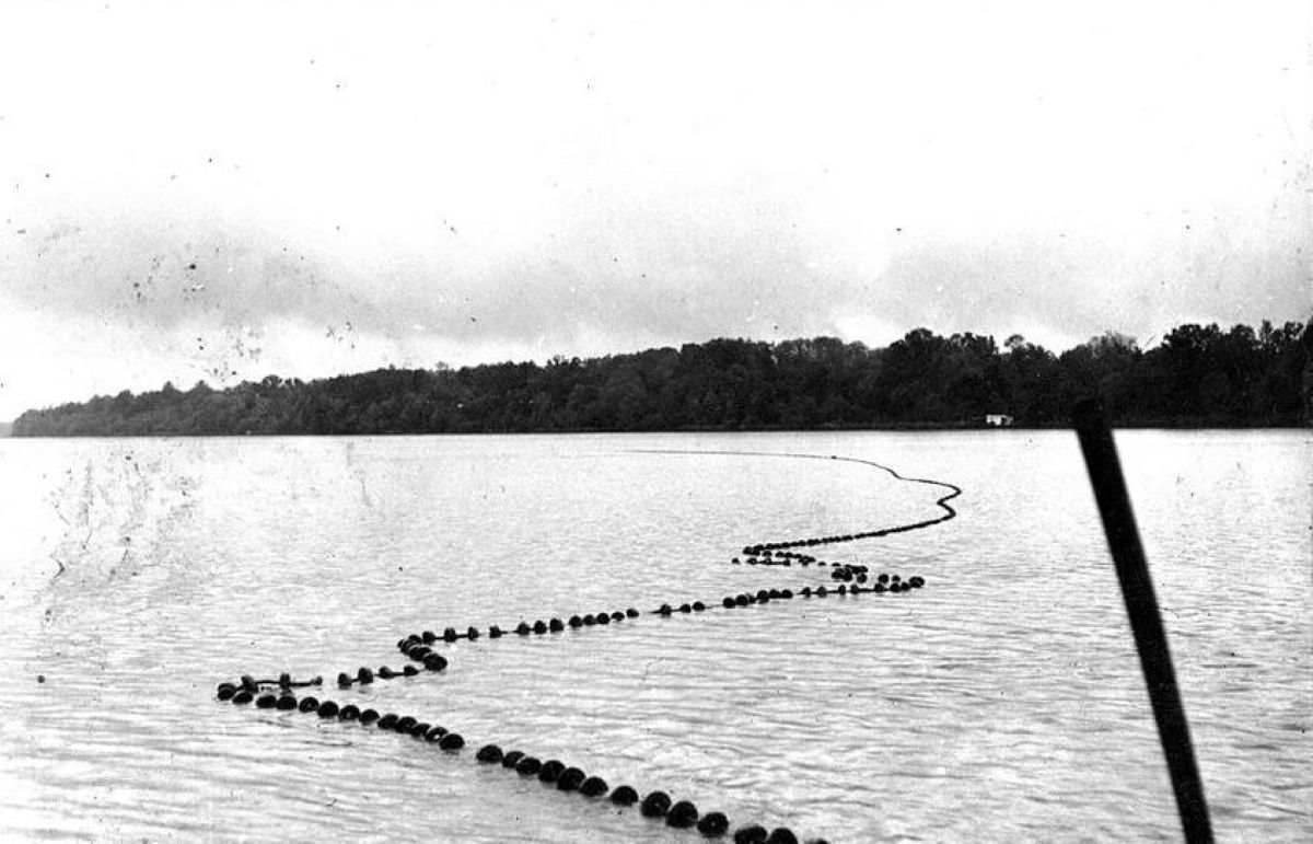
      Herring seine on the Roanoke River, 3 miles above Plymouth, May 1939. The Kitty Hawk and Slade seine fisheries had been in operation for generations, but would close for the last time a few days after these photographs were taken. Photo courtesy, State Archives of North Carolina Read more at Coastal Review, coastalreview.org.

      Working Lives: The Herring Fisheries at Plymouth 1939
      02/07/2025 by David Cecelski

      Be the first to comment!

    • Into the Mist – PassageMaker

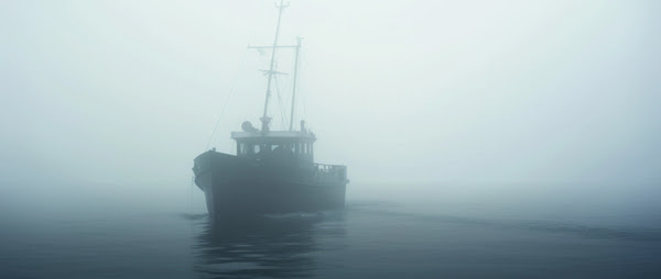
      Even the most experienced boater must acknowledge the risks that fog poses.

      Into the Mist
      Bob Arrington, Jan 27, 2025

      Comments from Cruisers (1)

      1. Winston Fowler -  January 30, 2025 - 11:54 am

        Great advise and suggestions: We were caught early one Sunday in a thick fog on the Chesapeake back in 1989 and used a watch for time, boat speed, water depth, and our paper charts to record where we should be along with two crew members watching from bow on both Port and Starboard.
        Made it back to Annapolis without a big hitch although in our approach to Bay Bridge, the large dark area in the fog was a bridge pier not an anchored container ship "whew"… Should have known that given the water depth "LOL"

        Reply to Winston
    • We Scarfed It – Janice Anne Wheeler


      Forwarded this email? Subscribe here for more

      SPARRING WITH MOTHER NATURE ~~ latest addition. I’m very honored that you’re following along. Thank you from the bottom of my writer’s heart.

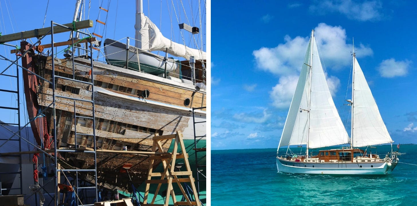
      Ah, the life of a liveaboard Sailor…on a Classic Wooden Sailing Yacht… as of August 2024 we are undergoing extensive repair and refit for the next several months(!). In boating terms we are hauled out “on the hard” in Cambridge, Maryland.

      I plan to mix Sailing Stories with the challenges and intricacies of restoring a 90-year-old boat. I’m always open to suggestions as to content….please feel free to weigh in as we manage and learn from this unexpected joust. Thank you! ~J

      A Wooden Boat is a strong, intricate entity constructed of Mother Nature’s finest materials.

      Share SPARRING WITH MOTHER NATURE

      Leave a comment


      WE SCARFED IT

      What Does That Bring to Mind?

      Be the first to comment!

    • History of Currituck Beach Lighthouse, Outer Banks, NC – Kevin Spencer

      December 1st
       
      ON THIS DAY in North Carolina history…
       
      1875:
       
      ON THIS DAY, the last of the four Outer Bank Lights, the Currituck Beach Lighthouse, is lit. It fills in the dark hole from Bodie Island to Cape Henry, Virginia. It is virtually identical to its three sister lighthouses (Bodie, Lookout, Hatteras) in construction. The 162-foot tall tower is constructed of approximately one million bricks. Its foundation extends seven feet below ground, with walls that begin at 5.5′ thick at the base of its tower, then tapering to 3′ thick at the top. It took one and a half years to build, beginning in 1874, and cost around $178,000 to construct.
       
      For its outer appearance, Currituck is left with its natural red brick. The thought by experts is this was the best way to distinguish it from the barber swirls of Hatteras, the diamonds of Lookout, and the horizontal stripes of Bodie Island.
       
      Initially, the beacon is fueled by a mineral oil lamp with five concentric wicks, the largest of which was four inches in diameter. The light is fixed white with a red flash, which occurred every ninety seconds and had a five-second duration. A clockwork mechanism rotates the light. Directly underneath the light, it is powered by weights and has to be hand-cranked every 2 1/2 hours.
       
      Today the light is automated and has been since 1939. The light has a flash pattern of three seconds on, and seventeen seconds off. It can be seen for almost 19 miles out to sea. As part of the automation, the lighthouse also has an automated bulb changer that holds a backup bulb. The Currituck Lighthouse comes on at dusk and turns off at dawn.
       
      ~Kevin Spencer, Author, North Carolina Expatriates

      Be the first to comment!


    Social Media Auto Publish Powered By : XYZScripts.com