Visit Logged
  • Select Region
    • All Regions
    • VA to NC Line
    • North Carolina
    • South Carolina
    • Georgia
    • Eastern Florida
    • Western Florida
    • Florida Keys
    • Okeechobee Waterway
    • Northern Gulf
    • Bahamas
    • New York
    • Ohio
    • Pennsylvania
    • Washington
    • Puerto Rico
    • Minnesota
    • Maryland
    • Tennessee
    Order by:
    • ‘Ditch of Death’: Navigation in Hatteras Inlet dicey … again


      Shoaling threatens navigation in economically vital Hatteras Inlet, prompting frustrated fishers to dub the South Ferry Channel the “Ditch of Death.” A consultant, responding to conditions, told the Dare County Waterways Commission Monday that continuing to dredge the passage appears “futile.”


      ‘Ditch of Death’: Navigation in Hatteras Inlet dicey … again
      CoastalReview.org

      Be the first to comment!

    • NOAA Navigation Services Quarterly Newsletter – June 17, 2021

      These quarterly newsletters report the work being done by NOAA to aid safe navigation.
       
       
      NOAA Navigation Services newsletter banner


      Quarterly Newsletter

      July 2021

      NOAA Custom Chart version 1.0 released to the public

      NOAA Custom Chart interfaceOn April 1, 2021, NOAA’s Office of Coast Survey released NOAA Custom Chart version 1.0, a dynamic map tool which enables users to create their own paper and PDF nautical charts derived from the official NOAA electronic navigational chart (NOAA ENC®), NOAA’s premier nautical chart product.

      Read more


      Sea level trends continue to increase at Atlantic and Gulf water level stations

      Map showing relative sea level trends

      The map above illustrates relative sea level trends, with arrows representing the direction and magnitude of change.

      NOAA calculated new trends for its long-term water level stations, incorporating all NOAA water level data up to the end of 2020. The data shows that most long-term trends along the U.S. coastlines point to long-term and persistent sea level rise. Specifically, all U.S. Atlantic and Gulf of Mexico coastal stations experienced an uptick in their sea level trends in 2020. However, many stations along the Pacific coast experienced a slight reduction in their sea level trends. These trends span over 100 stations along the Atlantic, Gulf, and Pacific coasts and islands within the Caribbean Sea and Pacific Ocean.


      NOAA’s Precision Marine Navigation data service receives first major update

      Precision Marine Navigation graphicThe Precision Marine Navigation (PMN) program has completed the first update of its prototype navigation data service – the PMN data processing and dissemination system and PMN Data Gateway viewer. The data processing and dissemination system provides surface current forecast guidance from NOAA’s forecast systems, in a prototype marine navigation data format. The viewer allows users to visualize the predictions and discover where they are. Both the system and the viewer were updated to include data from the recently upgraded Northern Gulf of Mexico Operational Forecast System (NGOFS2).

      Read more


      NOAA and its partners to host outreach webinar on upcoming vertical datum updates

      Tidal datums graphicNOAA and its partner agencies in Canada are updating three vertical datums: the International Great Lakes Datum (IGLD) used to reference water levels in the Great Lakes and connecting channels; the National Tidal Datum Epoch (NTDE) used to reference water levels along the U.S. ocean coastline; and the North American Vertical Datum of 1988 (NAVD 88), the geodetic vertical datum that will be replaced by the North American-Pacific Geopotential Datum of 2022 (NAPGD2022). The datum updates are expected to impact a range of communities, including: navigation and shipping, permitting and planning, surveying and mapping, and water management. To learn more, join us on July 15 from 2:00 – 3:00 p.m. (EDT) for a joint webinar, Vertical Datums: An Overview and Planned Updates.  

      Register here


      Coast Survey to shut down the Raster Navigational Chart Tile Service and other related services

      Raster Navigational Chart Tile Service interfaceNOAA will shut down its Raster Navigational Chart (RNC) Tile Service and the online RNC Viewer on October 1, 2021. The NOAA Seamless Raster Navigational Chart Services will be shut down on January 1, 2022. This is part of a larger NOAA program to end production and maintenance of all NOAA traditional paper and raster nautical charts that was announced in the Federal Register in November 2019.

      Read more


      NOAA works with partners to expand several Physical Oceanographic Real-Time Systems, enhancing safety of marine navigation

      NOAA has worked with its local partners on the Gulf Coast, Mid-Atlantic and Southeast to expand its Physical Oceanographic Real-Time Systems PORTSⓇ to include important sensors that will improve marine navigation safety in these areas. The Corpus Christi PORTS upgrade includes several additional visibility meteorological stations, an offshore wave sensor, and current meters that will provide real-time information mariners can use to navigate the increasingly busy and congested seaport. The Sabine Neches PORTS added a current meter at an LNG facility in Sabine Pass, making it the eighth operational current meter in this PORTS. The Chesapeake Bay South PORTS also added a current meter, for a total of seven around the lower end of the Bay. Finally, a newly rebuilt water level and meteorological station was added to Jacksonville PORTS for monitoring along the St. Johns River, near the Buckman Bridge. The addition of these valuable real-time data helps mariners – particularly from large cargo ships and assisting tug boats coming in and out of port – to navigate safely, protecting life and property and keeping commerce moving smoothly.


      The Interagency Working Group on Ocean and Coastal Mapping announces progress report on mapping U.S. ocean, coastal, and Great Lakes waters

      Unmapped waters as of January 2021The Interagency Working Group on Ocean and Coastal Mapping (IWG-OCM) released the second annual report on the progress made in mapping U.S. ocean, coastal, and Great Lakes waters. The depth, shape, and composition of the seafloor are foundational data elements that we need to understand in order to explore, sustainably develop, conserve, and manage our coastal and offshore ocean resources. The 2020 National Strategy for Mapping, Exploring, and Characterizing the United States Exclusive Economic Zone and the global Seabed 2030 initiative make comprehensive ocean mapping a priority for the coming decade. The Unmapped U.S. Waters report tracks progress toward these important goals.

      Read more


      New coastal models will aid mariner safety on the west coast and Gulf of Mexico

      Cargo vessel docked in Corpus Christi, Texas

      NOAA operational forecast models can help ships like this one docked in Corpus Christi anticipate coastal conditions that may impact the safety and efficiency of their travel routes.

      NOAA has launched two new models along the west coast and northern Gulf of Mexico that will provide continuous quality-controlled data on water levels, currents, water temperature and salinity out to 72 hours. These models will cover the entire west coast from Baja Mexico to British Columbia and the entire northern Gulf including the mouth of the Mississippi River, Lake Pontchartrain, and the Texas border. NOAA’s network of operational forecast models are being implemented in critical ports, harbors, estuaries, Great Lakes, and coastal waters of the U.S. to form a national backbone of real-time data, tidal predictions, data management and operational modeling. This network promotes safe marine navigation in the Nation’s waterways.

       Read more


      NOAA’s National Ocean Service · SSM
      C4, Room 9601 · 1305 East-West Hwy · Silver Spring, MD 20910
      GovDelivery logo

      Be the first to comment!

    • Our NC Coast’s History: The Herring Workers

      Coastal Review is featuring the work of North Carolina historian David Cecelski, who writes about the history, culture and politics of the North Carolina coast.


      Women gutting and heading herring at either the Perry-Belch or Cannons Ferry fishery, ca. 1937-41. Like so many women in those days, they’re using old fertilizer bags as aprons. Many a family came down to the river with that kind of fertilizer bag and carried salt herring home in them, too. Photo by Charles A. Farrell. Courtesy, State Archives of North Carolina


      Our Coast’s History: The Herring Workers
      CoastalReview.org

      Be the first to comment!

    • Ten State Parks in the Florida Keys

      Many people do not realize that the Keys are home to ten state parks. Each has something unique to offer and provides expansive scenery and wide-open spaces.


      “CHRIST OF THE DEEP” IN JOHN PENNEKAMP CORAL REEF STATE PARK (PHOTO CREDIT: STEPHEN FRINK / FLORIDA KEYS NEWS BUREAU)


      The 10 Incredible State Parks In The Florida Keys
      TravelAwaits

      Be the first to comment!

    • Battery Power by Barry Parker

      This discussion of battery powered ships focuses on commercial shipping, but can battery powered recreational vessels be far behind?


      Battery Power
      Marina News May 21, 2021

      Be the first to comment!

    • News from BoatUS: Five Things You Can Do to be Found in an Emergency

      The BoatUS Foundation for Boating Safety and Clean Water offers five tips that can potentially speed a rescuer’s response to a boater in need of emergency help.


      Five Things You Can Do

      to Take the ‘Search’ out of Search and Rescue

      Are you making it difficult to be found in an emergency?

      ANNAPOLIS, MD., May 25, 2021 – “Do I know how to be found in an emergency?” That’s a question every boater should ask at the beginning of the boating season. The answer, however, is likely to go far beyond simply having a cellphone aboard. The BoatUS Foundation for Boating Safety and Clean Water offers five tips that can potentially speed a rescuer’s response to a boater in need of emergency help.

      1. File a float plan: Telling a responsible family member or friend, leaving a note (on your vehicle’s dashboard) at the launch ramp, or using a smart phone float plan app, are great ways to allow someone else to trigger the alarm if you fail to return by an appointed time.
         
      2. Have a VHF radio aboard — but not just any old VHF radio: All VHF radios are not alike. One of the best ways to speed an on-water rescue is to have a Digital Selective Calling (DSC) VHF radio aboard. A DSC-VHF radio does all of the things a regular VHF does, but it also has a unique press-one-button mayday feature that gives rescuers your vessel’s location — taking the “search” out of search and rescue. The newest waterproof handheld DSC-VHF radios are great for small boats. Before you install your DSC-VHF radio, be sure to get your radio’s Maritime Mobile Service Identity Number (MMSI) that is your vessel’s unique ID. BoatUS members can request one for free.
         
      3. Label your SUP, canoe, or kayak: Adding contact information on the inside of your paddlecraft with a waterproof marker could mean less time U.S. Coast Guard and first responders need to spend chasing down false alarms. This frees up valuable resources when time really counts. And let’s face it, another benefit is that you may get your paddlecraft back after it blows down the lake. It’s also a good idea to let authorities know if your paddlecraft has gone missing.
         
      4. Do not leave shore … without a fully charged phone: Smartphones are part of life ashore and aboard. The reality, however, is that many boaters put all their safety eggs in one basket and rely solely on a cellphone to call for help. Cellphone batteries generally don’t do well after a long day of running apps, listening to music, texting, and taking photos. And for many phones, water is the enemy. Consider keeping your phone a waterproof pouch or case. If you need help for routine, nonemergency assistance, such as a tow home, battery jump, fuel delivery or soft ungrounding, download the BoatUS App that connects boaters to closest local TowBoatUS response vessel.
         
      5. Register your EPIRB or PLB: The U.S. Coast Guard receives hundreds of false alerts each year from these critical safety devices. To free up more time for responsing to real emergencies, boaters need to properly register their Emergency Position Indicating Rescue Beacon (EPIRB) or Personal Locator Beacon (PLB). If you need a beacon for only a short period of time, rent one from the affordable BoatUS Foundation EPIRB/PLB rental program.

      ###

      About the BoatUS Foundation for Boating Safety and Clean Water:

      The BoatUS Foundation for Boating Safety and Clean Water is a national leader promoting safe, clean and responsible boating. Funded primarily by donations from the more than 800,000 members of Boat Owners Association of The United States (BoatUS), the nonprofit provides innovative educational outreach directly to boaters and anglers with the aim of reducing accidents and fatalities, increasing stewardship of America’s waterways and keeping boating safe for all. A range of boating safety courses – including 36 free state courses – can be found at BoatUS.org/Courses.

      Be the first to comment!

    • Two Secrets for Better Boating – Off Center Harbor

      While compiled by a group of Northeast “old salts” these videos are equally as applicable to our southern waters. Thank you for sharing, Off Center Harbor.
       

      Hi Larry ~

      It’s easy to feel like a fool sometimes while at the helm of a boat, or while trying to fix it.

      There’s so much to learn, and it’s hard to develop new skills from reading a book or a magazine.

      But with the power of video and the following two secrets, you can get one-on-one instruction from pros at the top of their field, and your learning curve can shoot straight up.
       

      Secret #1: World-Class Instruction… 

      VIDEO: How to Trim Sails, Part 2 — The Headsail

      Even though top-notch instruction can quickly enhance your skills, there’s something that’s even more helpful in becoming a much better boater…

      Secret #2: Heart-Felt Inspiration​​​!

      Good instruction is valuable, but getting inspired is priceless.

      We get so many comments under our videos saying how much boaters have been inspired that we’ve given it a name — we call it the “inspiration curve”.

      It’s different than your “learning curve”, but directly related, because a good “inspiration curve” can cause your learning curve to grow steeper and move faster.

      Here is a video that provides a steep “inspiration curve”: 

      GETTING FULL ACCESSIn a few days, we’ll be sending you a great Mother’s Day/Father’s Day special to become a member with a 30% discount on your first year, plus a complimentary member’s hat.

      If these videos have inspired you, we hope you’ll consider joining thousands of others from more than 80 countries as a member of Off Center Harbor.

      Warmest regards,
      Steve, Ben, Bill, Eric and Maynard, Co-founders

      Off Center Harbor

      We’re proud to run Off Center Harbor the old fashioned way, relying on trust
      and authenticity among our customers, our crew, and our community.

      Our mailing address is:

      Worldwide Classic Boat Show

      7 Bay Road

      Brooklin, ME 04616

      Be the first to comment!

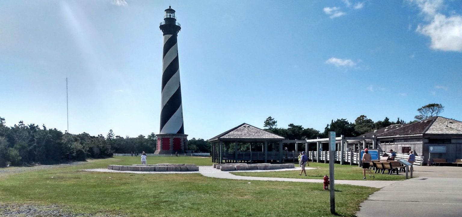
    • Hatteras Lighthouse Home to New Webcam, Cape Hatteras, NC


      With the launch of a new webcam, anyone with access to the internet can see the view from the top of Cape Hatteras Lighthouse.  The webcam can be viewed at www.obxforever.org/obx-national-park-webcams/www.outerbanks.org/webcams and www.surfline.com.


      Cape Hatteras National Seashore. Photo: Jennifer Allen


      Hatteras Lighthouse Home to New Webcam
      Coastal Online Review

      Be the first to comment!

    • St Augustine Morning Net now at 9:00AM on Channel 72

      For all the latest St. Augustine Cruising News, especially here in Race Week, tune into Morning Net on Channel 72. Our thanks to Michelle Bennett for this update. See Race Week.
       
      Hi Larry,
       
      Just a heads up the St Augustine Cruisers net has changed the time for morning net, it’s now at 9:00am on channel 72 every day through the end of May. We take a break June through October but have events all year long. More info at www.facebook.com/groups/CruisersNet.
       
      Thank you,
      Michelle Bennett

      Be the first to comment!

    • BoatUS: Vessel Documentation Cert Changed to 5 Years

      You have to wonder if this new convenience is not going to cause issues for the Coast Guard and for brokers when boats are sold.


       Guard Changes

      Certificate of Documentation to 5 Years

      New rule will spare some boaters a yearly task

      SPRINGFIELD, Va., April 14, 2021 — Of the nation’s nearly 12 million registered recreational boats, those owners who federally document their vessels, or about 165,000 boats, will be spared the hassle of renewing their U.S. Coast Guard Certificate of Documentation every year as a result of recent rule change that now makes documentation valid for five years. The move was the result of Coast Guard cost-saving efforts and requirements set forth in the Frank LoBiondo Coast Guard Authorization Act of 2018.

      “The change to a five-year documentation period will be a time-saver,” said BoatUS Manager of Government Affairs David Kennedy. Kennedy notes the new rule also eliminates some options that were formerly available.

      “Going forward, the five-year Certificate of Documentation is the only option available for recreational vessels as the 2018 Act did not allow for alternatives,” added Kennedy.

      Formerly, documentation was $26 per year and boaters could select the number of years, from one to five. The new five-year documentation cost for is fixed at $130. Additional fees apply for initial documentation as well as exchanges. The Coast Guard will not issue refunds if an owner chooses to cancel documentation before its five-year expiration or if a vessel is sold during the renewal period.

      Boat owners generally choose to federally document vessels with the U.S. Coast Guard versus the more common practice of state registration, for one of two reasons: the boat was purchased with a bank loan and the lender required it or the owner plans to travel beyond U.S. waters. A Certificate of Documentation is internationally recognized and makes it easier for American vessels to enter and leave foreign ports.

      Documented vessels must also be a minimum of 5 net tons, which is about the size of a 26-foot boat. BoatUS notes that net tons are more about (cargo) volume, than weight.

      In a related issue, BoatUS continues to advise boaters to be vigilant when renewing U.S. Coast Guard vessel documentation as official-looking vessel documentation renewal notices can lead to confusion and higher costs. Some BoatUS members have received notices that are not from the Coast Guard but rather third-party companies whose name or return addresses may appear similar to that of the official U.S. Coast Guard National Vessel Documentation Center (NVDC).

      For more information on documentation go to BoatUS.com/Documentation.

      ###

      About Boat Owners Association of The United States (BoatUS):

      Celebrating more than 50 years, BoatUS is the nation’s largest organization of recreational boaters with more than 700,000 members. We are the boat owners’ voice on Capitol Hill and fight for their rights. We are The Boat Owners Auto Club and help ensure a roadside trailer breakdown doesn’t end a boating or fishing trip before it begins. When boats break down on the water, TowBoatUS brings them safely back to the launch ramp or dock, 24/7. BoatUS offers GEICO Marine Insurance policies that give boat owners affordable, specialized coverage and superior service they need. We help keep boaters safe and our waters clean with assistance from the nonprofit BoatUS Foundation for Boating Safety and Clean Water. Visit BoatUS.com.

      1 Facebook Likes, 1 Facebook Reactions

      Be the first to comment!


    Social Media Auto Publish Powered By : XYZScripts.com