


CRUISERS NET
Cruisers Helping Cruisers
Comprehensive cruising resource for the Intracoastal Waterways
from Norfolk to the Northern Gulf and Bahamas.
from Norfolk to the Northern Gulf and Bahamas.
FREE to use due to the generosity of our sponsors - please patronize them
No Imminent Threats, We’ll Watch the Gulf Next Week – SCDNR
No Imminent Threats, We’ll Watch the Gulf Next Week 
Weather Alert – October 2, 2026
No Imminent Threats, We’ll Watch the Gulf Next Week
The Atlantic has returned to inactivity. We have no active tropical cyclones, and it’s unlikely that any will form over the next week. We’ll watch the Gulf for possible development starting later next week.
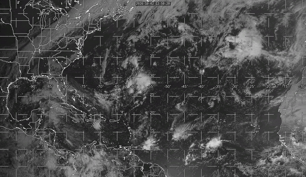
The above loop of visible satellite imagery above shows features of interest across the North Atlantic and eastern U. S.:
- The remnants of Fay well to the southeast of Bermuda.
- Tropical waves along 74° west over the Caribbean Sea and along 38° west over the central tropical Atlantic.
- A band of clouds stretching from Texas to New England along a cold front.
- Disturbed weather over the eastern and central Gulf that will be drawn northward by the approaching cold front.
Image Source: University of Wisconsin RealEarth
The only current feature of interest is the remains of Tropical Storm Fay, about 500 miles southeast of Bermuda, valiantly holding on in its fight to remain dead. The National Hurricane Center gives it a 10 percent chance of resurrection. However, it will remain too far from South Carolina to affect us.
Two tropical waves are passing through the deep tropics, one south of Haiti and the other around 1500 miles east of the Windward Islands. Neither is generating much thunderstorm activity. Dry air and strong vertical wind shear will prevent the waves from developing further as they drift westward.
We’ll continue to watch cold fronts over the next week as they push through the Southeast and become stationary over the Gulf and southwestern Atlantic. Stationary fronts can become tropical cyclone breeding grounds over warm waters, and computer models indicate a low-end risk of a storm developing over the Bay of Campeche or western Gulf later next week or next weekend.
This hurricane season has been the quietest in many years (2014 was the last season with only 8 named storms) and the first in over a century with no hurricanes to date (1914 had no hurricanes; we might go without a hurricane this season). Nevertheless, we have to stay prepped. You know, it only takes one. So stay ready and visit hurricane.sc if you need prep advice.
SC Weather Highlights For the Next Week:
Our current hot spell (and perhaps the last of the year, we can only hope) will end after today, as a cold front moves in this weekend.
It’s great that we’ll cool off and, even better, we’ll see a soaking rain and thunderstorms over the weekend as a tropical air mass now over the Gulf gets pulled in by the front. Well, that’s not so great for outdoor plans you might have and for Saturday football (lightning delays are possible), but it will help with our drought.
The downside is that the heavy rain we’ll see this weekend could cause isolated flash flooding. The Weather Prediction Center’s outlooks have the entire state at level 1 of 4 for flooding rain on Saturday, then level 2 on Sunday into Sunday night. The rain will linger into Monday along the coast and perhaps farther inland; there’s some uncertainty about how long it takes for the front to sag south far enough that even the Lowcountry dries out. In fact, the front may become stationary near our coastal areas, keeping clouds and maybe even a shower or two around into Tuesday and Wednesday, especially in the coastal Lowcountry. Most areas are likely to get 1-2 inches of rain in the coming days, with some areas seeing 3-4 inches locally.
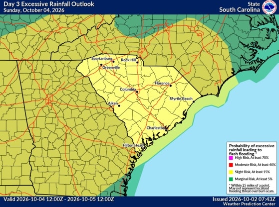
WPC’s Day 3 Excessive Rainfall Outlook graphic for South Carolina shows the entire state in a level 2 of 4 risk area for flooding rain Sunday and Sunday night.
We’re likely to remain dry elsewhere early next week, and across the state later next week, with the next chance of rain next weekend.
We’ll go from today’s summery warmth to early November-like temperatures behind the front. Saturday will be warm again with highs in the 80s, then near 70 in the Upstate to the low 80s in the Lowcountry on Sunday. It will be even cooler early next week; highs will be in the mid-to-upper 70s on Monday, then in the upper 60s and low 70s on Tuesday and Wednesday. Late next week looks a little warmer, but with highs still mainly in the 70s. Expect chilly mornings next week, with lows mainly in the 40s and 50s.
Frank Strait
Severe Weather Liaison
S.C. State Climate Office


South Carolina Department of Natural Resources
260 D. Epting Lane
West Columbia, SC, 29172Stay Connected with SCDNR: 




SUBSCRIBER SERVICES:
Manage Subscriptions | Unsubscribe | HelpBe the first to comment!
South Carolina Shellfish Harvest Season Opens October 1C – SCDNR

South Carolina Shellfish Harvest Season Opens October 1
FOR IMMEDIATE RELEASE: SEPTEMBER 24, 2026
CHARLESTON, S.C. – The 2026-2027 season for recreational harvest of shellfish (clams and oysters) in South Carolina’s coastal waters will open one-half hour before official sunrise on Thursday, October 1, 2026. The recreational shellfish season will remain open through May 15, 2027, unless conditions warrant extending or shortening the season.
In the event of a hurricane, major rain event or pollution spill, shellfish beds may be temporarily closed by the South Carolina Department of Environmental Services (SCDES, formerly SCDHEC). Harvesters should check with SCDES to verify whether any closures are in effect. Closure information is available by calling 1-800-285-1618 or through an interactive map on the SCDES website. SCDES will also use these resources and local newspapers throughout the year to announce temporary closures resulting from unusual rain events or spills.
Recreational harvesting is permitted on all Public Shellfish Grounds and State Shellfish Grounds within areas of open or approved water quality, as noted on shellfish maps. Twenty Public and seven State Shellfish Grounds are managed exclusively for recreational gathering. An additional 58 State Shellfish Grounds are managed for both recreational and commercial harvest.
Recreational harvesters should obtain updated Public or State Shellfish Ground maps at the beginning of each season, as areas open to harvest may change from year to year. Maps of designated harvest areas may be downloaded from the SCDNR website or accessed through the Recreational Map Web Application. Printed maps may also be obtained by calling (843) 953-9854 or writing to the Shellfish Management Section, Attn: Andy Hollis, SCDNR, PO Box 12559, Charleston, SC 29422-2559. When requesting maps, please specify the general area where you wish to harvest. Maps for the 2026-27 season will be available prior to the season opening on October 1, 2026.
Recreational harvesters must have a Saltwater Recreational Fishing License, available from SCDNR, at many fishing supply stores and online. The recreational limit is two U.S. bushels of oysters and one-half bushel of clams per day, limited to two calendar days per seven-day period. One U.S. bushel is equal to eight gallons. There is a maximum possession limit of three personal limits per boat or vehicle. Clams must be at least one inch thick.
Additional rules and restrictions may be found in the SCDNR Rules and Regulations, available where licenses are purchased or online.
Commercial Shellfish Harvest
Commercial harvest of shellfish requires a commercial saltwater license, mandatory harvester training, and other licenses and permits depending on where the harvest will occur. Call the Marine Permitting Office at 843-953-9301 (Option 4) for additional information on commercial harvesting requirements.
Shellfish Season Best Practices
- All harvesters are encouraged to “cull in place” by breaking off and leaving dead shell and smaller oysters on the shoreline, where they will continue to grow and provide habitat for other oysters. Only harvest clusters or singles of larger oysters.
- If you enjoy eating oysters, remember to recycle your shells! Check online or call (843) 953-9397 to find locations near you where shell can be dropped off for recycling.
- Please note that recycled shell placed in any SCDNR receptacle becomes South Carolina state property and is illegal to take. All shell collected by SCDNR is used to restore shellfish grounds in coastal South Carolina.
Cheyenne Twilley
Chief of Education, Outreach, and Information
South Carolina Department of Natural Resources
Stay Connected with SCDNR: 




SUBSCRIBER SERVICES: Be the first to comment!
Atlantic Active, But Nothing Near SC – SCDNR
Atlantic Active, But Nothing Near Us 
Weather Alert – September 25, 2026
Atlantic Active, But Nothing Near Us
The Atlantic has turned more active over the last week, and we have two tropical cyclones to track today. However, the nearest one to South Carolina is over 2100 miles away, and no tropical cyclones will affect us for the next week.
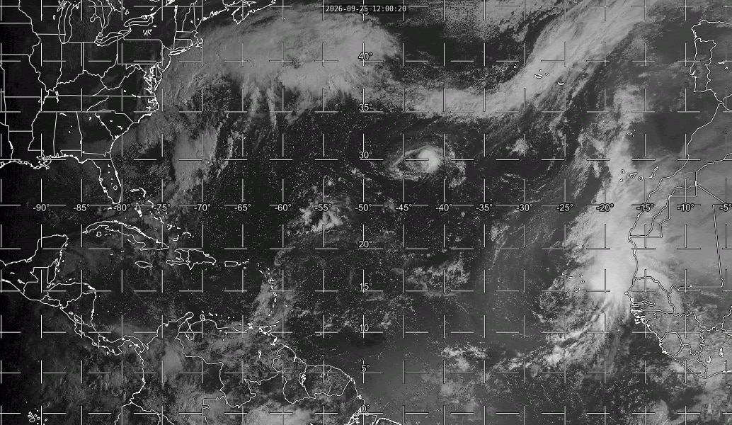
The above loop of visible satellite imagery above shows features of interest across the North Atlantic and eastern U. S.:
- Tropical Storm Fay over the middle of the North Atlantic.
- Tropical Storm Gonzalo over the far eastern tropical Atlantic, just off the West African coast.
- Tropical waves along 78° west in the Caribbean Sea and along 58° west just east of the Lesser Antilles.
- A strengthening extratropical storm centered east of North Carolina’s Outer Banks.
Image Source: University of Wisconsin RealEarth
The first storm to track is Tropical Storm Fay, which has been an off-and-on tropical cyclone since forming last Saturday. It will drift westward and should get a little stronger over the next 24 hours before dissipating early next week as it encounters hostile upper-level winds.
The other is Tropical Storm Gonzalo, even farther away (over 3700 miles), centered just east of Cabo Verde. Gonzalo is moving north into increasingly hostile conditions (very dry air, strong vertical wind shear, and cooler ocean waters), so it’s likely to weaken and become non-tropical by Monday.
A couple of tropical waves are worth tracking, but neither has much chance of becoming a tropical cyclone in the short term. The one east of the Lesser Antilles today might get pulled into the Gulf next weekend, where it could develop further.
We still have not seen any hurricanes in the Atlantic so far this season, putting us ahead of every hurricane season since 1900 except the two seasons, 1907 and 1914, that had no hurricanes.
We may also see some effects from the East Pacific’s Hurricane Polo in several days. It will eventually move across northwestern Mexico and into the Southwest before its remains move east, possibly bringing us downpours next weekend.
And finally, you’ll hear in the news about Hurricane Nolo bringing gusty winds and extreme rains to Hawaii (and by extreme, I mean FEET of rain on the windward parts of the Big Island, severe flooding and landslides will become likely), but at over 4500 miles away, it won’t affect us.
While nothing is near us now and nothing will be for at least another week, the weather pattern will be conducive to a storm forming closer to us in a week or so. So, stay prepped. If you need prep advice, hit up hurricane.sc.
We finally got our first taste of fall weather this week, but it won’t last much longer, as above-average temperatures will return over the weekend.
It will remain dry through the weekend despite an intense storm swirling off the Mid-Atlantic coast. The storm is not tropical, but it will impact areas from North Carolina’s Outer Banks northward into Atlantic Canada with heavy rain, strong winds and coastal flooding. The storm will weaken Sunday night as it moves north.
Our coastline has seen minor to moderate flooding at high tide, and this will continue for at least a few more days, but you can blame Saturday’s full moon, as our winds are offshore. A gusty breeze will affect the eastern part of the state through this evening, but that’s the only effect we’ll see from this coastal storm.
We’ll end up with a super weekend weather-wise, thanks to the cool, dry air that the East Coast storm is shoving into the Southeast. After highs only in the mid-70s today, we’ll warm up this weekend with highs within a few degrees of 80 tomorrow, then lower to the mid-80s on Sunday. Each day will feature bright sunshine and maybe a few high clouds. Enjoy!
It turns progressively more summery next week as it gets hotter and gradually more humid while an upper-level ridge builds over this part of the country. Most of the state will remain rain-free all week, but there’s a small chance for a sea breeze-triggered afternoon shower or thunderstorm later next week along the Coastal Plain. Highs early in the week will mainly be in the 80s across the state; later in the week, we’ll see mainly upper 80s and lower 90s.
Next weekend will bring the next chance for rain, as a cold front moves in, perhaps steering the remnants of Polo in the East Pacific our way.
Frank Strait
Severe Weather Liaison
S.C. State Climate Office


South Carolina Department of Natural Resources
260 D. Epting Lane
West Columbia, SC, 29172Stay Connected with SCDNR: 




SUBSCRIBER SERVICES:
Manage Subscriptions | Unsubscribe | HelpBe the first to comment!
Atlantic Perking Up, But No Imminent Threat To SC – SCDNR
Atlantic Perking Up, But No Imminent Threat To SC 
Weather Alert – September 18, 2026
Atlantic Perking Up
But No Imminent Threat To SCIt’s been over two weeks since we’ve had a tropical cyclone in the Atlantic Basin, during what’s usually the busiest time of the year. While the Atlantic is starting to show signs of life again, we’re likely to go at least another week before any possible threat to South Carolina.
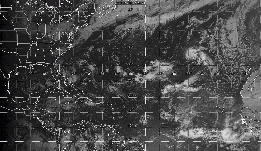
The above loop of visible satellite imagery above shows features of interest across the North Atlantic and eastern U. S.:
- A low-pressure area centered about 500 miles southwest of the Azores that has a chance to become a tropical cyclone.
- Tropical waves along 80° west in the Caribbean Sea and along 44° west over the tropical Atlantic, and a small area of low pressure centered near 12° north, 52° west.
- A band of clouds associated with a front from the Midwest through the Mid-Atlantic region and out over the Atlantic.
Image Source: University of Wisconsin RealEarth
A few interesting features are present. The one with a chance to develop is centered southwest of the Azores. It’s a non-tropical storm but may gain tropical characteristics over the weekend. Fay is next on the list if it does (the National Hurricane Center gives it a 30% chance to become tropical), but it will remain too far away to be a concern for South Carolinians.
Two tropical waves are present in the deep tropics, one over the Caribbean Sea and the other over the middle of the tropical Atlantic. An interesting little low-pressure area is also centered well east of Grenada, producing occasional puffs of thunderstorm activity. Strong vertical wind shear and the dry air mass over that part of the world will likely prevent further development from these features.
Starting next week, we’ll (insert your “finally!” and “it’s about time!” here) start to see more substantial cold fronts penetrate the Southeast again, with those cold fronts becoming a potential breeding ground for tropical cyclones as they stall over the Gulf and southwestern Atlantic. Models also indicate that a Central American Gyre will form later next week, and that’s another mechanism for a tropical cyclone to possibly form over the northwestern Caribbean or Gulf the following week.
Stay prepped; the tropics could turn more interesting at the end of the month and through the first part of October. If you need prep advice, hit up hurricane.sc.
Cooler Days Ahead (Finally)
We remain hotter than usual for September, and today should be the hottest day in this stretch before we cool off this weekend as another cold front moves in. Look for scattered thunderstorms this afternoon and evening, with a risk of isolated damaging winds with any storms. Highs will be in the lower to mid-90s.
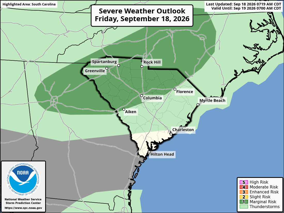
The Storm Prediction Center’s Severe Weather Outlook graphic for South Carolina for covering today and tonight indicates a low-end risk for damaging winds
mainly along and north of I-20.The next front moves in tonight, becomes stationary over us Saturday, then fizzles away Sunday into Monday. Temperatures will step down as a result, with highs each day in the upper 80s to lower 90s. Each day will bring scattered mainly afternoon and evening thunderstorms; the risk of a severe storm with locally damaging wind will be low but not zero.
Another cold front likely arrives on Tuesday into Tuesday night, so showers and thunderstorms become more widespread again with some risk of a severe storm. Highs will again be in the upper 80s to lower 90s.
Starting on Wednesday, we’re likely to see our first real taste of fall … and perhaps the first taste of what we could see a lot of this coming winter … a stretch of cool and damp to wet days. The exact details are in question, but it looks like much of the state will be cool and drippy on Wednesday and Thursday, perhaps Friday as well. The Lowcountry could remain warm, but steamy and showery. Highs those days may be only in the 70s in the north to the mid-80s in the Lowcountry.
We might dry out next weekend; it could be nice weatherwise.
Frank Strait
Severe Weather Liaison
S.C. State Climate Office


South Carolina Department of Natural Resources
260 D. Epting Lane
West Columbia, SC, 29172Stay Connected with SCDNR: 




SUBSCRIBER SERVICES:
Manage Subscriptions | Unsubscribe | HelpBe the first to comment!
Statewide Beach Sweep/River Sweep: Volunteers Needed – SCDNR

SCDNR, S.C. Sea Grant Consortium Lead Statewide Beach Sweep/River Sweep Cleanup Sept. 19
Volunteers Needed at Nearly 100 Cleanup Sites Across South Carolina
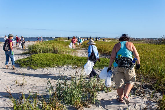
Photo Credit: Emma Berry, SCDNR
FOR IMMEDIATE RELEASE: SEPTEMBER 16, 2026
COLUMBIA, S.C. – The 37th annual Beach Sweep/River Sweep returns Saturday, September 19, bringing thousands of volunteers together at nearly 100 cleanup sites across South Carolina to remove litter from the state’s beaches, marshes, rivers, lakes, and waterways.
Organized by the S.C. Sea Grant Consortium in partnership with the S.C. Department of Natural Resources (SCDNR), Beach Sweep/River Sweep is South Carolina’s largest one-day litter cleanup. The statewide effort is held in conjunction with Ocean Conservancy’s International Coastal Cleanup.
Last year, 4,150 volunteers removed nearly 24 tons of debris and covered 972 miles statewide. Volunteers working from boats and on foot collected plastic and glass bottles, cans, food containers, clothing, toys, cigarette butts, and other litter. Larger debris included household appliances, vehicle tires, dock pieces, and building materials. As much of the collected material as possible is recycled.
The cleanup is open to everyone, including individuals, families, schools, youth groups, civic and conservation organizations, and businesses. Cleanup dates may vary by location.
To view cleanup locations in coastal counties, visit scseagrant.org/bsrs-sites or contact Susan Ferris Hill at (843) 953-2092 or susan.ferris.hill@scseagrant.
org. To view cleanup locations in inland counties, visit SCDNR’s Beach Sweep/River Sweep volunteer site or contact Bill Marshall at (803) 734-9096 or marshallb@dnr.sc.gov.
Cheyenne Twilley
Chief of Education, Outreach, and Information
South Carolina Department of Natural Resources
Stay Connected with SCDNR: 




Be the first to comment!
What’s Happening At the Sea Pines Resort (Sept 2026), Harbour Town Yacht Basin, SC AICW MM 565

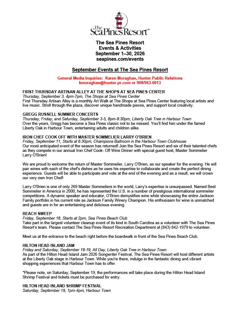
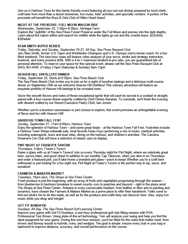
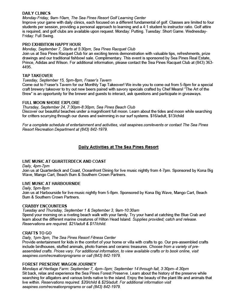
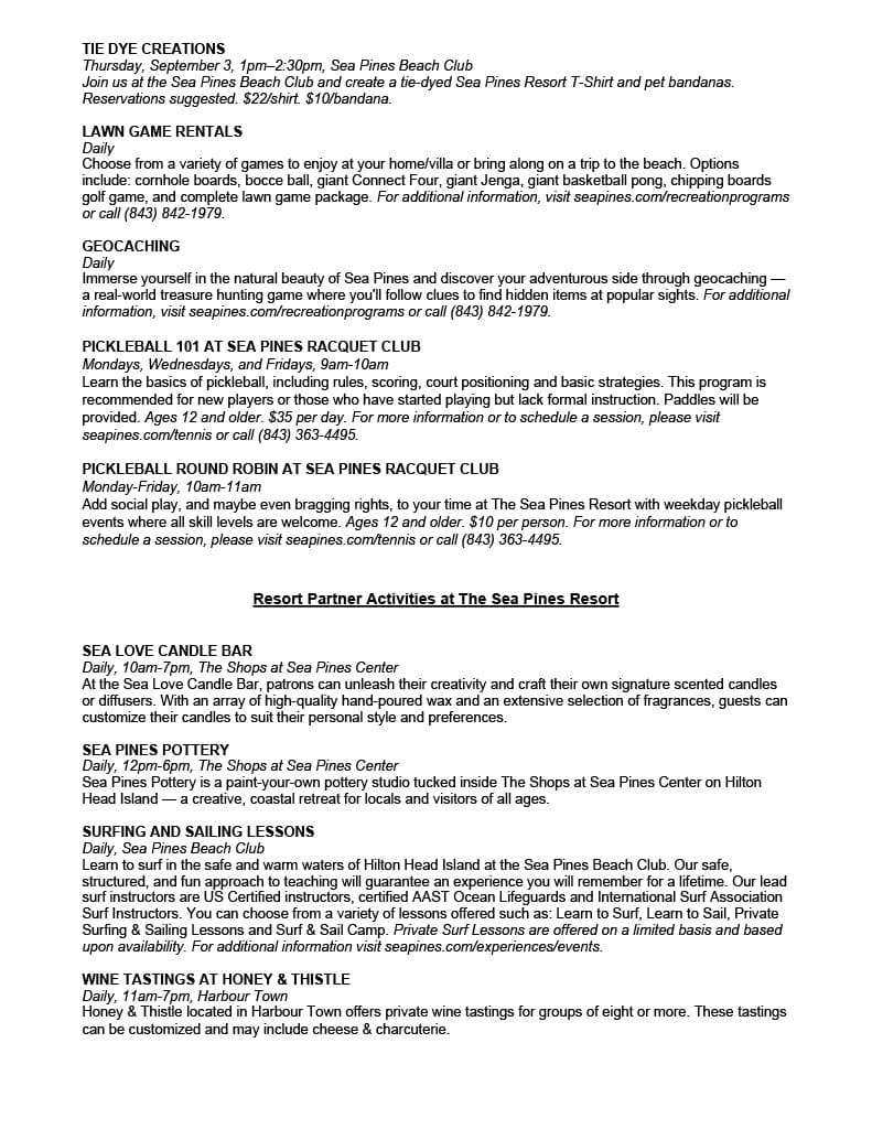
Harbour Town Yacht Basin, A CRUISERS NET SPONSOR, is ready for your reservation with newly renovated docks, upgraded electrical service and onSpot WiFi, also a CRUISERS NET SPONSOR. And, as always, numerous activities at the Sea Pines Resort are offered for your enjoyment, as you will see in the Event Schedule below. Hilton Head Island is absolutely marvelous any time of year.

Kerry Maveus
kmaveus@hunter-pr.com | www.hunter-pr.com
mobile: 831-917-2878
P.O. Box 1049 | Pebble Beach, CA | 93953
Be the first to comment!
Weather Alert: Atlantic Quiet For At Least Another Week – SCDNR

Weather Alert – September 11, 2026
Atlantic Quiet For At Least Another Week
We’re in what’s usually the most active part of the Atlantic hurricane season, but the tropical Atlantic is a ghost town right now.

The above loop of visible satellite imagery above shows several features of interest across the North Atlantic and eastern U. S.:
- Tandem tropical waves along 82° west and 77° west in the western Caribbean and one more wave over the tropical Atlantic along 38° west.
- A band of clouds associated with a front stretching from Arkansas and Missouri to the Delmarva Peninsula and over the western Atlantic.
- A blob of clouds over South Alabama and the Florida Panhandle associated with an upper-level disturbance.
Image Source: University of Wisconsin RealEarth
Today, we move into record territory for lack of hurricanes. Since 1960, when weather satellites became available, the latest hurricane development came on September 11, a record held by Gustav of 2002 and Humberto of 2013, with an honorable mention for Diana in the leap year of 1984; Diana’s formation on September 10 was on the 254th day of the year, the same as Gustav and Humberto. The last time we went this deep into the season with no hurricanes was in 1941. Two years, 1907 and 1914, had no known hurricanes, and 1914 had only one known tropical storm.
A few tropical waves are crossing the deep tropics, but none show significant thunderstorm activity.
The Atlantic is likely to remain calm for another week or so. In fact, the deep tropics could remain calm much longer because the El Niño-driven vertical wind shear in the region is unlikely to subside. We’re also likely to see a continuing feed of dry air from Africa; blame El Niño for that, too.
However, the subtropical Atlantic (the area between the Tropic of Cancer and 35° north) could turn active as we approach the end of the month. As we head into late September and October, we start to see cold fronts edge further south again, and they usually turn stationary over the Gulf and subtropical Atlantic. Stationary fronts over warm waters can become a breeding ground for tropical cyclones. Our computer models are picking up the risk, with some showing development in 10-14 days, but they disagree on exactly where and when. There’s no strong signal for any area to be on high alert, just an indication that vigilance is necessary.
Quiet times continue in the Atlantic, but there’s still a lot of hurricane season left (yesterday was halftime), so stay prepped. If you need prep advice, hit up hurricane.sc.
SC Weather Highlights For the Next Week:
We’ll be turning unsettled this weekend as an upper-level trough moves in and a cold front to our north sags southward. This afternoon will bring scattered showers and thunderstorms, primarily over the northern half of the state. Stronger storms can cause locally damaging winds, and isolated flash flooding is also a concern. Most of the state will reach the 90s.
Saturday should be our most active day, as a disturbance now along the Gulf Coast tracks through ahead of the approaching front. This moisture-laden disturbance will trigger widespread showers and thunderstorms, and isolated damaging winds and isolated flash flooding remain a risk. Clouds and rain will keep temperatures in the 80s in the Upstate with low 90s elsewhere.
Sunday looks less active, with afternoon thunderstorms more focused along the Coastal Plain. Most of the state will reach the low 90s.
Monday looks hotter as a second front approaches. This will be one of those ‘backdoor fronts’, moving in from the northeast. The front won’t produce many afternoon and evening storms. Highs will be in the low to mid-90s; hotter spots could get to the upper 90s.
A cooler, drier air mass will move in behind the front. A little cooler, lower humidity will be the real relief. Tuesday could bring a shower or thunderstorm to the Lowcountry before the front pushes south, but otherwise, Tuesday through Friday all look rain-free. Highs will be in the upper 80s to low 90s Tuesday and Wednesday, then mainly low 90s later in the week. We’ll have to wait until the week after next for any real taste of fall.
Frank Strait
Severe Weather Liaison
S.C. State Climate Office


South Carolina Department of Natural Resources
260 D. Epting Lane
West Columbia, SC, 29172Stay Connected with SCDNR: 


SUBSCRIBER SERVICES: Be the first to comment!
What’s Happening At the Sea Pines Resort (Sept 2026), Harbour Town Yacht Basin, SC AICW MM 565
Harbour Town Yacht Basin, A CRUISERS NET SPONSOR, is ready for your reservation with newly renovated docks, upgraded electrical service and onSpot WiFi, also a CRUISERS NET SPONSOR. And, as always, numerous activities at the Sea Pines Resort are offered for your enjoyment, as you will see in the Event Schedule below. Hilton Head Island is absolutely marvelous any time of year.
Kerry Maveus
kmaveus@hunter-pr.com | www.hunter-pr.com
mobile: 831-917-2878
P.O. Box 1049 | Pebble Beach, CA | 93953
Be the first to comment!
Its here! – SCDNR
SCW August 2026

South Carolina Wildlife magazine . . .
behind the scenes!

South Carolina Wildlife magazine September-October 2026 front cover: juvenile great horned owls by Phillip Jones
We are delighted to share the fall issue of South Carolina Wildlife magazine, brimming with stories perfect for curious minds of all ages. In this edition, writers wax poetic on topics ranging from owling, to hunting memories and younger years on the farm.
We are also excited to feature the SCDNR canine conservation team in a new SCW segment, K-9 Tracks!
This season’s collection invites you to deepen your connection with the natural world around you. So, let’s settle in and get ready to explore what makes our natural heritage so worth protecting.
If you are not already a SCW subscriber, simply visit GoOutdoorsSouthCarolina.com or SCWildlife.com to start up, renew or gift a subscription today.
Check out two excerpts from articles featured in the upcoming fall issue!
“Fright Night: Owling and Prowling”
by Will Mundhenke, SCDNR State Naturalist
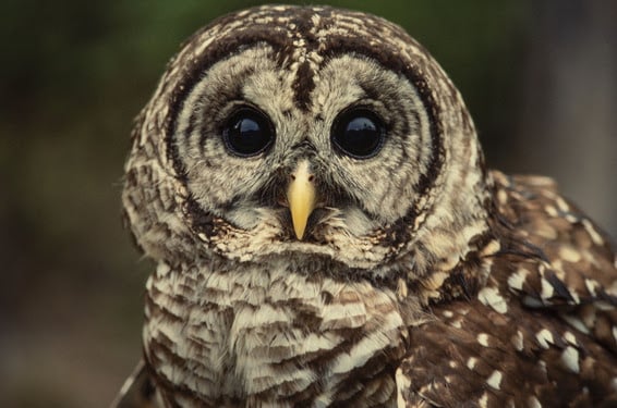
Barred owl, photo by Ted Borg
If you have ever spent the early morning hours in the turkey woods or climbing into a deer stand well before the sun rises, you may have heard a haunting sound. Experienced sportsmen will know the call as one from a friend, but anyone unfamiliar with the twilight hours will feel a chill in their bones. The ominous and drawn-out tones ring throughout the hardwood bottoms of the Palmetto State. If you are fortunate, or unfortunate depending on your disposition, there will be a cackling and a pair or more “hootin’ it up” as you wait for daybreak. “Who-cooks-for-you-who-cooks-
for-you-all” is the question of the morning when a barred owl makes their presence known. There are numerous strange sounds when you find yourself alone in a dark forest. The alien-like yelps and howls from the coyote sends chills down your spine. The non-stop chants from the Eastern whip-poor-will and chuck-will’s-widow that are reminiscent of the infamous goatsuckers. This family of nocturnal birds called nightjars earn that name due in part to their freakishly large mouth and the ancient Greek myth that they could blind animals. The rustling of treetops and eerie crunching of leaves in the distance from an unsightly armadillo or voracious raccoon. Perhaps, even, the stealthy bobcat with razor sharp claws waiting to pounce on its next victim. All these denizens of our South Carolina woods call the night home, but none are more prominent than the haunting hoots of the barred owl (Strix varia).
Read the full story in the upcoming SCW September-October 2026 issue!
If you are scouting out locations to hear or see an owl, look no further than Congaree National Park! The following is another excerpt from the SCW September-November issue! In her story, Alden Zerkle ventures deep into the woods and waters of Congaree National Park to show readers what makes it unique.
“The National Park Everyone Gets Wrong: Why Congaree National Park matters to all of us.”
by Alden Zerkle, SCDNR intern
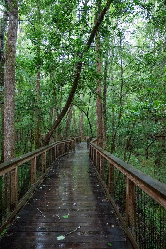
The boardwalk trail winds throughout Congaree National Park. Photo by Alden Zerkle
A Different Kind of National Park
Congaree isn’t a landscape park. It’s a biological one.
Beneath its seemingly ordinary canopy lies one of the largest remaining old-growth bottomland hardwood forests in North America — a place where seasonal floodwaters still shape the land, where wildlife thrives in ancient ecological rhythms, and where some of the tallest trees east of the Rockies rise into the sky.
In fact, Congaree contains the highest concentration of champion-sized trees in the United States. Some tower more than 170 feet overhead, roughly the height of a seventeen-story building. Standing beneath them is a humbling experience. Photos don’t quite capture it, statistics don’t either. Only when you crane your neck upward and watch the canopy disappear into the sky do you begin to understand what survives here. Much of the southeastern United States once looked like this. Vast floodplain forests stretched across river valleys, shaped by seasonal flooding and untouched by development.
Today, most of those forests are gone, but Congaree remains. And the deeper you venture into it, the more remarkable that fact becomes.
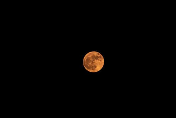
The moon from Congaree National Park. Photo by Alden Zerkle
The Forest Most People Never See
So how do you actually experience Congaree?
For starters, discover extensions of the boardwalk. Some of the park’s earthen trails offer an excellent introduction to the forest, winding beneath towering hardwoods and across pockets of swampy terrain. But stopping there is a little like visiting the beach and never touching the water. The real adventure begins beyond the wooden planks. A short walk from the visitor center, you can find Cedar Creek flowing quietly through the heart of the park. Its tea-colored water reflects the forest so perfectly that the trees seem to continue beneath the surface. Here, visitors can kayak, canoe, or paddleboard through one of the most unique landscapes in South Carolina. Bald cypress rise from the water on fluted trunks wider than compact cars, Tupelo trees lean over the creek’s edge, turtles slide from fallen logs as your paddle passes, and bright yellow prothonotary warblers flash through the canopy like sparks of sunlight. Around every bend, the forest seems larger, older and quieter, and you are pleasantly surprised how quickly civilization disappears.
Within minutes of launching a kayak, Columbia feels impossibly far away. The noise of traffic vanishes, there are no crowds waiting for photos and no lines of tourists at scenic overlooks. For students accustomed to constant notifications, crowded schedules and endless deadlines, that kind of silence feels almost foreign. And yet it might be exactly what we need.
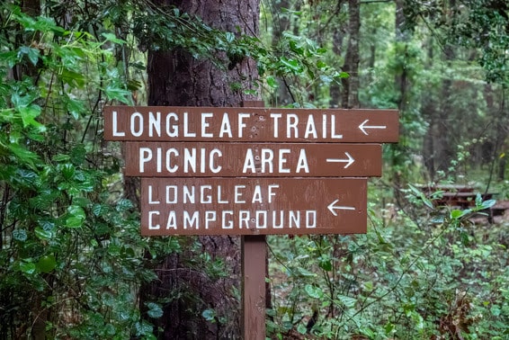
Congaree offers much more than first meets the eye. Photo by Alden Zerkle
Read the full story in the upcoming SCW September-October 2026 issue!
Press check!

A stack of SCW covers fresh off the press. Photo by Cade McCants
The September-October issue of South Carolina Wildlife magazine is hot off the press! And with the creation of each new edition, our magazine staff have the opportunity to visit the print shops where the physical magazine comes to life. It is awe-inspiring to witness the speed and quality at which the magazine is produced.
We visit the printers to ensure that the finished product matches our vision for the magazine. The original file passes across many screens and through a variety of machines to fine-tune the pages.
SCW Art Director Kathryn Badal Diaz plays a vital role in ensuring consistency and high quality. At the printer, as pages pass quickly through the machine, she compares the output with our original prints. She works in real time with machine operators to adjust color levels to get the right match.

SCW art director Kathryn Badal Diaz inspects pages for color accuracy. Photo by Cade McCants
The machines that print South Carolina Wildlife magazine are truly impressive. The web press, which produces the inner pages, is capable of printing around 21,000 pages an hour and spans nearly the entire length of the warehouse. Each page begins its life as part of a giant roll of paper. As the paper zips through the press, black, cyan, magenta and yellow ink are applied in stages. Then a glossy coating is applied, baked on at 300 degrees and rapidly cooled. Then it’s off to another machine for cutting and binding. This entire process happens in just a matter of seconds! 
The web press prints and finishes pages at incredible speed. Photo by Cade McCants
We are proud to present the fall issue of South Carolina Wildlife magazine, arriving in mailboxes soon. It is not too late to subscribe and receive the September-October edition.
The holidays will be here before you know it! You can wrap up your gift shopping today with a 2027 SCW subscription! South Carolina Wildlife is a wonderful, lasting gift that reconnects us with nature during every season of the year.
Thank you for your support!
South Carolina Wildlife
September-October 1995
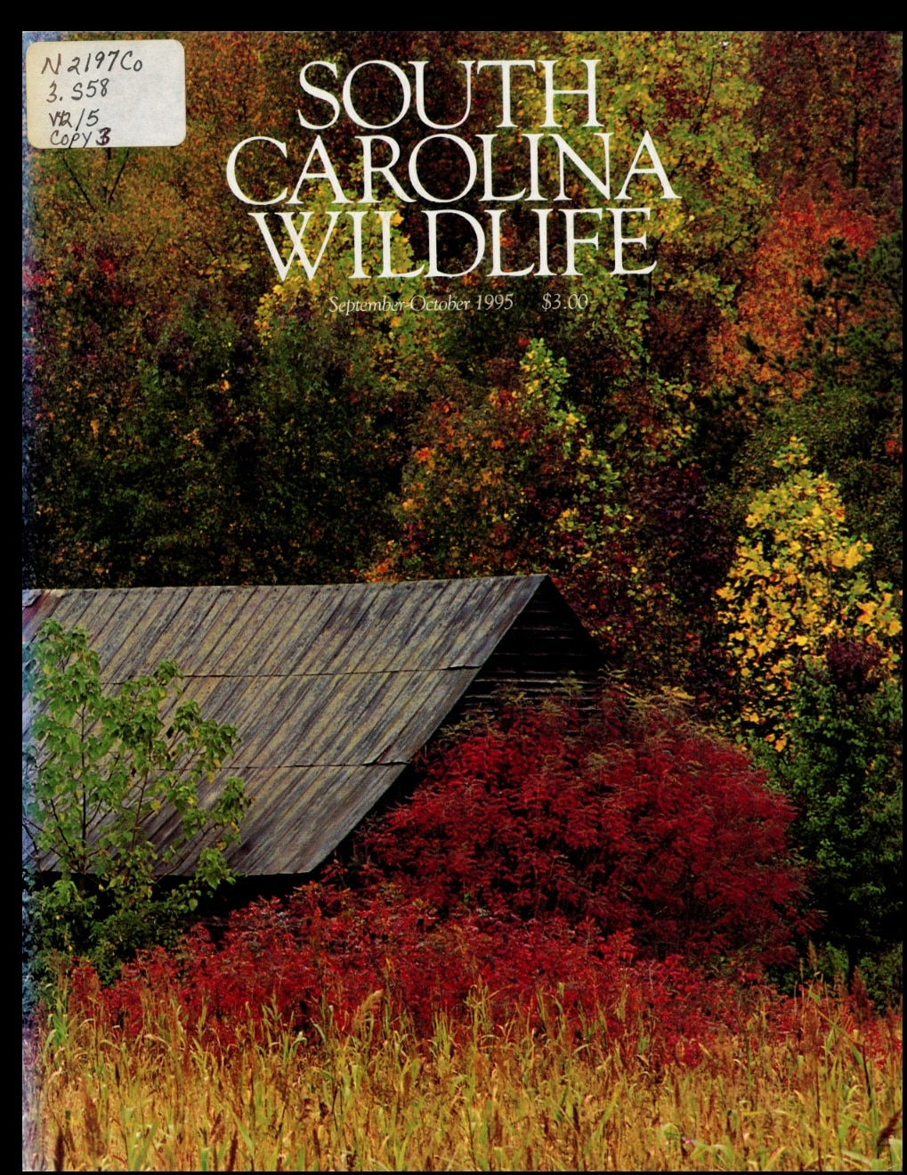
South Carolina Wildlife, September-October 1995
Thank you for supporting South Carolina Wildlife magazine, the flagship publication of the S.C. Department of Natural Resources.
If you are not already a subscriber, please visit GoOutdoorsSouthCarolina.com or SCWildlife.com to receive bi-monthly editions of this award-winning magazine.
South Carolina Department of Natural Resources
South Carolina Wildlife magazine
P.O. Box 167
Columbia, SC 29202Stay Connected with SCDNR: 




SUBSCRIBER SERVICES:
Manage Subscriptions | Unsubscribe | HelpBe the first to comment!
SCDNR Coastal Updates September – SCDNR

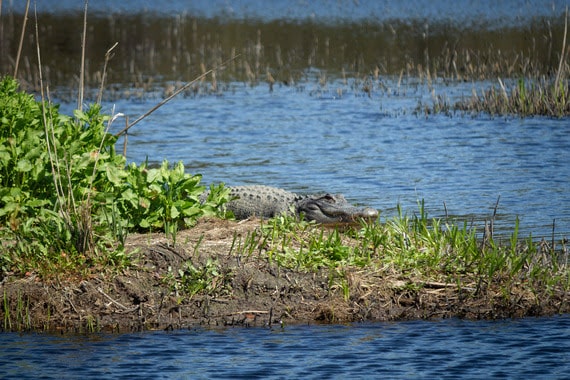
An American alligator sunbathes at Santee Coastal Reserve (Photo: Emma Berry/SCDNR).
Welcome to the South Carolina Department of Natural Resources Coastal Updates newsletter!
You are receiving this email because you attended one of our public programs or signed up for updates from our agency. In this monthly newsletter, you’ll find the latest outdoors news, volunteer opportunities, useful career information and more. We hope it will help you enjoy and protect our state’s beautiful coastline. What’s happening outdoors along the coast in September?
- Water temperatures remain high. Consider avoiding fishing for adult or ‘bull’ red drum until temperatures drop and spawning ends in October.
- The 2026 SC shrimp baiting season opens September 11th at noon.
- Sea turtles are still hatching. Keep lights out for loggerheads if you’re on the beach!
- September is SC’s peak hurricane month. Make sure you’re prepared.
 SC is having a banner year for loggerhead turtle nests | Post & Courier
Bird’s eye view: Reserves advance oyster reef drone monitoring in the Southeast | NERRA
Captain Sams Spit conservation deal moves forward after budget approval | ABC4 News
How SC is fighting derelict boats polluting Lowcountry salt marshes | The Island Packet
South Carolina youth continue to excel in national wildlife competition | ClemsonNews
 Advanced Pier Fishing (Myrtle Beach) | Wednesday, September 9th, 6PM – 8PM | This clinic builds on the introductory class to pier fishing. We will teach you how to tie your own rig, advanced knots and more technical aspects to pier fishing, such as using spoons or lures. Kids ages 6+ and adults are welcome. You must RSVP here to attend.
ACE Basin Property Tour (Edisto Island) | Friday, September 11th, 9AM – 12PM | Join SCDNR Staff on a tour of the ACE Basin where we explore the cultural and natural resources found throughout Botany Bay Plantation Heritage Preserve and Wildlife Management Area! Register here.
ACE Basin Fun Day (Edisto Island) | Saturday, September 12th, 10AM – 1PM | This free event will have hands-on activities, booth, scavenger hunts and a chance to ride on the E/V Discovery for an educational boat ride in the ACE! You must register here for the boat ride.
SCORE MWR Fabrication w/ Casual Crabbing with Tia (Charleston) | Wednesday, September 16th, 9AM – 12PM | Volunteers will help cut, bend, and fasten galvanized wire to form a reef structure and then shovel recycled oysters into shaped wire. These reefs will be used to attract oyster larvae to their new forever home! You must register here to attend.
Mackerel Pier Fishing (North Myrtle Beach) | Saturday, September 19th, 8AM – 11AM | This clinic will teach you how to tie fishing knots, rig a rod and reel for targeting mackerel, cast and more! Kids ages 6+ and adults are welcome. You must RSVP here to attend.
SCORE Trash Picking w/ Charleston Waterkeeper (North Charleston) | Tuesday, September 29th, 1PM – 3PM | Volunteers will use trash grabbers to pick trash out of recycled shells. Recycled oyster shell will be used to replant various State Shellfish Grounds and for various restoration projects. You must register here to attend.
Mommy & Me Saltwater Fishing Clinic (Georgetown) | Friday, October 2nd, 10AM – 1PM | Fishing Clinic for moms and kids! Join SCDNR, North Inlet NERR Staff and SCDNR certified instructors to learn the basics of saltwater fishing. You must RSVP here to attend.
SCORE Trash Picking w/ Charleston Waterkeeper (North Charleston) | Tuesday, October 6th, 1PM – 3PM | Volunteers will use trash grabbers to pick trash out of recycled shells. Recycled oyster shell will be used to replant various State Shellfish Grounds and for various restoration projects. You must register here to attend.
SCORE MWR Fabrication (Charleston) | Thursday, October 8th, 9AM – 12PM | Volunteers will help cut, bend, and fasten galvanized wire to form a reef structure and then shovel recycled oysters into shaped wire. These reefs will be used to attract oyster larvae to their new forever home! You must register here to attend.
Take A Kid Fishing Day (Horry County – multiple locations) | Saturday, October 17th, 8AM – 11AM | Join SCDNR & partnered Horry County Fishing Piers for the annual Take a Kid Fishing Day. This event will take place over multiple piers. Kids over the age of 3 and one adult guardian will get to fish for free! Participating children must RSVP to attend and be a SC resident.
Interested in saltwater fly fishing clinics? You can keep an eye out on our calendar at www.saltwaterfishing.sc.gov for upcoming clinics. Fly fishing clinics will only advertise for a short window and have limited capacities.

We’re hiring!
Wildlife Biologist I | Georgetown County, SC | The employee will conduct face-to-face interviews with marine recreational anglers following protocols established by the NOAA Fisheries Marine Recreational Informational Program.
Building/Grounds Specialist | Charleston, SC | This employee will be responsible for groundskeeping, landscaping, minor repairs and maintenance duties for the research and administration facilities of SCDNR, Marine Resources Division at Fort Johnson.
Natural Resource Technician II | Charleston County, SC | This employee will be responsible for assisting with habitat development work on the Upper Coastal Waterfowl Project.
See all open SCDNR jobs here. Click Search Openings, Filter, Search Agency, Department of Natural Resources.
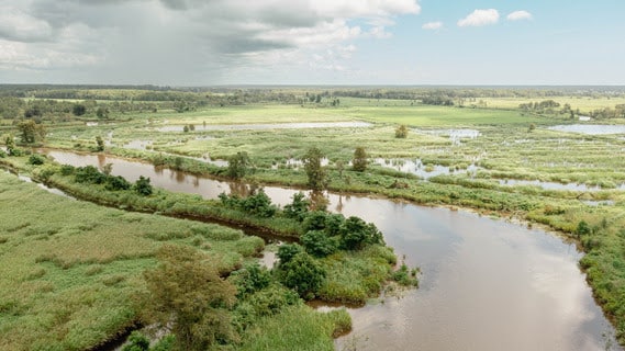
Landscape at Samworth Wildlife Management Area (Photo: SCDNR).
Partner Opportunities
Training Program Coordinator | North-Inlet Winyah Bay NERR | Georgetown, SC | This highly collaborative role strengthens science-informed management, builds stakeholder capacity, and supports the Reserve’s mission to protect and sustain South Carolina’s coastal resources through education, engagement, and applied science.
Executive Director | Open Land Trust | Beaufort, SC | The Open Land Trust seeks an experienced and community-minded Executive Director to lead South Carolina’s first and oldest land trust into its next chapter of conservation impact across the southern Lowcountry.
August and September are peak spawning months for red drum in South Carolina!
August and September are peak spawning months for red drum in South Carolina, and successful spawning activity is critical to producing the next generation of red drum, like the fingerling seen below.
If you’d like to help the population rebound, give these adult (or bull) drum a break from fishing pressure during these months. They’ll still be around when temperatures dip and spawning ends in October – after they’ve had a chance to contribute to next year’s crop of young fish.
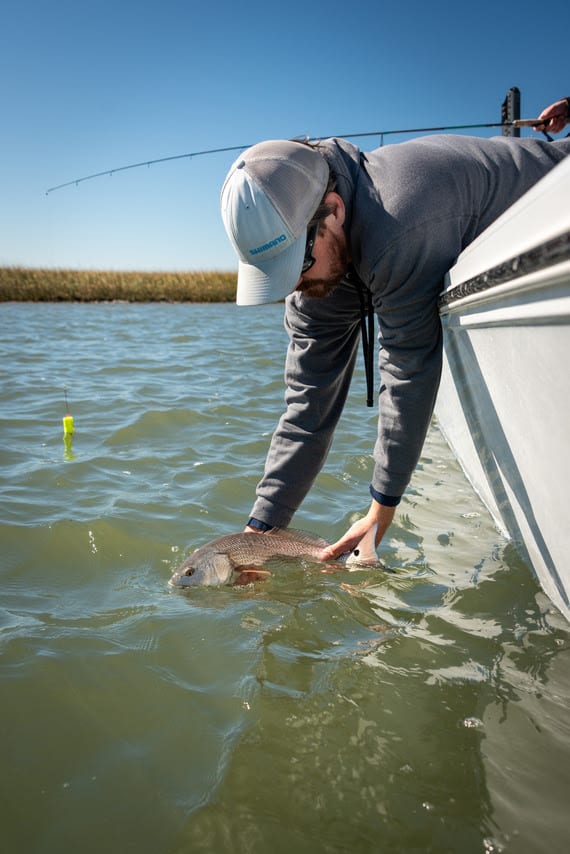
An angler demonstrates fish best handling practices by keeping the red drum horizontal and in the water. (Photo: Kaitlyn Hackathorn/SCDNR).
Stay Connected with SCDNR: 




SUBSCRIBER SERVICES: Be the first to comment!
Weather Alert – Quiet Tropics (Long Range Concern), Heavy Storms Through Tonigh – SCDNR

Weather Alert – August 21, 2026
Quiet Tropics (Long Range Concern)
The Atlantic tropics remain tranquil. The only two features of interest for tropical development are outside the tropics. Neither would affect South Carolina if they did develop. However, there is a potential concern in the long range.
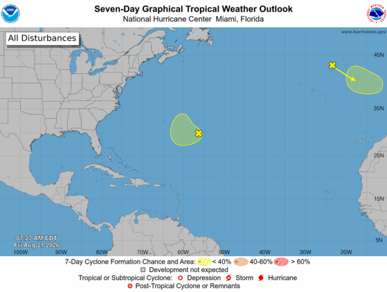
Four tropical waves are drifting through the tropical Atlantic and Caribbean Sea, but hostile conditions persist over most of the area. Upper-level westerly winds are causing vertical shear over the Caribbean Sea and vicinity, and a dry, dusty air mass remains over much of the tropical Atlantic.
Further north, the National Hurricane Center is watching a disturbance southeast of Bermuda for possible tropical development. However, it’s a long shot, and it will move northward rather than toward us. The other disturbance of interest is an extratropical storm west of Spain and Portugal that could gain tropical characteristics in time, but it will remain too far away from us to have any impact.
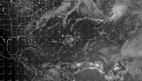
The above loop of visible satellite imagery above shows several features of interest across the North Atlantic and eastern U. S.:
- Tropical waves are along 78° west, over the Caribbean Sea; along 50° west, east of the Lesser Antilles; along 44° west, over the central tropical Atlantic; and along 22° west, southeast of Cabo Verde.
- Dry, dusty air is present between around 15° north and 25° north over the eastern tropical Atlantic.
- A disturbance southeast of Bermuda looks disorganized at the moment.
- A storm west of Spain and Portugal is generating thunderstorms over the eastern Atlantic.
- A band of clouds associated with a front stretches across Atlantic Canada, the East Coast, and the southeastern states.
Image Source: University of Wisconsin RealEarth
The Atlantic will likely remain quiet through at least this weekend, but things could change next week. A strong tropical wave will emerge from Africa early next week, and the computer models tell us that wave is likely to develop into a tropical cyclone. This makes sense with the Madden-Julian Oscillation becoming more favorable for Atlantic activity over the next week. The eventual track is uncertain, assuming it does become a tropical cyclone. It’s enough of a challenge to predict what a hurricane will do, and much harder to tell you what a storm that hasn’t even formed yet will do. But the signal from the models is that it could become a hurricane over the western Atlantic in early September. Such a storm would at least cause beach and boating hazards along our coast. So, there’s a chance we’re on the edge of our seats watching this feature a week or so from now.
We’re in the Atlantic hurricane season’s ‘prime time’; two-thirds of all Atlantic hurricane activity occurs between August 20 and October 10. Please ensure that your hurricane kits are fully stocked, just in case ‘that one storm’ we have this season comes our way. If you need prep advice, hurricane.sc is always the place to go.
Heavy Storms Through Tonight
The Lowcountry is stewing again today, but the heat wave is over for the rest of the state with a cold front moving in. Even the Lowcountry will return to more typical August temperatures starting Saturday. However, the front will bring us widespread thunderstorms with a risk of locally damaging winds this afternoon and tonight, and they can also cause localized flash flooding. The main area of concern is over the middle and northern parts of the state.
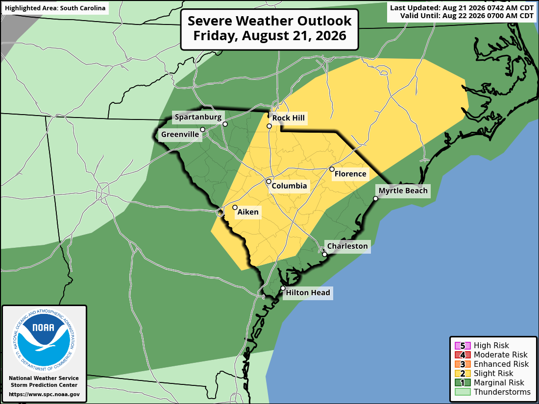
Top: The Storm Prediction Center’s Day 1 Severe Weather Outlook shows the entire state with some level of risk for locally damaging wind and hail with thunderstorms through tonight, with a part of the state at risk level 2 of 5.
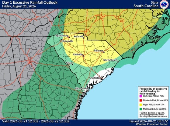
Bottom: The Weather Prediction Center’s Day 2 Excessive Rainfall Outlook shows much of the state at level 2 of 4 risk for flash flooding from thunderstorm downpours through tonight, and most other areas at a level 1 of 4 risk.
The front and its storms will shift to our coastal areas for Saturday and Saturday evening. Once again, there can be isolated damaging wind with the storms and perhaps localized flooding as well, but the risk will be lower than with this afternoon and tonight.
On Sunday, less-humid air will filter into most of the state and bring pleasant late-summer weather to all but the immediate coast, where an isolated shower or thunderstorm could pop up. Highs will mainly be 90-94° across the state; warm, but it will be a breath of fresh air compared to this week’s heat.
Monday looks fantastic for August with low humidity and highs in the upper 80s to lower 90s; enjoy that!
After that, it looks like the front will retreat northward and become stationary over us. So, the humidity will increase again, and we’ll have daily rounds of afternoon and evening thunderstorms starting Tuesday. Clouds and rain will keep our temperatures in check; daily highs across the state will be in the upper 80s to lower 90s, with middle 90s in the usual hot spots.
Frank Strait
Severe Weather Liaison
S.C. State Climate Office


South Carolina Department of Natural Resources
260 D. Epting Lane
West Columbia, SC, 29172Stay Connected with SCDNR: 




SUBSCRIBER SERVICES:
Manage Subscriptions | Unsubscribe | HelpBe the first to comment!
Georgetown Harbor Dredging Completed – More Information, Georgetown, SC

Thanks to Chris Carroll of Harborwalk Marina for this updated information regarding the recent dredging of Georgetown Harbor.
Harborwalk Marina, A CRUISERS NET SPONSOR, is only a boardwalk stroll away from Georgetown’s Historic District for history, entertainment, great food, and shopping. Harborwalk Marina is the third marina on your starboard side as you enter the very protected waters of Georgetown.
From https://www.facebook.com/CharlestonCorps
Click Here To View the Cruisers’ Net’s South Carolina Marina Directory Listing For Harborwalk Marina
Click Here To Open A Chart View Window, Zoomed To the Location of Harborwalk Marina
Be the first to comment!
Georgetown Harbor Dredging Completed, Georgetown, SC
Thanks to Chris Carroll of Harborwalk Marina for this updated information regarding the recent dredging of Georgetown Harbor.
Harborwalk Marina, A CRUISERS NET SPONSOR, is only a boardwalk stroll away from Georgetown’s Historic District for history, entertainment, great food, and shopping. Harborwalk Marina is the third marina on your starboard side as you enter the very protected waters of Georgetown.
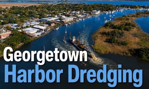
The Georgetown Channel coming to us and downtown is completely dredged. 18’ deep in some places at high tide.
Chris Carroll
Operations Manager
Harborwalk Marina – Georgetown Communications
www.harborwalkmarina.comClick Here To View the Cruisers’ Net’s South Carolina Marina Directory Listing For Harborwalk Marina
Click Here To Open A Chart View Window, Zoomed To the Location of Harborwalk Marina
Be the first to comment!
What’s Happening At the Sea Pines Resort (Sept 2026), Harbour Town Yacht Basin, SC AICW MM 565
Harbour Town Yacht Basin, A CRUISERS NET SPONSOR, is ready for your reservation with newly renovated docks, upgraded electrical service and onSpot WiFi, also a CRUISERS NET SPONSOR. And, as always, numerous activities at the Sea Pines Resort are offered for your enjoyment, as you will see in the Event Schedule below. Hilton Head Island is absolutely marvelous any time of year.
Kerry Maveus
kmaveus@hunter-pr.com | www.hunter-pr.com
mobile: 831-917-2878
P.O. Box 1049 | Pebble Beach, CA | 93953
Be the first to comment!






Social Media Auto Publish Powered By : XYZScripts.com
Be the first to comment!