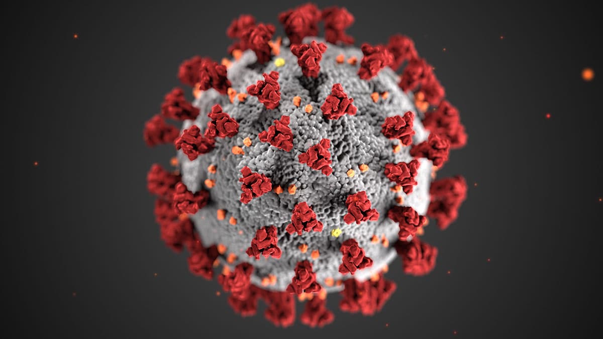
Red Tide Appearing on Gulf Beaches
Siesta, Lido and Longboat keys among Sarasota-area beaches reporting elevated measures.

Rising red tide levels prompt county advisory
YourObserver.com
Siesta, Lido and Longboat keys among Sarasota-area beaches reporting elevated measures.
Rising red tide levels prompt county advisory
YourObserver.com

Gulfport Municipal Marina, A CRUISERS NET SPONSOR, and the City of Gulfport always have a full calendar of events for all ages. The marina and harbor, found on the northern shores of Boca Ciega Bay, are easily accessible from the Western Florida ICW, just north of Tampa Bay.
| |||||||||||||||||||||||||||||||||||||||||||||||||||||||||||||||||||||||||||||||||||||||||||||||||||||||||||||||||||||||||||||||||||||||||||||||||||||||||||||||||||||||||||||||||||||||||||||||||||||||||||||||||||||||||||||||||||||||||||||||||||||||||||||||||||||||||||||||||||||||||||||||||||||||||||||||||||||||||||||||||||||||||||||||||||||||||||||||||||||||||||||||||||||||||||||||||||||||||||||||||||||||||||||||||||||
Click Here To Open A Chart View Window Zoomed To the Location of Gulfport Municipal Marina
Click Here To Open A Chart View Window Zoomed To the Location of Gulfport Anchorage/Mooring Field

But, as I’ve often said, there’s no such thing as too much information when you are on the water, so there are two more observations concerning this anchorage copied from the AGLCA forum. For more reports, enter Pelican Bay in the search window of our Homepage.
1/26/2021
Highly recommend the Punta Blanca anchorage. We spent a few nights there December 20-23 2020. I have attached our route getting in on our 5.5’ draft sailboat. We entered and left at high tide, there’s one little bar we bumped over on the southwest side, otherwise stay close to the mangroves. We only saw kayakers and fishermen and a park ranger checking for campers on the island. About a mile and a half dink ride to Cayo Costa State Park dock and Cabbage Key.
cheers,
Greg Scannell, AGLCA Member
S/V Dragonfly
— Attachment(s) —
89F8EB0D-489B-4306-AEEF-
Alan is absolutely correct about Pelican Bay; it’s one of the premier anchorages you will find anywhere. However, “local knowledge” is important getting in there. Neither the approach to the bay, nor its entrance channel, are marked. So, ass/u/ming you are southbound on the G-ICW, turn west at a point south of G “75,” and about 200′ north of R “74.” Note that just off the shoreline, there is a Florida Speed Sign visible. Head toward that sign. Just before you reach the sign, turn SW and follow the line of the beach on Cayo Costa Island there, holding your course parallel to the beach and holding the shore close by to stbd at 50′ – 75′. Yes, a boat length or slightly more off the beach line. That “channel” carries 9′ of water, but it shoals very rapidly to the south, to 3′ or less. Many, many unwary boats go aground there. When you have passed by the beach, you will
see the Cayo Costa State Park docks at your 11 o’clock, at a distance of about 1/2 to 3/4 miles. Aim at those docks, and set a rhumb line to them until you are past the shallowest water. There are slips there, with no services, but cruising boats generally can’t use them. Only the very outermost slips carry sufficient water depth. The dock tee heads are reserved for tour boats, of which there are several that ply those waters. Plan to anchor. The bottom is sand, and the holding is excellent.
The gulf coast of Florida has diurnal tides; that is, one high and one low per day. Water depths are lowest in the morning and moderate to high in the mid-to-late afternoon. The tidal range at Pelican Bay is only about 2′. The rhumb line from the beach to the State Park docks will get down to 5-1/2′ at MLLW. By the time you get to the docks, you’ll see 6-1/2′ or more. There is a deep pool correctly charted on the current charts that carries 9′, which is the deepest water in the bay. Some older charts that are still widely circulated do not show that 9′ pool correctly. If you do not see that deep pool, you do not have the current charts of the basin. The basin is actually a “pass” between Cayo Costa Island to the west and Punta Blanco Island to the east. To the south from Pelican Bay, the water appears visually to be open; but, it is shoal, and not navigable by cruising draft boats. The only access back to the G-ICW from Pelican Bay is the one to the north of Punta Blanco Island, described above.
Armed with this “local knowledge,” you will find Pelican Bay to be a delightful, well protected anchorage with a lot to see and do.
Hope this is useful.
Jim
There are two really good anchorages near Boca Grande entrance to Charlotte Harbor. The second is Pelican Bay at Cayo Costa. This is one of our favorites. Many people avoid it because of the shoal at the entrance. Just hug the beach – stay 25-50 feet off the beach and you will be in 6-9 feet of water. We draw 4.5 feet and anchor here a lot. The beach and park at Cayo Costa are great and again the park is only accessible by boat.
Marty & Jerry Richardson
Pelican Bay is right in my backyard, and I have been there a number of times. The descriptions above are reasonable, although the details change often.
However, the discussion about tides is not correct. The tides in this part of the world cycle from diurnal to semidiurnal twice each month. The diurnal tides are near full moon and new moon, while the semidiurnal tides are near the first and third quarters. There is also an important annual component. The lowest tides tend to be mid-day in the winter and mid-night in the summer.
There are no simple rules that can be conveniently remembered. Even thought the average tidal range is only a couple of feet, tide tables are essential if depth is important to you.
Gene Fuller
Punta Gorda
The nun has now been replaced with a post R74. We were just there 1/20/13.
Frank Cushing
Click Here To Open A Chart View Window, Zoomed To the Location of Pelican Bay
Is there any updated info on Pelican Bay accessibility/ permission to anchor there, etc????? Last I've seen is Dec 2022.
We went by several days ago on saw a number of boats anchored there. Can’t go ashore but great location for nice anchorage. Looked like the boats were following the same route into Pelican Bay. Sign is still up.
I did dig a bit deeper and made some calls including to the Florida Park Service where I spoke to a real person. ( I had googled state parks and they gave me a list of other places still closed.) She said that the Cayo Costa is completely closed down and that included the anchorage. She was quite firm about the anchorage even when I said we would not go ashore. Has she ever even seen the place? Probably not. We are going that way anyhow in the next day or two so…….
I’m also looking for status of Cayo Costa. Currently anchored off Ding Darling for our second night. Mangroves look really browned out. Have not tried the dinghy yet to go inside as the entrance looks partially blocked off. Hopefully the tide is still coming up but… We are going to move to Cayo Costa probably tomorrow and will keep our fingers crossed. Came across the lake on Tuesday and very saddened to see Fort Meyers and Cape Coral and now Pine Island.
Jérôme – not a word – have tried for info via Boats US – nothing – seems either no one knows anything – or notinterested in answering.
Paul
I am looking for the same info on Pelican Bay and if boats are even cruising the ICW between Fort Myers and Venice. Have you by heard anything Paul?
Since the passing of Hurricane Ian can anyone tell me if the main entrance off of Marker #74 off the ICW is still navigable with a 5 foot draft???
Thank you.
Paul
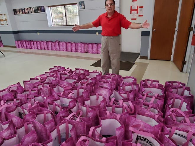
When boat owners from across the country make a seasonal visit to Lee County docks, they’ll receive bling bags.
Bling bags welcome visiting boaters to Southwest Florida
The News-Press
Courtesy Photo
Courtesy Photo
AREA SPONSORING MARINAS
Click Here To View the Cruisers Net Western Florida Marina Directory Listing For Legacy Harbour Marina
Click Here To Open A Chart View Window, Zoomed To the Location of Legacy Harbour Marina
Cick Here To View the Western Florida Marina Directory Listing For Gulf Harbour Marina
Click Here To Open A Chart View Window Zoomed To the Location of Gulf Harbour Marina
Click Here To Open A Chart View Window, Zoomed To the Location of the Fort Myers Beach Mooring Field
Gulfport Municipal Marina, A CRUISERS NET SPONSOR, and the City of Gulfport always have a full calendar of events for all ages. The marina and harbor, found on the northern shores of Boca Ciega Bay, are easily accessible from the Western Florida ICW, just north of Tampa Bay.

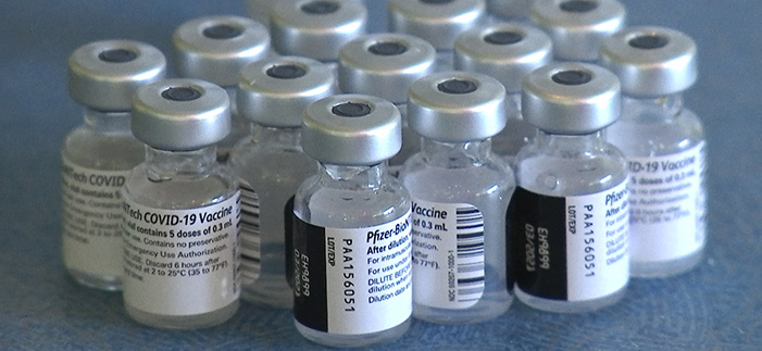
Virtual Art, MLK + the Vaccine
Click Here To Open A Chart View Window, Zoomed To the Location of Gulfport Municipal Marina
Click Here To Open A Chart View Window, Zoomed To the Location of Gulfport Anchorage/Mooring Field
During the pandemic, the Gulfport Historical Society continues its educational activities for the City of Gulfport, home to Gulfport Municipal Marina, A CRUISERS NET SPONSOR, located on the northern shores of Boca Ciega Bay and easily accessible from the Western Florida ICW, just north of Tampa Bay.

| |||||||||||||||||||||
|
Cove Anchorage is found on the waters of the large cove indenting the Waterway’s northeastern banks at unlighted daybeacon #35. Our thanks to James Aughton for this review.
This anchorage is near perfect, in the middle of a No Wake zone and well protected from winds. Unfortunately, this is not a great location during the hot, humid Florida summers. And don’t leave the hatch open after sunset, the no-seeums will eat you up. End of roadway just to the south is a good dinghy landing and short walk east to Publix grocery store.
James Aughton
Click Here To View the Western Florida Anchroage Directory Listing For Cove Anchroage
Click Here To Open A Chart View Window Zoomed To the Location of Cove Anchorage
Englewood Anchorage lies east of the Western Florida ICW, north of marker #25. Don’t confuse this anchor down spot with the Englewood Beach Anchorage while is located west of the ICW’s track. Our thanks to James Aughton for this review.
Good summer anchorage, usually a good breeze and few bugs as you can anchor away from shore. Adjacent to county park with beach and boat ramp/docks for landing. One mile walk to east is Grocery & Drug store.
James Aughton
Click Here To Open A Chart View Window, Zoomed To the Location of the Englewood Anchorage
Gulfport Municipal Marina, A CRUISERS NET SPONSOR, and the City of Gulfport always have a full calendar of events for all ages. The marina and harbor, found on the northern shores of Boca Ciega Bay, are easily accessible from the Western Florida ICW, just north of Tampa Bay.
| |||||||||||
This dogleg inlet channel has been an area of shoaling and shifting channels for years. Keep a sharp on your depth finder as you enter. See photo below.
FLORIDA – FORT MYERS TO CHARLOTTE HARBOR AND WIGGINS PASS – MATANZAS PASS CHANNEL: Shoaling and changes to channel.
Shoaling has been reported in the vicinity of the newly placed federal aids to navigation at Matanzas Pass at the previous position of Matanzas Pass Daybeacon 4 (LLNR 18095 [26°27.9340N / 081°58.1690W, 26.465566 / -81.969484]), in position 26-27-55.397n, 081-58-09.010w. Mariners are advised that recent dredge work has been completed returning the federal channel back to its original dimensions south of the current route. The channel runs close abeam of the southern beach at Bodwitch Point and is marked with a Temporary buoy 4. Additionally a temporary danger shoal light has been placed in position 26-27-58.002N, 081-58-09.943(26°27.9667N / 081°58.1657W, 26.466112 / -81.969429), flashing quick white at night with a white and orange danger board. This location was previously the position of Matanzas Pass Light 5 (LLNR 18107 [26°27.9664N / 081°58.1654W, 26.466106 / -81.969424]). All mariners are advised to be aware of these hazards to navigation and transit the area with caution.

During the pandemic, the Gulfport Historical Society continues its educational activities for the City of Gulfport, home to Gulfport Municipal Marina, A CRUISERS NET SPONSOR, located on the northern shores of Boca Ciega Bay and easily accessible from the Western Florida ICW, just north of Tampa Bay.

December (and the end of 2020!) are here! We have some open volunteer opportunities in December, both in the Museum and helping out with this month’s Porch Party.
Do you have some extra time? Looking to get out of the house for a bit?
Click on the link below to sign up. Covid protocols in place – masks and social distancing.
https://www.signupgenius.com/
Questions? Email us at info@
Our mailing address is:
Gulfport Historical Society
Gulfport, FL 33707
Click Here To Open A Chart View Window Zoomed To the Location of Gulfport Municipal Marina
Click Here To Open A Chart View Window Zoomed To the Location of Gulfport Anchorage/Mooring Field
The City of Gulfport, home to Gulfport Municipal Marina, A CRUISERS NET SPONSOR, always takes steps to protect its citizens and visitors. The marina and harbor, found on the northern shores of Boca Ciega Bay, are easily accessible from the Western Florida ICW, just north of Tampa Bay.
| |||||||||||
Safety Harbor Marina is in the northwest corner of Old Tampa Bay, north of St. Petersburg and the Howard Franklin Bridge. Our thanks to Larry Pritchett for this alert.
Destroyed ATON G9 Safety Harbor Marina Channel
Day mark G9 in the Safety Harbor Marina Channel was destroyed by Storm ETA. Piling is below the water at high tide.
Dock at one of the most accommodating marinas, CRUISERS NET SPONSOR, Long Boat Key Club Moorings, and get off the boat for a few days to enjoy Longboat Key Club’s recently renovated rooms and resort special areas. It will renew your inner-most appreciation of Florida’s West Coast.

Click here for Get the Look: Longboat Key’s Oh-So Yacht Sleek – Opal Unpacked
This non-ICW marker is on the north side of a maintained channel between two Cruisers Net sponsors.
Manatee River Daybeacon 24 Structure damaged, temporary buoy onsite. Chart 11416 LNM 39/20
AREA SPONSORING MARINAS
Click Here To Open A Chart View Window, Zoomed To the Location of Twin Dolphin Marina
Click Here To Open A Chart View Window, Zoomed To the Location of Riviera Dunes Marina Resort
The Cape Coral Cruise Club is a group of dedicated cruisers who always provide unique reports from the marinas they visit. Pink Shell Beach Resort and Marina, voted Best Small Marina in 2017, overlooks the westerly banks of the Matanzas Pass channel, west of marker #13. Pink Shell Beach Marina is a favorite of the CCCC, see 2020 Cruise to Pink Shell.
August 2020 Pink Shell Cruise
by Commodore Doug Rhees
After several months of quarantine, and adhering to CDC guidelines, the Cape Coral Cruise Club finally put together a cruise with the help of the excellent marina staff at the Pink Shell Resort on Ft, Myers Beach. Dates selected were August 18th-21st. Social distancing and mask wearing protocols assured all attendees remained healthy.
Nine boats ranging in size from 27 to 54 feet attended. A few non boating members joined the group and enjoyed the company of members at two evening dinners. Late afternoon docktail gatherings held on the lawn above the docks where adequate space was available for social distancing. Weather cooperated and made early morning beach walking a treat as, at this time of year, there are no crowds. The resort pools were not crowded as well, and every day provided sun time and an afternoon rain shower to cool things down. Several members enjoyed a memorable dinner at Mantanzas on the Bay the last evening.
The Cape Coral Cruise Club has made adjustments to upcoming Club activities to help assure the safety of members. The Club owns a portion of a spoil Island east of the Franklin lock on the Caloosahatchee River and has decided to hold membership meetings there in conjunction with the Club’s monthly picnics. Cruise locations for the fall have had to be changed due to marinas modifying transient boater rules. However, lots of fun events are in the works for the following cruises: September 17 to 21 at Tween Waters, October 27 to 30 at South Seas Island Resort, and November 17 to 20 at Fisherman’s Village, Punta Gorda.
The Cape Coral Cruise Club is open to new members who own a boat with overnight accommodations and reside in the Cape Coral / Ft. Myers area. For membership information please contact Terry Carlson at 239-770-6955. Read additional Club information on our website, https://ourgrouponline.org/CapeCoralCruiseClub
Attached pictures:
0500 – CCCC member boats at Pink Shell Marina.
0523 – beautiful sunset at Pink Shell, Ft. Myers Beach


Click Here To Open A Chart View Window, Zoomed To the Location of Pink Shell Beach Resort and Marina
Gulfport Municipal Marina, A CRUISERS NET SPONSOR, and the City of Gulfport are found on the northern shores of Boca Ciega Bay, easily accessible from the Western Florida ICW, just north of Tampa Bay.
| |||||||||||||||||||||||||||||||||||||||||||||||||||||||||||||||||
Gulfport Municipal Marina, A CRUISERS NET SPONSOR, and the City of Gulfport are found on the northern shores of Boca Ciega Bay, easily accessible from the Western Florida ICW, just north of Tampa Bay.
| |||||||||||||||||
Bravo Gulfport! What every city should be doing!


Comments from Cruisers (2)
Red tides were documented in the southern Gulf of Mexico as far back as the 1700s and along Florida’s Gulf coast in the 1840s.
Edward LePera Thanks Edward. Interesting note .Guess back then the resort market place wasn’t too worried about its impact on local tourism and fishing. Thank you for sharing.