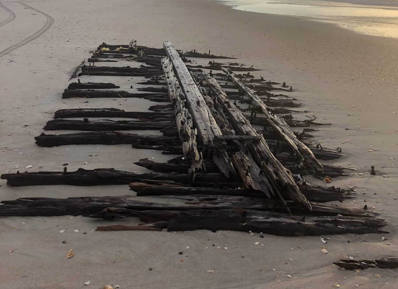
In a year with very few tropical systems, Hurricane Four of 1913 received barely a notice by the Raleigh office of the Weather Bureau of the United States.
A shipwreck believed to be the George W. Wells is shown on Ocracoke Island after being exposed by waves produced by passing Hurricane Teddy in September 2020. Photo: Cape Lookout National Seashore
This dataset contains mapped boundaries of intertidal oyster reefs and washed shell deposits found along the SC coast. Our thanks to Ted Arisaka for this information.
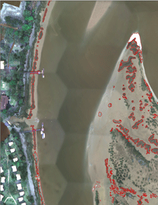
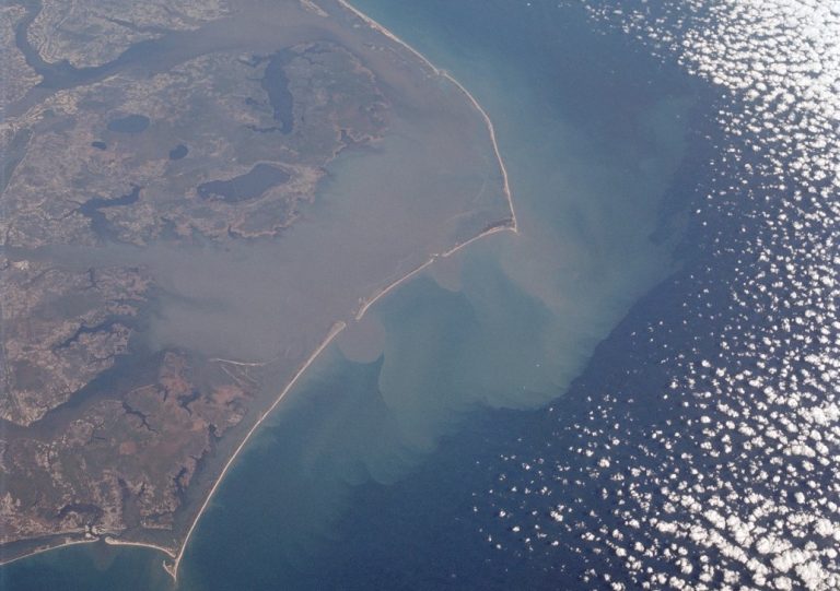
South Carolina Intertidal Oyster Reef Mapping
This dataset contains mapped boundaries of intertidal oyster reefs and washed shell deposits found along the SC coast. Reefs were mapped through a combination of automated and manual techniques using 4-band (blue, green, red, near-infrared) digital orthophotos with a theoretical ground resolution of 0.25 meters. These photos were taken from 2003-2006 and can be downloaded. The project area covered those sections of the SC coastal zone where oysters had historically been mapped by the SC Department of Natural Resources (SCDNR) in the 1980’s. The area spans 122 USGS quarter quadrangles (DOQQs).
Sixty of the mapped DOQQs were ground-truthed by boat to assess accuracy. The initial mapping process met the overall minimum accuracy requirements of the project (80% correct classification) and was completed through a joint effort between Photo Science Inc. and SCDNR. Since 2006, low-altitude helicopter photography (see photo below) has been used to edit and update the initial data product. In 2016, 18.5% of the mapped oysters had been updated using helicopter photography. Edits and improvements to this data product are ongoing, and this dataset will be periodically updated.
A link is included below for a table that lists initial accuracy and editing status data by DOQQ. Accuracy scores listed were calculated for the initial product and do not reflect the results of low-altitude helicopter photography editing, so these scores should be considered to be the minimum level of accuracy for the edited areas. Areas covered and analyzed by low-altitude helicopter photographs can be considered to have the highest degree of accuracy. DOQQs that have not been edited by SCDNR should be used with caution. Due to variations in image quality and visibility of oysters, some localized areas may not be as accurate as reported values. In particular, some of the oyster flats with sparse or patchy oyster coverage were difficult to map. Instructions and links are provided below for access to the data and associated metadata.
A federal judge has thrown out the Trump administration’s rule that gutted water quality protections put in place during the Obama administration. The challenge of the Trump rule was brought by six Native American tribes, who were represented by Earthjustice.
The Trump WOTUS revision removed protections for 18% of streams and 51% of wetlands in the U.S.
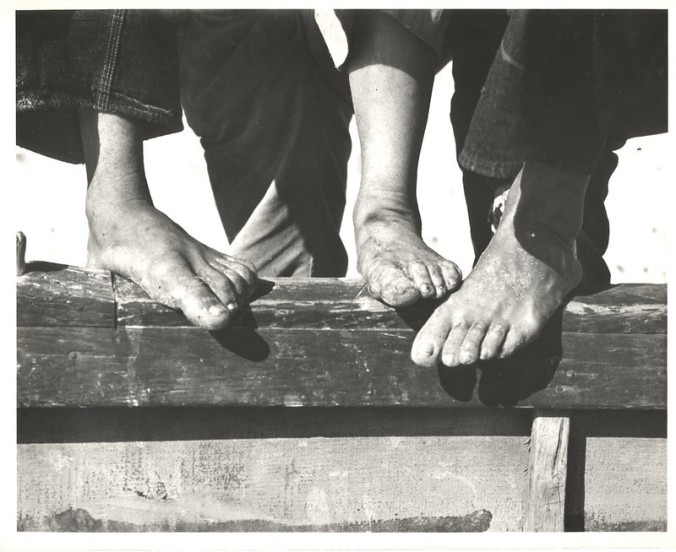
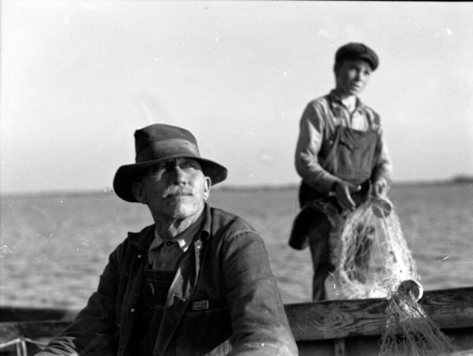
Photographer Charles Farrell captured how mullet fishermen in the fall of 1938 “made do,” as historian David Cecelski explains, on Bald Head Island during the Great Depression. Bald Head Island Marina is a CRUISERS NET SPONSOR!
The Horry County SCDNR office is closed due to COVID related staff shortages. The closure has been extended through Labor Day.
—- NEWS RELEASE —-
For Immediate Release
SCDNR Horry County office will be closed temporarily
AYNOR, S.C. (Aug. 24, 2021) — The SCDNR Horry County Boat Titling and License Sales Office will be closed this Wednesday through Friday (August 25-27th) due to staffing shortages and Covid related issues.
SCDNR sincerely apologizes for any inconvenience this temporary closure may cause to our customers.
Recreational hunting and fishing licenses, tags, and permits can still be purchased online at: https://www.dnr.sc.gov/legallicense.html. Please note that a small convenience fee may be included for online transactions.
Licenses and permits can also be purchased at any of more than 500 license vendors located across the state, including big-box retailers and locally-owned sporting goods, hardware, or bait-and-tackle shops, or at regional SCDNR offices.
Boating transactions can be processed by mail. Visit the boat registration and titling page on the SCDNR website for more information, frequently asked questions, downloadable applications and other assistance related to the requirements for registering and titling boats and motors at: https://www.dnr.sc.gov/boating/Titling_and_Registration/index.html
South Carolina Department of Natural Resources – Rembert C. Dennis Building 1000 Assembly Street, Columbia, SC 29201
If you spot a stranded or entangled leatherback, loggerhead, green or Kemp’s ridley sea turtles, call the National Oceanic and Atmospheric Administration’s Sea Turtle Stranding and Disentanglement Network for help at 866-755-6622.
Through Charles Farrell’s photographs of Sneads Ferry in the 1930s, historian David Cecelski learned the stories and people of Onslow County fishing village.
More watercraft were involved in crashes along the Intracoastal Waterway in Myrtle Beach than anywhere else in the state last year, according to a 2020 report from the South Carolina Department of Natural Resources.
We made the mistake, while traveling north on the ICW, of passing through the Myrtle Beach section on a Sunday in April. It was awful. We are in a 36foot sailboat. There were many many jet skis buzzing past, swerving in and out. Power boats passing us very closely! It was the most dangerous part of our trip.
I'm not surprised the Myrtle Beach area ICW leads in boat crashes. We see all kinds of craziness whenever we travel through there and I have a photo that says it all.

 This dataset contains mapped boundaries of intertidal oyster reefs and washed shell deposits found along the SC coast. Reefs were mapped through a combination of automated and manual techniques using 4-band (blue, green, red, near-infrared) digital orthophotos with a theoretical ground resolution of 0.25 meters. These photos were taken from 2003-2006 and can be downloaded. The project area covered those sections of the SC coastal zone where oysters had historically been mapped by the SC Department of Natural Resources (SCDNR) in the 1980’s. The area spans 122 USGS quarter quadrangles (DOQQs).


Be the first to comment!