Nautical Sayings: “Pipe Down”
Our thanks to Winston Fowler for forwarding this nautical saying.

Monday Motto – Facebook
Our thanks to Winston Fowler for forwarding this nautical saying.
Monday Motto – Facebook
For decades, organizations and groups across the country and worldwide have hosted festivals, celebrations and activities as part of Earth Day in an effort to educate the public on the importance of protecting our planet.
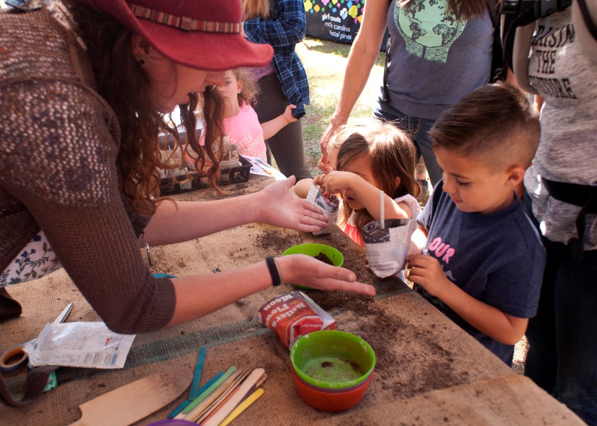
Children enjoy getting their hands dirty during Wilmington Earth Day in 2018. This year’s event will be from noon to 5 p.m. Saturday at Long Leaf Park in Wilmington. Photo: Alan Cradick
Earth Day celebrations abound along NC coast by Jennifer Allen
CoastalReview.org
Knowing your risk is the message federal officials delivered Wednesday during a press conference from the annual National Hurricane Conference taking place this week in Orlando, Florida.
Know your hurricane risk, FEMA, NOAA encourage
CoastalReview.org
In 1585, English explorers twice visited a Native American village called Aguascogoc, destroying it on their second stop.

Woman and child, Roanoke Island, 1915. Photo by Frank Speck. Courtesy, National Museum of the American Indian
Our coast’s history: From Aguascogoc’s ashes
CoastalReview.org

Fort Pierce Inlet leads directly to Fort Pierce City Marina, A CRUISERS NET SPONSOR. Fort Pierce City Marina’s entrance channel runs to the west, just south of the Fort Pierce high-rise bridge, and well north of AICW marker #188. Photos courtesy of Coastal Society.


Click Here To Open A Chart View Window, Zoomed To the Location of Fort Pierce City Marina
|
The saga of the transport Golden Ray, with its incredible photography in which cars looked like bugs pouring out of a hive, has finally come to a close. The Golden Ray went aground and partially capsized in Georgia’s St. Simons Sound on September 7, 2019. With numerous delays, the wreck of the capsized PCTC has taken more than two years to remove from St. Simons Sound. See Heavy Lift Barge Departs. Note: if you missed them, the earlier extraordinary photos can be accessed by typing “golden ray” in the search window of our Homepage.
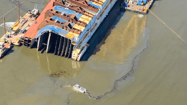
The suit cites the numerous oil leaks during the salvage (USCG photo)
Golden Ray’s Owners and Salvage Company Sued for Negligence in Salvage
Maritime Executive

Bald Head Island is home to Bald Head Island Marina, A CRUISERS NET SPONSOR, found hard by the seaward mouth of the Cape Fear River within sight of “Old Baldy” lighthouse!

Plan Your Spring Get-Away to Bald Head Island
Click Here To Open A Chart View Window, Zoomed To the Location of Bald Head Island Marina

Camden County is home to the Dismal Swamp Canal Welcome Center, A CRUISERS NET SPONSOR, located adjacent to the Dismal Swamp State Park, offering trails, exhibits and ongoing programs in Camden County, NC. Docks are provided by the Dismal Swamp Canal Welcome Center, a NC DOT Rest Area facility. Camden Heritage Museum is approximately 30 minutes by car in Camden, NC
Now open Saturdays, 10am to 3pm . Sunday through Friday are by appointment only.


 ️
️ 


Be the first to comment!