Assuming David is talking about the AICW intersection, this is good news for this Problem Spot. However, it is definitely wise to follow the advice David gives below and SSECN has been giving for some time: follow the markers and do NOT follow the Magenta Line in this stretch of the ICW!
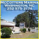
McCotters Marina and Repair Yard, A SALTY SOUTHEAST CRUISERS’ NET SPONSOR, is located on Broad Creek, off the Pamlico River, a few miles downstream of the Washington, NC waterfront. McCotters is one of the largest marinas in North Carolina and its repair capabilities are impressive.
McCotter’s seems to be a laid-back, easy to just relax environment. Good price, reasonable cleanliness, reasonable repair on the docks. Only problem, which is a significant concern for the younger boaters, is the Wi-Fi notoriously goes down on the weekend just when we need it most. Scott
BoatUS remains the premiere advocate for boaters and boating safety on all waters and SSECN is proud to present BoatUS News.
NEWS From BoatUS Boat Owners Association of The United States 880 S. Pickett St., Alexandria, VA 22304 FOR IMMEDIATE RELEASE Press Contact: D. Scott Croft, 703-461-2864, SCroft@BoatUS.com
Boaters need to be prepared for summer thunderstorms.
Three Tips for Any Boater Facing A Powerful Summer Thunderstorm Lessons Learned from Rescue of Four Kayak Anglers HILLSBORO INLET, Fla., July 27, 2016 – Recreational boaters and paddlers understand that late afternoon thunderstorms are common during the summer boating season. A recent incident involving two TowBoatUS Fort Lauderdale captains and their rescue of four kayakers pre-fishing a local tournament offers some lessons learned on how to survive an afternoon storm. Just before 2 p.m. on Friday, June 24, under severe thunderstorm watch, Captains Eric Laury and Steve Reuss ran for cover as a large, fast-moving storm approached. Safe in a marina close to Hillsboro Inlet, they began to “wait out Armageddon,” as Reuss described the strong storm. Minutes later the US Coast Guard reported three overturned kayakers in the water about two miles south of the inlet. With 3-foot chop, 40-knot winds and near constant lightning, both captains immediately headed out to provide Good Samaritan aid. Normally the response boats, which have red hulls and white “TowBoatUS” letters on the side, are used for towing disabled recreational boats. After a short search Captain Reuss quickly located and safely took aboard two kayakers in the near zero-visibility conditions. Captain Laury, reporting severe wind gusts “trying to lift” the boat beneath his feet, soon found and retrieved two other paddlers with overturned kayaks. It was later learned that these two paddlers had hailed the original mayday with no knowledge of the other two distressed kayakers, and the slightly erroneous report of three distressed kayakers yielded the safe return of all four. To share some lessons learned, BoatUS has three safety tips for any mariner or angler facing a powerful, summer thunderstorm: 1. Don’t let your guard down: “Sometimes during the summer we see boaters lulled into a sense that calm seas always prevail, but these kayakers were prepared,” says TowBoatUS Ft. Lauderdale spokesman Barney Hauf. “They had life jackets on, carried a handheld VHF radio and a Personal Locator Beacon.”
2. Don’t leave the boat: While caught out on the open water and unable to seek cover, the paddlers stayed with their overturned vessels. “They fastened themselves to each other and to their equipment to stay together,” said Captain Reuss. Staying with an overturned boat gives rescuers a larger target to find.
3. Watch your weight: Small craft are most prone to overloading. Says BoatUS Foundation Assistant Director of Boating Safety Ted Sensenbrenner, “Kayaks weighted with a lot of gear can loose buoyancy. No matter what kind of boat, know your vessel’s capacity rating.”
For more information on boating safety, go to BoatUS.org.
About Boat Owners Association of The United States (BoatUS): Celebrating 50 years in 2016, BoatUS is the nation’s largest organization of recreational boaters with over a half million members. We are the boat owners’ voice on Capitol Hill and fight for their rights. We help ensure a roadside breakdown doesn’t end a boating or fishing trip before it begins, and on the water, we bring boaters safely back to the launch ramp or dock when their boat won’t, day or night. The BoatUS Marine Insurance Program gives boat owners the specialized coverage and superior service they need, and we help keep boaters safe and our waters clean with assistance from the non-profit BoatUS Foundation for Boating Safety and Clean Water. Visit BoatUS.com.
BoatUS remains the premiere advocate for boaters and boating safety on all waters and SSECN is proud to present BoatUS News.
NEWS From BoatUS Boat Owners Association of The United States 880 S. Pickett St., Alexandria, VA 22304 FOR IMMEDIATE RELEASE Press Contact: D. Scott Croft, 703-461-2864, SCroft@BoatUS.com
8 Ways To Avoid Problems at the Boat Repair Shop
ALEXANDRIA, Va. July 25, 2016 – For over 25 years the BoatUS Consumer Protection department has helped Boat Owners Association of The United States members resolve disputes with repair facilities. The vast majority of shops do the job right, but sometimes they – or boat owners – make mistakes. To see what went wrong and to possibly learn from others, BoatUS has surveyed its BoatUS Dispute Resolution files to identify eight trouble spots that boaters needing work done should know:
Finding a shop: Word of mouth is still king. Having American Boat & Yacht Council (ABYC) and Better Business Bureau (BBB) certifications are also two good signs. Boaters can also check out the BoatUS Consumer Protection Database for complaints filed by BoatUS members.
Get it in writing: Get a written estimate before work begins, and remember that it is based on an approximation of how much the job will cost. If work may go beyond the estimated price, you can always direct the shop to obtain your authorization before proceeding with unforeseen repairs. Remember, if it’s not in writing, there’s no way to confirm the work was requested.
Is there a guarantee for the work? 30-, 60-, or 90-days are all typical. Ask if parts and labor are included. Don’t wait until after the warranty expires to check the repairs.
Remove valuables: Bring small electronics, personal items and fishing gear home.
Take photos: It’s always good to take a few “before” time-stamped photos of your boat in the shop (your smart phone may have this feature built-in or there are Apps available). Accidents do sometimes happen, and you may need before and after damage photos to show the shop damage took place and possibly file an insurance claim.
Languish at your peril: Avoid having your job pushed to the back burner by staying frequently informed about ongoing repairs. While there are often legitimate delays due to seasonality, parts sourcing, weather, and personnel, if you think you are getting put off, you probably are. Cut losses and find another shop. (Tip: For larger jobs, ask the shop to periodically email you pictures of work in progress. It may help keep the job on schedule.)
Inspect, inspect, and inspect: When picking up the boat after completion of repairs, ensure each bit of repair work matches the actual invoice. If you do have a dispute with the final bill, you’re in better legal shape if you pay it in full, preferably on a credit card, and then file a complaint with the shop and/or your credit card company.
A note about end of season repairs: Sea trials must take place during the warranty period, which has sometimes caused problems for BoatUS members who put their boats away for the winter before ensuring the repairs are satisfactory. Any open issues found in the springtime will likely come out of the boat owner’s wallet.
About Boat Owners Association of The United States (BoatUS): Celebrating 50 years in 2016, BoatUS is the nation’s largest organization of recreational boaters with over a half million members. We are the boat owners’ voice on Capitol Hill and fight for their rights. We help ensure a roadside breakdown doesn’t end a boating or fishing trip before it begins, and on the water, we bring boaters safely back to the launch ramp or dock when their boat won’t, day or night. The BoatUS Marine Insurance Program gives boat owners the specialized coverage and superior service they need, and we help keep boaters safe and our waters clean with assistance from the non-profit BoatUS Foundation for Boating Safety and Clean Water. Visit BoatUS.com.
Explorer Chartbooks, A SALTY SOUTHEAST CRUISERS’ NET PARTNER, has long been the standard navigational supplement for enjoyable, informative, and safe cruising through the beautiful Bahamian waters and island visits.
Bahamas Chatter: Winding Bay, Abaco, Update Winding Bay, Abaco, Update Posted: 24 Jul 2016 12:08 PM PDT Just wanted to give you an update on Winding Bay’s latest shenanigans.
RDA (Responsible Development for Abaco), with a lot of help from Fred Smith, filed for a Judicial Review against 9 government departments for “lack of consultation”. As a result, BEST posted the EIA, EMP, latest site plan, and a couple of cover-your-ass letters on their website (www.best.gov.bs). They also called a town meeting in Cherokee Sound on June 27th. At the meeting, the developers announced that the marina was critical to the survival of the Abaco Club, and would generate 1000 construction jobs. A ludicrous number, any way you look at it. They said that 6 moorings would have to be moved, but couldn’t say where to, or whose moorings they are.
They also said that WSC (Water and Sewerage Corp.) had tested the water in LH and found it “unswimmable”, full of E. coli and fecal matter, and that their marina would actually clean up the harbour by installing a pump out station. Please see below a couple of quotes along these lines, and also WSC’s response to our queries about the tests. There’s a big difference between “unswimmable” and “undrinkable”.
Explorer Chartbooks, A SALTY SOUTHEAST CRUISERS’ NET PARTNER, has long been the standard navigational supplement for enjoyable, informative, and safe cruising through the beautiful Bahamian waters and island visits.
Bahamas Chatter: Disney looking at developing Egg Island Disney looking at developing Egg Island Posted: 22 Jul 2016 04:19 AM PDT Disney is moving ahead with plans to build a cruise ship pier on Egg Island, North Eleuthera. Among many concerns is that Egg Island’s natural beauty and ecology will be destroyed if Disney proceeds with its plans to develop the island.
Click here for full article on Disney possibly developing on Egg Island as a new cruise ship destination.
15 Jul 2016 Bertram acquires refit facility on Florida’s Tampa Bay By Bryony McCabe
American boat builder Bertram has announced the acquisition of a waterfront facility on Florida’s Gulf Coast where it not only intends to build new Bertram yachts, but also fulfill clients’ service and refit needs. The new Bertram headquarters is an existing 120,000-sq. ft shipyard and marine service facility located in Tampa, immediately south of the Gandy Bridge on Tampa Bay, and is capable of hauling yachts up to 120ft in length.
“This plant, which already has been operating as a full-service marine facility for decades, is perfect for Bertram in so many ways,” explains CEO Peter Truslow.
“It will allow us to create a complete Bertram manufacturing and service center in one of America’s most popular year-round boating destinations. The facility has a great layout, with 40-foot-high buildings and high-tech fibreglass construction equipment already in place that we can utilise to build our new Bertram 35’ and larger models.”
This added second to our GPS clocks is certain to be of assistance when you are trying to reach that next bridge opening! LOL! Isn’t technology amazing?
All CGSIC: Yesterday, 18 July, the Air Force entered, into the GPS MCS, a Future Leap Second to become effective on 31 December 2016. As Navigation Uploads are/were performed over the following ~24 hours, GPS satellites will, one at a time, begin broadcasting this Future Leap Second, along with its date of effectivity and the Current Leap Second count, in accordance with IS-GPS-200. When specific satellites will begin broadcasting the new information will depend on the contact schedule over the next ~24 hours, which is dynamic and subject to real-time operations. When specific users will begin seeing the new information will depend on a number of factors, including satellite visibility and user equipment design. V/R Rick Hamilton CGSIC Executive Secretariat GPS Information Analysis Team Lead U.S. Coast Guard Navigation Center 703-313-5930
Share:
Comments from Cruisers (2)
Gene Fuller- July 22, 2016 - 2:07 pm
Very few people reading Cruisers’ Net would care about this. However, some GPS users and systems need to account for every second. The advanced notice is part of the long-standing GPS specification, and it allows for preparation time needed by those special users.
So would this mean that the new leap second would come into immediately ? The GPS doesnt bother about the leap second,however i believe it would offset an additional second. If the actual leap second is suppose to become effective 31 Dec 2016, why are these changes being performed now ?
Chris-Craft debuts new models at dealer meeting Posted on July 18th, 2016 Written by Chris Landry
SARASOTA, Fla. — More than 150 representatives from Chris-Craft dealerships in the United States and around the world gathered here during the weekend for the opportunity to test the boatbuilder’s entire fleet, including the new flagship Commander 42 and the new Calypso 30 dual console. It was the first public showing for both boats. “This is our biggest event of the year,” Chris-Craft marketing director Allison Scharnow told me as I waited my turn to test the Calypso. “It’s the only time we have all the models in the water at the same time. Dealers and customers get to touch, feel and drive them, and talk to the engineers. It’s important for our customers and dealers to see them here, at a special event for them, not just at a boat show.”
One of the four areas tested, Leighton Park, is in the South Fork of the St. Lucie River at Mile 9.5 of the Okeechobee Waterway just south of the Palm City Bridge. Central Marine is on the north side of the the Okeechobee/St.Lucie River, east of the New Roosevelt Bridge and Loggerhead Club and Marina. This report comes from WPTV.com of West Palm Beach, FL.
Report shows extreme toxicity in four bodies of water in Martin County WPTV Webteam 12:00 PM, Jul 15, 2016
Water samples taken in Martin County show extreme toxicity in four bodies of water. The analysis, done by chemists at the SUNY-College of Environmental Science and Forestry in New York, found that water samples from Leighton Park, Sandsprit Park, Deck and Central contained levels of microcystins that were “extremely high, well above the levels allowed for recreational contact.”
Microcystins are toxins produced by cyanobacteria, also known as blue-green algae. Those results are not surprising to Mary Radabaugh who manages Central Marine. That’s one of the locations where tests showed extreme toxicity.


Comments from Cruisers (1)
Browns Inlet….Passed through Sunday 4-2-17 3/4 tide. Straight through and no problem.
Raymond W. Smith