from Norfolk to the Northern Gulf and Bahamas.
TRAFFIC IN THE GALÁPAGOS, II – Janice Anne Wheeler, Sparring With Mother Nature
Forwarded this email? Subscribe here for more
If you just found our engaging little community, please read SPARS & SPARRING, .….it introduces my wonders and my wanders. ~J
If you missed last week’s Galápagos piece you can see it here:
TRAFFIC IN THE GALÁPAGOS, I
·Mar 8Read full story Usually, when I find a place that speaks to my soul, I tend to keep that information sacred, tucked around my heart, so to speak, especially when wildlife is included in the phenomenon. More than once a favorite high-altitude hike made Outdoor Magazine’s “Top Ten Trails” and then those pristine experiences changed forever. They became too busy for my taste, and if you think it’s selfish not to share such gems lest they be spoiled, well, that is one of the many adjectives you can use to describe my character.
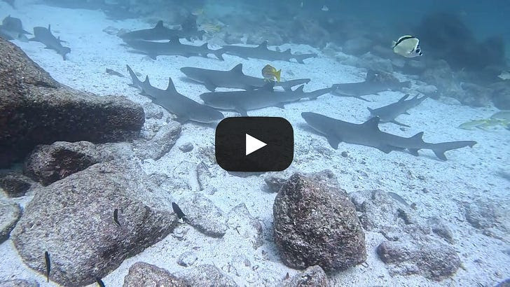
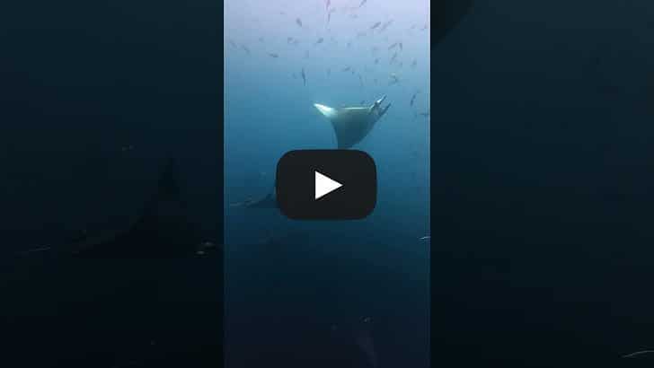
I found the Galápagos so remarkable that I wanted to share and added a YouTube channel to STEADFAST’s repertoire. I have considered taking this step since TALLY HO started documenting a wooden boat rebuild, and it’s definitely experimental. While there are a few folks around who call STEADFAST the TALLY HO of the Chesapeake Bay, there is no time here for long, edited works with background music. The YACHTING STEADFAST channel may eventually regale you with occasional stories of life aboard a classic sailing yacht, raw and rare processes, innovations and experiences; it currently gives you glimpses of the diverse creatures I found on the equator. Please know I’m a writer, and my main conveyance will always be the magic of words.
The guide who showed me Mother Nature’s awe-inspiring Grand Canyon (he knows of what he speaks) said simply, “Janice. The Galápagos. Go. Ya gotta go.” I’d always wanted to, for as long as I can remember. I thought I knew what I was in for, but beneath the surface, there was, and is, far, far more to discover. Some day, there may be too much human traffic looking for a peaceful place in the world, but for now, Sea Lions (Los Lobos del Mar) rule, so I tell you, if you have any inclination, “Go.”
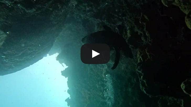
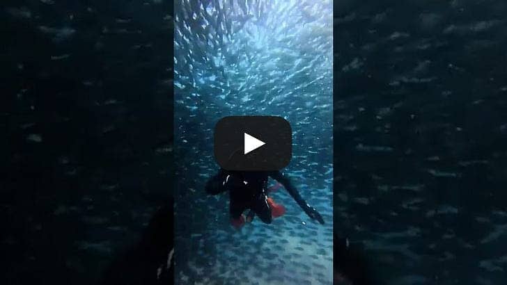
I’ve been SCUBA certified since I was thirty; the last six years I was more than satisfied surface diving and spearfishing in the stunning blues of the Bahamas. But the Galápagos are bucket list stuff; I dusted off the dive computer and paid the price for a review and single-diver guide. Was it worthwhile? Oh yes, my friends. Among diving enthusiasts, it is the Hammerheads that are notorious here (among other stunners), and dozens of those massive, matchless sharks circled above as we tucked between the underwater cliffs of Léon Dormido, Sleeping Lion, now known as Kicker Rock, just west of Isla San Cristóbal. I was gripping hard against the current, heart pounding at the proximity, eyes wide with the wonder of it all.

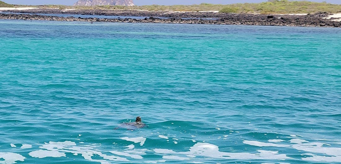
Seeking Sea Turtles
Who to my wandering eyes would appear?
This gentleman here
Twixt the boat and the beach,
Not even slightly out of reach
Off came the sarong
as I yelled to the Captain I wouldn’t be long
Quick search with a snorkel, I found him grazing
Endangered creatures, nothing short of amazing
More giants appeared and their guest count was short
The Crazy American had no retort
They found me although I was not really lost
If I had been left it would certainly cost
I could not hide my giant smile
It got broader with each passing mile
I am touched by something few folks can report
Seeking Sea Turtles is my favorite sport ****
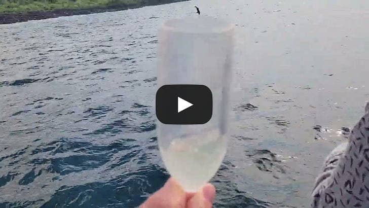
I didn’t imagine that day could have gotten any better but know this, even long-time guides and Captains still get damn excited about dolphins. Every time. And halfway back to the Harbour hundreds found us, the largest pod I have seen. It was awesome, but not the best quality capture of it all!
There was more than meets the eye everywhere, really. Early one morning on Isla San Cristóbal, capital of the Ecuadorean Provincia de Galápagos, all the municipalities gathered, dressed to the very hilt of their swords.

An unforgettable parade commenced: prideful, colorful, contrasting. Many residents possess physical characteristics far more like the indigenous peoples of South America than the Spanish whose language they speak and Christian Churches they worship. Similar to the unique creatures they protect, many emanate peace, and also extoll a certain fierce independence. It stopped traffic, that much is certain.
On that same island, for sixty-five dollars (Ecuador uses U.S. currency) you can hire high-energy Cesar to take you on a six-hour deep-dive tour that includes plant and animal identification, history, geology, biology, endangered species, agriculture, the invasive blackberry problem as well as anecdotes; how someone, just fifteen years ago, decided that the Caldera on San Cristóbal would be the perfect spot to raise Tilapia (they’ve been eliminated) and how his family has made a living here for generations. “You have an amazing country,” I told him genuinely. “Sí, amiga,” he looked at me in the rearview mirror carefully, to make sure I understood what was beneath the surface. I’m not fluent in Spanish, and yet the proud joy of sharing his homeland transcended the language barrier; I know I understood most of what he conveyed. He was respectful enough to answer questions as he has done thousands of times before. I asked a park ranger for the best guide and he called lucky #07 Amarillo Taxi; I paid $100. Buena suerte en encontrarlo! Good Luck finding him!
All my encounters in the Galápagos, as short as the time was, taught me that one can be perfectly, peacefully immersed there while still challenging your own limits, experiencing things you’ve seen only in National Geographic or science class, eating amazing, fresh, flavorful food and drinking local beer. These lava tunnels on Isla Santa Cruz are one of the incredible surprises; reminding me to embrace all twists and turns.
 My first lava tubes & their first brewery; Isla Santa Cruz.
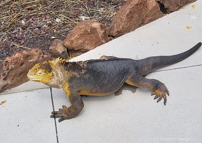
The final bus driver braked sharply, swung wide. Luggage tumbled, passengers grasped, necks craned, for one last glimpse of a not-too-creatively-named Land Iguana, much like this one standing just off the airport runway on Baltra.
This was the last soul I spotted in the Galápagos, and he certainly didn’t disappoint; so much to immerse yourself in, above and below the surface. Back on STEADFAST next week! ~J
Please RESTACK & send my work along to wanderers everywhere!
Share SPARRING WITH MOTHER NATURE
For more information on the Galápagos, feel free to inquire in the comments.


© 2026 Janice Anne Wheeler
Living aboard Sailing Yacht STEADFAST again soon!
UnsubscribeBe the first to comment!
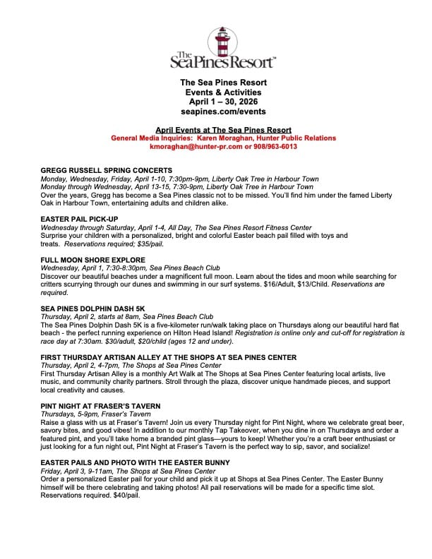
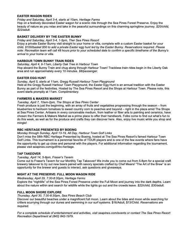
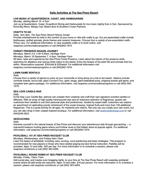
What’s Happening At the Sea Pines Resort (April 2026), Harbour Town Yacht Basin, SC AICW MM 565
Harbour Town Yacht Basin, A CRUISERS NET SPONSOR, is ready for your reservation with newly renovated docks, upgraded electrical service and onSpot WiFi, also a CRUISERS NET SPONSOR. And, as always, numerous activities at the Sea Pines Resort are offered for your enjoyment, as you will see in the Event Schedule below. Hilton Head Island is absolutely marvelous any time of year.

Kerry Maveus
kmaveus@hunter-pr.com | www.hunter-pr.com
mobile: 831-917-2878
P.O. Box 1049 | Pebble Beach, CA | 93953
Be the first to comment!
High-Impact Severe Weather Expected Monday (TODAY) – Fred Pickhardt
Fred Pickhardt’s Substack is free today. But if you enjoyed this post, you can tell Fred Pickhardt’s Substack that their writing is valuable by pledging a future subscription. You won’t be charged unless they enable payments.
 Forwarded this email? Subscribe here for more
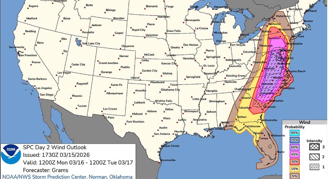
A significant severe weather event is anticipated on Monday, March 16, 2026, bringing a threat of extreme winds and possible tornadic activity to the Southeast and Mid-Atlantic coastal waters.
Overview
Widespread severe storms are expected to develop as a powerful cold front sweeps through the region. While land-based impacts are a major concern, the risk for those on the water is particularly high during the afternoon hours.
- Tornadoes & Damaging Winds: Strong tornadoes and destructive straight-line winds are most likely from South Carolina to Maryland.
- Rapid Development: Storms may organize quickly into a squall line, tapping into powerful upper-level wind energy to produce strong surface gusts.
Mariners should be prepared for significant wind events across the following areas:
- Chesapeake Bay & Delaware Bay: The highest risk for gusts exceeding 50 knots, with a 45–60% probability of these conditions.
- Georgia to Virginia: A 30% risk for wind gusts over 50 knots.
- Northern Florida: At least a 15% risk for 50+ knot gusts.
- Southern NJ: At least a 15% risk for 50+ knot gusts.
- Extreme Threat: There is at least a 10% risk for hurricane-force wind gusts in coastal waters from South Carolina to Virginia.
Bottom Line:
Monday is not a day to be caught unprepared on the water. The combination of intense wind shear and a potent cold front creates a high-risk environment for all maritime activities.
NOAA US Coastal Waters Forecasts
You’re currently a free subscriber to Fred Pickhardt’s Substack. For the full experience, upgrade your subscription.


© 2026 Fred Pickhardt
548 Market Street PMB 72296, San Francisco, CA 94104
UnsubscribeBe the first to comment!
Atlantic Sea Surface Temperature Anomalies – Fred Pickhardt
Fred Pickhardt’s Substack is free today. But if you enjoyed this post, you can tell Fred Pickhardt’s Substack that their writing is valuable by pledging a future subscription. You won’t be charged unless they enable payments.
 Forwarded this email? Subscribe here for more
Sea surface temperatures (SSTs) are one of the most important ingredients for tropical cyclone development and intensification. With the 2026 Atlantic hurricane season still a few months away, the current pattern across the basin is already showing a fascinating mixed signal. …

Continue reading this post for free in the Substack app


© 2026 Fred Pickhardt
548 Market Street PMB 72296, San Francisco, CA 94104
UnsubscribeBe the first to comment!
Jaming and Spoofing: When GPS Lies – Loose Cannon
Cruisers Net publishes Loose Cannon articles with Captain Swanson’s permission in hopes that mariners with saltwater in their veins will subscribe. $7 per month or $56 for the year; you may cancel at any time.


 Forwarded this email? Subscribe here for more
When all else fails, try journalism.
The author is a Ph.D. Candidate in Electrical and Computer Engineering at Georgia Institute of Technology. This story was first published on March 12, 2026 in The Conversation and is reprinted here with permission.
By ANNA RAYMAKER
The war in Iran has dominated headlines with reports of airstrikes and escalating military activity. But beyond the immediate devastation, the conflict has also illuminated a quieter and rapidly growing danger: the vulnerability of ships, and the people who operate them, to disruption of their navigation systems.
Modern shipping depends heavily on GPS satellite navigation. When those signals are disrupted or manipulated, ships can suddenly appear to their navigators and to other ships to be somewhere they are not. In some cases, vessels have been shown jumping across maps, drifting miles inland or appearing to circle in impossible patterns. The risk is even higher in war zones, where ships could be misdirected into harm’s way.
As a cybersecurity researcher studying critical infrastructure and maritime systems, I investigate how digital threats affect ships and the people who operate them.
To understand the threat from GPS disruptions, it helps to first understand how GPS works. GPS systems determine location using signals from satellites orbiting Earth. A receiver calculates its position by measuring how long those signals take to arrive. Because those signals are extremely weak by the time they reach Earth, they are relatively easy to disrupt.
Jamming and Spoofing
In GPS jamming, an attacker blocks the real satellite signals by overwhelming them with electromagnetic noise so receivers cannot detect them. When this happens, navigation systems lose their position. On a phone, it might look like the map freezing or jumping erratically.
GPS spoofing is more sophisticated. Instead of blocking signals, an attacker transmits fake satellite signals designed to mimic the real ones. The receiver accepts these signals and gives a false location. Imagine driving north while your navigation system suddenly insists you are traveling south. The receiver is not malfunctioning; it has simply been tricked.
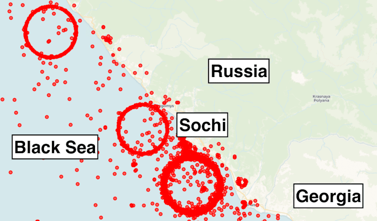
Circular loops in the Black Sea show spoofed ship positions recorded in January 2025. The red points represent false GPS locations broadcast during spoofing events, making vessels appear to move in perfect circles on tracking maps even though they were actually hundreds of miles away. These disruptions are widely believed to be linked to electronic interference in the region during the war in Ukraine. Image created with data from Spire Global. Anne Raymaker For mariners at sea, spoofing can have serious consequences. In the open ocean, there are few landmarks to verify a ship’s position if GPS behaves strangely. Nearshore, the margin for error disappears: Water depths change quickly and hazards are everywhere, especially in narrow routes like the Strait of Hormuz near Iran, where reports indicate that GPS spoofing has been happening since the outbreak of the war. Because ships are large and slow to maneuver, even small navigation errors can lead to groundings or collisions.
Red Sea Grounding
One example came in May 2025. While transiting the Red Sea, the container ship MSC Antonia began showing positions far from its true location. To navigators onboard, this looked like they had jumped hundreds of miles south on the map and started moving in a new direction. This caused the crew to become disoriented, and the ship eventually ran aground. The grounding caused millions of dollars in damage and required a salvage operation that lasted over five weeks.
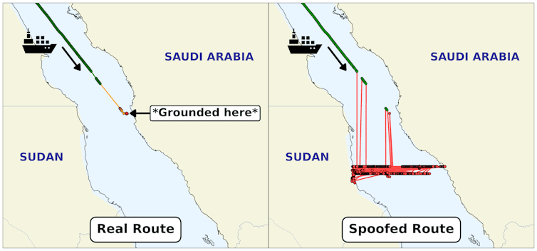
MSC Antonia route comparison showing the vessel’s true route and grounding point, left, versus the spoofed route, right. The red and black lines on the right show the spoofed locations where the ship appeared to suddenly jump to on GPS. These lines confused the navigators and caused them to run aground. Images created with data from VT Explorer. Anne Raymaker Incidents like the MSC Antonia are not isolated. Vessel-tracking data has revealed clusters of ships suddenly appearing in impossible locations, sometimes far inland or moving in perfect circles. These anomalies are increasingly linked to GPS spoofing in regions experiencing geopolitical conflict.
But GPS interference is only one type of cyber threat facing ships. Industry reports have documented ransomware attacks on shipping companies, supply chain compromises and increasing concern about the security of onboard control systems, including engines, propulsion and navigation equipment. As ships become more connected through satellite internet systems and remote monitoring tools, the number of potential entry points for cyberattacks is growing.
Military vessels often address these risks through stricter network segregation and regular training exercises such as “mission control” drills, which simulate operating with compromised communications or navigation systems. Some cybersecurity experts argue that similar practices could help commercial shipping improve its resilience, although smaller crews and limited resources make adopting military-style procedures more difficult.
Mariners’ Experiences
Much of the public discussion around maritime cybersecurity focuses on technical vulnerabilities in ship systems. But an equally important piece of the puzzle is the people who must interpret and respond to these technologies when something goes wrong.
In recent research, my colleagues and I interviewed professional mariners about their experiences with cyber incidents and their preparedness to respond to them. The interviews included navigation officers, engineers and other crew members responsible for ship systems. What emerged was a consistent picture: Cyber threats are increasingly occurring at sea, but crews are not well prepared to deal with them.
Many mariners told us that their cybersecurity training focused almost entirely on email phishing and USB drives. That kind of training may make sense in an office, but it does little to prepare crews for cyber incidents on a ship, where navigation and control systems can be the primary targets. As a result, many mariners lack clear guidance on how cyberattacks might affect the equipment they rely on every day.
This becomes a problem when ship systems begin behaving strangely. Mariners described GPS showing incorrect positions or temporarily losing signal. It can be difficult to tell whether these incidents are equipment failures or signs of cyber interference.
Even when mariners suspect something may be wrong, many ships lack clear procedures for responding to cyber incidents. Participants frequently described situations where they would have to improvise if navigation or other digital systems behaved unexpectedly. Unlike equipment failures, which have established checklists and procedures, cyber incidents often fall into a gray area where responsibility and response plans are unclear.
Another challenge is the gradual disappearance of traditional navigation practices. For centuries, mariners relied on paper charts and celestial navigation to determine their position. Today, most commercial vessels rely almost entirely on electronic systems.
Many mariners noted that paper charts are not available onboard, and celestial navigation is rarely practiced. If GPS or electronic navigation systems fail, crews have limited ways to independently verify their position. One mariner bluntly described the risk to us: “If you don’t have charts, and you’re being spoofed, you’re a little screwed.”
Increasing Connectivity, Risk
At the same time, ships are becoming more connected. Modern vessels increasingly rely on satellite internet systems like Starlink and remote monitoring tools to manage operations and communicate with shore.
While these technologies improve efficiency, they also expand the vulnerability of ship systems. Connectivity that allows crews to send emails or access the internet can also provide pathways for cyber threats to reach onboard systems.
As GPS spoofing becomes more common in regions experiencing geopolitical conflict, the challenges mariners described in our research are becoming harder to ignore. The oceans may seem vast and empty, but the digital signals that guide modern ships travel through crowded and contested space.
When those signals are manipulated, the consequences do not stay confined to military systems. They reach the commercial vessels that carry most of the world’s goods and the crews responsible for navigating them safely.
LOOSE CANNON covers hard news, technical issues and nautical history. Every so often he tries to be funny. Subscribe for free to support the work. If you’ve been reading for a while—and you like it—consider upgrading to paid.
Be the first to comment!
Cruisers’ Net Weekly Newsletter – March 13, 2026
Cruisers’ Net Newsletter for this week has just been emailed via Constant Contact.
If you want to view the newsletter but are not signed up to receive them automatically, you can view it at https://conta.cc/4baGls0 or see it below.
To automatically receive our emailed Fri Weekly Newsletter and Wed Fuel Report, click:Be the first to comment!
The Cult of the Solo-Sailor – Loose Cannon
Cruisers Net publishes Loose Cannon articles with Captain Swanson’s permission in hopes that mariners with saltwater in their veins will subscribe. $7 per month or $56 for the year; you may cancel at any time.


 Forwarded this email? Subscribe here for more
When all else fails, try journalism.
Many readers pushed back against a recent story about the potential consequences of singlehanded operation. Their pro-solo-sailing arguments appeared on various Facebook boating groups and in the comments section of the story itself.
One argument went like this: Solo-sailors are the master mariners of the sea, compared to the incompetent lot that like to take other people with them.
In debate circles, this is called a false dichotomy. That’s a logical fallacy that presents two extreme options as the only possibilities when in fact other possibilities exist.
The Legal Implications of Solo Sailing
Mar 6Read full story One other possibility is that singlehanders are actually not any more competent than the rest of us, taken as a group. Maybe the record-setters and round-the-world sailors are a cut above, but these represent a small subset of the solo category.
Let’s examine the reasons people make voyages alone.
Some are engaged in what one retired Coast Guard rescue swimmer called a “romantic quest for Emersonian self-reliance.” These folks may be the archtype that critics of the story used to bolster their position—they see wizzened, old-salt ocean warriors.
I call this the I-know-a-guy argument, but anectdotes, even when piled up, do not constitute data.
Can we be honest here? Many singlehanders also sail solo for entirely different reasons, which can fall into three categories: They are jerks and have no friends. They suck at sailing, and it shows. Or their boats don’t impress potential mates as being particularly seaworthy.
The Coast Guard doesn’t break out the number of times they have had to rescue solo-sailors, but a Google search will show there have been a fair number in recent years. These are just a few examples:
- November 2020: Vendée Globe Race participant is rescued by a fellow after his vessel founders in heavy seas.
- June 2021: A tanker rescued an 81-year-old German sailor whose 36-foot vessel, was disabled 400 miles southeast of Long Island.
- August 2023: A solo sailor was rescued from a deserted island in the Bahamas after being stranded for three days, thanks to a “HELP” sign.
- November 2023: A solo sailor was rescued 270 miles off North Carolina after their 38-foot sailboat was found adrift.
- February 2024: A solo sailor was rescued after 46 hours adrift in a semi-submerged vessel during the Global Solo Challenge.
- August 2024: A 62-year-old Frenchman survives for 16 hours in an air bubble inside his overturned boat until he was rescued by the Coast Guard.
Amazingly, the critics kept making the point that solo-sailors harm no-one, since they only have themselves to kill. They fail to consider that helicopter rescues are an expensive burden on the system and can put the rescuers themselves at risk.
Mario Vittone is a retired Coast Guard rescue swimmer and marine accident investigator. Vittone was asked if he thought single-handed types are any more capable that the rest of the voyaging herd.
“I would submit that the opposite is true. The solos lose one point for judgment in their romantic quest for their Emersonian self-reliance,” Vittone said, calculating potential human cost. “I think it lowers the risk of medical emergency (less people aboard) and raises the negative outcome of mishaps owing to the lack of hands. It may be a wash, really, overall.”
One such mishap was illustrated by the photo which accompanied Bob Arrington’s March 6 story. British sailor Jeanne Socrates was in the cockpit of her Najad 361, lying on its side, as waves broke around her on a Mexican beach.
Socrates holds the record as the oldest female to have circumnavigated the world nonstop single-handed and unassisted. One of the story’s critics responded in the comments section with a long list of her voyaging accomplishments. It was intended as a rebuke.
To me, losing your boat is not trivial, and her case illustrates the risks of singlehanding no matter how skilled the skipper.
Socrates said her autopilot had failed, which she obviously did not notice in time. As anyone who has sailed along a surf-beach will testify: If you are straying toward shore, you will eventually begin hear the dull roar of breaking waves.
Danger, Will Robinson!
The sound can be harder to notice, however, if you are sleeping.
Sleeping—that thing we all have to do.
One commenter suggested, without evidence but correctly, that Loose Cannon was not a singlehander and therefore, son, you can never truly understand. He was only half-wrong. I had singlehanded just long enough to know that it was a bad idea, even though I am constitutionally built for it.
I can fall asleep sitting up and wake myself 20 minutes later to check displays, scan the horizon and…repeat. This may be the only way in which I am like Napoleon, whose catnapping allowed him to micro-manage an empire.
This is where the technology wing of the pro-solo-sailor party chirped in. With the ability to enable alarms on radar and AIS, their argument goes, sleeping in violation of Rule 5 of the International Regulations for Prevention of Collisions at Sea should not be thing. (Rule 5 is the one that says: “Every vessel must at all times keep a proper lookout by sight, hearing and all available means in order to judge if risk of collision exists.”)
The other side of the false dichotomy is that one skilled solo-sailor is at less risk than two, three, four—name a number—of the knucklehead population that owns boats. This fake argument completely ignores reality. People’s sailing skills lie along a spectrum that extends from knucklehead at the bottom all the way up to Warrior Sailing God.
The dichotomists also completely ignore that as folks move up the spectrum (as one hopes they do, over time), it doesn’t take too long before three moderately skilled people are more resilient in the face of catastrophe than one Warrior God.
This is 2026, and the American population is quite literate in terms of using technology.
Even if unskilled in other aspects of boat management, new people will probably find that mastery of the AIS, chart-plotter, radar, sounder and auto-pilot is not that difficult. So let’s not pretend this is sacred knowlege available only for the initiated.
And do you know when AIS and radar work best for collision avoidance?
When someone is awake and monitoring them, watching the displays and seeing potential danger even before an alarm is triggered.
It’s called watchstanding, and takes a minimum of two to tango.
The greatest single-handed sailor ever (in my humble opinion) is Joshua Slocum, author of the best book ever written about the subject, “Sailing Alone Around the World.” I grew up two towns over from where Slocum rebuilt his gaff-rigged sloop Spray.
Alas, I was never able to visit his grave. Because why? The greatest single-hander in history died single-handing. On November 14, 1909, he sailed Spray out of Vineyard Haven, Massachusetts, and was never seen again. Lost at sea.
LOOSE CANNON covers hard news, technical issues and nautical history. Every so often he tries to be funny. Subscribe for free to support the work. If you’ve been reading for a while—and you like it—consider upgrading to paid.
Be the first to comment!















Be the first to comment!