The Blue Angels Air Show is a spectacular treat, especially viewed from the water. Please use caution, especially around anchored spectator boats. Be safe!
Good afternoon Charleston HSC,
Please find attached MSIB 07-26 regarding a safety zone for the upcoming Blue Angels Airshow. As a summary:
The U.S. Navy’s Flight Demonstration Squadron, The Blue Angels, will be conducting aerobatic maneuvers over the Charleston Harbor, SC, on Thursday, April 30th through Saturday, May 2nd, 2026.
A safety zone, encompassing a rectangular area within Charleston Harbor, will be enforced during the times referenced on the chart below. Please note that no one will be allowed to enter the safety zone without prior authorization from the Coast Guard Captain of the Port Charleston or a designated representative.
Mariners are encouraged to monitor the Broadcast Notice to Mariners on VHF Channel 16. Coast Guard Sector Charleston will announce the start and end of the safety zone enforcement each day. The Blue Angels’ schedule is dependent on weather, and any changes to the safety zone schedule will be reflected in a future MSIB.
For questions or concerns regarding this MSIB, please contact the Sector Charleston 24-hour Command Center at (833) 453-1261.
Very respectfully,
LT Nicholas Jones WWM Division Chief USCG Sector Charleston Nicholas.J.Jones@uscg.mil O: 843-740-3184 C: 843-323-7761
I spent half an hour or so with mineral spirits and a cotton rag, wiping every notable speck of dust off STEADFAST’s substantial port hull on a dew-less morning, before the sun rose and just after my first cup of sweet, strong coffee. It’s the best time of the day.
I smoothed every inch of 400ish vertical square feet yesterday, taped seams and edges, calculated timing and wind because we have a gorgeous wooden boat neighbor who is sanding with equal vigor before moving on to paint. Dust is an enemy, among others, to the shiny, protective coating I’m applying. And it’s up to $60USD per quart; we’re careful with it.
The pre-dawn breeze was cool with a forecast of 87F. I’m a lizard of sorts, always have been. My finely diamond-wrinkled skin demonstrates how much I worshipped our orb, and those dismaying gems are far more noticeable, I think, when it’s at its apex. Back when it was healthy to have a tan and I had much more resilience, everyone compared contrasting lines and selected tropical destinations for that very purpose. There are few more welcoming experiences than the first rays of spring sunshine warming your back or a colorful, luminescent sunrise announcing another day. Feels so good, doesn’t it? A primal element, essential for so many things, buteven sunshine burns if you get too much. Avoidance is advisable, impossible. A life inside could not be a life I chose.
My mother and I stained the deck each year and did all yardwork wearing bathing suits and tube tops. Now, grudgingly, I take cover with sweaty long sleeves, floppy androgenous hats, my beloved sarongs and substantial sunblock. There used to be single-digit SPF protection out there, which we thought was enough, and now some claim 100x your ‘natural protection’. Is it more poison or a different poison or a good idea or the best solution? I have a dozen or so varieties tucked aboard, none of which I treasure or trust. The scrubbing to get zinc off my tender exposed skin also seems like too much abuse. Who knows for certain what’s best?
As with many things in our lives today, the answer varies depending on how you phrase the question.
I don’t want to ask an entity, any entity, who is trying to figure out what answer it thinks I expect. I want the right answer, whether I agree with it or not. Such questions used to be called ‘leading’ in the realm of growing up when my parents were trying to ascertain truth from fiction. Anthropic AI can now figure out how to wreak serious worldwide havoc, according to a NPR story today. They withdrew their latest model for the safety of humanity, because it’s too I when the whole goal was to make it I! I’m just trying to wrap my mind around what AI can do while it replaces authors and writers, publicists and artists without a backward glance, in fractions of seconds. I don’t use any such tools SPARRING WITH MOTHER NATURE, both literally and in producing this weekly observe-all, but sometimes I feel surrounded.
Back here in the real world, second cup of coffee in hand on the scaffold (still) surrounding my antiquated wooden boat, I am prepped and ready to paint when an excavator arrived with two dumpsters and the contracted intention of dismantling a piece of Chesapeake Bay heritage—a neighboring classic Skipjack. In six short hours, the hand-hewn vessel was gone, the land leveled; nothing to show but, well, but what? Nothing to show, really. Sure, someone’s living was made upon her, more than one generation, perhaps, the name and hailing port were long faded.
In an attempt at resurrection or stabilization, steel i-beams were inserted lengthwise and side to side in order to maintain her original shape and a scrap of dignity. When I first saw her, she was too far gone to save but the presence that most vessels from early in the twentieth century garnered respect. I’m sure it wasn’t an easy decision to take her to the nearest dump, but it was probably a practical one. STEADFAST lies along the property border between the Richardson Maritime Museum and our current home port, Yacht Maintenance Company. The Museum is a burgeoning, well-intentioned non-profit with what appears to be an assortment of visions. While I personally liked the ashes-to-ashes display, now there is a patch of dirt where the scruffy trees and mulberry had grown up around the skipjack’s keel. Ray, the gentleman with the excavator, was precise and pragmatic. “I don’t know her story,” he said, ”but somebody left her here long enough for trees to grow up through the deck….” He tilted his head at me curiously, “time for her to go.” It was a question and a statement. Wisdom and consideration, combined. “I’m not a boat guy,” he told me in a local accent, meaning he’s got no skin in the game. He might think I’m crazy to live where I live, but still has a modicum of respect for how I spend my resources.
In this photo, I paint the final reconstructed bow section on our page of maritime history as another chapter is hauled efficiently away. The birds who perched there will have to change their routines, just like everyone does when lives are up-ended.
I shift gears with this turn of dust-kicking events, put the topcoat gallon away and pull the building primer back out. The label says “EZPrime” but that is not true. Fate does allow me to work on the shady side of the vessel, but it’s a back-pedal. I’m ready to get this damn project back in the water. Of course I mean damn in the most affectionate way possible; she knows how much I must love her.
The starboard side of STEADFAST (right side facing the bow for my crew of loyal non-sailors…of course I didn’t know that for 95% of my life, either…) is oriented perfectly north. Around the June Solstice there is barely a shady side, but today she protects me as she always does from the unexpected power that is beaming down on my stained t-shirt as I organize my bucket of tools; you’ve seen the kit before and although contents vary, the basics are in the bottom at all times, paint scraper, utility knife, screwdriver, tape, soft putty blade, assorted sandpaper, gloves, sometimes a pair, more often not. I wear the right ones out faster so it often happens that I’m only left with lefts. The awesome gifts received from subscribers last year are still going strong.
Fresh catch is far better use of a bucket. Also why my skin has that premature sun-damaged texture….
I’m solo today, Sailor Steve is working elsewhere, to pay for the primer I’m dripping down onto the filthy felt placed beneath us nearly two years ago, and the rent for the ground beneath that cloth, among other things. When his ears aren’t here I choose the classic country station; I know every word from those times when my mom and I stained the deck, and every Saturday morning without fail. Marti belted them out like I do, out of tune but so sincerely that no one should care.
Since we mentioned lizard, there’s a nine-incher aboard of late, sleek, slightly creepy, shiny black with yellow racing stripes. Yes, I know they eat bugs. I’m OK with it as long as I don’t have to sleep with him and he doesn’t want to sleep with me. ~J
Restacking is a great way to share my work— good folks can discover our wise comments and life lessons…. Thanks! & stay aboard!
*** The title this week comes from a famous, quotable work by Veronica A. Shoffstall, originally shared by my mom, lifetimes ago. I still have the ragged copy.
AFTER A WHILE
After a while you learn the subtle difference
Between holding a hand and chaining a soul,
And you learn that love doesn’t mean leaning
And company doesn’t mean security.
And you begin to learn that kisses aren’t contracts
And presents aren’t promises,
And you begin to accept your defeats
With your head up and your eyes open
With the grace of a woman, not the grief of a child,
And you learn to build all your roads on today
Because tomorrow’s ground is too uncertain for plans
And futures have a way of falling down in mid-flight.
After a while you learn…
That even sunshine burns if you get too much.
So you plant your garden and decorate your own soul,
Instead of waiting for someone to bring you flowers.
And you learn that you really can endure…
That you really are strong
And you really do have worth…
And you learn and learn…
With every good-bye you learn.
If you’re interested in learning more about AI, I highly recommend Ruv Draba from Down Under; he, along with Claude from Anthropic, can be found on Substack Ruv DrabaReciprocal Inquiry: from Doubt to Discovery.
Note that sea turtle season starts May 1st, and manatees are returning to South Carolina waters. Keep an eye out on the water and report any sick, injured, or dead sea turtles or manatees online or call SCDNR’s 24-hour wildlife hotline at 1-800-955-5431.
Cruisers Net is pleased to be partnering with GoChesapeake, A CRUISERS NET SPONSOR, to assist cruisers who are voyaging south or north via the Waterway through Great Bridge, VA, home to Atlantic Yacht Basin, also A CRUISERS NET SPONSOR.
Chesapeake Jubilee May 14th – 17th Chesapeake City Park 900 City Park Dr | Chesapeake, VA 23320 Music & Entertainment | Amusement Rides & Games | Fireworks Tickets required
Memorial Day Ceremony Monday, May 25th | 11 AM – 1 PM Chesapeake City Hall 306 Cedar Rd | Chesapeake, VA 23322 Free admission
Click here to discover more about Chesapeake: events, things to do, restaurants, trip planner and more!
Everything you need is within steps of the waterway!
Click here to download a walking map of the Great Bridge Village. Click here to download our Visitor Passport for our Waterway Guests.
Stock up on provisions at the Kroger grocery store. Enjoy a meal at one of our partner restaurants: Lockside Bar & Grill (casual waterfront dining), Woody’s Raw Bar & Grill (casual waterfront dining) or Vino Italian Bistro (upscale Italian). Or, shop in our locally owned shops, chic boutiques and funky retail shops, antique dealers, national retailers and premium outlets.
Feel free to contact us for personal assistance. No request is too small or impossible. Hello@GoChesapeake.net 757.296.3404 GoChesapeake.net
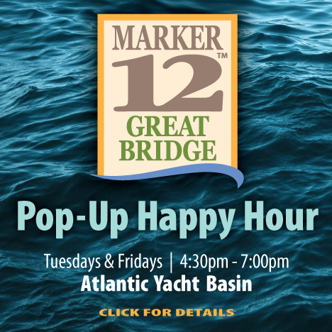
Marker 12 Boater Hospitality Events
The popular Pop-Up Happy Hour hosted by GoChesapeake is held on Tuesdays and Fridays in May and October. Learn more »
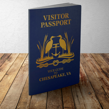
Visitor Passport
The Visitor Passport is your guide to dining, shopping, events and experiences. Pick up your copy at the dockmaster’s office or download a digital copy from the GoChesapeake website. Download a copy »
GoChesapeake Waterway Concierge Services
Let us help you make your visit memorable and uniquely yours. No request is too small or impossible. Contact us today with your request! Hello@GoChesapeake.net or 757.296.3404 – Option 1
A Kroger Supermarket is located in the Great Bridge Shopping Center providing our waterway guests convenient, one-stop shopping within steps of the waterway. Learn more and get hours >>
A Community of Partners Devoted to Supporting Our Waterway Guests
The Blue Angels Air Show is a spectacular treat, especially viewed from the water. Please use caution, especially around anchored spectator boats. Be safe!
Good afternoon Charleston HSC,
Please find attached MSIB 07-26 regarding a safety zone for the upcoming Blue Angels Airshow. As a summary:
The U.S. Navy’s Flight Demonstration Squadron, The Blue Angels, will be conducting aerobatic maneuvers over the Charleston Harbor, SC, on Thursday, April 30th through Saturday, May 2nd, 2026.
A safety zone, encompassing a rectangular area within Charleston Harbor, will be enforced during the times referenced on the chart below. Please note that no one will be allowed to enter the safety zone without prior authorization from the Coast Guard Captain of the Port Charleston or a designated representative.
Mariners are encouraged to monitor the Broadcast Notice to Mariners on VHF Channel 16. Coast Guard Sector Charleston will announce the start and end of the safety zone enforcement each day. The Blue Angels’ schedule is dependent on weather, and any changes to the safety zone schedule will be reflected in a future MSIB.
For questions or concerns regarding this MSIB, please contact the Sector Charleston 24-hour Command Center at (833) 453-1261.
Very respectfully,
LT Nicholas Jones WWM Division Chief USCG Sector Charleston Nicholas.J.Jones@uscg.mil O: 843-740-3184 C: 843-323-7761
Mother Nature reflects on the final finishings protecting STEADFAST’s rebuild. Stay aboard! Sometimes even I want to jump ship, don’t do it! We’re close to launching!
If you just found our very engaging little community, please read SPARS & SPARRING, .….it introduces my wonders and my wanders. ~J
I spent half an hour or so carefully wiping the dust off STEADFAST’s substantial port hull, having sanded all those square feet yesterday, taped seams and edges….does this sound familiar? If you absorbed last week’s edition, it could ring a bell, and since I went through that process twice more in the last few days, I thought, what the hell, you fine, patient, supportive people already have an unplanned blow-by-blow of wooden boat repair and since redundancy is a ridiculously large part of my STEADFAST-controlled world, why not share?!
Her substantial port side and the sandpaper to smooth it. Seriously.
I think my boat-dwelling on-land interlude can be/has been slow-moving and I’m trying as hard as my big heart will allow to keep all of this interesting, poignant, and personal, reaffirming that no matter what happens, life is a journey with unanticipated, challenging and marvelous ports of call with lots of adjectives.
On the West Slope of Colorado I owned a custom catering business supplied by an organic garden (LONG before it was trendy), and most people didn’t realize I was the sole guru; marketer, planner, procurement, farmer, chef, baker, employer, QA manager, cleanup crew and accountant. Because I understood the importance and interdependence of every aspect, after fifteen years, I was very good at what I did. When I baked my brilliant cheesecake, not a single ingredient was overlooked, substituted or rushed. Not one…and they all have to be added in a particular order, then manipulated perfectly, transformed into the finished product, and relished. My cheesecake was delish, and constantly reordered. Sometimes I baked three dozen of those cheesecakes at a time; big precision. We all do it in some aspect of our lives.
My current world couldn’t possibly be more different. My work here is done on a big scale, nearly all of it, but, like so many other professions, hobbies, crafts and trades, it takes relentless attention to particulars (as well as patience) in order to complete everything to the required standards.
Even with an inch of leeway, I didn’t stay inside the lines, which probably describes a large portion of my life. But that’s only with rough drafts; on the final product, we take the time for perfect, detailing every inch.
HERE ARE A FEW MORE INSIGHTS INTO BIG PRECISION—
Sighting with a laser level ensures that the waterline is true and straight.
The laser is utilized because not everything your eye tells you is actually true… the transom waterline is the blue line, which is actually level.
STEADFAST’s protective, original bronze Rub Rail was painted when we took stewardship, reclaimed with razor blades & grit. I pamper her bad-ass bronze.
Major milestone: the teak deck atop the replaced forward section is completed! Precise craftsmanship.
Attention to every angle– nothing on a boat is straight or square, gives her the strength to withstand Mother Nature’s occasional onslaught.
Over the course of the project, I’ve installed over 3500 plugs (bungs) to protect the fastenings. Each is created on a drill press, adhered with G-flex epoxy, secured, cured, cut off and sanded smooth. Aligning the grain is a standard.
Ultimately, all of these big details deter water ingress— after all, water is both our favorite medium and our most dire enemy. Since I have my Captain’s License and we can charter, more than our lives depend on the quality of what we are doing here. Until next week ~J
P.S. Maybe I should serve cheesecake…!
I’m so glad you’ve not jumped ship! If you want to learn a bit more about me and what I’ve produced, please visit my website. JaniceAnneWheeler.com; I’d be flattered.
*** Big news —my latest work is on the presses—you’re wondering, aren’t you, what interesting character I chose to draw out of the shadows? Stay aboard! ***
@YachtingSteadfast on Facebook & YouTube—here’s the latest.
Thanks so much for SPARRING WITH MOTHER NATURE! What crazy weather; she’s as riled up as the rest of the planet! Care to share a peaceful read with friends?
Fred Pickhardt’s Substack is free today. But if you enjoyed this post, you can tell Fred Pickhardt’s Substack that their writing is valuable by pledging a future subscription. You won’t be charged unless they enable payments.
The Pacific is entering a transition phase in 2026, and while ENSO-neutral conditions are currently in place, the latest guidance from the NOAA Climate Prediction Center points toward a likely shift to El Niño this summer. But as always with spring forecasts, the details—especially strength—remain uncertain.
Current Conditions: Neutral for Now
Right now, the tropical Pacific is in an ENSO-neutral state, meaning that the sea surface temperatures are near average and the Niño-3.4 index is close to -0.2°C and atmospheric patterns are not strongly favoring El Niño or La Niña. NOAA indicates an 80% chance that neutral conditions persist through April–June 2026, keeping things relatively stable—for now.
Subsurface Warming Signals a Shift
Beneath the surface, subsurface temperatures have increased for five consecutive months and warm anomalies now extend across much of the equatorial Pacific. At the surface, westerly wind anomalies have developed over the western North Pacific which are often a trigger for El Niño.
El Niño Likely by Summer
Forecast models are increasingly aligned with a 61% chance of El Niño developing by May–July 2026 with further development through the end of the year. This transition is supported by both dynamical and statistical models used by NOAA and other international forecasting centers.
El Nino forecasts made during the Spring have a high degree of uncertainty with a significant bias for over predicting the intensity. By the peak of the hurricane season, there is a 51% probability for a weak to moderate El Nino with a 41% probability for a strong to very strong event. By November to January, there is about equal probability for either a moderate, strong, or very strong El Nino.
For context:
Weak: ~0.5–0.9°C
Moderate: ~1.0–1.4°C
Strong: ≥1.5°C
Very strong: ≥2.0°C
Uncertainty: Summer Wind Patterns
The biggest factor determining how strong this El Niño becomes is how strong will the westerly wind anomalies persist through the summer? If they continue, warm water will surge eastward favoring a stronger El Niño. If they fade, the event may stay weak or stall in the moderate category.
The Spring Predictability Barrier
Forecasting ENSO in spring is notoriously difficult. Models often overestimate El Niño strength this time of year when atmospheric coupling is still developing. Early in the development, the models also tend to have a large range in outcomes as shown in the image below. Forecast confidence, however, improves significantly by early summer. This is why serious forecasters emphasize waiting until at least June.
Final Thoughts
ENSO-neutral conditions are currently in place
El Niño is likely to develop by summer 2026
Strength is highly uncertain, ranging from weak to very strong
NOAA probability tables confirm a wide spread of outcomes
June will be the key month for clarity
For now, the Pacific is sending signals—but not yet a clear message.
Cruisers Net publishes Loose Cannon articles with Captain Swanson’s permission in hopes that mariners with saltwater in their veins will subscribe. $7 per month or $56 for the year; you may cancel at any time.
A view of Sylvester Stallone’s Palm Beach estate from the Lake Worth Lagoon. (Special to the Trident)
The author is a senior editor for the Florida Trident. His work as an investigative reporter has won dozens of awards and led to criminal charges and the removal of corrupt public officials. The Trident published the story earlier today, and it is reprinted here with permission.
By BOB NORMAN
Of all the large lavish mansions lining the northern end of Palm Beach looking west on Lake Worth Lagoon, the one owned by Sylvester Stallone is unique.
It has a private beach—nearly a football field’s length of it.
The beach is just one feature of the waterfront estate the film icon bought on the barrier island for $35 million six years ago. He says it’s his family’s “sanctuary.”
“We have never really enjoyed or respected an area so much in our life,” Stallone told the Palm Beach Town Council during a special meeting on December 19, 2024. “It’s just a jewel … a blessing everyday.”
But for Stallone the property also carried a curse – boat traffic at the busy Palm Beach Inlet. He said his peace is shattered by “looky-loos” lured by his movie fame as well as long-term boaters in the Intracoastal Waterway.
“I would just love to have a tranquil moment,” he told the council.
Sylvester Stallone and a supporter on the Palm Beach Town Council, Julie Araskog.
The answer, the “Rocky” and “Rambo” progenitor said, was simple: just clear the permanently moored boats from the lagoon where his estate sits about a mile southeast of Peanut Island.
“It’s unbelievable to me you can have … a place that’s your sanctuary, and you can have some guy sit there for ten months and do his laundry and there’s nothing you can do about it,” Stallone complained. “I disagree.”
The Tulsa King actor said he’d had already enlisted the help of his friend, President Donald Trump, in the mission.
“Nobody has really paid attention,” he told the council in a moment that had the ring of one of his action movie taglines. “Well I’m gonna pay attention, trust me.”
Fast forward 17 months and Stallone has made good on his vow in stunning fashion. After an ordinance limiting anchorage in the lagoon was passed in October, Palm Beach cracked down on boaters, many of whom have been there for decades, cutting their unpermitted mooring balls and slapping their sloops with five-day removal notices and towing those in violation away.
The enforcement action was initially funded in an unusual way: a private donation of $250,000. Writing the check was the non-profit Palm Beach Police and Fire Foundation, which happens to count Stallone as a major contributor but claims the actor had no role in directing the money.
Boats moored at the lagoon, including Marty Minari’s catamaran in the foreground.
At a council meeting in March, town police announced they’d issued 50 notices of violation, towed 15 boats, and overall had run 128 of the 168 boats originally targeted out of the lagoon. Councilor Bobbie Lindsay thanked Stallone personally from the dais for his role in making that happen, as well as his part in the previous year’s passing of a state bill, HB 481, that paved the way for the new ordinance by giving municipalities like Palm Beach the legal power to enforce stricter anchoring restrictions.
“I’m gonna give a shoutout to Mr. Sylvester Stallone,” she said, adding he “made a lot of phone calls to a lot of important people who decided this was a bill that should be passed” and “deserves a lot of thanks.”
But not everyone is so thrilled with Stallone, or with the town. It isn’t just boats that have been removed from the lagoon, after all. It’s boaters—local residents who see themselves as part of an egalitarian and independent Palm Beach seafaring community that stretches back a century in the lagoon. They want the town to clean up the harbor of broken-down “derelict” vessels as well, but wish it would leave their seaworthy—and often very expensive—boats alone.
Hounded from the harbor, they insist they have the right to moor and anchor there, with or without a state-issued permit. They’ve been doing it for decades and they see the current crackdown as serving only the benefit of Stallone and some of the island’s other wealthy elite.
“I love your movies dude, but you’re an asshole,” said one of the displaced boaters, Marty Minari, of Stallone. “You’re an entitled asshole.”
‘Here First’
For Minari and dozens of other boaters, the fight against Stallone and the Town of Palm Beach is infinitely larger than the lagoon. It’s about the public’s right to navigable waters guaranteed in federal law and the Florida Constitution.
On February 13, town police placed a notice on Minari’s 40-foot catamaran, called Mulligan, demanding the vessel, which is insured for $325,000, be out of the lagoon within five days or it would be “removed and disposed of by the Palm Beach Police Department.”
Cal Landau said he’s fighting more than just Stallone and the town. (Credit: YouTube)
A lawsuit was filed against the town in circuit court just 11 days later on behalf of Minari, who is a pilot instructor by trade, alleging the town doesn’t have jurisdiction over the federally regulated Intracoastal Waterway. The boaters see themselves as the vanguard of the boaters’ rights movement nationwide. “We have to win this,” said boater Cal Landau. “It’s us trying to save Florida, and that’s kind of hard. But it’s up to us to fix this.”
In February, town police cut the mooring ball in the lagoon where Landau kept his 42-foot catamaran for years. A charter guide and boat broker who lives with his wife in a condo but works on the water, Landau said all nearby marinas have year-long waiting lists and cited one that would charge him $64,000 a year. A call by the Florida Trident to the nearby municipal Riviera Beach Marina Village found a waiting list of over a year and an annual cost of about $34,000 for a slip to accomodate Landau’s catamaran.
“If I could say anything to Sylvester Stallone,” Landau said, “it would be to tell him he’s ruined the lives of almost 100 boaters. And we live here. We were here first.”
Stallone and the town have “messed up a lot of people’s lives,” said Elie Edmondson, a veteran mariner and long-time official of the Palm Beach Sailing Club. “I’ve had adult men on the phone literally be in tears that they moved here just to enjoy the water and now they have nowhere to go.”
A Palm Beach marine patrol cop is photographed while taking enforcement action against Elie Edmondson’s sloop. (Special to the Florida Trident)
Edmondson, a property appraiser who lives in West Palm Beach, feels the pain firsthand. His 44-foot sailing sloop, which he’s kept on an unpermitted mooring in the lagoon since 2007, was towed by town police 40 miles away to a marina in Stuart while he was on vacation in February.
“A friend called and said there was a yellow sticker on my boat saying I had five days to move it,” said Edmondson. “By the time I was able to get back, the boat was gone.”
“It’s the mentality of, ‘I want this all to myself. I’ll get mine, and screw you,’” he added. “We feel like we’re the little guys getting crushed underfoot.”
Stallone didn’t respond to detailed messages from the Trident left on his website and social media – but he made his stance very clear in December 2024 while making the clarion call to remove the boaters in the lagoon.
‘Right To Enjoy’
The council meeting starring Stallone wasn’t supposed to be about clearing boats from the lagoon; it concerned his bid to install a 241-foot long “seaweed barrier”—basically a floating curtain of mesh—in the Intracoastal Waterway roughly 50 feet out from his private beach.
The proposal bombed with both residents and the council.
Stallone initially couched it as somehow related to rejuvenating “aquatic life,” but quickly pivoted to the bothersome “derelict” boats, which he said were drawn by his “notoriety” and were “dumping sewage and gas and trash and dog feces, ad nauseum.”
“It’s nice to be appreciated, but there’s a tremendous amount of looky-loos, fishermen, tour boats,” Stallone said. “And sea turtles have been hit, fish have been disarrayed, a lot of trash, a lot of garbage, and so on and so forth. We’re trying to make this pristine, to bring it up to what probably it was 20 years ago.”
An example of the kind of seaweed barrier Stallone wanted to put in the Intracoastal outside his property. (Town of Palm Beach)
Among the Palm Beachers who spoke against the seaweed barrier was socialite Minnie Pulitzer, daughter of the late clothing brand founder Lilly Pulitzer and great granddaughter of newspaper publisher Joseph Pulitzer. She turned from the public lectern to address Stallone, who was seated behind her just a few feet away.
“It’s not privately owned, the Intracoastal,” Pulitzer told Stallone while very literally looking down on him. “It’s everyone’s right to enjoy it. I’m sorry you’ve got some people—you are famous—that want to torture you, stopping by, but … it’s for everybody’s use.”
Stallone, who famously wrote “Rocky” with $106 in his bank account, correctly read the room and withdrew the request for the seaweed barrier. But he’d already made clear his larger plan to “clean up” the waterway and evict long-term boats.
The notice of violation issued on Mulligan, Minari’s cat. (15th Judicial Circuit Court)
“And I’m not just talking about for here,” Stallone said of the boat removal. “I’m talking about eventually Miami, the whole east coast, and maybe the entire United States. I really think there’s a time for this to be overhauled and if I can be at the forefront of that, which I think I can, I plan to do that.”
The first step in that process came just a couple of months later with House Bill 481, which was originally aimed at liveaboard boaters on Miami’s Biscayne Bay. It gives municipalities the power to restrict boats from anchoring overnight for more than 30 days during any given six-month period.
The town hired a lobbyist from the GOP-connected firm Ballard Partners to help push HB 481 through, but Stallone’s exact involvement isn’t known. While thanking Stallone in March, Councilwoman Lindsay said the actor worked with then-state Rep. Vicki Lopez (R-Miami) and made those “important” phone calls to help get the legislation passed, but neither Lopez, now a member of the Miami-Dade County Commission, nor Lindsay, who just retired from office, returned messages from the Trident requesting details.
Others who worked on the bill described Stallone as a sort of ghost in the process. One lobbyist who asked not to be named said HB 481 was referred to in the halls as the “Stallone bill.” State Sen. Jonathan Martin (R-Fort Myers), who co-sponsored the bill, said he’d heard Stallone was involved behind the scenes, but was never personally contacted by him.
“Should I feel like I was left out?” Martin joked. “He didn’t throw me a fundraiser.”
‘We’re the Good Guys’
After DeSantis signed the bill last May, the Town of Palm Beach enacted its own ordinance to enforce the 30-day rule. In a discussion about the ordinance in September, the town again focused on derelict boats, defined essentially as partially sunken inoperable boats, as a target of the ordinance, which doesn’t actually address derelict boats.
Several boaters, including then-Palm Beach Sailing Club Commodore John Hough, told the council it was responsible mariners with seaworthy craft who’d be hurt along with the club itself.
The Palm Beach Sailing Club, established in 1966, has been hurt by the new ordinance. (Credit: Facebook)
“I just want you to be aware we’re the good guys,” Hough told the council. “We take care of things, we’re not derelicts, we’re very concerned about the environment. But what you’re gonna do is going to be very harmful to these folks.”
Even prior to the ordinance being passed, the town’s marine patrol unit began cutting unoccupied—and unpermitted—mooring balls that had been in use for decades. The boaters point out that professionally installed moorings, where chains are affixed to the seabed, are more environment-friendly than anchors, which can damage the seabed. Potentially worse, the town has left the cut mooring chains at the bottom of the harbor, where they could snag anchors and become a hazard to boaters.
Town manager Kirk Blouin and multiple council members acknowledged that responsible boaters were not the problem and promised to look into ways to protect them. But that protection never came. Boaters’ rights activist Wally Moran, of Wellington, unleashed on the council, along with Stallone and other wealthy islanders who support the measure.
An example of a derelict boat in the lagoon the boaters agree need to be removed. (Town of Palm Beach)
“If they don’t like looking at boats, they should have bought property in Orlando, not West Palm Beach,” Moran said. “And their leader, Mr. Sylvester Stallone, needs to demonstrate what he claims are his roots as a common man and start supporting the little man, not his wealthy neighbors.”
Those words caught the ear of council member Julie Araskog, who resides in a $10 million home right next to the actor’s estate. Araskog scolded Moran and said Stallone had been “incredibly helpful” to the town on the anchorage issue.
“I think that attacks against people are not great and I don’t think you know the Stallones,” Araskog said. “And I don’t think you know that a boat washed up [on Stallone’s beach] and it cost $39,000 and on top of that he couldn’t move it for quite a while. They’ve also had feces, so for you to say he’s just there for his view and the rich people, that’s not true. He actually is a lovely man. He is actually someone who fights for people who are both poor, medium, and rich.”
When reached by the Trident on the phone, Araskog cut the communication short. “I need to hang up,” she said to a reporter. “I thought you were someone else.”
The council was determined to conduct the crackdown, but it had a major problem in executing it: The town didn’t have money in the current year’s budget to pay for it.
Enter the windfall from the Palm Beach Police and Fire Foundation.
‘Get Rid of Them All’
Just before the town council voted for the anti-mooring ordinance, it accepted the $250,000 check from the foundation to kickstart the boat removal process.
Because there was no money in the 2025 or the 2026 budget earmarked for the operation, the money allowed the town to start its work immediately, said Councilor Bridget Moran. “We could have made it a line item in the budget, but not for the immediate year,” Moran told the Trident.
It was Moran’s husband, Tim Moran, who presented the foundation’s check to the town. He’s a co-founder of the 20-year old organization, whose board includes a host of major business leaders and at least two billionaires (oil titan and conservative political donor William Koch and real estate mogul Jeff Greene).
A major contributor is Stallone, who’s contributed $352,727, according to foundation records, with the first $300,000 donated in April 2024, and another $52,727 in the last year.
The foundation’s executive director, Rebecca Godwin, maintained that Stallone had no influence regarding the $250,000 donation.
“The Foundation’s decision to support the derelict boat removal initiative was made independently, consistent with its mission to underwrite public safety efforts,” Godwin wrote in an email to the Trident. “There was no involvement by Mr. Stallone in the initiation, discussion, or approval of this grant, and no communication with the Foundation regarding this matter.”
After the council accepted the check it unanimously approved the ordinance. The general consensus was that it was a shame long-time responsible boaters would be harmed by the move, but they were necessary collateral damage.
“I understand that people are unhappy and I understand that people are going to complain about what is happening,” Councilor Moran told the Trident. “But when we enforce the law it can’t be selective.”
Saying she “loves rules,” she said she had no regrets about the ordinance.
“If you’re doing something that’s prohibited and it’s not legal does it make sense to keep doing it? It doesn’t to me,” she said, adding, “We’re trying to get rid of all of them. It’s the right thing to do for the environment.”
She also expressed sympathy with Stallone’s frustration.
“They anchor within 100 yards of his backyard, screaming music like the [“Rocky III” theme song] ‘Eye of the Tiger,’” Moran said. “Nobody wants that.”
The boaters, however, pointed out they weren’t the ones pestering Stallone and pounced on the environmental rationale as a false argument. Very few of the permanent boaters illegally dump waste from their boats, they said, and laws were already on the books for those who do.
If the town really wants to fight pollution in the lagoon, they said, it should focus on stormwater runoff and sewage leaks. Just this past December, the Florida Department of Health issued a no-swimming alert in the lagoon due to suspected fecal matter contamination following a sewer line break.
“The pollution comes from breakage in the Palm Beach sewage lines and it comes from pesticides and fertilizer coming off the lawns,” said Chris Kellogg, who moved his own boat before it was towed away. “Do you know that one manatee produces 150 pounds of waste a day? There are sometimes 100 of them in the harbor. The thing about waste is a ruse meant to stir people up to hate boaters.”
Reject Compromise
The 82-year-old Kellogg is no looky-loo; he comes from social royalty on the island. Kellogg’s grandfather, businessman Gurnee Munn, first built an Addison Mizner-designed home called Louwana there in 1919. Gurnee’s brother, Charles Munn, was known for decades as “Mr. Palm Beach” and built the Mizner-designed home called Amado, which sold for $148 million two years ago. In 2018, Louwana was purchased by Dr. Oz, the heart surgeon and current Trump Administration official. Kellogg resides next door to Dr. Oz in another home built by his grandfather, but his passion is the lagoon where he’s been boating since he was a kid.
Kellogg has responded to the crackdown by running large ads in the Palm Beach Daily News decrying the enforcement action in the lagoon and calling for relief.
Chris Kellogg, pictured above in a vessel he recently sold, has been boating in the lagoon for 65 years. (Special to the Trident)
“The damage reaches far beyond the displaced boaters,” he wrote in one. “Many companies supporting the marine industry and employing hundreds of Palm Beach County residents will also suffer. Marine Industries Association figures estimate an approximate $2,000,000 loss locally.”
He too aims blame at Stallone.
“He didn’t like these boats out in front of his house,” Kellogg said. “He didn’t like the idea there were boats he could see out there. He wanted a clear vista.”
Kellogg is hoping the lawsuit prevails and the boaters return to what he considers their rightful place in the lagoon. But Kellogg, like seemingly every one of the boaters, sees an easier solution: a town-regulated mooring field with 100 or more slips.
“The town has a responsibility to install a mooring field and patrol it,” Kellogg said. “They have boats to patrol it anyway, so there’s no additional cost.”
The sailing club’s Hough brought up the idea to the council in September.
“That would be ideal for us and for you, because those moorings would be safe and they wouldn’t allow derelicts out there,” Hough told the council.
The town, however, opposes the installation of a mooring field and has gone so far as to file legal objections to the nearby City of Rivera Beach’s proposal for one. At a council meeting last May, one of Stallone’s neighbors, Bradford Gary, explained that a mooring field would drive down property values on the island.
Edmondson is now keeping his sloop, pictured above, 40 miles north in Stuart. (Courtesy: Elie Edmondson)
“We have a neighbor who’s trying to sell his place for $90 million,” Gary told the council. “You think that’s gonna sell when there’s boaters coming to shore from a mooring field using his front yard as … a bathroom?”
Minari, the plaintiff in the lawsuit, said it was a typical elitist—and false—claim.
“Who’s climbing a seawall to take a dump on a $90 million lawn?” he asked.
Displaced boater Edmondson said Blouin, the town manager, told him personally the town would object to any mooring field being put in the lagoon. “I have residents that don’t want to see any boats out there,” Edmondson recalled Blouin telling him. (Blouin didn’t return a message for comment from the Trident).
Edmondson said he feels little hope of a compromise at this point. He said he’s tried everything from addressing the council, meeting with the town manager, and writing letters pleading for help on behalf of the Palm Beach Sailing Club. One letter was sent to Stallone.
“I’m 64 now, but remember as a younger man how the story lines of Rocky and Rambo moved me and encapsulated the American spirit,” Edmondson wrote in an Oct. 6 letter to the actor. “For the Club this is a bit of a ‘Rambo’ moment in that the Town is taking actions we feel are heavy-handed and will destroy our lifestyle and freedom to enjoy public waters…It is not possible for me to overstate how much your help on this issue would be appreciated.”
He didn’t receive a response.
LOOSE CANNON covers hard news, technical issues and nautical history. Every so often he tries to be funny. Subscribe for free to support the work. If you’ve been reading for a while—and you like it—consider upgrading to paid.
There are 2 sides to every story & I think you have done a good job representing both. If this had been an effort to eliminate junk, unsightly boats, as a boater we could easily join forces with Mr Stallone to remove them from the waterway. But this is an obvious movement to use his riches to deprive responsible boaters from the intracoastal. These boats have been Have been there for years. There is literally no where else to go.


 Ironclad Anglers Fishing Rodeo at Colonial Lake (Charleston) | Saturday, May 2nd, 8:30AM – 11:30AM | SCDNR is partnering with the City of Charleston for a hero-themed Youth Saltwater Fishing Rodeo. This is a catch-and-release fishing rodeo (not a tournament) and instructors will be available to help anglers learn the basics of saltwater fishing. Children 15 years of age or younger and their parents/guardians are welcome.


Be the first to comment!