NOAA Navigation Services Newsletter – July 2022
|
|
Away from the bustling summer crowds, the Cape Hatteras National Seashore’s new “Kayak with a Ranger” program allows participants to get close to and appreciate nature during guided paddles of the salt marshes and waters of Pamlico Sound.

Click her for more: Ranger-guided paddles encourage ecosystem appreciation
CoastalReview.org
Officially “The Friendly City,” Bradenton is a vibrant city located along the Gulf Coast in Manatee County in the US State of Florida.
Click here for more information: Bradenton, FL
WorldAtlas.com
AREA SPONSORING MARINAS
Click Here To View the Western Florida Cruisers Net Marina Directory Listing For Twin Dolphin Marina
Click Here To Open A Chart View Window, Zoomed To the Location of Twin Dolphin Marina
Click Here To Open A Chart View Window, Zoomed To the Location of Riviera Dunes Marina Resort
Cruisers Net lists only one marina, Four Winds Marina, suitable for drafts less then 3.5ft, at the northern tip of Pine Island. However, there are several good depth anchorages at the southern tip of the island just north of the Caloosahatchee River and the Okeechobee Waterway.

Of the entire US, Pine Island is the 118th largest island and resides in Florida’s Lee County, which is west of Cape Coral. Pine Island is a part of a chain of islands that constitute the Matlacha Pass and separates it from the Florida Mainland. On the west side of Pine Island reside the Intracoastal Waterway, a waterway that runs from Massachusetts to Texas, passing around the Florida Peninsula. Of the nearby islands, Sanibel Island lies to the south, North Captiva Island to the west, and Captiva Island to the southwest.
Similar to nearby Fort Myers, Pine Island is made up of deposits of coral rock. This variation of limestone encrusted with fossilized shells, animals, and even pine trees found in the northern tip from the excavation is common throughout southern Florida. Following millions of years of North America settling into place from the continental drift, that state’s land mass was twice as large. This saw extensive forests, dunes, and tributaries with the coast of the Gulf of Mexico starting another 100 miles west of Pine Island. Thus, came the ice age, which brought forth flooding as the glacier defrosted. Around 4500 BC, the shape of Florida formed into something similar to today. The former ice age also increased water levels and created the long and narrow islands seen off the gulf coast, including Pine Island. With churning ocean water, channels, shoals, and the unnamed sand beaches that are a familiar attraction of Pine Island formed. However, the mingling of freshwater and saltwater from the tributaries’ output created sedimentation. The fallen trees from the shore, among shells, animals, and other items fossilized in this sedimentation, created the limestone, better known as coral rock.
Long before the town of Pine Island existed, the Calusa Indians were the first known inhabitants of this island, around 800 AD. The first contact with outsiders did not occur until the mid-16th century when Spanish conquistadors landed. By the 19th century, there were no further documented occurrences of the Calusa Indians, and it is believed the tribe could have died off or dissolved into other tribes. Ongoing research is being conducted on Pine Island to further understand the Calusa Indians, with artifacts being unearthed as of today.

|
"national security issue"- what a pant load. Climate has been changing since it existed. This is a red herring pushed by the socialist left and China. China is the "national security issue". Pay attention.
In boating, etiquette isn’t just about being polite but also about safety.
Boating Etiquette 101: |

In boating, etiquette isn’t just about being polite but also about safety. So you shouldn’t take it lightly, specifically if you’re new to boating. But, unfortunately, no one has written down these so-called rules–well, until now.
If you’re a first-timer simply asking another friend that boats is unreliable as every boater is different, and some might play by their own rules. In this case, it’s best to trust us, the experts.
Below you’ll find some boating etiquette basics, from the “rules of the road” to docking and dock manners, fueling, and more, plus other helpful blogs so you can avoid being THAT boater everyone loves to hate. |
Ramps and Trailer Etiquette
If you’re using a trailer, there are a few things you need to know before hitting the road, like checking your trailer lights and brakes before heading to the ramp. You don’t want to be the boater who has to call a tow! |
 |
 |
Fueling
If you’re running low on fuel, it’s time to head to the gas dock. When refueling your boat, there are several things to keep in mind. For example, NEVER leave your boat unattended while fueling! |
Docking and Dock Manners
If you’re new to boating, docking can be one of the most daunting tasks, especially if you’re trying to dock in a crowded marina. But, don’t worry; with a bit of practice (and patience), you’ll be docking like a pro in no time! Our best advice is to remain calm. |
 |
For more helpful tips and advice for your VHF radio conduct, anchoring, respecting your neighbors, your guests, and pets, and keeping the waters green, check out our full article below!
These rules help keep the waterways clean and friendly, making boating a more pleasant experience for everyone. The guidelines also help ensure safety while boating. In addition, boaters familiar with and adhering to boating etiquette will have a fun, trouble-free time out on the water! |
Dockwa, PO Box 179, Freeport, ME 04032, USA janelle .cox@dockwa.com |
Construction of wind turbines off the North Carolina coast could affect birds and marine life, and while scientists and others seek more information on the extent of those effects, those who spoke during a forum last week in Wilmington said climate change is likely a greater threat.

Offshore wind turbine impacts a trade-off, panelists say
CoastalReviewOnline.org
In addition, the nucs provide power 24/7.
The article states that "The Kitty Hawk WEA and Wilmington East WEA are under lease. These areas have the combined potential to generate upwards of 4 gigawatts of power, the equivalent output of four nuclear power plants." That is not really factually accurate when comparing apples to apples.
It is true that the nameplate capacity of the wind farm and four nuclear plants are both 4 gigawatts. But the capacity factor of a nuclear power plant ( the amount of power it actually produces compared to the nameplate capacity) is 90%. So 4 nuclear plants are capable of producing 3.6 gigawatts of power 24/7, 365 days a year. The average capacity factor of an off shore wind turbine is 45%. So the off shore wind farm is capable of producing 1.8 gigawatts of power 24/7, 365 days a year. A good amount of power for sure, but only the equivalent of 2 typical nuclear plants.
Ancient mariners used to gauge how fast their ship was moving by throwing a piece of wood or other floatable object over the vessel’s bow then counting the amount of time that elapsed before its stern passed the object.

Why is a ship’s speed measured in knots?
history.com
There are five cuts in the Satilla River basin, including the often used Umbrella Cut, an alternate route for ICW cruisers. This estuary restoration does not include Umbrella Cut or the Floyd Creek Cut. See Umbrella Cut.
Georgia Outdoor Stewardship Program helps fund coastal estuary restoration
GADNR – Coastal Resources Division

Outer Banks Forever is proud to support our Outer Banks national parks in a variety of ways — large and small.


|
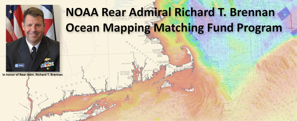 NOAA’s Office of Coast Survey invites non-federal entities to partner with NOAA National Ocean Service’s ocean and coastal mapping programs on jointly funded projects of mutual interest using NOAA’s geospatial contracting vehicles. Known as the Brennan Matching Fund, the opportunity relies on NOAA’s mapping, charting, and geodesy expertise, appropriated funds, and its authority to receive and expend matching funds contributed by partners to conduct surveying and mapping activities. Partners benefit from this opportunity by leveraging NOAA’s contracting expertise, including its pool of pre-qualified technical experts in surveying and mapping as well as data management to ensure that the mapping data are fit for purpose and are usable for a broad set of purposes, including, for example, safe navigation, integrated ocean and coastal mapping, coastal zone management, renewable energy development, coastal and ocean science, climate preparedness, infrastructure investments, and other activities.


 We’re excited to introduce you to our friends at
 Thank you to everyone who has adopted a sea turtle nest this summer!


Be the first to comment!