Tropics Staying Quiet, First Cold Snap Of the Season
Weather Alert – November 13, 2026
Tropics Staying Quiet
The tropical Atlantic remains tranquil today, just how we like it and typical for mid-November. The rest of the Atlantic also has no features of interest for tropical development. It’s unlikely we’ll see any more developments over the next week or even the rest of the hurricane season.
The visible satellite imagery loop above shows features of interest across the Atlantic and eastern U. S.:
Disorganized thunderstorms along the Intertropical Convergence Zone around 5-10° north
Clouds associated with a cold front off the East Coast, the Gulf and the northwestern Caribbean Sea
Clouds cover much of the Midwest and the Northeast, and snow-bearing clouds are along the spine of the Appalachians
Image Source: University of Wisconsin’s RealEarth
The tropical Atlantic is essentially empty. There are no thunderstorms to be found except along the Intertropical Convergence Zone, which is shifting southward toward the equator as usual this time of year.
Over the rest of the Atlantic Basin, a band of clouds associated with a cold front stretches from the southern Gulf and northwestern Caribbean Sea to a storm centered east of Nova Scotia. Fronts over warm water can lead to surprise developments, but probably not in this case because upper-level winds are unfavorable.
So, it’s looking increasingly likely that we won’t see any more named storms form in the Atlantic Basin this year. However, it’s always good to stay prepared. Hurricane prep is good general disaster prep. If you need prep advice, SCEMD has you covered at hurricane.sc.
SC Weather Highlights For the Next Week: Our First Cold Snap Of the Season
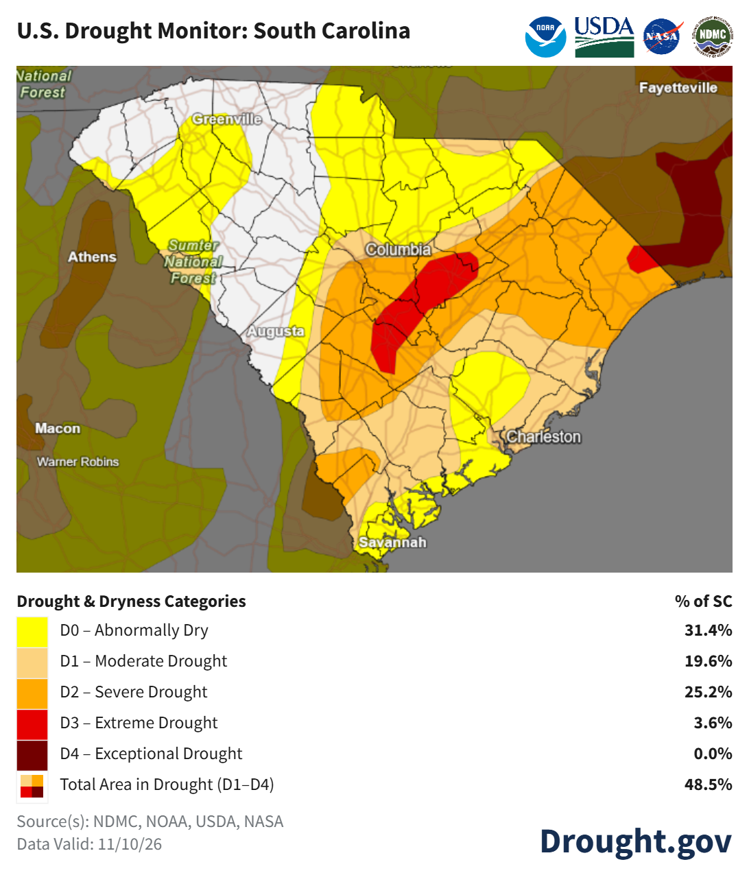
A 1-2 punch of cold fronts has ended the stretch of warm days across South Carolina. It’s too bad that we didn’t see any rain from the fronts, because we need it and the drought is getting worse again.
The U. S. Drought Monitor for South Carolina with data through November 10 shows about half the state in drought and parts of the state in Extreme Drought (D3). Learn more about South Carolina’s response to drought at scdrought.com.
Rain prospects are not good over the next week. Chilly high pressure now centered over Ontario, Canada, will shift southeastward and become anchored over West Virginia by the middle of next week. That will deflect storms to our south and keep our weather cool and dry for several days. The possible exception will be stray showers along our coast from easterly winds around the high on Tuesday through Thursday. If the showers do happen, don’t expect significant rain.
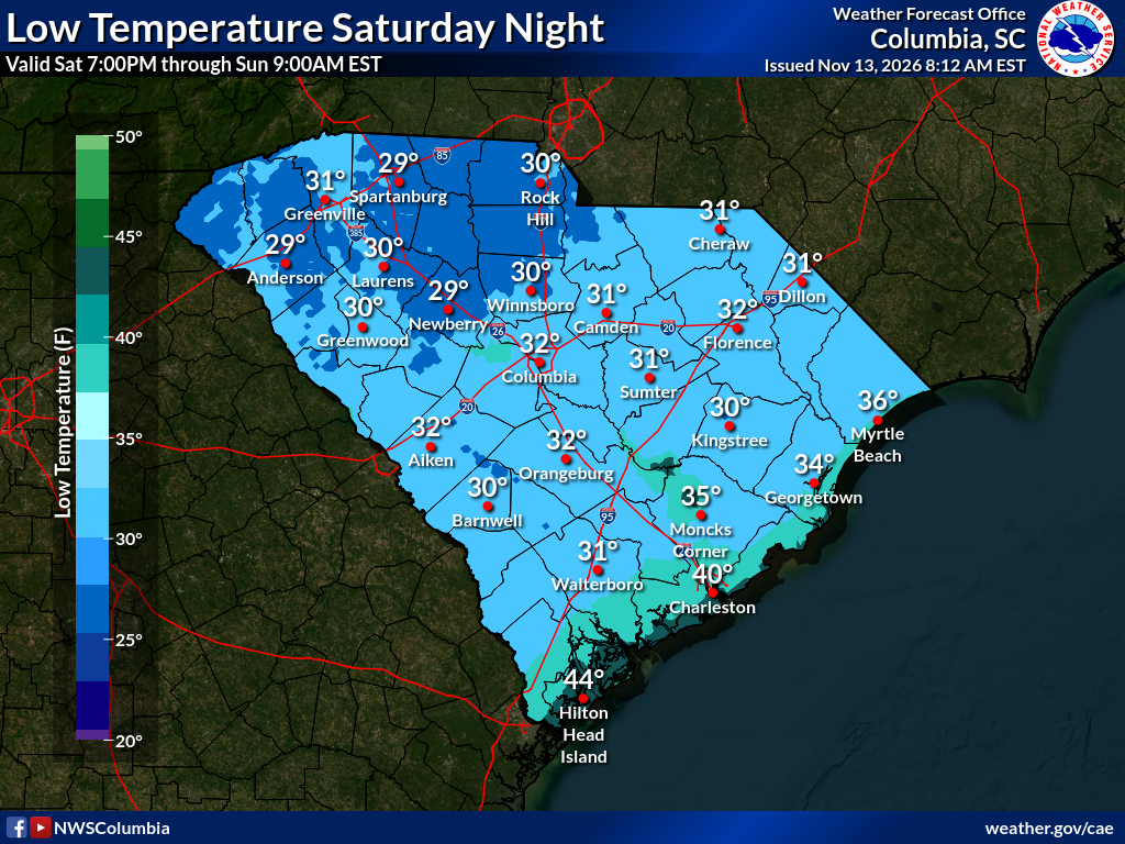
Our main highlight is that we’ll see our first widespread frost and freeze of the season Saturday night, and Sunday night will be almost as cold. Lows in the 20s are in the forecast for the Upstate and Catawba region Sunday morning. So, the growing season will end for most of the state, where it hasn’t already. It’s also time to make sure your pipes are properly protected from the cold if you haven’t already.
Side note: It’s snowing in the higher ground of western North Carolina, and the snow will continue into Saturday morning. So, if you’re just dying to see snow, it’s happening within a reasonable driving distance.
Temperatures will moderate to near average by the middle of next week, then we’ll be back in the 70s again at the end of next week. There’s no sign of any more significant rain until at least next weekend and perhaps early in the following week. However, there are signs that a more active, wetter weather pattern could get underway around that time. I hope so — not only is it too dry; frankly, I’m also getting bored with this weather pattern!
Frank Strait Severe Weather Liaison S.C. State Climate Office








Be the first to comment!