Visit Logged
  • Select Region
    • All Regions
    • VA to NC Line
    • North Carolina
    • South Carolina
    • Georgia
    • Eastern Florida
    • Western Florida
    • Florida Keys
    • Okeechobee Waterway
    • Northern Gulf
    • Bahamas
    • New York
    • Ohio
    • Pennsylvania
    • Washington
    • Puerto Rico
    • Minnesota
    • Maryland
    • Tennessee
    • NW Waters
    Order by:
    • CURRENT LOCAL NOTICES TO MARINERS

      Here are the latest Local Notices to Mariners and NAV ALERTS that are relevant to ICW cruising in Districts 5, 7 and 8, the OBX, AICW, OWW, Keys, GIWW and adjacent waters. Open each LNM link for the USCG notice and a chart for each location. Listed north to south to north. NAV ALERTS will also be posted on our Homepage.

      For previous Local Notices, go to the Specific State or Region on our Homepage


      Week 43/26

      LNM: Off AIWW MM:571.6, Savannah River North Jetty Light Extinguished

      LNM: Off WW, Situational Update – Hazardous Weather Outlook for the Western Atlantic – Wed Oct 21, 2026 11:45 Extinguished

      LNM: Off OWW MM:1.7, St Lucie Inlet Buoy 6 Missing

      LNM: AIWW MM:1,119.0, Cutter Bank Light 14 Missing

      LNM: AIWW MM:245.8, Bogue Sound – New River Buoy 71A Offstation

      LNM: GIWW-East MM:148.9, Pensacola-Mobile Buoy 114 Offstation

      LNM: Off AIWW MM:159.6, Bay River Daybeacon 6 Missing

      LNM: Off WW, Situational Update – Hazardous Weather Outlook for the Western Atlantic – Tue Oct 20, 2026 11:45 Extinguished

      LNM: Off AIWW MM:463.8, Wando River Light 14 Extinguished

      LNM: Off , York Spit Swash Warning Daybeacon A Missing Dayboards

      LNM: AIWW MM:1,066.6, Port Everglades Light 6 Extinguished

      LNM: Off AIWW MM:1,090.5, Fishermans Channel Light 3 Extinguished

      LNM: AIWW MM:1,054.0, Hillsboro Inlet Entrance Daybeacon 5 Extinguished

      LNM: Off AIWW MM:979.3, St Lucie River (North Fork) Daybeacon 10 Destroyed

      LNM: Off WW, Situational Update – Hazardous Weather Outlook for the Western Atlantic – Mon Oct 19, 2026 15:00 Extinguished

      LNM: AIWW MM:208.8, Bogue Sound Lighted Buoy 5A Shoaling

      LNM: Off AIWW, Oregon Inlet Cut Buoy 4 Offstation

      LNM: Off AIWW, Oregon Inlet Cut Buoy 1 Offstation


      Week 42/26

      LNM: Off WW, Situational Update – Hazardous Weather Outlook for the Western Atlantic – Sun Oct 18, 2026 09:00 Extinguished

      LNM: Off WW, Situational Update – Hazardous Weather Outlook for the Western Atlantic – Sat Oct 17, 2026 14:00 Extinguished

      LNM: OWW MM:64.1, Clewiston Channel (Rt 1B) Daybeacon 13 Destroyed

      LNM: Off WW, North Creek Entrance Light 1NC Missing Dayboards

      LNM: Off AIWW MM:1,091.3, Government Cut Range Front Light Extinguished

      LNM: Off OWW, Lake Okeechobee Fad Buoy A Damaged

      LNM: GIWW-West MM:472.3, Port O’Connor Channel Buoy 9 Missing

      LNM: Off WW, Little Wicomico River Light 11 Destroyed

      LNM: GIWW MM:110.8, Boca Ciega Bay Daybeacon 14 Missing

      LNM: GIWW MM:52.8, Lemon Bay Daybeacon 51A Missing

      LNM: GIWW MM:51.5, Lemon Bay Channel Daybeacon 49 Set TRUB

      LNM: Off AIWW, Oregon Inlet Buoy 24 Relocated

      LNM: AIWW MM:1,163.3, Lignumvitae Key Daybeacon 91A Missing

      LNM: Off , New Jersey Intracoastal Waterway Buoy 99 Extinguished

      LNM: Off , New Jersey Intracoastal Waterway Buoy 102 Extinguished

      LNM: Off , New Jersey Intracoastal Waterway Buoy 101 Extinguished

      LNM: GIWW MM:110.8, Boca Ciega Bay Daybeacon 14 Destroyed

      LNM: Off GIWW MM:117.2, Pass-A-Grille Entrance Light PG Extinguished

      LNM: Off AIWW MM:61.2, Corpus Christi Channel Light 56 Missing

      LNM: Off WW, James River Channel Light 98 Extinguished

      LNM: Off WW, Rappahannock River Light 40 Extinguished

      LNM: Off WW, Rappahannock River Light 38 Extinguished

      LNM: Off GIWW MM:117.2, Pass-A-Grille Entrance Light PG Extinguished

      LNM: Off GIWW MM:117.2, Pass-A-Grille Entrance Light PG Extinguished

      LNM: Off AIWW, Roanoke Island West Side Light 4 Missing

      LNM: AIWW MM:227.8, Bogue Inlet Lighted Buoy 15 Shoaling

      LNM: Off AIWW MM:227.7, Bogue Inlet Buoy 9 Shoaling

      LNM: AIWW MM:227.7, Bogue Inlet Lighted Buoy 14 Temporarily Discontinued

      LNM: Off AIWW MM:227.7, Emerald Isle Cut Lighted Junction Buoy EI Temporarily Discontinued

      LNM: AIWW MM:227.8, Bogue Inlet Lighted Buoy 15 Temporarily Discontinued

      LNM: Off AIWW MM:227.7, Bogue Inlet Lighted Buoy 13 Temporarily Discontinued

      LNM: Off AIWW MM:227.7, Bogue Inlet Buoy 11 Temporarily Discontinued

      LNM: Off AIWW MM:227.7, Bogue Inlet Buoy 9 Temporarily Discontinued

      LNM: Off AIWW, Big Foot Slough Channel Light 10 Offstation

      LNM: Off AIWW MM:227.8, Bogue Inlet Lighted Buoy 3 Missing

      LNM: Off AIWW MM:227.7, Bogue Inlet Lighted Buoy 2 Missing

      LNM: Off AIWW MM:227.7, Bogue Inlet Lighted Buoy 1 Missing

      LNM: Off GIWW, Alligator Creek Daybeacon 14 Broken

      LNM: Off WW, Port Tobacco River Daybeacon 8 Changed

      LNM: Off GIWW-East MM:69.9, Gulfport Ship Channel Light 59 Damaged

      LNM: Off AIWW MM:250.2, New River – Restricted Areas Closed to Navigation


      Week 41/26

      LNM: GIWW MM:111.2, Boca Ciega Bay Daybeacon 16 Set TRLB

      LNM: GIWW MM:111.2, Boca Ciega Bay Daybeacon 16 Leaning

      LNM: Off GIWW-East MM:186.0, Pensacola Bay East Channel Outer Range Front Light Damaged

      LNM: Off GIWW, Apollo Beach Daybeacon 6 Destroyed

      LNM: GIWW-East MM:77.0, Ship Island Light 4 Destroyed

      LNM: Off WW, Situational Update – NWS Tropical Atlantic Marine Weather Briefing 12:45

      LNM: GIWW-East MM:89.4, Belle Fontaine Light 8 Missing Dayboards

      LNM: GIWW-East MM:57.0, Marianne Channel Daybeacon 18 Destroyed

      LNM: Off AIWW MM:688.0, St Simons Sound Entrance Lighted Buoy 13 Extinguished

      LNM: AIWW MM:680.2, Brunswick Point Cut Range Rear Light Extinguished

      LNM: Off AIWW MM:675.4, Turtle River Lower Range Front Light Extinguished

      LNM: Off GIWW, Hillsborough Cut C Channel Outbound Range Rear Light Extinguished

      LNM: AIWW MM:776.8, Salt Run Daybeacon 9 Damaged

      LNM: Off , Lake Conoy Light 2 Changed

      LNM: Off WW, Reedy Island Dike Warning Buoy B Relocated

      LNM: Off WW, Gadsden Point Cut Range Rear Light Extinguished

      LNM: Off WW, Winyah Bay Channel Lighted Buoy 23 Missing

      LNM: AIWW MM:591.0, Skidaway River Light 53 Missing

      LNM: Off GIWW, Tampa Bay Cut J Channel Outbound Range Front Light Extinguished

      LNM: Off OWW MM:145.8, Matanzas Pass Channel Daybeacon 6 Missing

      LNM: Off OWW MM:145.8, Matanzas Pass Channel Daybeacon 6 Missing


      Week 39/26

      Expected Closure of W.P. Franklin and Ortona Locks for Major Maintenance – 1/4-3/1 2027, W P Franklin Lock, FL

      Torry Island Bridge Closure 10/12-12/22, Okeechobee Waterway Statute Mile 60

      For previous Local Notices, go to the Specific State or Region on our Homepage

      Be the first to comment!

    • Southeast Marine Fuel Best Prices as of Oct 21

      This week’s lowest current marina fuel prices as of Oct 21
              Diesel Range: $5.46 to $8.09 Lowest @ Cricket Cove Marina in (South Carolina)
              Gas Range: $4.79 to $7.00 Lowest @ Dudley’s Marina in (North Carolina)
      Remember to always call the marina to verify the current price since prices may change at any time. Also please let us know if you find a marina’s fuel price has changed via the Submit News link.

      SELECT Fuel Type:
      SELECT Format:
      Lowest Diesel Price in Each Region

      Fuel Price Report Brought to you by:

      Ft. Pierce City Marina
      Ft. Pierce City Marina specializes in overnight dockage and 22 hour fueling.

      Lowest Diesel Prices Anywhere

      All Regions (Price Range $5.46 to $8.40)

      $5.46 Cricket Cove Marina (10/19)

      $5.49 Two Way Fish Camp & Marina (10/19)
      $5.50 Lambs Yacht Center (10/19)

      Lowest By Region

      Virginia to North Carolina (Price Range $5.90 to $7.21)


      North Carolina (Price Range $5.60 to $7.58)


      South Carolina (Price Range $5.46 to $8.09)

      $5.46 Cricket Cove Marina (10/19)
      $5.58 Grande Dunes Marina (10/19)
      $5.80 Osprey Marina (10/19)


      Georgia (Price Range $5.49 to $6.99)


      Eastern Florida (Price Range $5.91 to $8.00)


      St Johns River (Price Range $5.50 to $8.40)


      Florida Keys (Price Range $6.29 to $7.89)


      Western Florida (Price Range $5.65 to $7.99)

      $5.65 Turtle Cove Marina (10/19)
      $5.78 Shields Marina (10/20)
      $6.09 Sea Hag Marina (10/19)


      Okeechobee (Price Range $6.65 to $6.65)

      $6.65 Gulf Harbour Marina (10/20)


      Northern Gulf (Price Range $6.17 to $7.06)

      $6.17 Moorings of Carrabelle (10/19)
      $7.06 St. Andrews Marina (10/19)


      Texas (Price Range $6.33 to $6.33)


      Be the first to comment!

    • LTM Additions So Far Today: Today (Wed, Oct 21)

      0 New LTM\’s Added Today. Note this post is updated hourly so check back as the day progresses for the lastest and updated information.

      SELECT LTM Area:

      SELECT Format:
       

      0 ALL Areas LTM\’s Added on 2026-10-21

      ALL Areas List for 2026-10-21 (0 Found)

      No LTM on 2026-10-21

      Be the first to comment!

    • NHC: TROPICAL STORM CHARTS AND UPDATES

      The National Hurricane Center chart below updates automatically and shows the latest storm positions. Click the chart for the full NHC report. While port conditions are primarily for commercial mariners, they give a strong indication of the Coast Guard’s appraisal of the storm’s severity.

      Categories:
      • Category 1: winds between 74 m.p.h. and 95 m.p.h.
      • Category 2: winds between 96 m.p.h. and 110. m.p.h.
      • Category 3: winds between 111 m.p.h. and 129 m.p.h.
      • Category 4: winds between 130 m.p.h. and 156 m.p.h.
      • Category 5: winds of 157 m.p.h. or greater.
      Hurricane Season Port Condition Definitions 


      Be the first to comment!

    • And Then Some Idiot Says, ‘And I Never Hadda Problem’ – Loose Cannon

      Cruisers Net publishes Loose Cannon articles with Captain Swanson’s permission in hopes that mariners with


      Forwarded this email? Subscribe here for more

      When all else fails, try journalism.


      And Then Some Idiot Says, ‘And I Never Hadda Problem’

      The Strange Psychology of Cruising the Caribbean Klepto-Pelago


      READ IN APP


      Caribbean island people are stealing dinghies and outboards for sport. The cruising community shames the victims and talks about feelings. And everybody pretends this is normal. Cultural norms all around. My arse!

      Yes, my Happy Campers. You with the floppy hats riding your clown bikes. It’s your own fault that somebody you might have seen in the market yesterday now has your new Zodiac with the 9.9.

      It seems that you didn’t raise the dinghy out of the water. You didn’t chain it to the boat with a lock from Tractor Supply—and the outboard, too. Shoulda festooned that hypelon harlot with unnecessary patches until she had the all sex appeal of a past-her-prime divorcee smoking a Marlb. Shoulda painted drippy zebra stripes on the motor, too.

      Do all that, and you earn the right to crow on Facebook, “And I never hadda problem.” No, not me. Never-hadda being some uninterruptable state of grace.

      Share

      Then something happens that makes you realize that lesser theft in the Petty Antilles is a varsity sport. Challenge accepted. Like what happened on Guadelope on October 1, as reported by our good friends at the Caribbean Safety and Security Network:

      Overnight while the owner slept onboard, the entire lower unit of the Yamaha outboard was stolen. The dinghy was lifted. The thieves apparently disassembled the lower unit from the locked-to-the dinghy outboard from underneath the raised dinghy. No police report was made.

      Ha! No report necessary. By then, the boys at the Saint-Louis cop shop had probably heard and were celebrating cousin Luc’s NASCAR-pit-crew-worthy performance. “Mon Dieu, ce gamin est fort!”

      Pity the Never-Haddas the next morning. Maybe, they didn’t notice right away.

      Imagine them donning matching Tilleys and plunking their own retired-with-money lower units onto opposing tubes of their relaunched Tender/To. That baguette fresh from the ovens at Victoire & Les Saveurs? They can almost taste it.

      Satan has taken a vape break, so the 9.9 starts first pull, but something still ain’t right. Yama Mama’s revving like a banshee. WTF! Give it a minute and she’ll overheat to a standstill, sans lower unit to send cooling water upward. The Never-Haddas have an epiphany: No boulangerie for them. Not today.

      Any/Many/Most

      Then, there’s that other cruiser crime trope. Forget the nearby presence of homicidal gang warfare and the fact that it translates into thuggery against cruisers on a fairly regular basis. Sooner or later, you will hear some version of I feel safer here than I do in any/many/most places in the United States.

      Really? When’s the last time masked men boarded your boat at the Fort Pierce Municipal Marina (See, I even picked the dodgiest waterfront in Florida) and ran away with your precious refuse? Again, from an October 18 CSSN dispatch from Grenada:

      The owner and four guests were onboard when three masked men approached from the land-side and boarded a yacht berthed on the T-dock at Le Phare Bleu marina at 2315 hours. A scuffle ensued. One of the intruders jumped in the water, and the two others managed to grab a bag as they rushed away up the dock. It contained trash. Apparently, the intruders had knocked the dock security camera off on their way to the yacht. A report was made to the marina and the police.

      Nothing left to say here, Loose Cannon out.

      LOOSE CANNON covers hard news, technical issues and nautical history. Sometimes he tries to be funny. Subscribe for free to support the work. If you’ve been reading for a while—and you like it—consider upgrading to paid.

      Be the first to comment!

    • Count Basie Orchestra to perform at UNCW, Nov 13 – CoastalReview

      https://coastalreview.org/2026/10/count-basie-orchestra-to-perform-at-uncw-in-november/

      Be the first to comment!

    • Offshore Nor’easter Unleashes Dangerous Marine and Coastal Conditions – Fred Pickhardt


      Fred Pickhardt’s Substack is free today. But if you enjoyed this post, you can tell Fred Pickhardt’s Substack that their writing is valuable by pledging a future subscription. You won’t be charged unless they enable payments.


      Forwarded this email? Subscribe here for more
         

      A potent atmospheric duo—combining a strong high-pressure system parked over the eastern United States and southeastern Canada with a developing offshore nor’easter is generating hazardous weather stretching from New England down through eastern Florida. Gale Warnings and Storm Warnings are in effect for offshore and coastal waters.

      Gale Warnings & Coastal Hazards

      A tight pressure gradient between the mainland high pressure and the offshore low-pressure system is driving northeast to north winds to 35-45 knots, with higher gusts offshore and 20-30 knots near the coast. As a result, Gale Warnings remain in effect for significant portions of the Mid-Atlantic and North Carolina coastal zones through at least Wednesday.


      Coastal Hazards:

      There is a high risk for dangerous rip currents from the Carolinas all the way down through parts of eastern Florida. Rough surf conditions, beach erosion, and coastal flooding are an ongoing concern.

      Current Status

      The center of the low pressure is located near 36N 70W (roughly 300 miles east of the North Carolina Outer Banks) with a central pressure of 1001 MB and is drifting slowly north to northeast.

      Within 180 nautical miles (NM) of the west and northwest of the center, winds are 35 to 45 knots with higher gusts. Elsewhere west of a line spanning 31N 71W to 33N 66W to 43N 60W, sustained winds are 25 to 40 knots. Significant wave heights are 4 to 7 meters (13 to 23 feet) are occurring west of the center.

         
      Current Wave Heights 13-23 feet offshore

      18-24 Hour Forecast

      The low is expected to deepen to 997 MB within 12 hours with winds increasing to 40 to 55 knots within the northwest semicircle and significant wave heights will build to 5.5 to 8 meters (18 to 26 feet).


      Longer-Term

      The low center will move northeast, however, it will remain over warm sea surface temperatures and there is a 40% chance that the system could transition into a sub-tropical storm.


      Ocean Weather Services

      Forensic Marine Weather Expert

      NOAA National Hurricane Center

      NOAA Ocean Prediction Center

      NOAA High Seas Forecast

      NOAA Offshore Forecasts

      NOAA US Coastal Waters Forecasts


      You’re currently a free subscriber to Fred Pickhardt’s Substack. For the full experience, upgrade your subscription.

      Upgrade to paid

       
      Like
       
      Comment
       
      Restack


      © 2026 Fred Pickhardt
      548 Market Street PMB 72296, San Francisco, CA 94104

      Be the first to comment!

    • Pumpkins, Stars & a Little Spooky Fun 🎃✨ – Elizabeth City


      Elizabeth City sits at the southern terminus of the Dismal Swamp Canal and has the well-earned reputation of being a transient-friendly town with free dockage for 72 hours.

      https://visitelizabethcity.com/
      https://mailchi.mp/1d1a53af3ca3/pumpkins-stars-a-little-spooky-fun-4334578?e=f94c759194


      Newsletter icons created by Freepik – Flaticon

      Be the first to comment!

    • City of Gulfport Celebrates Florida City Week, Gulfport, FL


      Gulfport Marina includes dry boat storage, ship store, bathroom, public boat ramp, parking, fueling stations, lighted range markers and guest docking facility.

      The City of Gulfport and Gulfport Municipal Marina, A CRUISERS NET SPONSOR, always has a full calendar of events for all ages. The marina and harbor, found on the northern shores of Boca Ciega Bay, are easily accessible from the Western Florida ICW, just north of Tampa Bay.


      City of Gulfport

      Public Information Office

      2401 53rd Street South

      Gulfport, Florida                                               

      (727) 893-1066

      www.mygulfport.us

      For Immediate Release

      CITY OF GULFPORT CELEBRATES

      FLORIDA CITY WEEK

      October 19–25, 2026

      The City of Gulfport is joining municipalities throughout the state in celebrating Florida City Week, October 19–25, 2026, a statewide initiative sponsored by the Florida League of Cities to raise awareness about the importance of municipal government and its daily impact on residents.


      As the level of government closest to its residents, municipal government plays an essential role in providing public services, maintaining infrastructure, supporting public safety, and enhancing the quality of life within the community. Florida City Week provides an opportunity for residents to better understand how their local government operates, the services it provides, and the importance of community involvement. 

      “Local government is the government closest to the people, and it touches our daily lives in so many ways, from the streets we travel to the parks we enjoy. That’s why we hope every resident will take a moment to see how their city works,” said Vice Mayor Marlene Shaw.

      Throughout Florida City Week, the City of Gulfport encourages residents to learn more about the many departments, programs, and services available to the community. From public safety and infrastructure maintenance to recreational programming, cultural facilities, library services, and community development, City employees work every day to meet the needs of Gulfport residents.


      Residents are encouraged to become more involved in their local government by exploring the City’s website, attending City Council meetings, participating in public discussions, and contacting City departments with questions, concerns, or suggestions.

      “Florida City Week invites residents to learn about the many services our City provides and to reach out with ideas, take part, and ask questions. You may be surprised by how much your City does every day,” added Vice Mayor Shaw. 

      Florida City Week is sponsored by the Florida League of Cities, the statewide association representing Florida’s municipal governments. The annual celebration promotes civic education, community engagement, and a greater understanding of the role municipal government plays in residents’ everyday lives.


      For more information about City departments, services, and upcoming public meetings, visit:

      City Website: https://mygulfport.us/

      Main Phone: (727) 893-1000 

      Facebook  Web

      Florida City Week – Florida League of Cities

      Florida City Week Held annually in October, Florida City Week is a weeklong event when Florida’s cities celebrate, showcase, and engage citizens in the work of municipal government. Florida City Week is a time for municipalities to foster civics education, collaboration, volunteerism, and more.
      Read More
      City of Gulfport Florida | 2401 53rd Street South | Gulfport, FL 33707 US

      Be the first to comment!

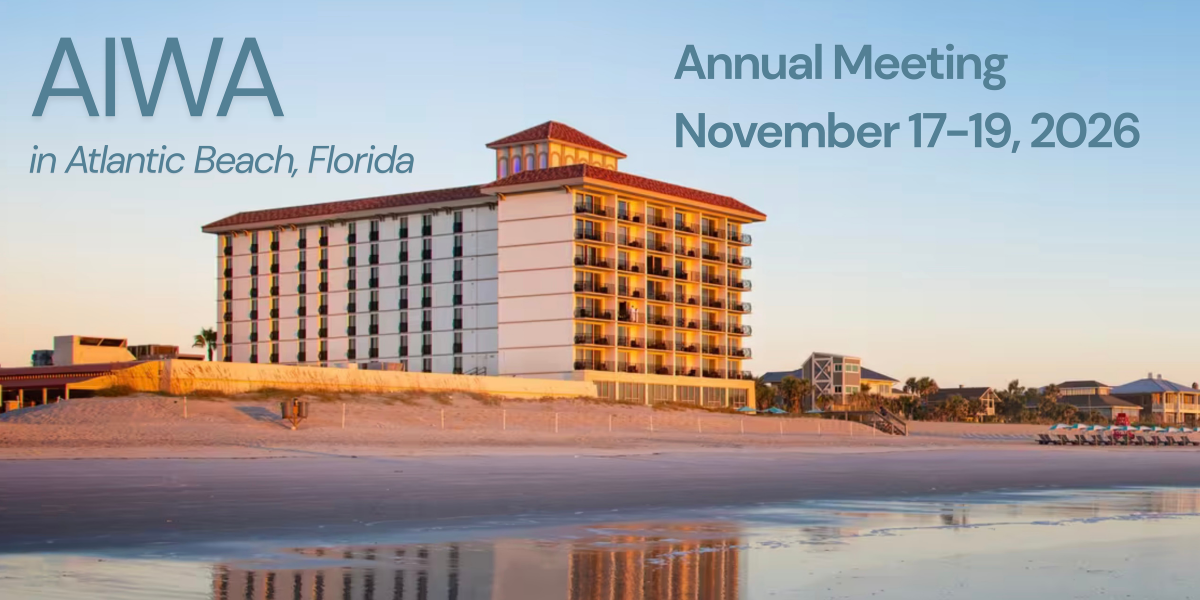
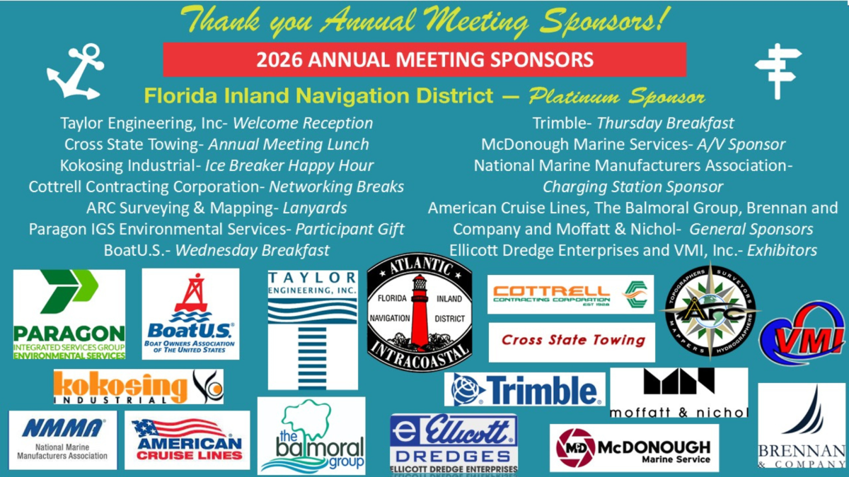
    • AIWA Annual Meeting, Nov 17-19, 2026

      Cruisers Net is proud to be a member of the Atlantic Intracoastal Waterway Association, whose lobbying work is crucial to keeping the Waterway navigable and safe. Your membership dollars directly support their vital work. Please join and encourage your boating neighbors to do the same, regardless of their home port.


      Early Registration Ends Today, October 19th
      The AIWA Annual Meeting is one month away! Join us to learn from distinguished speakers in the industry, and network with fellow waterway stakeholders.

      Early Registration Ends OCT 19: 🔗 https://atlanticintracoastal.org/2026-annual-meeting

      The program includes:

      • State of the Waterway presentations of recently completed projects and upcoming projects for all USACE Districts along the waterway in 2027
      • Updates from our federal partners at the U.S. Coast Guard, Maritime Administration and National Ocean Service
      • A View from Washington, D.C. and the Waterway Access Initiative led by the National Marine Manufacturers Association
      • A deep dive into beneficial use of sediment with success stories and emerging technologies
      • Changes in Contracting for Federal Dredging Projects
      • Emerging technologies and solutions
      • and the kickoff event for Florida Inland Navigation District (FIND) 100th year in 2027!

      Sponsor: Sponsorship opportunities are still available! Visit the conference webpage.  

      Hotel: Group rate of $294 per night (inclusive of all taxes + fees) ends today, October 19. 
      Visit 🔗 booking link for the Dune House in Atlantic Beach, Florida. 

      We look forward to welcoming you to Atlantic Beach, FL next month!

      Brad Pickel, Executive Director
      Atlantic Intracoastal Waterway Association


      Members Notice
      On November 18, 2026, the association will vote on a recommended change to the bylaws language related to the number of possible board members in Article 5, Section 3 as outlined below:

      The current language:
      Section 3. At the Annual Meeting there shall be elected by ballot the Chair, Vice Chair, Treasurer and Secretary. The Board of Directors shall consist of no more than 15 members. At each Annual Meeting, one-half (or, one half plus one in the event of an odd number) of the Directors shall be elected for a term of two (2) years. Any Director shall be eligible for re-election provided they are representing members in good standing, or who are members in good standing themselves. Directors shall, upon election, immediately enter upon the performance of their duties and shall continue in office until their successors shall be duly elected and qualified unless they resign, are removed, or are otherwise unable to fulfill an unexpired term.

      The proposed language:
      Section 3. At the Annual Meeting there shall be elected by ballot the Chair, Vice Chair, Treasurer and Secretary. The Board of Directors shall consist of no more than 17 members. At each Annual Meeting, one-half (or, one half plus one in the event of an odd number) of the Directors shall be elected for a term of two (2) years. Any Director shall be eligible for re-election provided they are representing members in good standing, or who are members in good standing themselves. Directors shall, upon election, immediately enter upon the performance of their duties and shall continue in office until their successors shall be duly elected and qualified unless they resign, are removed, or are otherwise unable to fulfill an unexpired term.

       
      Instagram
      Facebook
      Website
      Email
      Copyright © 2026. Atlantic Intracoastal Waterway Association. All rights reserved.

      The AIWA is a national non-profit organization with the mission of securing funding and support for the maintenance of the Atlantic Intracoastal Waterway. We are the only organization dedicated to ensuring the future of the AIWW and proudly represent all stakeholders of the waterway. 

      Contact:
      Atlantic Intracoastal Waterway Association
      5a Market |  Beaufort, SC 29906
      (843) 379-1151 |  atlanticintracoastal.org

      Want to change how you receive these emails?
      You can update your preferences or unsubscribe from this list.
       

      Be the first to comment!


    Social Media Auto Publish Powered By : XYZScripts.com