Our thanks to Jan Irons for these beautiful photos and report from the Dismal Swamp Canal. During this cruise, Jan visits two of our favorite CRUISERS’ NET SPONSORS, Dismal Swamp Welcome Center and Elizabeth City, NC.
Did you know George Washington was the first “Drain the Swamp” supporter? The Great Dismal Swamp, that is … now a historic landmark. After the frenetic pace of the past 5 weeks winding our way north on the Atlantic ICW, the Dismal Swamp route felt so effortless. Just peace and quiet, serene waters and reflections. This posting includes an audio/video/photo media file: Download Now Jan Irons, Commuter Cruiser
Sorry that we have to disagree with Jan. We did the Dismal Swamp route 5/19/18 in our DF 49′ RPH trawler with 4’9″ draft. I do agree that it is pretty but we were so distracted by hitting things on the bottom that we could not enjoy it. We contacted stumps or logs at least 15 times between South MIlls and Deep Creek. These were not just bumps or taps but hard bangs. Near the end we picked up something on our prop that rotated around and keep hitting the bottom of the boat until we went into reverse and it came off. It is not our first rodeo as we have traveled 75,000 miles and been to 7 countries aboard our vessel.. Just our 2 cents. On the other hand, another trawler that pulled in next to us in Hampton, went the traditional route and right before the Centerville Bridge hit hard and was having both props taken off for repair. Maybe we were lucky.
Our thanks to BoatUS for this very good advice for boaters.
3 Easy, No-Cost Ways to Be Safer on the Water National Safe Boating Week is May 19–25
ALEXANDRIA, Va., May 14, 2018 – With the start of boating season and next week’s National Safe Boating Week, May 19–25, the BoatUS Foundation for Boating Safety and Clean Water has three tips to get boaters thinking about safety aboard any type of boat.
1. Open up your boat for a vessel safety check: You may think getting a vessel safety check from the U.S. Coast Guard Auxiliary or U.S. Power Squadrons can open yourself to problems. However, a no-risk, free vessel safety check does the opposite. It points out both the required and recommended items to have aboard, such as fire extinguishers, life jackets, distress signals, first-aid kits, and engine spark arrestors, and also helps provide a better understanding on the care and use of this critical equipment. Checks are done as a courtesy with no risk to the boater, so you won’t be in trouble if discrepancies are found. Go to https://bit.ly/1syhbDA to request a U.S. Coast Guard Auxiliary safety check or https://bit.ly/2I2uc8w for a U.S. Power Squadrons safety check.
2. Believe the numbers – take a safety course: Statistics from the U.S. Coast Guard Office of Boating Safety show that only 13 percent of all boating deaths in 2016 occurred on vessels where the operator had taken a nationally approved boating safety education course. So take this number to heart – taking a boating safety course improves safety. The BoatUS Foundation offers free online boating safety courses that meet the education requirements in 36 states and also may earn you a boat insurance discount. Go to BoatUS.org/Free.
3. Give a safety talk before you head out: Taking out guests is half the fun of boating, but before you head out give a little talk about how to stay safe aboard your boat. Some important things to include may be how to distribute weight in a small boat, how to hold on when crossing a wake, how a tuber or water skier should safely reboard after being towed, how the VHF radio works and the location of important safety equipment. Also, give everyone a life jacket to wear or keep in his or her immediate vicinity. If you don’t have a right-sized life jacket for a youngster, borrow one for free at more than 550 locations nationwide from the BoatUS Foundation Life Jacket Loaner Program at BoatUS.org/Life-Jacket-Loaner.
Share:
Be the first to comment!
May 14, 2018by: Larry DorminyNo Comments32.785,-79.819999
This stretch of shoaling has been a Problem Stretch for some time and just recently, see https://cruisersnet.net/171976. Our thanks to Bill King for this onsite report confirming shoaling and groundings, as well as good advice about mid to high tide passage.
Crept through at 30-minutes after low tide. This entire stretch between the bridges is a very challenging area. We draw 4′. Stayed in center most of the time for 5′-8′, favored the red side opposite the small inlets for double-digit depths. Just south of the high rise bridge, it is shoal on the red side. A sailboat with 5.5′ draft was aground; 50′ sportfisherman was just off center to red side and being pulled off as we approached. Much less stressful to do this stretch at mid-tide or more. Bill King
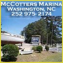
McCotters Marina and Repair Yard, A CRUISERS’ NET SPONSOR, is located on Broad Creek, off the Pamlico River, a few miles downstream of the Washington, NC waterfront. McCotters is one of the largest marinas in North Carolina and its repair capabilities are impressive.
55th Annual Ocracoke Regatta
CLICK ON ALL THE LINKS BELOW FOR THE FULL DETAILS:
Bennett Brothers Yachts/Cape Fear Marina, A CRUISERS’ NET SPONSOR, is located on the eastern banks of the northeast Cape Fear River, just north of the Isabel Holmes – Highway 133 bascule bridge, and only a few steps from the downtown Wilmington waterfront.
MAKE YOUR HURRICANE PLANS BEFORE STORM SEASON STARTS We have released our 2018 Hurricane Storage Application and it is now live for you to submit online. All of our frequently asked questions can also be found online on our website. There is NO CHARGE to submit an application. Be sure you check with your insurance company for their requirements when formulating your plan for storm refuge.
Our sincerest thanks to Greg and Barbara Allard for sharing their thoughts and beautiful photography from their Bahamas cruises. These photos and descriptions will have you aching to follow in the Allard’s wake! Stay tuned for more letters in the weeks ahead.
Letter # 1
We left our home dock in Palmetto, Florida in mid February. We’ve owned Meander for five years, and she has served us well.
As we did last year, we are traveling with another boat, Latitude, owned by Jim and Ellen Pope; they are wonderful cruising friends.
On the west coast of Florida on Gasparilla island, we saw this small rowing boat. It doesn’t have quite the comfort of a larger cruising boat, but we imagine that the rower is having just as much fun. We couldn’t tell whether there was a child or a pet under the smaller umbrella.
Lake Okeechobee is a huge lake in the middle of the state. To move our boat from the west coast of Florida to the east coast (before we continue to the Bahamas), we cross Florida by using a series of rivers and man-made canals which connect the lake to each coast, a total journey of 150 miles. The Okeechobee Waterway was created in 1937 for commercial boats, but now is used mostly by recreational vessels.
In this photo Meander is traveling in one of the man-made canals which run along the southern side of the lake.
Ahead of us we spotted this huge fire, which dumped ash on the decks of the boat. Such fires are a regular occurrence in late winter and early spring: they are related to the sugar cane industry. In Florida, the sugar cane is burned just before harvesting to remove dead leaves. The burning does not harm the stalks of cane. From friends in Louisiana, we learned that there is another reason: sugar cane can be harvested yearly (from the same plantings.) However, after five years or so, the plants are exhausted, and they must be burned so that new plantings can be made in the field.
As you might imagine, there is serious pressure on the sugar cane industry to stop such burnings, which deposit soot and ash as far east as Palm Beach. But there are equal pressures based on the economics of the industry. Florida is the second largest producer of sugar cane in the U.S.
Lake Okeechobee is usually 13’ or so above sea level. A series of five locks lift the boats up as they approach the lake, and then lower the boats back down to sea level on the other side.
The locks can be tricky. This is the St. Lucie lock in Stuart, Florida. It has the highest lift or fall (depending on which way you are traveling) of all the locks, at about 12’. As you enter the lock, there are lines hanging down from the sides, and to reach them you have to carefully maneuver the boat towards the hard concrete wall. We have fenders (bumpers) hanging over the sides of the boat to prevent damage. Then one of us has to grab the bow line (at the front of the boat, temporarily tie it off, and then move quickly to the back of the boat to reach for a stern line. At that point each of us is positioned at one of the lines, and we have undone the temporary knots to the cleats.
In this photo, the lockmaster has opened the doors of the lock to lower us down; the rush of water out of the lock is tremendous, and it causes the boat to lurch and tug at its lines. You have to be careful not to actually secure the line to the cleat of the boat, because as the boat falls, you must gradually let out more line. Each of us carries a knife, in case the line gets hung-up; cutting the line is preferable to having the cleats literally ripped off the boat.
We crossed the Gulf Stream to the Bahamas in early April. We passed close to this container ship just off Freeport on Grand Bahama island. The small black boat on the left is the Pilot boat; it will drop off an experienced pilot from the area, who will assist the captain in bringing the boat safely into the harbor.
Approximately 90% of the world’s goods are shipped by sea, and 75% are in “containerized cargo.” Containers are large steel boxes (often transported on land as part of a “tractor-trailer” combination). Their design make it easy to load and unload them from the ship by crane. The containers are stacked quite high on the deck, and are held together with strong (?) connectors.
Why is there a question mark after “strong”? On March 5, 2018, off the coast of North Carolina, a sister-ship to this one, also owned by Maersk Lines, lost between 70 and 73 containers off its deck due to high winds and heavy seas in a bad storm. The simple explanation is that the connectors broke, or had been improperly installed. The U.S. Coast Guard issued an alert: some of the containers sank, but others were floating end-on-end, with as little as one foot sticking out of the water. This situation creates a huge risk. A container floating at or just below the surface would severely damage – or sink – any smaller boats who struck it.
This picturesque boat house (with residence) is at Port Lucaya on Grand Bahama. If there were no palm trees, it would look very much like something that Jay Gatsby would have built on the north shore of Long Island. We may not be the only ones who thought that: take a close look at the name of the boat inside.
We went for dinner on Chub Cay, at the southern end of the Berry Islands, and this man was our waiter. His name tag read, simply, “Remedy.” He is originally from Nassau, but has worked on Chub Cay since 1976. He came to Chub looking for a temporary job as a waiter, and stayed there as a waiter for his career. He is 67 years old. We had a wonderful conversation with him, so good that we forgot to ask him about his name.
In front of the club house at Chub there was a bronze sculpture of a woman holding up a dolphin. Barbara just couldn’t resist mimicking the pose.
Chub Cay is in an area of the Bahamas which has some excellent fishing. As a result, sport fishing boats congregate there, and in the evening each of them tries to outdo the others with dramatic displays of lights, both above and under water. The mega-yacht at the bottom of the dock, La Sirena, is 43 meters long (141’).
Nature always surprises us.
During one of our open water ocean crossings to the Berry Islands, we saw a huge disturbance in the water ahead of us, which is usually a school of fish.
It is not uncommon to see dolphins as we travel. They are usually in pods of 4-6. As we got closer we were astonished to see that the disturbance was caused by around 150-200 dolphins! They were in an area about the size of a basketball court. We thought at first that they were feeding on a school of fish, but there were no fish around. They were just traveling together, and playing. There were many small dolphin calves in the group. As we proceeded, the group moved towards us, until it completely surrounded our boat. Dolphins were jumping in the air everywhere, and a large one jumped three feet from the boat, about ten feet into the air. I immediately slowed the boat down, but they are so quick that there is no risk that they will be hit by the boat. I couldn’t get to my camera fast enough to record the initial bedlam, and within a minute or so they started to move along.
The dolphin in this photo ran along side of our boat and made a spectacular leap; at the top right of the photo is a disturbance in the water which was from another group of perhaps six dolphins.
Another photo of our dolphin meeting. Two leaping at the left, two at the surface in the middle, and a third group underwater to the right.
Sometimes the best photos are accidental. This is David, who makes conch salad at Great Harbor Cay. It was not until I looked at this photo later that day that I saw the sign to the right. The sign refers to manatees, but having met David, the cautions could apply equally to his independent spirit.
On our way south to the Exuma islands, we stopped in Nassau, the capital of the Bahamas. One day we came upon this Bahamian wedding. Very much like any wedding we would have attended in the U.S. except for one thing. The outfits are so much more colorful.
Just down the street from the wedding, and directly across from Parliament, was this public service sign. It’s playful, in that the Bahamians are making fun of their habit of dropping “th” from many words. So “thing” becomes “ting”.
In Downtown Nassau there is a shop that specializes in white clothing made from Egyptian and Turkish cotton.
These three sales women were just as they appear – warm, Bahamian people; yes, the one on the right was a handful! The one in the middle was named “Peachy” and the woman on the left appeared to be the voice of reason.
We were in Nassau while we waited for some strong winds to lay-down, docked at the Palm Cay marina on the southeast corner of New Providence island, about 10 miles from downtown Nassau.
This sailboat had left the marina a couple of hours earlier, in heavy southeast winds. It was owned by a Canadian, who had just bought it. We are not quite sure how much experience he had, but he wanted to go, so he went.
Somewhere offshore, in heavy seas, his rudder failed, which means that while his engine worked, he could no longer steer the boat. The channel coming back into the marina is narrow, it makes a hard turn left and then an immediate turn right. Three dinghies went out to meet him, and acted as mini tug boats to push his boat back and forth to keep him in the channel, while the 20+ knot winds threw the boat all over. As his boat was corralled into marina there were many close calls, including narrowly avoiding several yachts worth millions of dollars.
His boat was an older one, and with many untried systems it was foolhardy for him to have departed in such conditions.
God protects fools.
The end of the day, and the end of this Letter. We’ll be back again soon.
As you and your crew get ready to travel north fleeing the beginning of the hurricane season along the Intracoastal Waterway, please remember to take advantage of all the information available on Cruisers’ Net in making your float plan. Of particular importance are the listings and reports from the various AICW Problem Stretches listed north to south and state by state:
And do not forget to check for Navigation Alerts and Local Notices to Mariners, also listed for each state from Virginia to the Northern Gulf, for example:
All of these reports are accessed from the right hand column on our Homepage and are available on our mobile app.
While some of these reports have a much earlier posting date, the comments and advice by your fellow cruisers are usually recent. Also, the problem highlighted by the posting and comments is often still present, requiring you to slow down, use caution and, as we have often advised, do not blindly follow the magenta line on your GPS!
Please keep in touch as you travel by being a “Cruiser Helping Cruisers” and send us reports of your experiences along the Waterway. Cruisers’ Net is always here for you and we wish you safe and pleasurable cruising.
Explorer Chartbooks, A CRUISERS’ NET PARTNER, has long been the standard navigational supplement for enjoyable, informative, and safe cruising through the beautiful Bahamian waters and island visits.
Intracoastal Yacht Sales, a long-time CRUISERS’ NET SPONSOR, offers full service brokerage representation from three locations, Wrightsville Beach, NC, Little River, SC and Charleston, SC. You will want to see these new offerings!
See Legal Battle over the dredging of Big Sarasota Pass which, with its frequent channel shifts and shoals, connects the Gulf with the Gulf Waterway and the southern tip of Sarasota Bay.
Siesta, Lido sides prepare for Big Pass court hearing
Judge recommends approving Big Pass dredge permit
An administrative judge says the state should permit the proposed Lido Key renourishment project if some time and scope restraints are put in place.
The stretch north of the Ben Sawyer Bridge around marker 118 has been a Problem Stretch for years and, as Phillip Mullins notes, the channel is constantly shifting, negating area dredging very quickly. Cruisers’ Net continues to recommend mid to high tide for passage through this stretch.
Return back to our home Marina yesterday at very dead low tide. Made it through the breach Inlet section but read five and six foot deep at the lowest point. From the Isle of Palms Connector Bridge North to Isle of Palms Marina it is 6 ft for several yards before you get to the marina. Saw 5 and 5.5 feet several places. Was able to stay close to marker 118 as we passed along beside it at 6.1 feet. Does not look like the dredging 2 years ago lasted very long. Thought u might want to pass this along to the cruisers. Phillip Mullins
77 Miles in one day – that is definitely a good day’s run, especially through the numerous shallow spots in that stretch. Such tidal luck may be a once in a lifetime occurrence! And that fact that both Downtown Marina of Beaufort and Isle of Palms Marina of Charleston are CRUISERS’ NET SPONSORS had a lot to do with it! Well done Phillip.
Left Beaufort South Carolina two hours after low tide from the downtown Marina and caught the incoming tide up the Beaufort River it continued through the Coosaw back into the Waterway and all the way back to Isle of Palms. Could not believe it. 42-foot sail and we averaged 6.6 knots. Saw 7.5 and 8.10 several times. Never had a head current. Could not believe it. Please pass this along to the Northbound Cruisers this spring.
This trip usually takes us two days but on this occasion it took 10 hours. Phillip Mullins
Explorer Chartbooks, A CRUISERS’ NET PARTNER, has long been the standard navigational supplement for enjoyable, informative, and safe cruising through the beautiful Bahamian waters and island visits.
How is the Bottom Harbour Inlet in Eleuthera lately (the inlet just South of Valentines Marina at Harbour Island)? Are both the North and South Channels still OK? See picture below. It appears that the South route has more water, but it gets very narrow at one point. While the North route has less depth, but is wider and a straight run. Our draft is 3 feet. Which route do you recommend? Thank You! ???? By the way, we plan to take Harbour Inlet on the way in and take the Devil’s Backbone with the pilot A1 Brod Shad on the way out.
In the jargon of the cruising community, “Enjoy the journey not just the destination”. Okay, that is often the case, but don’t you love it when both the journey and destinations are equally enjoyable? Whoever said, “You can’t have your cake and eat it too” never was part of a cruising or boating family.
Albemarle Loop
For those who don’t live in or near North Carolina, as you pass through North Carolina there is so much to be enjoyed that is not along the shores of the ICW. Like it’s sister cruising waters of the Chesapeake Bay, the many rivers and creeks along the shores of North Carolina’s sounds are dotted with waterfront communities that invite you to explore the local culture, foods, and history. The area’s heritage dates back over 300 years. The callings of the Roanoke, Perquimans, Pasquotank, Croatan, and Chowan, are inviting you into a new cruising adventure. Learn how Native Americans lived in this resource rich area; follow in the wake of the area’s first English settlers; visit where 51 women signed their real names to a document sent to King George that they planned to boycott all British goods. This was to be known as the “Edenton Tea Party”.
Whether you are traveling back north for the summer, or making plans for this Fall’s trip south, the rivers and communities that frame the Albemarle Sound are inviting you to explore their shores and experience their warm southern hospitality.
A community of marine businesses and historical locations, located on and around the Albemarle Sound of North Carolina, have organized to serve boaters through The Albemarle Loop, https://www.albemarleloop.com
This group of marine businesses and waterfront towns have joined together to educate and invite the area boaters and cruising enthusiasts to “enjoy the journey and the destinations,” to be their guests, and to let the area’s warm hospitality, culture, and history be part of your personal enjoyment.
Passport
And while you are doing so, you can earn points towards rewards for free nights at their participating marinas. Points earned accrue from year to year and when you reach certain levels you earn levels of what is known as “Cruising Passport Member Levels” which start at “Surveyor” and go up to “Explorer” and “Voyager”.
Check out this link to see all the discounts and other rewards available from participating businesses located at or near participating marinas: https://albemarleloop.com/coupons.html
How’s that for welcoming hospitality??
Participating marinas will be in italics with an asterisk, eg. *Albemarle Plantation.
Since we are currently in the late months of Spring, let’s assume most of our readers have the pointed end of their vessels to the north. You will find Albemarle Sound as you leave the Pamlico Sound, either through the Pungo River into the ICW Canal and into the Alligator River or to the west or east of Roanoke Island around Manteo, NC.
Yacht Doc at Cypress Cove
One of your starting points into the Albemarle Loop experience might be *Shallowbag Bay Marina on the east side of Roanoke Island in Manteo, NC. You are within easy walking distance to the most interesting town of Manteo, NC. Near by is the seasonal outdoor presentation of the “Lost Colony.” If you are inclined to stick to the ICW route, leaving Pamlico Sound into the Pamlico River, then into the Pungo River and through the ICW Canal into the Alligator River, a good place to rest before “looping” is *Alligator River Marina.
If you are headed back towards Chesapeake, most suggest starting this journey on the south side of Albemarle Sound, visiting small towns and villages like Columbia, NC, where your host would be *Columbia Municipal Marina, or * Yacht Doc at Cypress Cove.
Progressing on westward towards the town of Plymouth, your host marina, *Plymouth Landing Marina (City Docks), lies along the upper area of the Roanoke River.
Edenton
Then head over the north side of Albemarle Sound into Edenton Bay and the charming town of Edenton, NC where you are invited to stay two nights free at *Edenton Harbor Marina. At the Colonial Edenton Downtown Harbor, you can dock while you visit and enjoy this charming town. The Harbor has, within walking distance, many historical homes, restaurants and shops. Lots to do, even a “Ghost Walk” ! Information is available below outlining the rules, regulations and rates for using the docks. Contact: 252-482-2832 (phone) Email: edenton.harbor@edenton.nc.gov
Transient boaters are also welcome to a full service marina, Wharf Landing Marina, but it is not close to the town itself, about five miles west of the town. While in Edenton, you will find many fun places to satiate your yearnings for sea food or other southern culinary delights. But one “particular harbor”, (my Jimmy Buffett, slips in every now and then), where you will want to dine, is *The 51 House. There you can tie up and enjoy some very fine traditional American delights. The old home overlooks Albemarle Sound and is a fine example of a waterfront setting, great food and warm hospitality. It takes its inspiration from Revolutionary War period when 51 women of the local area had “tea” together and drafted, signed, and sent to England a document stating that they would be boycotting all British goods. This would later be known as the “Edenton Tea Party.”
Albemarle Plantation
Looking for a place to retire, or to just have that residence on some tranquil, beautiful southern waters, then next stop is *Albemarle Plantation with their full service modern marina. Take a look at some nice home locations and get off the boat to go swimming in their pool or play a round of golf. Catch some awesome sun rises and sunsets. Check out this video link to this pristine location: https://www.youtube.com/watch?v=qt0j-8zCleA&t=18s
Continuing eastwards, you can take a run up the Perquiman River to the town of Hertford and stay at their *Hertford Bay Marina. It’s a nice ride up this river and a quiet place to get some R&R. The marina is small, nine slips with water, shore power for both 30 and 50 amps, waste pump-out, and the first 48 hours are free. Town is historic and has an aggressive program developing the historical homes and places.
Mariners Wharf, Elizabeth City
On your way north, I highly recommend you experience the Dismal Swamp Canal, and its host city, “The Harbor of Hospitality,” *Elizabeth City, at their *Mariners Wharf which is right in the town proper. Or stay just across the small Hwy 158 bridge at *The Pelican Marina, which is a very easy walk over to town. Elizabeth City was founded in 1793, the same year construction started on the Dismal Swamp Canal, which was a key to safe commercial water passage between the Chesapeake Bay’s Elizabeth River in Norfolk, VA, and North Carolina coastal waters. Elizabeth City is rich in history, filled with fun and excellent places to eat or “dine”, and it is home to the Museum of the Albemarle. We could fill pages on this delightful town, check it out here: https://visitelizabethcity.com/ ENJOY.
Dismal Swamp Welcome Center
Then on to the Dismal Swamp Canal as you continue your cruise towards Chesapeake Bay. The *Dismal Swamp Welcome Center” is one of North Carolina’s most beautiful “rest stops” and it is next to a “SWAMP”. But not your ordinary swamp!
As mentioned briefly above, the Dismal Swamp Canal is a national treasure, and so very worth the trip. Explore the rich history and colorful past as well as the floral beauty and wildlife. Take the ranger led tours, participate in the interpretive programs, and let the secrets of the Dismal Swamp Canal awaken you to a new experience. Here’s the link to their website: https://dismalswampwelcomecenter.com/
Be sure to take full advantage of all the special offers available through the Albemarle Loop group of marine businesses to enhance your cruise and save you some money. Website address: https://www.albemarleloop.com
We wish all fair winds and gentle seas.
***********
Editor’s note: Several of the marinas on the Loop route are Cruisers’ Net Sponsors and this FOCUS ON article is brought to you by the following CRUISERS’ NET SPONSORS:
Share:
Comments from Cruisers (4)
Winston Fowler- September 16, 2025 - 10:49 am
Stephen – Check with both Dowry Creek Marina and McCotter's Marina. They may be able to help – Also, Albemarle Plantation may be able to help especially if they know of your intent to do the loop.
Are the any points on the loop tata I would be able to park a trailer while on the loop? I had talked to Mackies marina , however they are closed now ,looks like permanently closed
The Albemarle Loop has such great marinas, each with a unique personality. Sailing on the Albemarle Sound is a treat, as you rarely see another boat…..beauty just for you.
This stretch of shoaling has been a Problem Stretch for some time, see https://cruisersnet.net/153694. Our thanks to Phillip Mullins for this most recent warning.
Just south of IOP connector high-rise bridge Isle of Palms South Carolina red day mark 118. Middle of channel on the magenta line it was four feet deep two hours after low tide on May 2nd. You must hug the Daymark 118 to get around this low spot in the Waterway. It is not marked and I have seen no information about it. There is 10 to 12 feet next to marker 118.
Crept through at 30-minutes after low tide. This entire stretch between the bridges is a very challenging area. We draw 4′. Stayed in center most of the time for 5′-8′, favored the red side opposite the small inlets for double-digit depths. Just south of the high rise bridge, it is shoal on the red side. A sailboat with 5.5′ draft was aground; 50′ sportfisherman was just off center to red side and being pulled off as we approached. Much less stressful to do this stretch at mid-tide or more.
A CRUISERS’ NET SPONSOR, Dowry Creek Marina, now under new management and ownership by The Zeltner family who want to “roll out the red carpet” to transients, doing whatever you might need during your visit to this highly praised and transient friendly marina lying off the AICW/Pungo River north of Belhaven, NC. Upon their retirement from shore life, the Zeltners went shopping for a trawler and ended up buying Dowry Creek Marina! Steve, Connie and their grown children, Teresa, Zac and Nicole will treat you like family!
Jeff has been acting on an older Cruisers’ Net posting re compressed natural gas. If you can direct Jeff to a source for CNG , let us hear from you!
Unfortunately, it seems this is a dead end. I have called the number above and getting no answer and a voicemail box that is full. I feel like I’m the only one that has CNG on my boat. No one seems to know where or how to get these refilled. If anyone has any updated information about this, please let me know.. Thanks Jeff Sawyer
This dredging operation is west of the Pensacola Beach Bridge, Pensacola, FL.
FL – GIWW – SANTA ROSA SOUND – Dredge Operation Continuing until further notice, the Dredge KELLY L will be conducting dredging operations to remove shoaling in an area between GIWW, mile 179.0, EHL and GIWW, mile 180.0, EHL. Dredge material will be disposed into an upland disposal area located just south of the channel utilizing floating and submerged pipelines. All vessels will be lighted in accordance with U.S. Coast Guard Safety Regulations. The Dredge KELLY L will be monitoring VHF-FM Channel 13 or 16. Mariners are urged to exercise caution when transiting the area. Chart 11378 11383 LNM 18/18
We recently spent time in Spanish Wells. While there we stumbled on a unique radio station. It’s on 89.9 FM and is very low power so you can only listen in the immediate Spanish Wells area. This is no normal commercial radio station. It is the most ecletic station that I’ve found. In one set you can hear Jimi Hendrix, Elvis, Glenn Campbell, Depeche Mode, Bruno Mars, and the list goes on. The breadth of the playlist is truly amazing and entertaining. The “station” is run out of the back of the liquor store on the north road. While there check out the ultra-light in the front yard.
Chris, the owner of the station is wonderful! He also built an ultra light and you can see his video of his plane and learn more about it on his you tube site -just google Chris Weed Hopper 2018. Chris is multitalented and full of personality and love of life! We enjoyed meeting him this week.


Comments from Cruisers (1)
Sorry that we have to disagree with Jan. We did the Dismal Swamp route 5/19/18 in our DF 49′ RPH trawler with 4’9″ draft. I do agree that it is pretty but we were so distracted by hitting things on the bottom that we could not enjoy it. We contacted stumps or logs at least 15 times between South MIlls and Deep Creek. These were not just bumps or taps but hard bangs. Near the end we picked up something on our prop that rotated around and keep hitting the bottom of the boat until we went into reverse and it came off. It is not our first rodeo as we have traveled 75,000 miles and been to 7 countries aboard our vessel.. Just our 2 cents.
On the other hand, another trawler that pulled in next to us in Hampton, went the traditional route and right before the Centerville Bridge hit hard and was having both props taken off for repair. Maybe we were lucky.