Derelict Vessels Removed – Florida Keys
Removal of these vessels has resulted in significant improvements in recreational boating access.
County removes derelict vessels from Keys waters with FWC Grant
Florida Keys Weekly
Removal of these vessels has resulted in significant improvements in recreational boating access.
County removes derelict vessels from Keys waters with FWC Grant
Florida Keys Weekly
Due to the importance of public safety, the annual BeachWeek events, typically scheduled for the week leading up to Independence Day, has been canceled.
|
This suspension of mobile pumpout service is not good news to cruisers in the Florida Keys. Cruisers now must rely on land-based pumpout until mobile pumpout is restored. See link below for locations.
FLORIDA – FLORIDA KEYS: Monroe County Mobile Vessel Sewage Pumpout Service suspension.
Effective July 1, 2020 the Monroe County Mobile Vessel Sewage Pumpout Service will be suspended. Vessel owners are advised that waters of the Florida Keys are within a No Discharge Zone and proof of legal pumpout is required. For a list of available pumpout facilities, please visit www.monroecounty-fl.gov/pumpout or call 305-289-2505 for more information. LNM 25/20
There are more than 30 land-based pump-out facilities located throughout the Keys.
This is why people pump overboard!
Broward County, FL, includes Waterway communities such as Boca Raton, Fort Lauderdale and Hollywood. These actions follow in the wake of a surge in COVID-19 cases in south Florida.
Broward to shut down businesses that don’t comply with social distancing and mask rules
Sun Sentinel

This West Florida county emergency action mirrors similar ordinances recently enacted in east coast Palm Beach, FL. See Masks to be Required. Gulfport continues to be a leader in preventive measures to curb the spread of COVID-19. Gulfport is home to Gulfport Municipal Marina, A CRUISERS NET SPONSOR
| ||||||
City of Gulfport
2401 53rd Street South
Gulfport, FL 33707
(727) 893-1000
www.mygulfport.us
For Immediate Release, 6/24/2020 – 8:20 AM
CITY OF GULFPORT COVID-19 SAFETY MEASURES:
FACE COVERINGS IN CITY FACILITIES
In addition to the Pinellas County Board of County Commissioners emergency ordinance requiring that citizens wear face coverings in most indoor public places, the City of Gulfport is requiring face coverings in all City of Gulfport public facilities with the exclusion of the Gulfport Recreation Center.
As COVID-19 cases surge, let’s hope this requirement is not too little, too late.
Masks to be required in public places in Palm Beach County
Sun Sentinel
A referendum was put before Key West voters that sought to dredge a wider channel through the Florida Keys National Marine Sanctuary to accommodate super ships and voters defeated the referendum with an astonishing 74% of the vote.
Opinion: Safer, cleaner ships for the future of Key West
Florida Keys Weekly
The original state report on sea level rise in 2010 yielded controversy rather than policy changes to address the problem, but officials say there’s response happening now at the state and local levels
NC’s First Sea Level Rise Report, 10 Years On
Coastal Review Online
This is good news for Waterway cruisers in Georgia. Our thanks to Kim Russo for this announcement posted on AGLCA’s Forum.
Minutes ago the Georgia State Senate passed legislation that will undo the disastrous anchoring regulations that took effect in that state on January 1st of this year. HB 833, sponsored by Georgia Representative (and Gold Looper!), Ron Stephens, passed the Georgia House on March 12th, but didn’t make it to the Senate floor for a vote before the General Assembly adjourned for COVID-19 quarantine. The lawmakers have returned, and the bill passed the Senate today by a vote of 48-1.
HB 833 takes back some of the widespread power the previous law afforded DNR to regulate anchoring. In short, HB 833 removes the ability to require permits for all overnight anchoring, removes the requirement to keep records of pump outs, and perhaps most importantly, removes the requirement that boats not anchor within 1,000 feet of water front structures and within 300 feet of marinas. Instead, the new law changes those set-back distances to 150-feet from waterfront structures, 300-feet from marinas, and 500-feet from commercial shellfish beds for short-term anchoring, which is defined as anchoring in the same place for up to 14 cumulative nights per calendar year. Long term anchoring (over 14 days in the same place) will require a permit.
The bill now requires a signature from the Governor, which is expected soon. Once signed, the new law takes effect immediately.
This is a big win for the boating community and a great example of what our membership can do with our collective advocacy efforts.
Kim Russo
Director
America’s Great Loop Cruisers’ Association
A big thanks to you two Wally and James.. huge thanks.
Thanks CN for all your support publicizing this issue.
As the first inlet into NC waters south of the Chesapeake, Oregon Inlet is very tempting to offshore cruisers. HOWEVER, Oregon Inlet is notorious for shoaling, keeping the USCG busy relocating ATONs. Even with this dredging project, Cruisers Net still recommends attempting navigation ONLY with shoal draft and good local knowledge.
Park Service OKs Oregon Inlet Dredge Plan
Coastal Review Online
If you’re a fan of state parks, you’ll enjoy checking out Florida’s unique selection: the state’s parks encompass more than 800,000 acres across 175 state parks, nine state trails, and many historic sites.
Exploring Florida’s Wild Outdoors
The Epoch Times

Sunset on Long Pines Key Lake, Everglades.(Shutterstock)
Due to having no password access and our inability to close Claiborne’s Facebook accounts, your Cruisers Net Team is unable to open or respond to Facebook postings sent to accounts other than:
contact@cruisersnet.net
facebook.com/cruisersnet
kaye.adams@cruisersnet.net
larry.dorminy@cruisersnet.net
winston.fowler@cruisersnet.net
curtis.hoff@cruisersnet.net
Facebook accounts, such as Old Cruising Writer, are invalid and cannot be opened or forwarded.
Your past submissions to these old accounts have looked really interesting and we appreciate your thinking of us, but, sadly, we cannot open them. Please remove Claiborne Young’s name from your contact list.
With fewer male hatchlings emerging from nests over the past few decades, researchers are now studying male sea turtles with more urgency.
The mystery of male sea turtles in Florida: There may be fewer but does it matter?
Miami Herald
Let’s hope that “mandatory” will magically make individuals “responsible.”
Florida Keys Makes Mask Wearing Mandatory
TravelPulse
In June of each year the Cruisers Net team pauses to remember our founder and our friend, Claiborne Young, who was taken from us six years ago in a tragic accident. Because he is with us on every page of his website, it is still hard to believe that he is gone. We hope that you, too, will continue to see him in the work we are continuing. See also Tribute to Claiborne.

Claiborne Sellars Young 1951-2014
Claiborne S. Young was considered one of the foremost authorities on cruising the waters of the Southeast, having written numerous cruising guides from North Carolina to Mobile, AL, as well as creating video guides along the Atlantic Intracoastal Waterway through the Carolinas. Claiborne was a larger than life man with a huge dream and a large family of cruising and boating friends that boated or cruised the coastal and near coastal waters from all over the southeast from Virginia to Alabama. He was a real people person, meeting and making new friends wherever he went. We remember and miss his tireless commitment to serving the cruising community concerning water access, clean water, navigational rights, safety, as well as providing information that would make every cruise most enjoyable. His ability to tell a story was unmatched and made him a very popular quest speaker. In his rich southern drawl, Claiborne’s ability to tell you where to anchor safely or visit a marina comfortably was matched equally by his yearning for a fine and enjoyable dining experience. In his own words, “a gastric-intestinal delight” or “cholesterol enriching experience.”
Since his tragic and untimely death in June of 2014, his Salty Southeast Cruisers Net team of associates, and now new owners, have worked to keep Claiborne’s dream alive by continuing to provide detailed, up-to-date cruising information free of charge to the boating and cruising community. This work, Claiborne’s dream, is supported by many maritime business sponsors contributing to the growth and sustenance of our website. The SSECN Team is constantly upgrading the site with easier to open and read graphics, new data formats, technology such as ARGUS, a crowd sourced bathymetry depth recording available on all ChartView pages, and a powerful mobile app putting all the tools of Cruisers’ Net and more in the palm of your hand.
The members of the SSECN Team were deeply touched and extremely grateful for the outpouring of remembrances and expressions of sympathy from those who knew Claiborne personally and from some who knew him only through his writings and his website. We are determined to keep his life work alive.
And we are ever so grateful for your continued participation: “CRUISERS HELPING CRUISERS!”
Kaye Adams
Larry Dorminy
Winston Fowler
Curtis Hoff
Claiborne was a true gentleman and a helping hand, and he is still an inspiration to the cruiisng community. Thank you for keeping his dream and spirit alive.
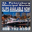
St. Pete is home to CRUISERS NET SPONSOR, St. Petersburg Municipal Marina, a great liveaboard and transient marina located on the western shore of Tampa Bay in downtown St. Petersburg. See FOCUS ON for more on this great facility.
Meet Me in St. Pete: Your Weekend Guide
Flamingo Magazine

Bahamas Chatter is produced by Explorer Chartbooks, A CRUISERS NET PARTNER, which has long been the standard navigational supplement for enjoyable, informative, and safe cruising through the beautiful Bahamian waters and island visits.
Bahamas Chatter: “Update from Nassau Harbour Club & Spanish Wells Yacht Haven” plus 1 more
|

Royal Marsh Harbour Yacht Club is a premier yacht club in the Abacos and A CRUISERS NET SPONSOR! If you cruise to Abacos and Marsh Harbour area, you should consider joining this great group of like minded cruisers.
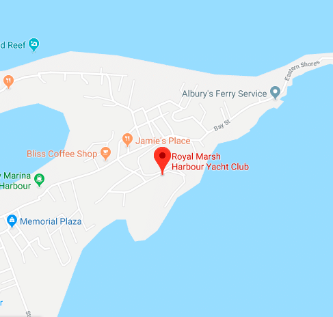
Royal Marsh Harbour Yacht Club Open Letter
Who would think that anything could push Hurricane Dorian and its destruction of Abaco out of our collective minds, but something did. As we watched the Abacos struggle to gain a foothold on the devastation caused by Dorian yet another catastrophe, Covid 19, hit not only our Bahamian friends but the entire world. In an instant, the focus switched from assisting Abaco in their recovery to assisting the world in the prevention and recovery of a pandemic. Covid 19 greatly affected the boating community, especially those already in the Bahamas. There were many uncertainties and questions of safety. One of the benefits of belonging to an organization such as RMHYC is the help and support the members provide to each other.
Overnight the major NGOs recalled their personnel. Contractors from the US and other countries returned home to take care of their own families. The Bahamas closed their borders to all. The recovery came to an abrupt halt. But all is not lost. Significant headway was being made before the restrictions caused by Covid 19. Supplies had been shipped in to help rebuild and headway was being made.
There was momentum. As we know, the Bahamians are STRONG! They have rallied against the odds and have kept that momentum going. Good news has continued to come from Abaco.
Several RMHYC members were in Eleuthera when the borders closed and inter-island travel was banned. Those boats were quarantined for several weeks as the pandemic ramped up. Once travel restrictions lifted, they headed back to the US on a route through Abaco and stopped at Abaco Beach Resort, the home base for RMHYC. Two Club boats spent several nights at the resort and reported that Abaco Beach Resort is making great strides and will be ready for us in November!
A few days ago, I had a conference call with the owners and general manager of Abaco Beach Resort and Boat Harbor Marina. We discussed the upcoming season and what we can expect. The short answer is the resort will be fully open for our return in the fall. Much of the work is already done.The docks will all be new and have new utilities. Docks 1 & 2 are 100% complete with all utilities.
Docks 3, 4, 5, 6 are in various stages of construction but will be completed in 2 months. The pool is open and looking good. The new laundry room is open with brand new machines. The pool bar and outdoor restaurant is open now. The new main restaurant will be located up at the hotel and is still under construction. The new function tent is up and waiting for the return of the Commodore’s Ball.
Take a look at the RMHYC Facebook page for some very encouraging pictures and information. The only thing missing is “you”!
We all know it will be very different than before. Marsh Harbor is still nowhere near recovered though things are happening daily. Heavy equipment has been working to clean up Dove Plaza and the pictures are encouraging. Recently, the Bahamian government extended a program of VAT tax relief on building materials going to Abaco until June 2021. It will be a slow process for sure but in my opinion, quite exciting to experience. Kind of like a Phoenix rising from the ashes.
I am hoping that because of the Bahamian “gap year” most of us have experienced, we can get more RMHYC members in Abaco than ever before! I for one have been Jones’n for the Abacos and I am really looking forward to being back there next season.
Scott Coles
Commodore
Royal Marsh Harbour Yacht Club
Good morning,
Click Here To View the Cruisers’ Net’s North Carolina Marina Directory Listing For Oriental Marina
Click Here To Open A Chart View Window, Zoomed To the Location of Oriental Marina
Assuming it is Sweet Iced Tea, this is an iconic symbol of southern living. Have some!
Iced Tea Day Celebrates Southern Brew
Coastal Review Online


Be the first to comment!