Visit Logged
  • Select Region
    • All Regions
    • VA to NC Line
    • North Carolina
    • South Carolina
    • Georgia
    • Eastern Florida
    • Western Florida
    • Florida Keys
    • Okeechobee Waterway
    • Northern Gulf
    • Bahamas
    • New York
    • Ohio
    • Pennsylvania
    • Washington
    • Puerto Rico
    • Minnesota
    • Maryland
    Order by:
    • LNM: Tybee Island Entrance Buoy V-AIS T Replaces Lighted Buoy T, Tybee Island, GA


      Until NOAA corrects its chart issues, I cannot give you the distance offshore of this entrance buoy.

      GEORGIA – ATLANTIC OCEAN – TYBEE ISLAND TO DOBOY SOUND: Changes to Aids to Navigation

      Tybee Lighted Buoy T (LLNR 350 [31°57.8677N / 080°43.1591W, 31.964461 / -80.719318]/4530) has been discontinued and the buoy removed from the location. Tybee V-AIS T has been established as an AIS Virtual Aid with MMSI # 993672996 at assigned position 31-56-09.548N/ 080-35-03.436W (31°56.1592N / 080°35.0573W, 31.935986 / -80.584288) . Mariners are advised to exercise caution while transiting the area.

      Be the first to comment!

    • Update: LNM: N Gulf, Sunken Vessel, St Andrews Bay, FL


      This sunken vessel, now marked with lighted buoy WR, is in 5ft of water c. 300 yards south of Buena Vista Pt. See Sunken Vessel.

      FL – ST ANDREW BAY – Wreck – UPDATE

      The partially submerged F/V reported in the vicinity of ST Andrew Bay, Panama City, FL.,. in approximate position 30-09-47.3N 085-42-09.9W (30°9.7883N / 085°42.1650W, 30.163139 / -85.702750), is reportedly marked with a temporary lighted buoy WR, showing a flashing quick, red light. Mariners are urged to avoid this area.

      AREA SPONSORING MARINAS

      Click Here To View the Northern Gulf Cruisers Net Marina Directory Listing For St. Andrews Marina

      Click Here To Open A Chart View Window, Zoomed To the Location of St. Andrews Marina

      Click Here To View the Northern Gulf Cruisers Net Marina Directory Listing For Panama City Marina

      Click Here To Open A Chart View Window, Zoomed To the Location of Panama City Marina

      Be the first to comment!

    • NAV ALERT: USACE: OWW MM 94 Width Restriction CANCELLED, Ortona Lock, FL


      This Notice to Navigation on the Okeechobee Waterway Ortona Lock Width Restriction has been  CANCELLED– operations are normal and there is no width restriction at Ortona Lock

      To all east and west bound traffic transiting the Ortona Lock, the southeast gate is inoperable causing a width restriction of 25 feet until repairs are made. All vessels needing to transit Ortona Lock should anticipate delays. No estimated time of repair is currently available. Our thanks to Spec. Erica Skolte for this notice.

      Notice to Navigation 2022-003: Okeechobee Waterway – Ortona Lock Width Restriction


      Click Here To View the Okeechobee Cruisers Net Bridge Directory Listing For Ortona Lock

      Click Here To Open A Chart View Window, Zoomed To the Location of Ortona Lock


      Be the first to comment!

    • LNM: Cape Canaveral Rocket Launch Schedules

      For cruisers in the Cape Canaveral area wishing to view launches, the schedule link is found below.

      ATLANTIC OCEAN – FLORIDA – CAPE CANAVERAL: Rocket Launch Activity

      Mariners making plans to transit offshore Cape Canaveral Florida are advised of frequent rocket launch activity and associated launch hazard areas which may include free falling debris and/or descending vehicles or vehicle components under various means of control. Mariners should contact Coast Guard Sector Jacksonville at (904) 714-7558 for more information. Specific launch schedule information and Marine Safety Information Bulletins (MSIB) can be found at the following website https://homeport.uscg.mil/port-directory/jacksonville.
      Upcoming launch information and Launch Hazard Areas are also posted on the following Patrick Air Force Base website

      Comments from Cruisers (1)

      1. R J Norman -  April 17, 2022 - 8:18 am

        Once you manage to penetrate the USCG Jacksonville website to the LNM page you find several notices of rocket launches but none of them has an actual date/ time associated with it. Therefore, no useful information.

        Reply to R
    • LNM: AICW MM 878 Closure of Bridge of Lions, April 10, St. Augustine, FL


      With a closed vertical clearance of 18ft, the Bridge of Lions Bridge crosses the Waterway connecting the heart of downtown St. Augustine. See Blessing of the Fleet.

      FLORIDA – ATLANTIC INTRACOASTAL WATERWAY – TOLOMATO RIVER TO PALM SHORES – ST AUGUSTINE – BRIDGE OF LIONS: Bridge Closure.
      The Bridge of Lions across the Atlantic Intracoastal Waterway, St Augustine, Florida will be closed to navigation Sunday April 10, 2022 from 12 p.m. to 3 p.m. to accommodate the Saint Augustine Blessing of the Fleet.
      Vessels that may pass through the bridge without an opening may do so at any time. For Coast Guard waterways related concerns call ore-mail USCG Sector Jacksonville Waterways Division at (904) 714-7631 or via email at D07-DG-SECJAX-WATERWAYS@uscg.mil

      Click Here To View the Cruisers Net Eastern Florida Bridge Directory Listing For Bridge of Lions

      Click Here To Open A Chart View Window, Zoomed To the Location of Bridge of Lions

      AREA SPONSORING MARINA

      Click Here To View the Eastern Florida Cruisers Net Marina Directory Listing For Camachee Cove Yacht Harbor

      Click Here To Open A Chart View Window, Zoomed To the Location of Camachee Cove Yacht Harbor

      Be the first to comment!

    • LNM: Coast Guard Urges Hilton Head and Beaufort Area Mariners: Check Your VHF Radios


      Coast Guard Sector Charleston command center watchstanders received multiple uncorrelated distress calls on the digital selective calling (DSC) system carried over a VHF marine radio in the Hilton Head and Beaufort area over the past few months.

      united states coast guard

      Coast Guard requests mariners inspect VHF marine radios

      CHARLESTON, S.C.— The Coast Guard has received multiple uncorrelated distress calls on the Digital Selective Calling (DSC) system carried over a VHF marine radio in the Hilton Head and Beaufort, South Carolina area over the past few months.

      These DSC calls are originating from an unregistered radio displaying an MMSI address of 100000001. 

      The first signal was received by the Coast Guard on April 26, 2021, ceased in July of 2021, and resumed intermittent transmissions in February 2022, causing interference with marine radio traffic in the Hilton Head and Beaufort, South Carolina area.

      False distress calls have the potential to mask genuine distress calls and overwhelm the search and rescue system’s ability to respond to emergencies. The Coast Guard urges all mariners to check their VHF radios and contact the Coast Guard if you have any information about the faulty radio at 843-740-7050.

      -USCG-

      AREA SPONSORING MARINAS

      Click Here To View the South Carolina Cruisers Net Marina Directory Listing For Harbour Town Yacht Basin

      Click Here To Open A Chart View Window, Zoomed To the Location of Harbour Town Yacht Basin

      Click Here To View the VA to NC Cruisers Net Marina Directory Listing For Shelter Cove Harbour and Marina

      Click Here To Open A Chart View Window Zoomed To the Location of Shelter Cove Harbour and Marina

      Click Here To View the South Carolina Cruisers Net Marina Directory Listing For Windmill Harbour Marina

      Click Here To Open A Chart View Window, Zoomed To the Location of Windmill Harbour Marina

      Be the first to comment!

    • LNM: MSIB: near AICW MM 465, Security Zone, April 2 – Cooper River Bridge, Charleston SC

      This security zone is beneath the Ravenel Bridge which is parallel to and north of the Waterway’s east/west path through Charleston Harbor. Our thanks to Officer Chad Ray for this notice.

      SECURITY ZONE – COOPER RIVER BRIDGE RUN

      Cooper River and Town Creek Reach, Charleston, SC

      The Coast Guard is establishing a temporary security zone on certain waters of the Cooper River and Town Creek Reaches, near the Arthur Ravenel Bridge during the Cooper River Bridge Run on Saturday, April 2, 2022 from 7:30 a.m. to 11:00 a.m.

      This temporary security zone prohibits persons and vessels from entering, transiting through, anchoring in, or remaining within the security zone unless authorized by the Captain of the Port Charleston or a designated representative.

      In addition, Commercial Anchorage C will be utilized for the event’s planning and staging. Marine traffic is encouraged to use Commercial Anchorages A, B, and D, if needed.

      This MSIB can be viewed at https://homeport.uscg.mil/port-directory/charleston. For questions or concerns regarding this MSIB, please contact on scene security assets via VHF-FM Channel 16, Sector Charleston Waterways Management Division at (843) 740-3184, or the Sector’s 24-hour Command Center at (843) 740-7050.

      LCDR Chad Ray

      USCG Sector Charleston

      Waterways Management Div., Chief


      (843) 323-7761

      Be the first to comment!

    • LNM: near AICW MM 840 Shoaling Reported, Ponce De Leon Inlet, FL


      The Ponce has two access routes from the Waterway. Buoy 18 is an ICW marker at the end of the southern inlet access route. Buoys 2 and 3 are at the end of the northern access route. Chartview is centered on Buoy 18; scroll north to find buoys 2 and 3. Our thanks to Richard Ross for this alert.

      Less than 5 ft depths at low tide in mid channel near red 18. There is slightly deeper water about 50 ft off red 18. Also there is 6 ft depth at low tide between red 2 and green 3. Richard Ross


      Be the first to comment!

    • LNM: Hatteras Inlet, Buoy 18A Added, Pamlico Sound, NC


      This channel  buoy is the east side of the channel connecting the Inlet with the maintained channel into Hatteras Village.

      THE FOLLOWING AID TO NAVIGATION HAS BEEN ESTABLISHED.

      1. HATTERAS INLET CHANNEL BUOY 18A (LLNR 28761 [35°12.5026N / 075°43.1635W, 35.208376 / -75.719391]) HAS BEEN ESTABLISHED IN APPROX POSIT 35-12-30.153N, 075-43-09.806W (35°12.5026N / 075°43.1635W, 35.208376 / -75.719391)

      Be the first to comment!

    • LNM: USCG Navigation Center – Website Update

      U.S. COAST GUARD NAVIGATION CENTER – WEBSITE UPDATE

      The U.S. Coast Guard Navigation Center is going to transition the Navigation Center website to a new, enhanced version in the first quarter of 2022. As part of this transition, URLs will be updated across the site including URLs linked to PDFs. Therefore, once the transition is complete, legacy site URLS will no longer function, including bookmarked URLs and URLs used in automatic downloading of data and/or products. Outdated URLs will automatically redirect to the home page of the site, and from there you will be able to easily navigate to your preferred page. Below are a few of the “old”/new URL pairs listed for your convenience. Please note that the new URLs will not be active until we launch the new website. Of course, once it is launched, the new URLs will be available for re-bookmarking. As a reminder, these are top level URLs that may contain additional links that you use.
      This notice will be updated when the final launch date is determined and another notice will be issued to notify you when the site goes live.
      Questions/concerns may be directed to the NAVCENWebTEAM@uscg.mil.
      Local Notices to Mariners (LNMs)
      Current URLs: https://www.navcen.uscg.gov/?pageName=lnmMain
      Replacement: https://www.navcen.uscg.gov/local-notices-to-mariners-by-cg-district
      Light Lists Annual Publication
      Current URLs: https://navcen.uscg.gov/?pageName=lightLists
      Replacement: https://www.navcen.uscg.gov/light-list-annual-publication
      Light List – Weekly
      Current URLs: https://navcen.uscg.gov/?pageName=lightListWeeklyUpdates
      Replacement: https://www.navcen.uscg.gov/weekly-light-lists
      Light List – Corrections
      Current URLs: https://navcen.uscg.gov/?pageName=lightListCorrections
      Replacement: https://www.navcen.uscg.gov/light-list-summary-of-corrections

      Be the first to comment!

    • LNM: AICW MM 205 Light 2 Destroyed, Morehead City, NC


      This ICW light is on the north side of the Waterway’s passage through Morehead City Harbor.

      BOGUE SOUND LT 2 (LLNR 38630 [34°42.7728N / 076°42.8976W, 34.712880 / -76.714960]) RPTD DESTROYED.


      AREA SPONSORING MARINA

      Click Here To View the Cruisers Net North Carolina Marina Directory Listing For Morehead City Yacht Basin

      Click Here To Open A Chart View Window, Zoomed To the Location of Morehead City Yacht Basin

      Be the first to comment!

    • LNM: AICW MM 458 Permanent No-Wake Zone, Isle of Palms, SC

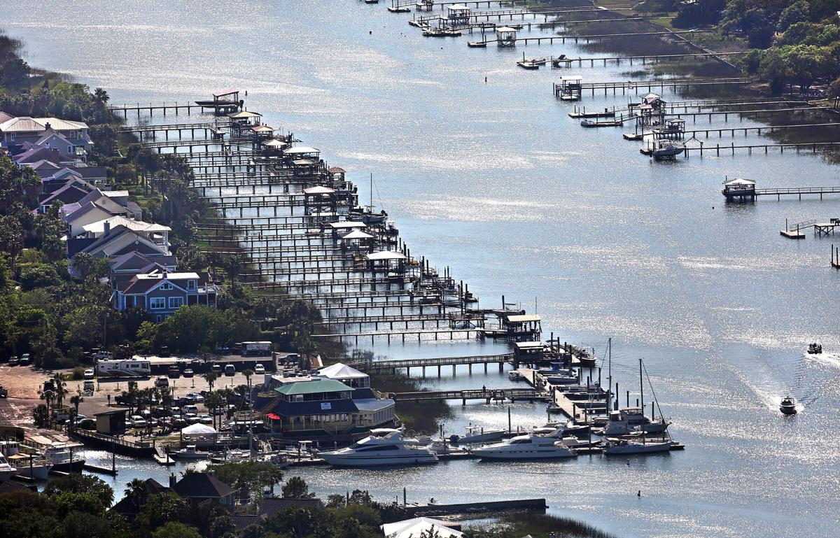
      An uptick in recreational boating has led the state Department of Natural Resources to make permanent its longstanding seasonal no-wake zone for part of the Atlantic Intracoastal Waterway.

      Docks line the Intracoastal Waterway between the back side of the Isle of Palms (left) and Goat Island (right) on April 20, 2017. The S.C. Department of Natural Resources has established a permanent no-wake zone for the area. File

      Safety concerns lead to permanent no-wake zone between Goat Island, Isle of Palms | SC …
      Post and Courier

      AREA SPONSORING MARINA

      Click Here To View the South Carolina Cruisers Net Marina Directory Listing For Isle of Palms Marina

      Click Here To Open A Chart View Window, Zoomed To the Location of Isle of Palms Marina

      Be the first to comment!

    • LNM: AICW MM 496 Trust the Daybeacons, N Edisto/Dawho Intersection, SC


      This is good advice from one of our tall-masted and deep keeled friends. Go slow and trust the markers.  The southbound Waterway enters Dawho River at White Point and there is a shoal charted in the mouth of the river entrance.

      Entering the Dawho River from the N Edisto River, Navionics chart was erroneous. Follow the day markers to prevent grounding.  

      Ann Frederick

      S/V Bees Knees

      Be the first to comment!

    • LNM: AICW MM 465 Parade of Boats, Dec 11, Charleston, SC


      You are reminded that spectator boats navigating in the darkness following the parade are at great risk. Please take your time and keep a sharp watch as you leave your anchorage.

      CHARLESTON PARADE OF BOATS

      Charleston Harbor, SC

      On Saturday, December 11, 2021 the City of Charleston will host its annual Charleston Parade of Boats in Charleston Harbor from 4 p.m. to 8:30 p.m.

      The parade will assemble in Commercial Anchorage B and begin its northern route around Commercial Anchorage A, continuing up through Bennis Reach, beyond Patriots Point to the Ravenel Bridge. The parade will then transit south down the east side of the Charleston peninsula, and will conclude at City Marina.

      No persons or vessel may enter, transiting through, anchor in, or remain within the designated area unless authorized by the Captain of the Port Charleston or a designated representative.

      This MSIB can be viewed at https://homeport.uscg.mil/port-directory/charleston. For questions or concerns regarding this MSIB, please contact Sector Charleston Waterways Management Division at (843) 740-3184 or the Sector’s 24-hour Command Center at (843) 740-7050.

      AREA SPONSORING MARINAS

      Click Here To View the South Carolina Cruisers Net Marina Directory Listing For Charleston Harbor Marina

      Click Here To Open A Chart View Window, Zoomed To the Location of Charleston Harbor Marina

      Click Here To View the South Carolina Cruisers Net Marina Directory Listing For Cooper River Marina

      Click Here To Open A Chart View Window, Zoomed To the Location of Cooper River Marina

      Be the first to comment!

    • LNM: near GIWW MM 267, Shoal Excavation, West Bay, FL


      As reported in October, this shoaling is north of Panama City. See More Shoaling.

      FL – GIWW – WEST BAY – Shoaling – UPDATE

      Continuing until approximately November 12, 2021, Carter’s Contracting Services is excavating a shoal on the south side of the channel in the West Bay Land Cut of the GIWW, near Mile 267.7, EHL, at Boar Hog Branch, in Bay County, Florida. The south side of channel is blocked and the north half of the channel has depth restrictions of approximately 8.5 feet. A temporary unlit can buoy (39A) was established to mark the shoal area, in approximate position 30-19-07.390N 085-55-35.030W (30°19.1231N / 085°55.5838W, 30.318719 / -85.926397) . Additional information will be provided as it becomes available. For further information, mariners can contact Mr. Waylon Register at the U.S. Army Corps of Engineers, Panama City Site Office, at (850) 784-9780. Chart 11378

      Be the first to comment!

    • LNM: RWO Offshore Race Event, Nov 10, 12 and 14, Key West, FL

      This event will consist of approximately 50 powerboats racing around a designated course set up in Key West Harbor and the Atlantic Ocean off Key West, FL. See chart below.

      FLORIDA – FLORIDA KEYS – KEY WEST: RWO Offshore World Championship Boat Race

      The RWO Offshore World Championship Race event will be held on November 10, 12, and 14, 2021 on the waters of the Atlantic Ocean off of Key West, FL. This event will consist of approximately 50 powerboats racing around a designated course set up in Key West Harbor and the Atlantic Ocean off Key West, FL.
      A special local regulation has been established by the Captain of the Port (COTP) Key West, FL for this event. The race course and spectator area encompasses all waters established in the special local regulation. The special local regulation will be enforced from 9:30 a.m. until 4:30 p.m. on November 10, 12, and 14, 2021. The harbor will be open to traffic from 11:30 a.m. to 12:30 p.m. During the enforcement period, no person or vessel may enter, transit through, anchor, or remain within the regulated area without permission from the COTP or his designated representative. A succession of not less than 5 short whistle or horn blasts from a patrol vessel will be the signal for any non-event participating vessel to take immediate steps to avoid collision. Also, the display of a red distress flare from a patrol vessel will be a signal for any and all vessels, including event participants inside the regulated area, to stop immediately.
      Mariners are advised to abide by all Navigation Rules and proceed with caution in the vicinity of the course and event participants. All spectator vessels are reminded to anchor within the designated spectator area located Southwest of Buoy Number 17 near Sunset Key and anchor in sandy bottom to prevent damaging seagrass, coral, macroalgae, sponges, and other hardbottom community species. For more information on this event or the Special Local Regulation please contact the Sector Key West Command Center at (305)-292-8727.

      Be the first to comment!

    • LNM: Safety Zone, Key West Paddle Classic, October 2, 8 a.m. to 3 p.m. Key West, FL

      The 2021 Key West Paddle Classic will be held on October 2, 2021 on the waters surrounding Key West, FL.


      FLORIDA – FLORIDA KEYS – KEY WEST: Key West Paddle Classic and Safety Zone

      1. The 2021 Key West Paddle Classic will be held on October 2, 2021 on the waters surrounding Key West, FL. This event will consist of approximately 200 paddler boarders completing a 12 mile clockwise course starting along the southern shoreline beginning at Higgs Beach, transiting through the main harbor and Fleming Key Cut, around Dredgers Key, through Cow Key Channel and returning to the finish line at Higgs Beach.
      2. A temporary moving safety zone has been established by the Captain of the Port (COTP) Key West, FL for this event. The safety zone encompasses all waters extending 100 yards to either side of the race participants and safety vessels; extending 50 yards in front of the lead safety vessel preceding the first race participants; and extending 50 yards behind the safety vessel trailing the last race participants. The safety zone will be enforced from 8 a.m. until 3 p.m. on October 2, 2021.
      3. During the enforcement period, no person or vessel may enter, transit through, anchor, or remain within the safety zone without permission from the COTP or his designated representative.
      4. A succession of not less than 5 short whistle or horn blasts from a patrol vessel will be the signal for any non-event participating vessel to take immediate steps to avoid collision. Also, the display of a red distress flare from a patrol vessel will be a signal for any and all vessels, including event participants inside the regulated area, to stop immediately.
      5. Mariners are advised to abide by all Navigation Rules and proceed with caution in the vicinity of the course and event participants.
      6. For more information on this event please contact Sector Key West at (305)-292-8727

      Be the first to comment!


    Social Media Auto Publish Powered By : XYZScripts.com