Adventures in Fog Navigation by Douglas M. Wartelle
When fog sets in, these 11 tips can help you at the helm.
Click here for Adventures in Fog Navigation by Douglas M. Wartelle
PassageMaker.com
When fog sets in, these 11 tips can help you at the helm.
Click here for Adventures in Fog Navigation by Douglas M. Wartelle
PassageMaker.com
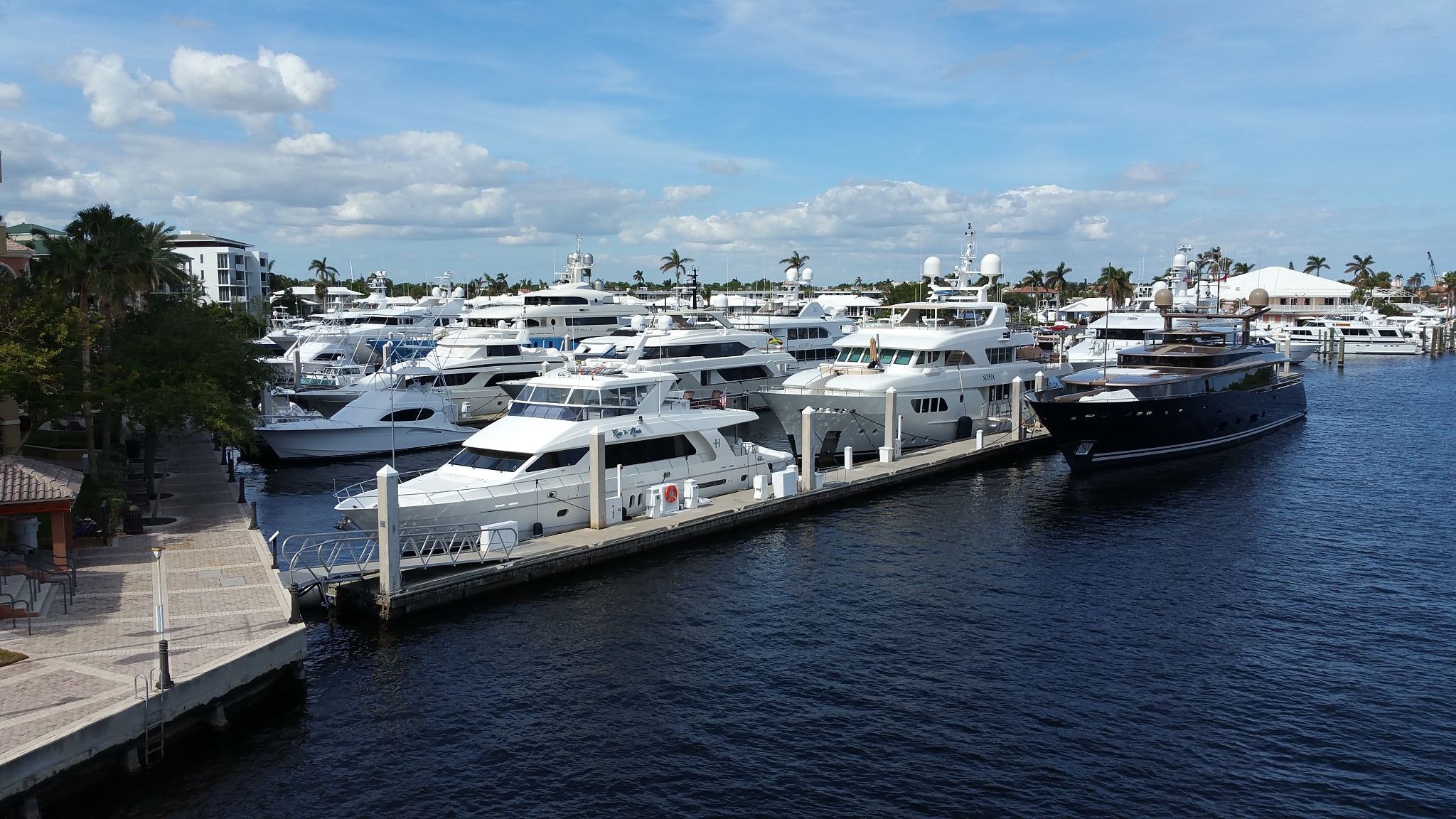
I don’t have a problem going “outside” when transiting the East Coast. But there is one section I won’t do outside—the Outer Banks. See Grounded Vessel Afloat Again, Ocracoke Island, NC. Our thanks to Peter Swanson for sharing his knowledge.
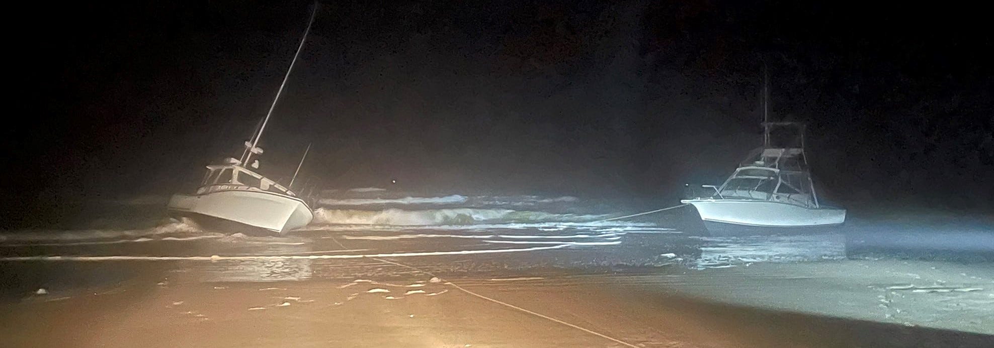
A week after Vivens Aqua went aground, two buddy-boating recreational fishing vessels—Bite Me and Reel Lucky—suffered the same fate on another Outer Banks beach. Their owners had become disoriented in fog.
Whistling Past the Hatteras Graveyard
from Loose Cannon by Peter Swanson
BOTH VESSELS HAVE RADAR MOUNTED.
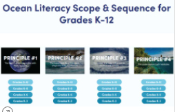
These materials present an extensive framework to share the vision of an ocean-literate society and the range of knowledge required to be considered ocean literate.
The U.S. government has released its latest forecast for sea level rise through 2150, updating a report last revised in 2017.
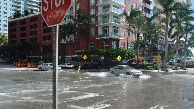
Tidal flooding in Miami, 2016 (B137 / CC BY SA 4.0)
NOAA Predicts a Foot of Sea Level Rise Along U.S. Coastlines by 2050
Maritime Executive
David, you're right… just BS.
This is Mother Nature and she's been doing this since the beginning of time. Some years wet, some dry. That's life.
The oceans are rising faster than scientists predicted. If you live along the coast, any coast, now would be a good time to think about moving inland to higher ground.
Yep it happens everything we have a nor’easter and a tropical storm and hurricanes. Expect we will have some rising tides this year as well.
The tide rises and falls every day…knock off the bullshirt. Nothing that comes from the government can be believed with any certainty.
A new U.S. Coast Guard regulation beginning April 20 for disposable fire extinguishers mandates a 12-year expiration date from the date of manufacture.
BoatUS: New U.S. Coast Guard Fire Extinguisher Regulation Effective April 20
BoatUs
just another money grab mandated by the federal govt.
Few coastal visitors know that the secluded hammock of Davis Ridge was once home to an extraordinary community founded by liberated slaves.
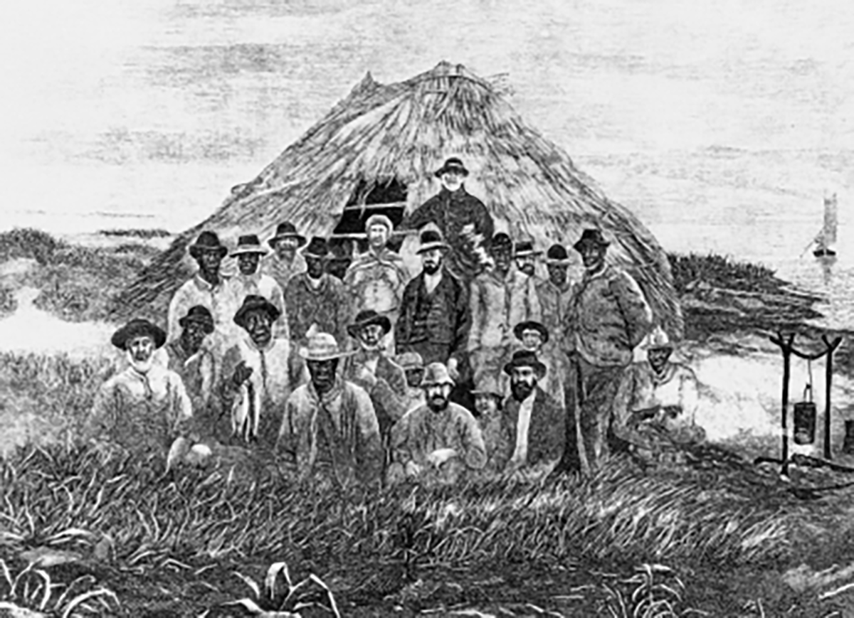
Mullet fishing camp at Shackleford Banks, near Beaufort, circa 1875-80. From George Brown Goode, ed., The Fisheries and Fishery Industries of the United States, (Washington, D.C.: Commission of Fish and Fisheries, 1884-87), sec. 5, vol. 2.
Our coast’s people: Last daughter of Davis Ridge
CoastalReview.org
The Florida Keys National Marine Sanctuary continues to offer a free, online course so boaters can learn how to protect themselves, their vessels, and the unique Keys marine environment.
Sanctuary offers free boating class online | Mile Markers | keysnews.com
Key West Citizen
An interesting report on the early development of the Southwest Florida Waterway.
History of the Intracoastal Waterway
Bradenton Times

View of the Intracoastal Waterway at Lido Beach circa 1946. Photo: State Archives of Florida
|
View of the Intracoasta Waterway at Lido Beach circa 1946. Photo: State Archives of Florida |
Sunday, Jan 16, 2022 |
Back in the 1890s, when people were just starting to realize the agricultural potential of the area, it became clear that there was an advantage to transporting popular exports like citrus, vegetables, livestock, lumber and fish to neighboring villages through inland waters, which were sheltered from severe weather and could provide safe passages to shallow-draft vessels unable to go offshore.
Local communities requested the assistance of the federal government and the United States Congress committed $5,000 for the project. In 1895, the U.S. Army Corps of Engineers began dredging a 100-foot-wide channel, nine feet deep, that ran from southern Tampa Bay to Charlotte Harbor. The Intracoastal Waterway took 72 years to complete, according to document The Historical Development of the Gulf Intracoastal Waterway: The Boating Geography of Southwest Florida Before Development.
At the time, the 54-mile stretch from Tampa Bay to Gasparilla Sound included three separate bays that were not connected: Big Sarasota Bay; Little Sarasota Bay and Lemon Bay. These bays were separated by natural barriers, mostly mangroves, and had varying depths and navigability. Settlers were forced to sail around these barriers into open water, which left them vulnerable to choppy seas and unpredictable weather patterns.
The dredging occurred sporadically and began in south Tampa Bay with a series of cut-throughs. The first “cut,” joined Tampa Bay and Sarasota Bay in 1895. The following year, Sarasota Bay joined Casey’s Pass. In 1907, another cut through extended to Venice. The plan worked. By 1917, all sorts of goods were being transported safely from Tampa to Charlotte Harbor. Some of the major supplies were brick, canned goods, groceries, cement, corn, fertilizer, grain, ice and lumber. In 1919, Congress approved more funding for a wider channel to accommodate more traffic.
At the time, an experimental vessel was tasked with the dredging project. “Suwannee” was a U.S. steam snag boat, 100 feet in length with a shallow draft and a square bow. With the help of a 10-man-crew, she sucked slurry from the bottom and discharged it along the shore while a derrick lifted rocks and snags from the bottom. A launch, float boat and two rowboats accompanied her during the project.
The project went so well, that in 1939 the Board of Engineer for Rivers and Harbors recommended another intracoastal project reaching from Tarpon Springs to Fort Myers. A 3-foot-deep by 75-foot-wide channel existed from Sarasota to Venice. The Corps of Engineers surveyed Lemon Bay in 1899 but determined insufficient economic justification for dredging the southern inland waterway sector to Gasparilla Sound.
The sea robin is one weird-looking fish.
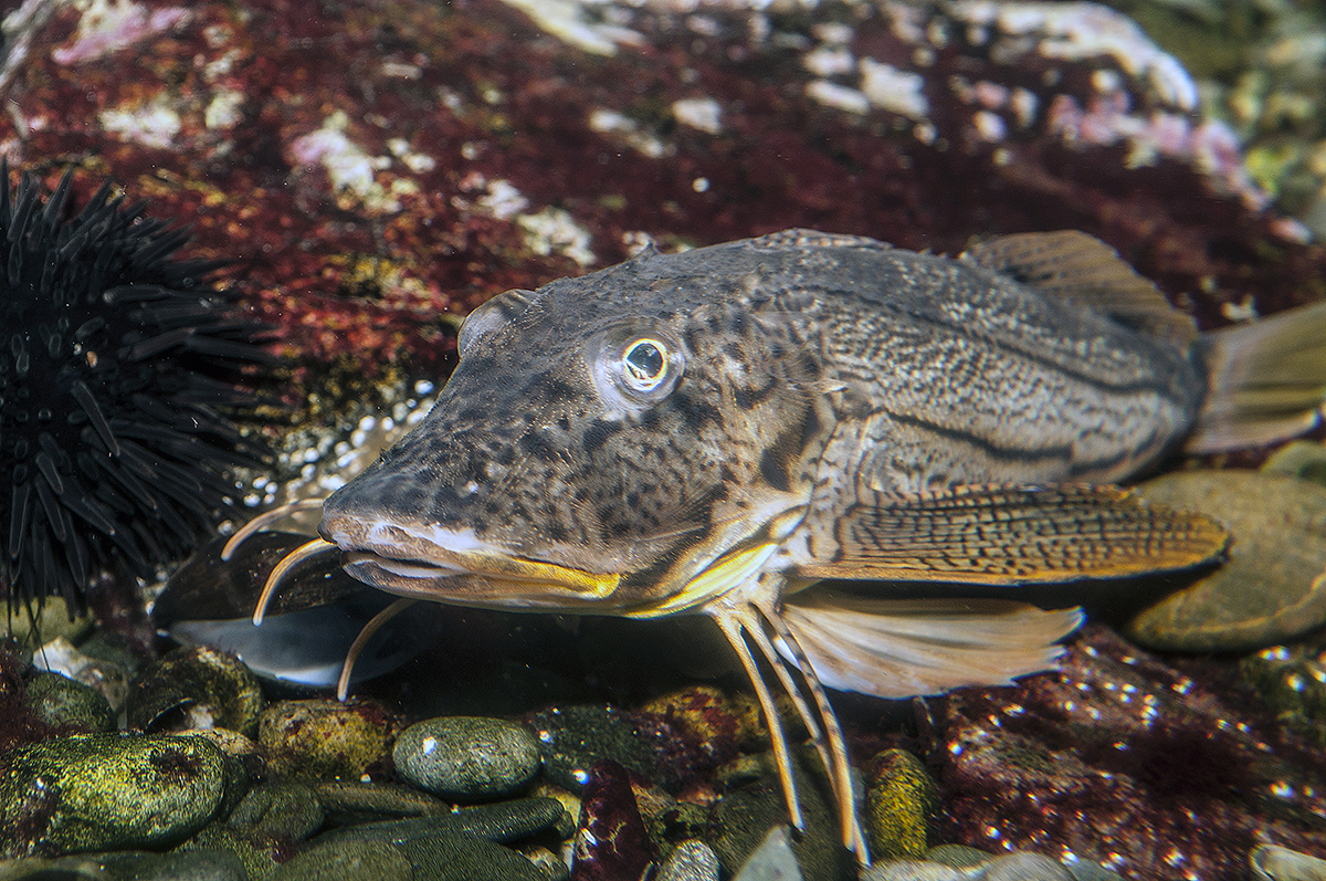
A striped sea robin. Photo: Robert Michelson
What’s on the line? It’s a bird, it’s a plane — it’s a sea robin
CoastalReview.org
Is your boat over 50ft? Is bigger better? After ten years on a 50ft trawler on the ICW, this editor was thinking smaller. What do you think?
Bigger Boats Equals Bigger Opportunities & Bigger Challenges
Marina Dock Age
When East Florida and West Florida were still Spanish territories, they were wild, sparsely-populated frontiers.

KEYS HISTORY: LIEUTENANT DECLARES U.S. POSSESSION OF KEY WEST SOME 200 YEARS AGO
Keys Weekly
A humorous look at mal de mer. Our thanks to Winston Fowler for sharing this link.
The Grant Game by Chris Caswell
PassageMaker

The Dismal Swamp Canal Welcome Center is located adjacent to the Dismal Swamp State Park, offering trails, exhibits and ongoing programs in Camden County, NC. Docks are provided by the Dismal Swamp Canal Welcome Center, A CRUISERS NET SPONSOR and a NC DOT Rest Area facility.
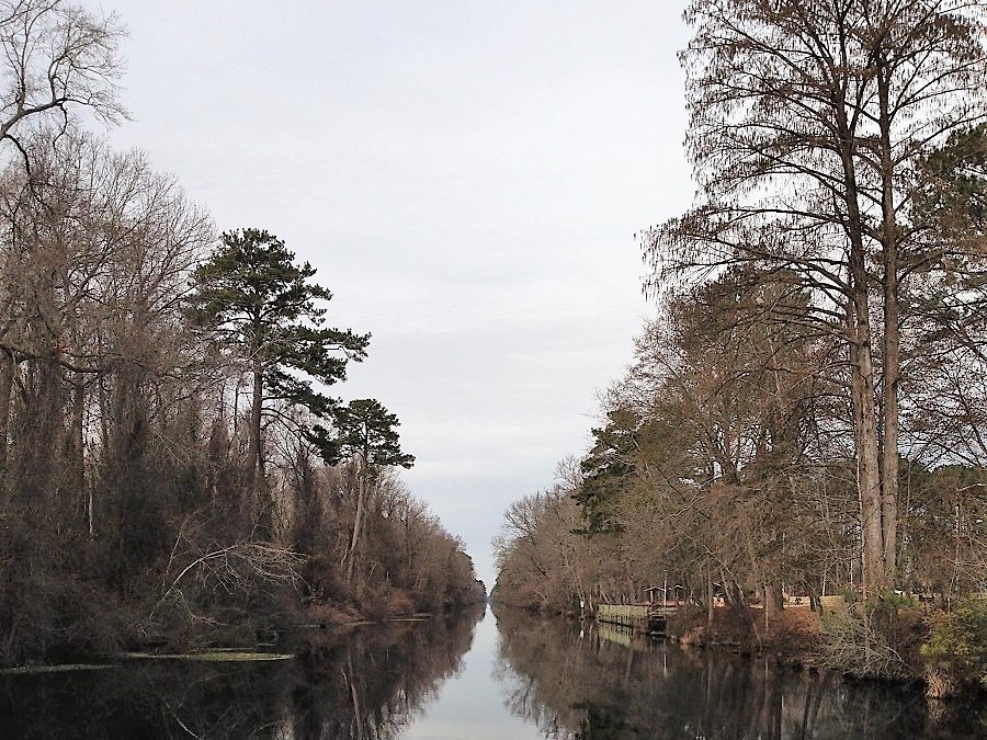
The Great Dismal Swamp Canal, which was opened in 1805 and widened in 1829 with the use of slave labor, passes through Camden County. Photo: Eric Medlin
Camden’s history, economy rooted in Great Dismal Swamp
CoastalReview.org
The Florida Fish and Wildlife Conservation Commission and the U.S. Fish and Wildlife Service have announced a “supplemental feeding” plan to save malnourished manatees on the Atlantic coast.
Supplemental feeding for the malnourished manatees | Science & Technology | crimson.fit.edu
The Florida Tech Crimson
In tandem with pollution, jet skis are wreaking havoc. These can easily go over 50 mph. Neither manatees, human swimmers, nor birds have a chance against them. Jet skis are highly unsafe, noisy, pollute, and, for all the above, need to be illegal on public waterways.
This situation occurred several years ago when the Save the Manatee Club made its big push. The ideal is super, but the reality is not. Yes, they are large docile creatures that have a place in Florida. However, when steps are taken to increase their numbers above and beyond what the natural food supply will support, the situation that we have now takes place. Mess with Mother Nature, and you create a second problem. I guess it is a steep learning curve.
Cape Lookout National Seashore has been certified as a Dark Sky Place, the first in the National Park Service on the Atlantic coast to receive this certification. The popular Cape Lookout Bight anchorage is practically in the shadow of Cape Lookout Lighthouse. In rough offshore weather, cruisers with shallow draft may choose to access the anchorage via Taylor Creek and Barden Inlet which separates Shackleford Banks and Core Banks. See Dark Sky Park.
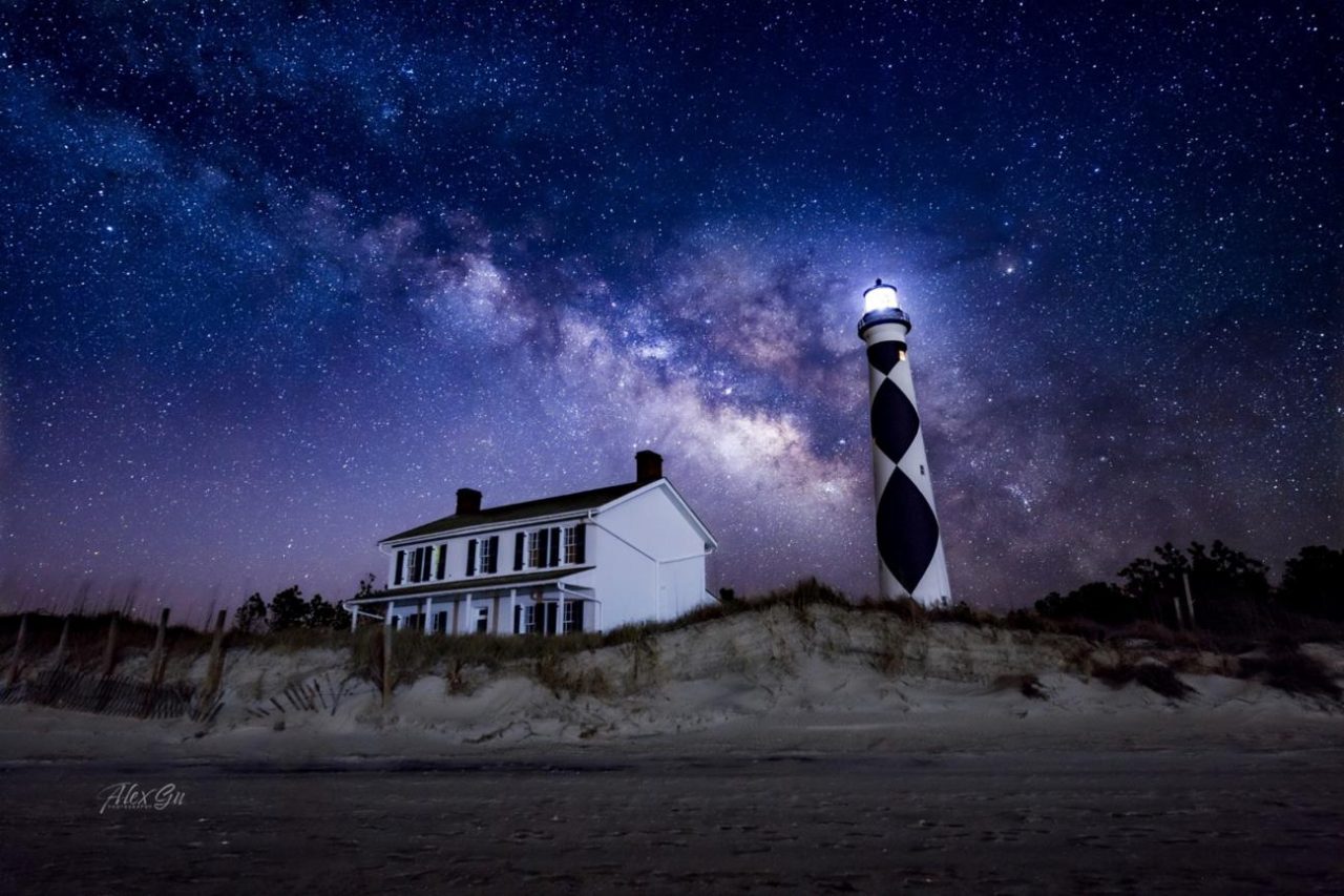
Cape Lookout Lighthouse under the night sky. Photo: Alex Gu/Crystal Coast Stargazers
Cape Lookout is now a certified International Dark Sky Park
CoastalReview.org
Click Here To Open A Chart View Window, Zoomed To the Location of Cape Lookout Bight
Searching for clues about one of the most important forces in the planet’s climate system: a network of ocean currents known as the Atlantic Meridional Overturning Circulation (AMOC).
The Atlantic’s vital currents could collapse. Scientists are racing to understand the dangers.
MIT Technology Review
Did you know that Coast Guard units served alongside the Navy firing anti-aircraft barrages against the Japanese attackers and performing harbor and anti-submarine patrols? Open link below.
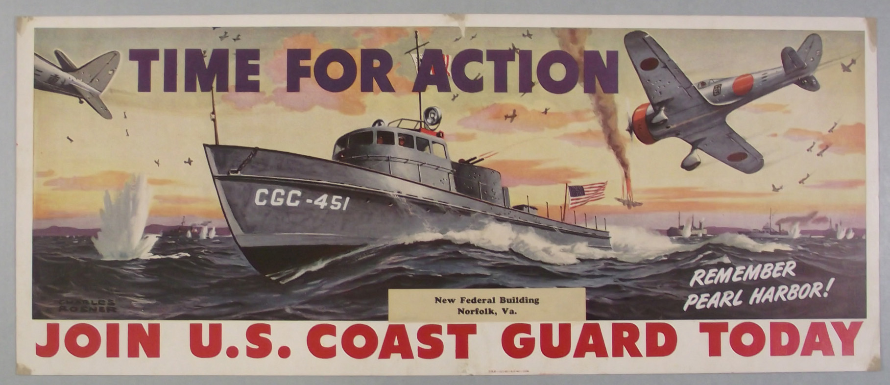
U.S. Coast Guard Commemorates the 80th Anniversary of Pearl Harbor
Maritime Executive
Plastic waste of all shapes and sizes permeates the world’s oceans. It shows up on beaches, in fish and even in Arctic sea ice.
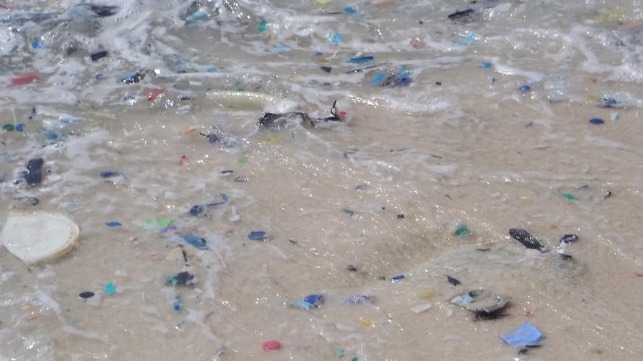
Once it reaches the ocean, plastic waste degrades into millions of small particles (CSIRO file image)
The U.S. Has a Leading Role to Play in Reducing Ocean Plastic
Maritime Executive
Research, published in the journal Nature on Thursday, found that species usually confined to coastal areas — including crabs, mussels and barnacles — have latched onto, and unexpectedly survived on, massive patches of ocean plastic.

World – There’s so much plastic floating on the ocean surface, it’s spawning new marine communities
Coastal News Today
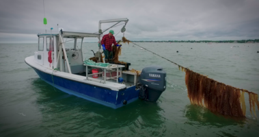
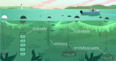
NOAA’s Ocean Today Harvest Season Special – THE FUTURE OF OCEAN FARMING video collection
National Ocean Service.
| Learn how sustainable practices are helping to grow healthy seafood and support a clean ocean. |
|


Be the first to comment!