Hertford’s quiet, rural setting, rich history add to its appeal – Eric Medlin
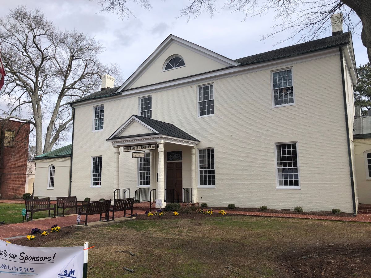
Perquimans County Courthouse in Hertford. Photo: Eric Medlin
Click here for Hertford’s quiet, rural setting, rich history add to its appeal
CoastalReview.org
Perquimans County Courthouse in Hertford. Photo: Eric Medlin
Click here for Hertford’s quiet, rural setting, rich history add to its appeal
CoastalReview.org
Cruisers Net publishes Loose Cannon articles with Captain Swanson’s permission in hopes mariners with salt water in their veins will subscribe.. $7 a month or $56 for the year and you may cancel at anytime.
Click here for Guns on ‘The Loop?’ New York Law Challenged in Court

Click here for Around the world in a 32 footer
ForeCast
Cruisers Net publishes Loose Cannon articles with Captain Swanson’s permission in hopes mariners with salt water in their veins will subscribe.. $7 a month or $56 for the year and you may cancel at anytime.

Click here for As Right Whale Nursery Becomes ‘Crime Scene,’ Renewed Pressure To Slow Down Small Craft
Peter Swanson
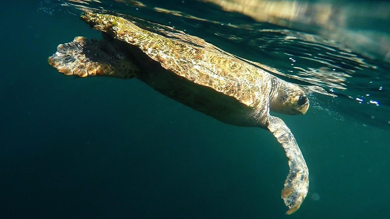
A loggerhead sea turtle swims just under the water’s surface. Photo: NOAA
Click here for DNA project links individual female loggerheads, nests
Trista Talton at CoastalReview.org


Driving down Outer Banks beach by shipwreck. Photo: D. Victor Meekins Papers, Outer Banks History Center
Click here for Excerpt: Conflict Over Water Access from ‘Time And Tide’
CoastalReview.org
Cruisers Net publishes Loose Cannon articles with Captain Swanson’s permission in hopes mariners with salt water in their veins will subscribe.. $7 a month or $56 for the year and you may cancel at anytime.
Click here for Heavens! They’ve Put Rental Moorings in Front of Chat ‘n’ Chill
Peter Swanson
Captain John Easley is a professional, USCG-Licensed 100 ton Master based out of Palmetto, FL. He specializes in training new owners on their boats during the process of delivery to its new home port. He can be reached directly through http://uscgcaptain.johneasley.com/
Should I stay or should I go?
As boaters, we are all subject to the whims of the weather. Sometimes it works well
with our plans. Other times, not so much.
A storm front passed through much of the southeastern United States a few weeks ago.
Considerable damage and tragic loss of life occurred in Tennessee. In the Bradenton,
Florida area, we saw sustained winds of 23 mph and gusts as high as 32 mph Sunday
night.
The next Monday morning was clear and sunny but brought sustained winds of 22 miles
per hour out of the north. The forecast was for four foot seas at six-second intervals on
Tampa Bay.
A client wanted me to bring his catamaran to the boatyard for haul-out Monday morning.
The cat can tolerate running in 4×6 seas on the nose. What concerned me was the 22
mph crosswind while trying to pull into a travel lift haul-out well with only six inches of
clearance on each side. Yeah, you read that right: six inches. That’s a bit tight even in
the best of conditions. During discussion with the owner, we agreed it was better to
reschedule than risk damaging the vessel on the concrete walls of the haul-out well.
Responsible boating occasionally calls for making the tough call to abandon plans and
stay at the dock during unfavorable conditions. Make that tough call. Be responsible.
Don’t be a statistic for the Coast Guard or end up on the evening news. Injuries, or
worse, are not worth a day on the water.
——————
Captain John Easley
Our on-the-water contributing editor is Captain John Easley, a professional, USCG Licensed 100 ton Master based out of Palmetto, FL. He specializes in training new owners on their boats during the process of delivery to its new home port. He can be reached directly through http://uscgcaptain.johneasley.
Managing Risk – Rule of Complications
From an admittedly-biased point of view, boating is one of the most enjoyable recreational activities. But it does not come without some risk. Managing those risks helps ensure passenger safety and an enjoyable time for all aboard.
One way to look at risks is to consider them as “Complications.” Rain would be considered a complication. So would fog or darkness or heavy seas. Equally, entering a marina with which you are unfamiliar could be considered a complication. Running on the inland rivers or the ICW when there can be a lot of debris would also be a complication. By no means should this be considered an exhaustive list; those are just examples.
Can an experienced captain safely navigate during a white-out thunderstorm? Certainly! But it is definitely more complicated and not every boater has the experience to do it with a reasonable margin of safety.
I have a rule for recreational boating: One complication only. Two or more complications at the same time is asking for trouble. A sunset cruise from your regular home port on a mechanically sound vessel in calm weather with friends is a memorable experience. Returning in darkness is the only complication in that scenario. On the flip side of the coin, attempting to spot and dodge debris on the ICW at night with building fog and a strong current while navigating into an unfamiliar marina is a formula for stress and unpleasantness.
Use the Rule of Complications to manage the risks: Only one complication at a time for recreation cruising. If two or more complications overlap, consider finding a safe anchorage or port in order to sort things out.
Captain John Easley
Seasoned boat owner Gilbert Park shares his tips for making your time on the water as safe and stress free as possible.
Click here for Tips and advice for safer boating
Practical Boat Owner and Forecast

The white supremacy meeting was held at the Craven County Courthouse in New Bern, shown here. Photo: Susan Rodriguez/File photo
Click here for The other coup d’état: Remembering New Bern in 1898
CoastalReview.org
New Bern is home to CRUISERS NET SPONSOR New Bern Grande Marina.
Click Here To Open A Chart View Window, Zoomed To the Location of New Bern Grand Marina
|
The First Shipwreck of 2023. Every boater’s nightmare.

The grounded 1983 WASA Atlantic 51 Sloop is a nicely appointed sailing sloop. It is a high performance racer-cruiser built in Sweden with a 7’ draft
Click here for 51’ Wasa Sailing Sloop Grounded Near Ocracoke Inlet Early On The Morning Of November 2nd

Frank Stick plays with his dog outside a Flat Top cottage in 1950. Photo: Charles Brantley ‘Aycock’ Brown and courtesy of the Maud Hayes Stick Collection at the Outer Banks History Center/North Carolina State Archives.
Click here for Frank Stick finds success, designs signature Banks cottage
CoastalReview.org
Fourth in a special series: Frank Stick’s Outer Banks development dreams.

The Stick family, from left, Maud, David and Frank, pose at beach resort. Photo courtesy of the Maud Hayes Stick Collection at the Outer Banks History Center/North Carolina State Archives
Click here for A future tied to tourism: Stick presses for national park
CoastalReview.org

A print of the USS Fanny under attack by the CSS Raleigh, CSS Curlew and CSS Youngalasaka, from Harper’s Weekly, Oct. 19,1861.
Click here for Today’s CoTabbastal Review: Scuttled Confederate ship had served both sides in Civil War
CoastalReview.org, by Kip Tabb

Guests arrive at the Virginia Dare Shores Pavilion in the 1920s. Photo likely by Frank Stick and courtesy of the Maud Hayes Stick Collection at the Outer Banks History Center/North Carolina State Archives
Click here for ‘Faith In the Future’: Troubles befall Virginia Dare Shores by Gilbert M Gaul
CoastalReview.org

BoatUS is the leading advocate for boating safety in the US and A CRUISERS NET SPONSOR!

Photo 2 Caption: A Tier 1 Boating Infrastructure Grant in Brunswick, Georgia funded installation of dockside power pedestals, giving local utility access to visiting boaters (credit: Scott Meister – USFWS).

Photo 1 Caption: BIG gives traveling boaters parking spots to safely tie up for the night and facilitates access and tourism spending in waterfront communities, such as this recently completed Tier 1 BIG project in New Iberia, Louisiana (credit: Scott Meister – USFWS).
Click here for Boating Infrastructure Grants Can Make It Easy to Attract Visiting Boaters
Our thanks to Sean Welsh for this excellent, detailed explanation of bridge clearance boards.
Bridge Clearances Explained
by Sean Welsh USCG licensed Master inland, Mate near coastal
I was asked by the moderation team to write a few words about bridge clearance markings, after the comments
on a recent post revealed that there is a lot of confusion on the subject. That seemed straightforward, but, as it
turns out, it’s messy. That probably accounts for some of the confusion, so let me see if I can shed some light.
There is a standard for these markings, which are officially known as “Vertical Clearance Gauges” on the ICW
and other federal waterways, codified in federal law as 33 CFR § 118.160. Among other things, this standard
requires black markings on a white background, “foot marks” (horizontal lines of a specific size), specific spacing
of numbers, location at the right side of the channel, and regular maintenance.

This Vertical Clearance Gauge complies with the regulations. “Foot marks” every foot show the clearance; on this board the numerals are next to the foot marks every other foot. This board reads just a hair over 65′, as the entire foot mark and a little white below it is visible.
If all bridges were marked according to this standard this would be an easy post to write. But the reality is that state or county road maintenance departments, railroads, and other bridge owners, and not the federal government, are actually responsible for installing markings on bridges, and there appears to be little consequence for these entities when they break federal law by straying from the standard. The bridge that prompted this post, the infamous Wilkerson Bridge in North Carolina, is one of the many non-compliant bridges and thus the source of much confusion.

My own photo. This board, not compliant with standards. This board reads a couple of inches more than 64′. It’s hard to read because non-compliant colors have been used and the agency has failed to “… maintain each gauge in good repair and legible condition.”
Apart from the markings being a noncompliant white on a green background, the gauges on this bridge also lack
foot marks (horizontal lines) of any kind, and have numbers every foot. Since the numerals are 12" tall, this
means each number abuts the numbers above and below it. This is by no means the only bridge with this type of
marking, but it gets the most discussion here because the bridge is lower than ICW standards and is on a non-
tidal stretch of waterway, making it a tight fit for many sailboats.
On this type of clearance gauge, the clearance to low steel is between the largest number that is completely visible (not covered by any water at all) and the next larger number that is wholly or partially under water. This is a critical point to remember, because the human brain wants to see the largest number that is “mostly” visible, and count upwards from there. Among other things, this is because we are conditioned to see numbers increase from lower to higher elevations, and on a bridge gauge it’s the other way around.
This stands in contrast to many standards-compliant gauges, where the numerals are often (but not always) next to, rather than above, the foot marks. When you see a gauge where the foot marks fall mid-numeral, it is the bottom edge of the mark, and not the bottom edge of the numeral itself, that shows the level.
On the ICW, most compliant numerals will be either 12 or 18 inches tall and spaced every two feet. But on bridges sized for ships or large tows, which need to be visible from much further away, you will find gauges where
numerals may be spaced five or ten feet apart and are much larger in size. Compliant gauges, whether on fixed or movable bridges, show the clearance to “low steel” which is the lowest hard part of the bridge that is directly over the navigation channel. The edges of the channel are defined by the red channel limit lights, which are often on the fenders but sometimes hang below the span. If you stray outside these markers you may have lower clearance. Also, the “range lights” which are the green mid-channel lights that hang below the span, are not considered “low steel” and thus may hang down lower than the clearance measurement. If your clearance is close, pass between the range and the channel limits and do not take the range down the middle.
Having said that, once again there are some agencies out there installing non-compliant gauges and I have seen
some, notably on drawbridges, which show the clearance “at center” as noted on the sign. When in doubt, call
the bridge tender and ask. They are generally not allowed to tell you the clearance, but they can usually state
whether the gauge reads low steel or center-span, and in the case of low steel gauges, how much additional
clearance may be available center span.
While I am on the subject, now is a good time to remind everyone that bridge clearances marked on charts show
the low steel clearance at “mean high water” (MHW) for tidal bridges, and at “normal pool” for river bridges.
Actual clearance may be less; spring tides can be well above MHW and there may be freshet on top of that, and
river pools vary greatly.
Bridges, their clearances, and movable bridge regulations and schedules can be found in the relevant edition of
the Coast Pilot. Every skipper should carry the local Coast Pilot edition on board, available as a free download.
Temporary clearance changes, for example due to construction work, can be found in the current issue of the
Local Notices to Mariners (LNMs), which, again, every skipper should download and check as part of their
voyage planning.
BoatUS is the leading advocate for boating safety in the US and A CRUISERS NET SPONSOR!
Click here for A 27-Inch Chartplotter? | Prop Inspection Guide | Alternative Fuel Test Results | 5 Hot Fall Fish
BoatUS


Be the first to comment!