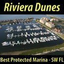
NOAA’s Hydrographic Services Review Panel
Boaters will be able to provide input and participate in public sessions.
|
Boaters will be able to provide input and participate in public sessions.
|
Having been temporarily closed on Monday, the USACE had it re-opened by Monday evening.
We had a pocket of storms blow through on Friday night, resulting in some downed trees and a temporary closure of the canal. I’m aware the USACE is currently working on the problem. It was a hard fast storm, with local damage from high wind and hail. The advisory from the Norfolk District is attached and has been posted on the Dismal Swamp Welcome Center’s Facebook page.
Donna Stewart, TMP
Director, Dismal Swamp Canal Welcome Center
Chairperson,Camden Tourism Development Authority
2356 US Hwy 17 North, South Mills, NC 27976
252-771-8333 | dstewart@camdencountync.gov
www.DismalSwampWelcomeCenter.com
www.VisitCamdenCountync.com
Click here for the USACE Advisory Closure DSC-Aug-2019
VA-NC CUT AREA SPONSORING MARINA
Click Here To View the VA to NC Cruisers Net Marina Directory Listing For Atlantic Yacht Basin
Click Here To Open A Chart View Window, Zoomed To the Location of Atlantic Yacht Basin
The effects of a slowing Gulf Stream will impact offshore cruisers’ navigation plans, but the implications of the Gulf Stream’s slowing for the environment are yet to be seen. More on challenges to our southeast waters, see Present and Future Concerns.
The Gulf Stream is slowing down. That could mean rising seas and a hotter Florida
Phys.Org
If you are interested or not in purchasing property in the Charlotte Harbor area, these Market Snapshots by the Herald Tribune make for interesting reading. There are several Snapshots in this single link. Cruisers Net is not associated with any realty concern.
Market snapshot: Grove City — Old Florida charm, excellent deep-water boating in historic …
Sarasota Herald-Tribune
AREA SPONSORING MARINA
Click Here To View the Cruisers Net Western Florida Marina Directory Listing For Fishermen’s Village
Click Here To Open A Chart View Window, Zoomed To the Location of Fishermen’s Village
Excellent deep water?????? This article must have been written by a paddle boarder. Sand bars on both sides of the GICW
Channel 5 is ,arguably the most important of the Inside Route to Hawk Channel, or the other way around, passages in the Florida Keys, north and east of Marathon and Moser Channel. And, Captain Charmaine has found a real possibility of dangerous navigational error in these well traveled waters. ALL Florida Keys cruisers need to read the article below CAREFULLY!!
We would very much like to hear about your Channel 5 cruising experiences. Have you had a similar/dissimilar experience from Captain Charmaine. Please click the “Comment on This Posting/Marina/Anchorage/Bridge” link below, and share your information.
April 29th 2011
“Channel 5 Bridge Passage – Chart 11449 Recommended Route in Error”
24 50.281 N, 80 46.401 W
by Charmaine Smith Ladd
The Channel 5 bridge spans between Long Key and Lower Matacumbe Key. It has a fendered underpass for vessels needing clearance (65′). Being the first opportunity for boats coming down to the Keys from the West coast of Florida to cross over from Florida Bay into the Atlantic, Channel 5 is understandably heavily traversed. For those desiring a calm anchorage while traveling the Atlantic to those wanting to explore the backwaters of Florida Bay, crossing via the Channel 5 bridge underpass has its reward of a calm night in the shallower waters of Florida Bay and does not disappoint with its access to the serenity and beauty of its backwaters.
September Sea and her crew have used Channel 5 for such purposes for nearly a decade. From the first time, it became apparent that the bridge underpass was marked incorrectly on my paper chart (#11449). There is a recommended route on that chart that is in error. The recommended route takes you between the wrong bridge pilings and dangerously close to a massive utility pole piling. I made note of it directly on my chart and drew a line to show the actual route.
The next time we passed through Channel 5, we had a chartplotter and had plotted a course based on the recommended route of the vector charts in the chartplotter. Of course the vector charts had propagated the same error, and we once again had to adjust our course to pass between the correct fendered bridge pilings. This is when the reality of the true danger became much more apparent. Charting a course based on an erred recommended route could find one in a very confusing situation, especially in foul weather or at night. The intersection of the black tracks in the photo below show where to properly cross (24 50.281 N, 80 46.401 W).
Each time we’ve come here, it never fails that we observe other boats attempting to follow the recommended route of the chart. Just the other day, s/v Restless (shown above) was spotted on the wrong course to cross beneath Channel 5 from the Atlantic, while September Sea (also shown) was on the correct course.
I tried to hail the vessel on Channel 16 but the couple in the cockpit either could not hear me or did not have the VHF turned on. Their vessel continued and just as I thought the Captain would try to pass beneath between the wrong bridge pilings, the realization of a huge utility pole piling staring back at him from the other side proved to quickly change his mind. The vessel turned hard to port. That was when the fenders lining the proper bridge underpass were noticed by its Captain. I am sure the vessel’s Captain then noticed that the boat behind him (we aboard September Sea) were on the proper course.
This is a dangerous situation. The huge concrete pilings (foundations for communication cables) run parallel to the bridge on Bay side and do not give a boat much room to maneuver if the bridge is crossed anywhere but at the proper fendered opening. Those pilings are very difficult to notice from the Atlantic side.
Yesterday, checking online with NOAA’s most recent charts, I saw the error still exists (see photo below). I’ve added a red dot on the NOAA chart to indicate where the proper crossing is actually located.
I have learned from this that navigational chart changes do not take place unless we as cruisers report potentially dangerous errors when we see them. In the meantime, please make note on your current chart (#11449) and manually update any pertinent routes in your chartplotter.
Cruisers helping cruisers, it’s what we’re all about!
Charmaine Smith Ladd, s/v September Sea
SSECN Correspondent, Florida Keys
“Bringing you the low down from down low!”
Question for Captain Charmaine:
Is water always deeper in the middle of a channel when crossing? And when approaching a bridge to cross, how far in advance do you choose which pilars or opening to go thro? Maybe questions a rookie sail person might ask like me. Thank You
Skipper Burr Bault
Captain Charmaine replies:
Thanks so much for taking the time to read my article, Burr. Local knowledge is often handy when navigating channels. Over time, areas of a channel can be silted in (due to hurricanes, usually) and not have the minimum depth as shown on charts. So the answer to whether or not the middle of a channel is always where the deepest waters are is: not always. Most of the time, especially in wide channels, you will find deeper water in the middle. The narrower the channel, the more local knowledge one should seek.
On the charts, the opening beneath bridge spans for boats needing height clearance is well indicated. At that area, in most cases, boats with a mast height of up to 65′ can clear safely. In the case of Channel 5, I believe that the chart is still showing where a drawbridge of the old bridge span opened and allowed boats to pass through. When the new elevated bridge span was built, it was done so that boats could pass beneath without the need of a drawbridge and bridge tender to raise it. Therefore, the recommended route for Channel 5 shown on the charts is outdated, as it is in line with a drawbridge which no longer exists.
At Channel 5, the placement of the new fendered opening for vessels is on the opposite end of where the old drawbridge used to be. Pilings are shown incorrectly. It is therefore very important to pass through where height clearance is optimal and the opening is clear of obstructions. Such areas are well marked on the charts and usually correct. However, in this particular case the recommended route is in error because it has not been updated since the new bridge span was built.
Hope this helps!! Hugs!
Charmaine
Very informative article. Your knowledge of the 5 Channel Bridge, of the Florida Keys, is awesome!
Linda Honore-Pitts
I have read many of your articles and appreciate your advice and warnings. My husband and I are bringing our s/v, draft 4’8’³ from Tampa Bay to Ft. Lauderdale the last week in November. What passage would you recommend from Marathon to Miami? We have limited sailing experience on the Atlantic but we like the greater depths. We do like to anchor and are not overly excited about visitng any towns or marinas unless necessary. And as always we are under some time constraints. Thank you for any suggestions!
Beth Falkenhagen
The first thing you should do is check the date of the chart survey. You might be surprised! I have been through the bridge several time with no problem, but I make a deliberate effort to compare the terrain when in sight to the chart. Remember to keep those dead reckoning skills sharp and if you really want to be amazed and confused pick up a copy of Nigel Calder book "How to read a Nautical Chart". Lots of info into what goes into making an chart and what to look for.
S/V Dreamweaver
i need to bring this petterson sailboat with wing keel 6ft draft up to blackwater sound unloaded would like to use icw bayside ..do you think i can do it? i know the waters fairly well my last sloop was 4.5 anyone done similar route?
Captain Charmaine, we are moving our Beneteau 381 (5.5 draft) from Virginia to our new homeport in Alabama. We are making the transit through the Keys for the first time and are looking for the best place to safely transit from the Atlantic side to the Gulf. Based on what I've read from other experienced Captains, I take it that Channel 5 requires spot on navigation getting to the Gulf. The other option appears to be Moser Channel as we do not desire to sail all the way around KW. We're seeking advice for our transit from Miami and then through the Keys until we're in good open water in the Gulf, and based on your post with pictures of Channel 5 we'd love to hear from you your recommendations.
Thanks in advance.
Hi Capt Bob I am trying to get an answer to the same question you had. Did you make the crossing? If so what route did you end up taking? Im in a 60 Bertram Sportfish. Sounds like we have the same draft, about 5.5'. It looks pretty staright forward getting to the bridge from the Atlantic side, just wondering how tricky it is once you get under to navigate to open water on the gulf side to make our way up the gulf coast. . Any input or experience is appreciated.
Thomas Point Lighthouse is just south of Annapolis and well out of Cruiser Net’s coverage. However, anyone who has cruised the Chesapeake south of the Bay Bridge knows this historic aid to navigation, so we offer you this chance to contribute to the much needed maintenance of Thomas Point light.
Click here for Supporters of Historic Lighthouse in the Bay Seek Community’s Support
Maryland Matters
Hurricanes are among nature’s most powerful and destructive phenomena. On average, 12 tropical storms, 6 of which become hurricanes form over the Atlantic Ocean, Caribbean Sea, or Gulf of Mexico during the hurricane season which runs from June 1 to November 30 each year. Preparation is essential!
Hurricane Safety Tips and Resources
National Weather Service
See also: Revised NOAA Hurricane Forecast
Click here for National Hurricane Center and latest updates.
Registration is now open for the Atlantic Intracoastal Waterway Association’s (AIWA) 20th Anniversary Annual Meeting in Savannah, Georgia. For more detail , see Registration.
Click here for Registration Open for the Atlantic Intracoastal Waterway Association’s Annual Meeting
International Dredging Review
This proposed mooring field at Fort Walton Beach Landing Park would be located west of the Brooks Bridge and due north of ICW daybeacon 8.
Fort Walton Beach could create boat mooring field (PHOTOS)
The Northwest Florida Daily News
This is one of Claiborne’s early posting and today TJ Palmerton has questions for you, in the comments below.
I’ve copied the discussion below from the Net’s “Ask Your Neighbor” page, and the AGLCA mailing list. The never completed Florida Barge Canal pierces the Big Bend portion of the Western Florida coastline north of Crystal River, and short hop south of the western entrance of the Withlacoochee River. I have never tried anchoring here, but after reading the messages below, it looks like a real possibility!
Does anybody have recent information regarding access, depths and anchoring in the abandoned Cross Florida Barge Canal instead of going up to Yankeetown or Crystal River. This would mean continuing straight into the Barge Canal at G 23 instead of turning NE up the Withlacoohee River toward Yankeetown as mentioned in “Skipper Bob”.
Chuck and Barbara Ganem
“Gold Watch”
We anchored twice in the CFBC – once in 2008 and again in 2009. We need 4.5 feet of water and had no problem with depth. As I remember, it was 7-9 feet. The CFBC is well-sheltered from winds and has otters, dolphin, and bald eagles. Small (fast) boats use the CFBC to get to/from the boat ramp by the bridge, but the traffic is light and almost non-existent after dark.
One caution, in 2009, we started to anchor a mile from the entrance (where we anchored in 2008) and were stopped by the Coast Guard. They directed us to anchor in the turning basin, which is maybe a mile east of the bridge. The turning basin will add about 4-5 miles to your trip (one way).
Billy
Thank you for responding to my question regarding anchoring in the CFBC. I have since contacted the park ranger for that area thru a phone number I found on the government chart for that area now called the Cross Florida Greenway. His name is Chris McKenzie. He was very informative about the area and assured me that my draft of 4.5 feet would have no problem in the canal all the way to and including the turning basin which was about 1/2 mile past the highway bridge on the right side of the channel. He recommends that the turning basin is where to anchor and said it provides excellent protection from any direction. He explained that maybe about once every three months a tow and barge uses the canal to transport loads from mining either into or out of the canal.
The lowest water depth is at where the canal enters the point of land on the chart. He explained that at low tide the tow captains wait for a rising tide to pass this point with a loaded barge, but for a 4.5 ft draft this should be no problem.
This anchorage appears to be easier access, deeper and less distance than either going up the Crystal River or to Yankeetown but of course is still only an anchorage.
Chuck and Barbara Ganem
M/V “Gold Watch”
As you get close to the non-operational lock the Withlacoochee river comes in from the south. Good depth up to within a 1/4 mile of the dam and spillway. There is no boat access to the Lake. Strong current in this part of the river.. The Withlacoochee is blocked on the north side as it is fed by another spillway on the north side of the lock. I have done both sides of the lock in my 11' Zodiac. Depth is good all the way from the Gulf to the lock.
I am wondering how far up the canal you can go. Can you go all the way up to the locks and is there any way to get past them going a different way around them?
Does anyone know how far that you can go up the canal? I heard that there’s a fresh water lake off to the east to anchor in. I have a 38’ Sea Ray and am curious about the depth all the way up.
Thank you,
TJ
Whether you want to revisit the past, satisfy your curiosities, discover the arts or explore your true nature, you can do it from the heart of the Inner Banks – Washington, North Carolina. Washington City Docks, A CRUISERS NET SPONSOR, has proven to be well worth the journey up the beautiful Pamlico River! Our thanks to Bob McLeran for theses good words.
Little Washington is a little out of the way for cruisers on the ICW, but it is absolutely worth the short detour to spend a few days in this very hospitable village on the Pamlico River. Super-easy entry to docks, several nice restaurants to choose from, and the towns-people couldn’t be more helpful and friendly. It’s really a don’t miss stop.
Bob McLeran
Click Here To Open A Chart View Window, Zoomed To the Location of the Washington City Docks
Our thanks to SOUTHWINDS and to James Newsome for this report following the June 15 public meeting with the GADNR re HB 201.
Our thanks to SOUTHWINDS , to Director Haymans and to James Newsome for this interview following the June 15 public meeting with the GADNR re HB 201.
I'm befuddled and disappointed. After this HB201 issue surfaced to public attention, several emails and forum posts circulated. Post authors and quotees like Amy Thurman, Charlie Waller (GAMBA) and Jack White all indicated they had not been consulted as HB201 moved through the legislature. How is it now possible for Doug Haymans to have such a different perspective? How can he assert that GAMBA was involved when both the president and the executive director said they were not? There is obviously something wrong here. Perhaps someone can clear it up for me? Doesn't feel right.
Be the first to comment!