Interesting Issue of GPS Jamming on the Southeast Coast
Has this issue of GPS jamming been a problem for any of you? If so, let us hear from you. Our thanks to Ted for sharing this link.
https://theaviationist.com/
Ted R. Bost, Jr.
Has this issue of GPS jamming been a problem for any of you? If so, let us hear from you. Our thanks to Ted for sharing this link.
https://theaviationist.com/
Ted R. Bost, Jr.
Longboat Pass separates Longbeach and Bradenton Beach south of Tampa Bay north of Sarasota, FL Adjustments to the uncharted ATONS in the Pass are a common and frequent USCG procedure and the last dredging was completed in April of ’17 (https://cruisersnet.net/164177). Our thanks to Bob Dockery for this update on earlier confusing marker positions
CHANNEL MARKS NOW IN PROPER PLACE
Bob Dockery
Click Here To Open A Chart View Window, Zoomed To the Location of Longboat Pass
Area Sponsoring Marina
Click Here To Open A Chart View Window, Zoomed To the Location of Longboat Key Club Moorings
For details and admission, go the official site, Palm Beach International Boat Show.
Palm Beach International Yacht Show
Announcing the 2019 annual Palm Beach Boat Show, in West Palm Beach, Florida, from Thursday the 28th to Sunday the 31st of March, 2019.

The battle with Florida legislators over anchoring privileges has been going on for years and the restrictions on anchoring appear to be raising their ugly heads…AGAIN! For earlier discussions, see Right to Anchor, Restrictive Anchoring, Continued Discussion. Please donate if you can.

We want to thank each of you who has made contributions to help keep Florida anchorages open to cruisers. While contributions from our members and members of SSCA, DeFever Cruisers and MTOA are appreciated, presently, the total contributions are running short of our expectations.
This year, SEVERAL FLORIDA CITIES ARE ACTIVELY ENGAGED IN A HOST OF ANTI-ANCHORING, ANTI-CRUISING BILLS including but not limited to the Cities of Melbourne and Hollywood. These bills can result in the elimination of specific anchorages that you currently enjoy.
Our coalition and the lobbying firm representing us in Tallahassee are working closely with BoatUS lobbyists to stop local governments from passing legislation which would allow them to regulate anchoring in their jurisdictions, but we need your help. Please do not assume that our lobbying efforts can proceed without your help. We can win but it takes resources and commitment throughout the upcoming Legislative Session.
We know that a law passed in Florida will set the precedent for the same maritime treatment in other states along the I95/AICW corridor.
WHETHER YOU CRUISE IN FLORIDA OR NOT, WE NEED YOUR HELP TO STOP THIS ASSAULT ON OUR RIGHTS TO CRUISE AND ANCHOR IN FLORIDA AND BEYOND.
Thanks to all of you for your support!
-Kim
Kimberly Russo
Director
America’s Great Loop Cruisers’ Association
krusso@greatloop.org
843.879.5030
This large tug capsized in December just north of the fixed bridge over Jekyll Creek, Jekyll Island, GA. The tug has now been removed, see Bruce’s comment below. See Sunken Tug and Capsized Tug for earlier reports.
Capsized tugboat floating off Jekyll Island for more than 2 weeks
WJXT News4JAX
This report comes from our good friends and partners, Sara and Monty Lewis, of Explorer Charts. Search “Bahamas Chatter” from our Homepage for more on Explorer Charts.
The Moore Haven lock had only one gate open and it was a narrow squeeze for our 17’ wide catamaran. All locks require life jackets now for all persons aboard and they all supply lines to tie up. Some of them hang in the water and are a bit slimy. Good to have a wiper handy.
Sara and Monty
Click Here To View the VA to NC Cruisers’ Net Marina Directory Listing For Moore Haven Lock
Click Here To Open A Chart View Window, Zoomed To the Location of Moore Haven
The reported missing ICW buoy marks the west side of the southbound entrance into a controlled channel at the southern end of Ramshorn Creek. This unconfirmed report by Capt. JoePat Brasfield has been forwarded by James H Newsome from Bob423. Thank you James and JoePat.
Capt JoePat Brasfield reported this morning that R40 near ICW StM 570 at the south end of Ramshorn Creek just north of Beaufort County Free Public Dock at Daufuskie Island is missing.
These changes are an effort to standardize depth presentation on printed and raster charts.
February 7, 2019 
Contact:
Kristen Crossett, 301-325-2113
NOAA announces change in channel depths on raster nautical chart products
NOAA’s Office of Coast Survey recently announced plans to change the U.S. Army Corps of Engineers (USACE) maintained channel depth values on raster chart products, which include paper nautical charts and the corresponding digital raster navigational charts (NOAA RNC®). Minimum depths (also called controlling depths) are collected during periodic USACE sonar surveys of channels. In the past, controlling depths were provided on raster charts but will now be replaced with the original channel design dredging depths used by the USACE (called project depths). Standardizing depth presentation on these products will improve data consistency and overall safety. Implementation begins in early 2019.
NOAA’s suite of electronic navigational charts (NOAA ENC®) are not affected by these changes. Mariners are encouraged to use NOAA ENCs for critical safety information as these products are typically updated up to one month ahead of raster products.
For more information, please visit: https://www.nauticalcharts.noaa.gov/updates/?p=171708
NOAA Office of Coast Survey is the nation’s nautical chartmaker. Originally formed by President Thomas Jefferson in 1807, Coast Survey updates charts, surveys the coastal seafloor, responds to maritime emergencies, and searches for underwater obstructions that pose a danger to navigation.
NOAA Office of Coast Survey, 1315 East-West Highway, SSMC3 #6509, Silver Spring, MD 20906

Explorer Chartbooks, A CRUISERS NET PARTNER, has long been the standard navigational supplement for enjoyable, informative, and safe cruising through the beautiful Bahamian waters and island visits.
Big Changes in Explorer Electronic Data Availability
February 2019 introduces some changes in the sources of data being used for electronic navigation in the Bahamas. If you have come to rely on the accuracy of the Explorer chart data, this is important information for you. If you are planning a trip to the Bahamas in the near future, you may need to make some changes right now to assure that you go with the best chart data.
One of the recent developments causing a shift is that Garmin has purchased Navionics.
Garmin has announced that its new g3 marine electronics offerings will contain only Navionics data for the Bahamas. With this February 2019 issue, Garmin will no longer make Explorer Bahamas data available to its customers. The g3 will be included in the g3 accessory cards and pre-loaded chart plotters.
The Explorer data is still available on g2 accessory cards (Garmin) and earlier pre-loaded chart plotters which may be in inventory for a few more weeks. Although the release of the new g3 material has already begun, customers desiring Explorer data still have an opportunity to upgrade their g2 cards.
If you haven’t upgraded your Garmin for awhile and don’t have the g2 data, we urge you to call Garmin or visit your marine electronics store to insure that you travel to the Bahamas with the tried and true Explorer chart data.
Other avenues for insuring Explorer-only data is to go with C-Map by Navico products and its affiliates SIMRAD, LOWRANCE, and B&G. Also, chart data through MapMedia, MaxSea, Nobeltec, Standard Horizon, RosePoint Coastal Explorer, and Furuno can be trusted to use Explorer vector and raster information. If you are using RayMarine hardware, please inquire of the company as Explorer data is available but not on all units.
There are also three new apps for phone/tablet that now include Explorer-only raster data. Check out AquaMap and iNavx. Links below:
Aquamap links
iTunes
https://itunes.apple.com/us/app/aqua-map-marine-boating-gps/id919552329?mt=8
Google Play
https://play.google.com/store/apps/details?id=com.gec.MarineApp.WorldViewerLite
iNavX links
Itunes
https://itunes.apple.com/us/app/inavx-marine-navigation/id286616280?mt=8
Google Play
https://play.google.com/store/apps/details?id=com.gpsnavx.iNavX
Embark (by C-Map) links
Itunes
Google Play
https://play.google.com/store/apps/details?id=com.isea.Embark&utm_source=stylum.teamworkpm.net
Explorer Charts are “The Standard” IMHO.
Using Aqua Map on my iDevices in The Bahamas right now. The Explorer maps are great.

Albemarle Loop
Whether you are traveling back north or south, the rivers and communities that frame the Albemarle Sound are inviting you to explore their shores and experience their warm southern hospitality. A community of marine businesses and historical locations, located on and around the Albemarle Sound of North Carolina, have organized to serve boaters through the Albemarle Loop. For more see FOCUS ON Albemarle Loop. Our thanks to Bill and Amy Denison for this reminder posted on AGLCA’s Forum. Bill and Amy reside at Albemarle Plantation, A CRUISERS NET SPONSOR!
As Loopers are heading north this spring we invite you to come and explore the North Carolina southern hospitality for those boats willing to explore the Albemarle Sound which is just off the ICW. Yes, we are a mini loop that extends 2 nights of free dockage at its many locations. Visit our small towns and rural settings with many opportunities to anchor as well. Check our web site at albemarleloop.com.
We are currently on the loop and a resident at Albemarle Plantation which has a 166 slip marina with gas and diesel available. Also on site is an 18 hole golf course and 2 restaurants. Golf carts are available to explore our neighborhoods. Come for a visit, relax and stay a while.
We will be returning the end of March and would be happy to act as a harbor host during your visit to Albemarle Plantation.
Bill and Amy Denison
M/V MAR-KAT
Back Cove 41
Click Here To Open A Chart View Window, Zoomed To the Location of Albemarle Plantation Marina
Our thanks to Pete and Peggy Frazier for forwarding this very entertaining account by John Cebalo of what was essentially a self-operated, hands-on travel lift. Such is a fall and spring chore in which few of us get to participate.
THAT TIME OF YEAR
The friendly September sun was unseasonably warm, and the afternoon was mild and humid. Now, at twilight, it is still warm and calm; and, as always, on precious, numbered evenings like this, which magnetize people out of doors, the Mattson Harbor parking lot is crowded. The congestion tonight is increased by the trucks and boat trailers of the Salmon fishermen, as they shuttle in and out of the launch ramp. “They’re running at the mouth of the Carp.”
The north half of the Cinder Pond Marina’s launch ramp is called The Well. It was originally built to accommodate a marine travel lift, but none was budgeted. Pete Frazier was on the Harbor Committee that oversaw the construction of the marina. It wasn’t until nearly twenty years after its opening that the Lake Superior Yacht Yard purchased a lift, and, with the City’s consent, operates it. And now it’s that time of the year to use it: haul out.
A truck, which has seen happier days, backs into marina office’s parking lot. It has a yellow and red Vietnam ‘chopper license plate on its front bumper. Pete, attired very casually, in a classic blue collar way, gets out and stands next to the travel lift. Fashion plate, he ain’t.
The lift straddles The Well, and looks like a large, faded blue Lego – or like something out of the movie Tron. It came from Nestegg Marine in Marinette. On the side it says “35 B F M.” Pete is not sure what B F M stands for, but the 35 means it can lift 35 tons. It has an internal clearance of 19’; and the distance between the two straps along the sides is 18’. When set up, of course, the straps run across The Well, under a craft, cradling it. Some boats have marks on the hull indicating proper strap placement. But Pete has good reason not to trust these. And he relates a horror story about factory marks and crushed railings – so judgement is required. The machine is something of an anomaly. Because it was built to span a larger, 50 ton, well, and consequently has an internal clearance wider than normal. The jib boom atop it was acquired from a character over in Ishpeming. It is used for stepping and unstepping masts. Its controls are attached to a power cord. Naturally, Pete has modified it.
In The Well now is a sailboat, with two men aboard. Pete, controls in hand, is operating the boom, which has a belt wrapped around the mast, under the spreader. “They’ve done a good job with the stick. Otherwise it can take forever.” He means that the backstay, forestay, and shrouds stabilizing the mast have been loosened for easy removal. While hauling out a boat can be accomplished in an hour, unstepping an aluminum mast can easily take twice as long, and is another delicate operation.
Pete slowly raises the boom, and the mast, now suspended, floats free. Clutching its heel, one boater guides it toward the bow, where a triangular wooden support awaits it. A similar support is on the stern, and the other man rests the mast head upon it. Once the mast is snug, the men clamber off the boat onto the pier. Nowadays, at haul out, most masts are left stepped. But the owner feels that because of winter winds, this places undue stress upon the hull. The hollow heel will later be covered because, in the spring, more than one sailor has discovered birds nesting in the exposed end.
Now, to find a way through all these vehicles…
Pete climbs up to the cockpit of the travel lift and, with warning beeper sounding, slowly drives it, with the slowly swaying boat, off The Well and onto the parking lot. The men walk ahead, acting as road guards, and also as scouts to find a safe route through the irregular parking pattern. The City has set aside the north side of Mattson’s parking lot for winter boat storage. Here, trailers and boat cradles, allocated a parking space apiece, are set one parking place apart. At the selected spot, Pete pivots the machine 180 degrees, and backs up over a waiting cradle. After some minor horizontal shifting, he gently lowers the sailboat onto the cradle. He waits patiently until the boaters assure him that they are satisfied the craft is secure. The straps are collected. And then they guide him back over to The Well.
It is dusk now, but the parking lot is still abuzz with activity, as people seem reluctant to leave. A small constellation of bright lights lies sprinkled across the placid black waters of the Bay, as the fishermen too, hesitate to return to shore. Pete parks the lift over The Well and climbs wearily down. It’s been another long day.
*
Christy is standing all by herself at the end of Pier 2 on the Fuel Dock at the Cinder Pond Marina. The 5’8”, 120 pound Marina Attendant is being confronted by a 60’, 27,000 ton metal houseboat, which is being pushed broadside toward her by a 20 knot wind. How is she going to moor this out of control monster?
CRACK! The boat’s stern slams into the floating wooden dock, shivering its timbers, and cleaving a 5×5 post in half. On board, on the fly bridge, the owner cringes.
“Ouch. What’ll that cost?” he shouts.
Fortunately Bob Frak arrives a moment later to lend Christy an expert hand, and, working together, the vessel is made fast. This is the one they’ve all been talking about up at Presque Isle. When it was learned that Pete was going to haul it out the universal response was, “I want to be there to see that.”
It is now late in the season, a Saturday morning in October, cool and cloudy, with the threat of rain. But the backdrop is inspiring. On the far shore, across the turbulent waters, autumn is in full bloom and shafts of brilliant sunlight slide across the landscape.
Since this annual exercise can be quickly complicated by the weather, the houseboat came down from the Presque Isle Marina last night. It is always prudent to have a cushion between your haul out date and when you leave the Upper Harbor. Those who wait until the morning of can quickly find themselves over matched, as they try to bash their way downtown across a resisting Lake. The plan was to dock along the bulkhead at Mattson Park. But another strong wind had sprung up, white capping Marquette Bay; the bulkhead was definitely not the place to be, so an alternative accommodation was arranged on the sheltered T-Dock at the end of Pier 3 in the Cinder Pond. Now the boat must be brought down the fairway, between Piers 1 and 2, to The Well and the waiting travel lift.
Although a twin screw, twin rudder, power boat with bow thrusters and not a sailboat, still, there is a great deal of topside, square yardage in fact, for the wind to push against, just like a sail. It does so now, and as the boat motors down the fairway, she bumps, slides, scrapes, and chisels her way down the row of wooden posts which picket the ends of the fortunately empty 30’ slips on the right. Meanwhile, Pete is standing calmly next to the lift, just watching.
Finally, with the help of several men gingerly fending off (“Watch out for your fingers!”), or hauling strenuously on lines, the boat noses into The Well. Pete, tape measure in hand, starts to work his way down the hull. He instructs the owner, who is now peering out of a hatch on deck, “Find the rib.” The rib, a transverse member, is located. Pete and Bob and Repete Frazier take more measurements, but then Pete stops and shakes his head. “The weight is in the stern. We’re going to have to turn it around.”
The owner shrugs, and climbs back up to the fly bridge. The craft slowly backs out of The Well against the wind. Once in the fairway, the straining vessel is warped around, stern to The Well. She starts to move backwards. But now red lights are blinking on the control console and the owner yells, “I’ve lost the bow thrusters!”
“Keep her coming.”
Screws slash and claw at the white water, as they painfully pull the boat back into The Well.
A small crowd has gathered to watch the lifting. The lift has carried the D N R’s RV Lake Char, which is 56’ long and displaces 26 tons. So this should work…
The houseboat is 60’ long, and its weight requires extra heavy duty straps. Still, there is going to be a lot of overhang. The trick here is weight distribution: there should be a variance of no more than 10% between the two ends, i.e. 45%-55%. To miscalculate is a good way to end up on the front page of The Mining Journal. But Pete has checked and is satisfied. So he climbs aboard the lift and, with beeper sounding, very slowly eases the craft out of The Well. He does a 90 degree turn to the left and then, with flanking parties of both helpers and the curious, rolls backward across the nearly empty parking lot to the corner of the storage area. In order to position the boat as tightly as possible an offending wooden post is removed. Then Pete waits as the owner and friends go beneath the craft with blocks and jacks. The boat is then gently lowered atop them. When everyone is completely satisfied that it is stable, the straps are removed. As a finishing touch Pete puts electricians tape on the hull to mark the strap’s positions. They will go in the same places next spring when the craft is hauled in. The lift will stay where it is for the time being, over the boat. Finally, he steps back and takes a photo of lift and boat together.
A cold rain has started and this disperses the crowd. The line of boats in the parking lot is almost filled and so is the available space over in the Yacht Yard. But there are still more boats to haul out, and the weather is closing in fast. It’s going to be another busy afternoon. But then, it’s that time of year.
JOHN CEBALO
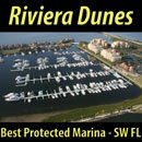
A CRUISERS NET SPONSOR, Riviera Dunes Marina Resort occupies the Manatee River’s northern banks, just east of the easternmost of three bridges crossing the river at Bradenton and Palmetto near charted Craig Point.


A very nice, comfortable social deck located so that it is in a “for boaters only area.”

Riviera Dunes provides stable, wide concrete floating docks. They make it so easy to board, clean and move around your vessel. Plenty of room for dock carts being used and for a nice casual walk around the marina.

And the wide fairways provide a comfortable margin while entering or leaving your slip.

Need to stretch those muscles, get all the parts moving again without the pounding of the feet or knees, then you know there is nothing like a nice swim. Riviera Dunes Marina has two separate pools, one for families where kids are welcomed, and one for adults only. Both are heated for winter comfort. So, these pools are ready when you arrive, to provide you with a comfortable area for exercise and or pure relaxation.

Arrive hungry and take advantage of the onsite Dockside Social Bar and Grill. The name says it all. A local dining favorite, where you may enjoy views of the marina while dining inside or out in the open-air atmosphere.
The Cape Coral Cruise Club is a group of dedicated cruisers who always provide unique reports from the marinas they visit. And, of course, several CRUISERS NET SPONSORS will be visited in their 2019 spring cruise schedule: Legacy Harbor, Pink Shell Resort, and Fishermen’s Village.
LEGACY HARBOUR CRUISE JANUARY 2019
By Mike Stewart
Ahh, good old bitter cold weather with high winds…perfect cruise conditions! Seems like a January constant.
Legacy Harbour dock hands helped six boats to their berths on Tuesday, with two more boats arriving on Wednesday. The cruise leaders, Mike and Brenda Stewart, he with a shoulder replacement and she with a knee replacement less than a week away, left their boat at home and took a room in the Legacy Marina Hotel and Suites for the three days of the cruise. It took the Jettons, their two guests and two hotel employees to unload the Stewart’s car’s load into the room!
The hotel room was most fortuitous as it served the group as respite from the brutal weather conditions. “Heavy” hors d’oeuvres, provided by the cruising ladies, were eagerly downed by the bone-chilled cruisers, who then escaped to the hotel room for cocktails and tales.
Wednesday morning showed no warming trend so everyone gathered in the Stewart’s room for scrambled eggs, sausage, muffins, bagels, fruit and orange and tomato juices prepared by the cruise leaders, with early rising sausage chef Pete Oiderma. Couples Scavenger Hunt III was explained after breakfast. The couples had until 11:30 AM to return with their collection of items off their boat. Again, ingenuity and creativity were encouraged. The participants returned and each submission was documented and “inventive” items were agreed on or rejected by the group. Score sheets were left behind for Mike and Brenda to tally scores and determine First, Second and Last places to be announced with prizes to be awarded at 4:30 PM at happy hour.
At 4:30 the hotel room again filled with boaters. After some time for everyone to warm up a bit, it was time for contest results. First place was Moonlighter, Lee and Brenda Jetton and guests. Second place was Semper Paratus, John and Patti Queen. Last place was claimed by Spoiled Yacht’n, Armond and Pam Sikes. Prizes were in large bags and a blind pick conducted according to placing. Deals were struck on trades afterwards and everyone was happy.
Thursday. Oh well, just repeat Wednesday without the game! The weather relented some, so there were a couple of hours later in the day that negated the need for layered clothing. It was ideal weather for lunch and exploration downtown.
It was back to the Stewart’s for cocktails before dinner at Pincher’s. Cruisers were joined by car attendees, some of whom had also joined the group for breakfast/cocktail activities. After some cancellations, we ended up with 26 attendees. We had a long table in a side room shared with a yacht club. Yes, it was loud!
On Friday everyone left by boat or car and peace returned to Legacy Harbour.
The Cape Coral Cruise Club is open to new members who own a boat with overnight accommodations and reside in the Cape Coral / Ft. Myers area. For membership information please contact Phil Kryger at 239-541-0236. Read additional Club information on its website, www.c-c-c-c.org Like us on Facebook.

Click Here To Open A Chart View Window, Zoomed To the Location of Legacy Harbour Marina


Comments from Cruisers (2)
Redundancy is not an option for us but a must !! I will always have paper charts and will record my location on a timely basis depending on course speed.
Winston Fowler, Cruisers Net
Thank you! This explains our crazy experience a few days ago with our anchor alarm! Although the experience made us go back to taking bearings as part of our engine shut down/anchoring. Easy to get complacent when we rely too much on GPS.
Michele Kastler