A Delivery Meant To Faill – Loose Cannon
Cruisers Net publishes Loose Cannon articles with Captain Swanson’s permission in hopes that mariners with saltwater in their veins will subscribe. $7 per month or $56 for the year; you may cancel at any time.![]()
![]()
![]()
![]()
![]()
![]()
![]()
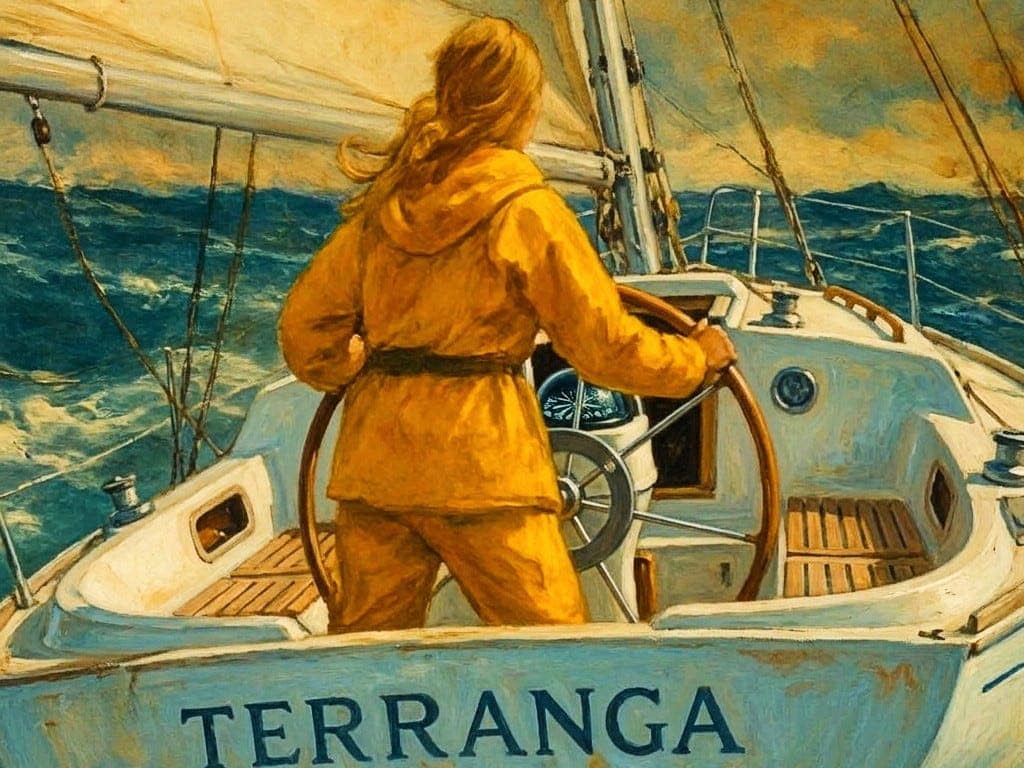
When all else fails, try journalism. The author is a longtime professor of Psychology and Communications. She landed in Vermont in 1987 after a decade of cruising under sail. This is an excerpt from her forthcoming book tentatively entitled “Jenny: A Night Sea Journey.” The sloop is called Terranga, a Beneteau 38. Double handed delivery—I’m hired in Falmouth (“foul mouth”, as I call it in American) to double-hand this thing on it’s second leg of a voyage, Las Palmas Canarias to Port Leucate in Mediterranean France. An hour or two later I learn the hired captain isn’t with a company, but directly hired by the French owner. Captain started the delivery from Abidjan months earlier in a decent season but had “some issues” and ducked into Las Palmas, waiting for spare parts. Now, it’s November, going on December, and England is cold and drizzly. It’s late to sail this route—but a lungful of air scented by palm trees sounds good to me. I ask, what’s the rush, wait til season? Owner has some sort of tax concerns. Needs the boat back in France ASAP. Later, much later, I learn that this boat name is from the Wolof people of Africa. It means welcome, hospitality. Ancient concept of graciousness: Of a gift given, of trust and the kindness of strangers. Later, much, much later, I learn a harder lesson to hear: that sometimes your captain doesn’t want to make harbor. Sometimes your boat owner has another plan, of which the hired captain is party, but crew naive. Kinda like when the president of your democracy turns out to be Agent Krasnov, okay? Like I said, much, much later, I learn stuff. So, at the time I’m only 19 and I have the heart of a lion and I don’t doubt my skills too much, and I have great faith in the ocean and Mother Nature, and I take on the assignment. It’s so delicious to get out of England, the fog the crud the heaviness and all the brick and silver and mold! I get off the plane ecstatic and in wonderment to breathe in the softly scented airs. I am in love with the Canary Islands. Sadly, I will only have a few days here, as we outfit the boat a little more before we embark on next leg. But I meet this cool couple down the dock while I’m grabbing lines and mixing epoxy daubs and doing inspections. He is Brit man and talks as if he’s got grapes in his mouth, He’s a retired orthodontist or maybe like a dentist but with a fancier title. She is his Spanish flame, and she is HOT flame, walks in spike heels down the dock and has sparkling little diamond earrings and laughs with full toothiness and courageously (for boaters) wears a white lace mini crochet singlet all the time. Ordinary people would get grubby but she pulls it off. I worry she won’t find cruising life to be as glamorous as she imagines. So, we have a glass of wine and I learn so much about them. not as much as i’d like to know, but enough to know that I don’t really need to know much more anyway. They ask me to jump ship and sail with them across the Atlantic to the Virgin Islands, but I feel duty bound. I am obligated to do this Beneteau trip already. The hired captain paid my ticket here. I can’t just do that, abandon ship. So, the Cap and I finish up in a couple days getting the Beneteau more or less ready. Everything I notice in my survey is taken sourly, even though it’s not even his boat. He is not the world’s most objective individual, shall we say. I start to wonder if he is ego blind, or if he is just an irresponsible bad sailor. I hope it’s the former, not the latter. Although, both are so often intertwined. He’s awfully vague when anything practical comes up. But we have our onions, our opinions, and our potatoes, our fuel, all the bits and bobs for self steering gear from the aborted prior leg, and the winds are fair, so we go. We go up the coast, doublehanded for a few days with wind on the beam and then on the nose. I start to wonder about the boat as I check the bilge pump somewhat compulsively only a little water but in my mind there should be NONE. I stay in the cockpit the whole time, taking my watches as needed, because I really don’t want to be down below with my tummy so funny. It’s as if my tummy and the bilge are married and both taking in water. Which shouldn’t be there. I don’t trust mechanical stuff for the most part, so the electric bilge pump does not comfort me. I have a mental eye on the buckets. Three, 3, 3, 3, 6, 6 that’s our watch schedule. I make hasty fry-ups of potatoes and onions. We fart in our oilskins. It’s a very wet passage, lots of heavy water over the sides but good scuppers—no problem. I tell myself that’s the source of the bilge water. Luckily, the battery keeps the pump purring. Even so, I keep an eye on the buckets mentally. Not sure where the water’s shipping from. Strong tea. Whenever I see Cap getting a scowl on. He jokes. “ Ask the committee what to serve up!” Well, my committee says, hot strong black tea. Thanks. Maybe a week goes by, he’s doing a decent job with the navigation, even though it’s not that hard to dead reckon as we claw up along the coast of Africa. We have a little discussion as each time he emerges from his sleep. I am clawing seaward and he seems inexplicably to want to hug the shores. Keeping a tight logbook of every tack and variation on wind direction and the knot meter, I learn that this modern design and our very light condition doesn’t point all that well in heavy seas. It seems to me that the fine bow entry and the bulging midships aft seem to get nudged aside instead of just settling down and tracking and trudging along. One night I begin to smell land: Morocco! Fabled origin of films like Casablanca and music like Marrakesh and exotic oils like argan, frankincense, foods like figs and animals like camels! We are now approaching the straits of Gibraltar, as dawn breaks and I see unforgettable streaks of sandy skies and a crescent moon and peachy pink and rosey mauve and the palest blue and the dawn mists of golden blowing sand reveal the bones of a massive wrecked hull of a World War II ship, stranded and rusting on the beach all these decades I am so taken aloft that I actually grab my pastel chalk from my knapsack and scribble some marks, a pitiful poem Trying to capture this Trying to capture this stranded ship with rusting ribs So high up on the shore, bow aslant it’s as if they’d driven it ashore And this crescent moon While my hands, wrinkled from the seawater, the paper damp and crinkled, but my mind and heart wide are open as if I could hear the music of the land and the strange mix of salt and of sand together… But the clouds say, truthfully: You are in for it. YOU are but a leaf on a stream and guess what: We are going to blow, blow, blow. Before long. And they did as we approached the strait. I said, we could reach to Cadiz, wait for it to blow over. Cap says, “WE HAVE TO DO THE STRAIT TONIGHT.” No explanation. No reason i could discern. I say, well…okay to do that and clear this bluff, but we need to have the engine and the jib and the main furled. He doesn’t say yes. Just vanishes below for his six-hour snooze. But I take a minute, seeing the moon rising like that over the desert, and I think, I’m a little too young to die yet, but let’s go. So, I make what I would now call an executive decision, and I reef the main and use the smallest jib and sharpen up and hack the engine just to about 1400 to 1700 revs, just enough to help us make our point. Also, to keep our battery fresh to handle that mystery bilge water. Sails are doing most of the work with just a nudge from the motor. He comes up like a groundhog from some deep sleep into the wind and says “WHAT THE HELL ARE YOU DOING?” I say, mildly, I think it’s called motorsailing. He looks disgusted, but there’s hot tea and he subsides. I say the word “Cadiz?” (you pronounce it as Hadeeth), and he is unusually precise and furious. NO. Okay, I’m only crew. The goal is to get into Gibraltar harbor, so okay WE SHALL. And we round the point into a full on gale building up called, according to my favorite radio thread ever, BBC weather radio, a Levanter. Force 7, Force 8, Force 9 and building. All the big ships are coming downwind against us. I tack, I dodge. No ships are going our way. NONE. Not a one. This becomes painfully apparent in the next eight hours. We tack up the channel, such a narrowing channel it is: so many giant ships. As it grows dark I feel less and less confident. A tiny voice in my head seems to whisper louder than the howling rigging. Why isn’t the captain helping me dodge these behemoths? Our radar reflector is dangling in the shrouds. Can they even see us? None of them are talking to us on VHF. This is weird, Is the VHF working? He’s vague about this and scoffs, “Well it’s not as if they could change course anyway, is it?” He has a point there actually. So, it’s us bouncing from the wake of one to the wake of another, all in the night. Well, sometimes you can’t control the circumstances. You just have to do the best you can. We got through around midnight. A calm bay, astonishing—how can this be true? Just the orchestra of wind on the rigging of a hundred boats. Under this legendary rock we slid into a dock, and, before I had even finished coiling lines, the Customs people were aboard. They had many questions. I slipped into the head and whipped my greasy 10 days of hair into a ballerina bun and shed the oilskins and put on the softest cashmere woolen sweater dress god ever made and emerged feeling refreshed because i’d had a splash of fresh water on my face. They checked our passports and proceeded to rip all the galley to shreds and empty the canisters as if looking for drugs or something. As if! I felt insulted, but also embarrassed, realizing I didn’t fully know what might be the case. I had a feeling of unseen agendas, so uneasy. Like an unwitting bystander when a bank heist is happening. Next day, we set off again with a fresh bag of potatoes and onions I had hastily grabbed from the nearest vendor. I surreptitiously check the bilges again. There’s only an acceptably small amount of water now, I surmise that as long as the engine stays true and the bilge pump keeps working we will probably be okay. And we’re heading into the relatively protected waters (hahaha) of the Med Sea now. I say a small prayer to my father’s trimaran Triffid that sunk here in 1966, shattering into smithereens his dream of a transatlantic voyage, after an unfortunate collision with a fishing boat which “underestimated the speed of a multihull.” The hired captain of Triffid was an Aussie named Herb Gardner, which name alone earned him so much grace. I would meet him later, decades later, in Australia and give him supper on our 18-foot boat. Alas, again, only much much later do we realize some things. True things about life. The next days are fine, we claw towards the bay of Lyons, leaving the cliffs of Spain, so arid, to port, a place I imagined where the mystic Manly P. Hall had scribed his “Secret Teachings of The Ages,.” Port Leucate is not far beyond. I feel hopeful and sure even though the gathering swells are so massive and so deeply blue as to be purple. I think of the wine dark seas in the Odyssey and how this water seems half solid, as if thickened by blood of all the sailors who have drowned here, all the wars that have been fought and suffered. I feel lucky, and privileged. I check the bilge. It annoys the captain. I do it anyway. So far the pump is keeping it under control. The committee keeps serving up food and tea without anyone needing to ask for it first. We approach the Balearics. “Is that a rock,” he asks, with a strange eagerness. He decides we shall cut through that way to the harbor of Ibiza. I did not know we intended to land in Ibiza at all. I thought our course was straight to Port Leucate. It looks dodgy to me on the chart but, hey, I’m only the crew. We do it. I grab the helm at one point in the rocky bit, and there’s a little tension, but we manage it. That was really out of line by me. But, instinctive as a mother, I did. He sort of shrunk back into his oilies. We anchored and made merry with the locals, and I was again exhorted to join a couple other boats, jump ship and take better chances. The light spilled out all over the town, across the streets with doors and windows thrown open: Come in, have soup, listen to someone pluck guitar. This our world. I am sorely tempted. But I am stout and loyal and determined to see this boat through to Port Leucate. We leave and it’s a Mistral. Snowy peaks of the Pyrenees and I have developed a bad cold, and I cannot feel my limbs at all, so numb. I check the bilge pump. The engine is still working. Three days and nights beating hard. We get in to a deservedly deserted marina. The captain is inexplicably discouraged. Isn’t this victory? Over adversity? Shouldn’t he be as glad as I am? The skeleton crew of the resort brings us Pastis, a liquor that smells like licorice, and i dump it into my plastic mug of hot chocolate, toss it back with a smile of appreciation. They look at me and laugh, “maudit Americain,” but I have just won them over. But not the Customs people. They cannot believe we have sailed in here, against a Mistral with snow and ice in the gale. They are harsh. They tear the boat apart. I am too numb to care. I had again put on my cashmere and used some fresh water on my face. The next norning sun comes out, the way it will, as if nothing happened at all. Don’t you hate that? Blue sky, fresh mountains covered in snow, peaks all peaky, everything bright and jolly and fresh, while you feel you’ve just been gnashed and digested and spit out in pieces. Maybe that was due to the Pastis in my Hot Chocolate. The boat is strangely sinking at the dock because we ran out of fuel now, and the captain doesn’t seem to care. I can’t suss it out. I am very ill, now, some kind of flu. The skeleton crew takes me into their empty cafe and feeds me the most exquisite soup of some red clear fish broth, the best medicine I have ever before or since tasted. I drink it up. We watch a TV mounted on the ceiling wall: “The Wizard of Oz” in French. The next morning, the owner is supposed to arrive so we can scoot. But it’s only a woman and her daughter, maybe eight years old. The captain and the mother sit in the cockpit of Terranga and argue vociferously in French, and I sit down below with the child who is practicing her best english. Politely, she says, “My father is very surprised that you have arrived. He told us you had sunk out at sea.” “Excusez moi? He said what?!” “He is…angry. He said that we do not have a boat anymore.” Fast forward, a year later: I am rowing my dinghy across the basin at Coconut Grove when a soprano voice calls out “Genoveva!” It’s the Spanish glamourpuss from Las Canarias, except now she is barefoot and looks wonderfully free of cosmetics. Cruising life agrees with her! I go aboard and they cover me with kisses and hugs. They tell me they had believed I was lost at sea because apparently… That same captain had subsequently lost another delivery boat in the North Atlantic. He had drifted by himself for three days in a dinghy, then rescued, but his crew was lost. I felt the way you feel when you wake up from a dream. A dream you didn’t really love, but perhaps this life was the one you wanted to live. Reality. Bites. Oh, yeah, and speaking of bites: We didn’t get paid, the captain said. So, I left with six tins of sardines in my pockets and a canister of Cote D’Ivoire coffee. LOOSE CANNON covers hard news, technical issues and nautical history. Every so often he tries to be funny. Subscribe for free to support the work. If you’ve been reading for a while—and you like it—consider upgrading to paid. |














Be the first to comment!