Fran is expressing exactly the frustration that we are experiencing here in Charleston. More and more development on our coastal islands is underway without adequate supporting construction of roadways and bridges to accommodate the resulting increase in vehicle traffic. Until planners either wake up to the downside of rampant development, drivers and boaters alike are going to continue to suffer long waits during rush hours or in emergency evacuations. SSECN asks, that as you confront fewer and fewer bridge openings, please be patient! Rarely is delayed vessel travel as dangerous as miles of backed up idling vehicles. And DO NOT yell at the Bridge Tender! It is NOT their fault. If you want to yell at someone, yell at the developers and city planners! Fran is responding to an earlier comments on Ladys Island Bridge in Beaufort, SC.
I live on Lady’s Island and work in Burton. If anyone traveling from Beaufort to Lady’s Island or the outer Islands thinks there is NOT a traffic problem when this bridge opens and closes, they are delusional. I’ve lived at my residence since 1976. The growth on the Lady’s Island side is enormous and once the Wal-Mart is built, it will be a nightmare. It [congestion] already is when the Woods Bridge breaks down. The McTeer Bridge is not adequate to accommodate traffic to or from Lady’s Island, St. Helena, Fripp Island, etc. The only solution to this issue is to build another bridge or limit the bridge openings. Traffic backs up well beyond Bellamy Curve during rush hours in the evening. I can’t even imagine what traffic is going to be like should a hurricane head to Beaufort. Well, actually I can. During Hurricane Fred it took two hours to get from Lady’s Island to the National Cemetary on Boundary… and 11 hours to get to Atlanta. People will need to evacuate Beaufort a week in advance of hurricane at the rate the population of Beaufort is growing on the Lady’s Island side. Fran H
Having driven in the area, too, I certainly agree that the bridge is a major bottleneck for road traffic. But it’s equally a nightmare for water traffic. I remain amazed that a fixed bridge hasn’t replaced the swing bridge. I understand that finding a suitable site, that doesn’t harm Beaufort and the community on Ladys Island will be a challenge. Nonetheless, it’s something South Carolina should have done years ago.
In the meantime, we will continue to avoid the area, which currently effectively blocks the AICW rather than find a solution that serves land and water traffic.
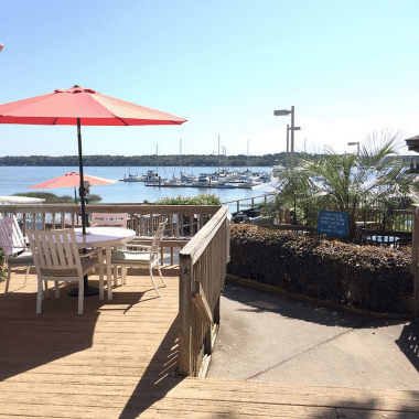
As Claiborne would have said, news of good food is always welcome! So we thank Bob and Susan Crenshaw for these good words for a new Georgetown restaurant, especially as this lovely port is recovering from a devastating fire in 2013 that destroyed a number of waterfront cafes. Harborwalk Marina, A SALTY SOUTHEAST CRUISERS’ NET SPONSOR, is the northwesternmost marina on the downtown Georgetown/Sampit River waterfront.
Cruising News Great new restaurant in Georgetown DiAngelo’s We just had a wonderful dining experience at DiAngelo’s on 929 Front street in Georgetown. We had opportunity to meet the owner, Pat DiAngelo and his wife Debbie. Also the chef, Tony came out and introduced himself. A.J. was our server. Wonderful home made Italian food that was fantastic. Chef Tony prepared us a sample of his yet unnamed dumpling gnocchi dish that was fantastic. Then to top off the nite he brought us some samples of Zeppoli, an Italian doughnut that melted in your mouth. These are wonderful people who need to be supported to make their business successful. The owner, Pat, was very gracious and appreciative of his customers. We cannot recommend a better dining experience than one we had. The kicker is that Chris, Dockmaster at Harbourwalk recommend we try them out. You will not be disappointed. Bob & Susan Crenshaw Carolina Girl
This Problem Stretch is perennially the source of shallow water reports and over the years we have received numerous complaints of skinny depths in this narrow Waterway channel, from south of the intersection with Jeremy Creek and McClellanville to Statute Mile 435. As always, SSECN recommends mid to high tide passage if you draw 5ft or more! Our thanks to Captain Bob Crenshaw for this onsite report.
Cruising News Extremely low water at SM 430 between 430 and SM 432 at Jeremy Creek We were coming north in our 42 trawler with 4 foot draft and encounter extreme low water with ranges from 4 to 6 feet. This occurred between SM 430 and 432 at Jeremy Creek near McClellanville. We had to monitor depth finder and pull back to idle speed as we mover thru the low water. This occurred at two hours before low tide. It was extremely nerve racking trying to find the deep water. When we arrived at our destination at Georgetown we were told,that two boats that had planned to stay at Georgetown had called in and said they had gotten aground in this area and had to wait for tide to come back. We are unable to provide safe path in this area except monitor depth finder and try to search out low water. Carolina Girl 42 Trawler Captain Bob Crenshaw
Located on the western shore of the Stono River just south of the Waterway’s passage out the western/southern mouth of Wappoo Creek – Elliot Cut, and only a very short cruise from Charleston Harbor, St. Johns Yacht Harbor is A SALTY SOUTHEAST CRUISERS’ NET SPONSOR! By boat or by car, it is worth a trip just to see these beautiful facilities with probably the nicest Captains’ Lounge and Clubhouse on the east coast!
Very nice, clean facility. Friendly and helpful staff. Convenient location. Grocery, drug stores and restaurants close by with courtesy car provided. Current can be tricky when tide is running,, but staff will assist with lines when docking. Will stop here again and recommend it highly to others. Capt Jack B-H and 1st mate Steve O. Aboard the trawler “Whatever”
Hilton Head Harbor RV Resort and Marina overlooks the Waterway’s southwestern shoreline opposite marker #20, north of Calibogue Sound.
Hey all I stopped for 3 days due to sickness and Jack and Bourbon were both friendly and they checked in on me regularly. If your looking for good food and a good nights sleep give them a try. The restaurant was pricey but the food is great and the ladies will go the extra mile. I was so sick and the restaurant gave me a big bowl of soup and would not take a penny. If you stop make sure you have a biscuit for Bourbon, Jack’s Labrador and give him a hug from me. Before you leave don’t forget to top off your tanks as the fuel is the lowest price around. M&M’s Delite
This article by Prentiss Findlay in Charleston’s Post and Courier is a second follow up to his earlier piece on much needed dredging in the Problem Stretch at Isle of Palms area of the Waterway, /?p=150352. As before, SSECN recommends SLOW passage at mid to high tide.
Inland Waterway at Breach Inlet to get long-awaited dredging Prentiss Findlay Prentiss Findlay Email Facebook @prentissfindlay Nov 13 2015 12:26 pm Nov 13 4:50 pm The Intracoastal Waterway at Breach Inlet will be dredged to improve navigation. Dredging of the dangerously shallow Intracoastal Waterway at Breach Inlet between Sullivan’s Island and Isle of Palms begins this week, the U.S. Army Corps of Engineers said. `It’s long overdue,’ said Charleston County Councilman Dickie Schweers. The county contributed $500,000 to the nearly $3 million effort which includes work in McClellanville to dredge a waterway channel for fishing trawlers. Some $2.4 million in federal funds has been authorized for both projects. `This project is a prime example of how collaboration between federal and non-federal partners for dredging can lead to increased waterway maintenance,’ said Brad Pickel, executive director of the Atlantic Intracoastal Waterway Association. The waterway at Breach Inlet is almost dry at low tide because of shoaling, a condition in which sand builds up and blocks the channel. The authorized channel depth is 12 feet and the width is 90 feet. Waterway dredging at the inlet will last about a week, said Glenn Jeffries, Corps spokeswoman. Mile-long Jeremy Creek in McClellanville, which is part of the waterway, will be dredged starting in mid-January, Jeffries said. `This schedule is tentative. Weather and machinery have a lot to do with a dredging schedule. But we will start in Breach Inlet for sure,’ she said. The last substantial funding the Army Corps received for waterway dredging was in 2009 through the American Recovery and Reinvestment Act. Waterway conditions at Breach Inlet at low tide have been blamed for boating injuries. `There’s just been a huge safety issue out there,’ said IOP City Administrator Linda Tucker.
A Mount Pleasant woman was seriously injured in a 2013 boating accident blamed on the shallow waterway. She was traveling in a 44-foot trawler drawing 3 feet 10 inches of water that hit bottom. The impact caused her to fall. Doctors determined she had a fractured vertebrae, a concussion and a broken rib. She spent two nights in the hospital, officials said. IOP Marina and Charleston City Marina lose customers because recreational vessels often go offshore to avoid the waterway here, said IOP Mayor Dick Cronin. `They just basically have bypassed our marina and the city marina to a large extent,’ he said. Sen. Lindsey Graham’s office was instrumental in getting funds for the dredging, Cronin said. `We had appealed to everybody and their brother,’ he said. In McClellanville, Jeremy Creek is the route to two seafood processing plants. But it has become a muddy mess that idles trawlers for long stretches of the day, said Mayor Rutledge Leland. `It’s getting worse and worse. Every time you see a boat moving anywhere from half-tide on down there’s mud boiling up behind it,’ he said. After dredging, the creek will be eight feet deep at low tide, he said. `That should help for a couple or three years anyway. It will start silting immediately. We’ll have to start arguing and lobbying and begging almost as soon as they get through but that’s the way it works to get ourselves into the next budget,’ he said. The creek was created from mud flats as part of the original waterway project, he said. Some states, such as Florida and North Carolina, have dedicated funding for waterway maintenance. The Florida Inland Navigation District collects about $20 million annually to pay for waterway maintenance in 12 counties. North Carolina funds waterway maintenance through boater registration fees and the gas tax.
Intracoastal Yacht Sales, a long-time SALTY SOUTHEAST CRUISERS’ NET SPONSOR, offers full service brokerage representation from three locations, Wrightsville Beach, NC, Little River, SC and Charleston, SC.
Get Free Electronics When You Purchase Your New Boat! Purchase any one of our Stock Boats, or Build your very own boat between Now and January 1, 2016 and get a FREE Chartplotter, Autopilot, and VHF Installed at no cost to you! Pick the brand you like and have us install it for you at no charge!
Garmin 1040xs Chartplotter $2,099.99 Value FREE
Garmin VHF-100 Marine Radio $249.99 Value FREE
Garmin GHP20 Autopilot $4,049.99 Value FREE
34 Nordic Tug – In Stock Now
31 Marlow-Mainship Available Now!
CLICK HERE For a Virtual Tour of our 34 Nordic Tug In Stock Now
CLICK HERE For More Information on our 31 Marlow-Mainship Available Now! NEW AND BROKERAGE BOATS AVAILABLE
Ladys Island Marina, A SALTY SOUTHEAST CRUISERS’ NET SPONSOR, continues making improvements in the marina portion of this property under the direction of owner, Kelly Ryan, as confirmed by the positive comments SSECN has received. Ladys Island Marina is located on Factory Creek just east of Ladys Island Bridge.
Ladys Island Marina Arrived to a rousing welcome of “welcome home”. As you recall we were here last spring for a month. What a wonderful place. All needs are close and everyone here is very friendly. Shopping area for projects and lots of eateries very close. Love this place. Phil and Sandy Herl
This good advice was forwarded to us by Hank Pomeranz at Carolina Yacht Care of Southport Marina, A SALTY SOUTHEAST CRUISERS’ NET SPONSOR! Skipper Wehmer has been communicating with Hank about Problem Stretches he had encountered. Funding for dredging the Problem Stretch north of Ben Sawyer Bridge has been approved but has not yet begun. See /?p=149544. SSECN continues to recommend mid to high tide passage for this stretch.
Hank, From connector bridge to Ben Sawyer: Favoring the red side found more water as suggested. At G117A and B a sailboat in front of us drawing 6.5′ went aground staying to the far red side. They had approx. 1.5′ of tide. They radioed us and suggested to stay 40′ off of those buoys, which we did and had about 8′ MLW. For the balance of the passage, the notes you provided were good. If you draw 6 feet or over, we recommend waiting until there is at least 3′ of tide before making the trip, however, other than grounding next to 117A, the boat in front of us made it through with 1.5-2′ of tide. We are going to try to go outside from here to Fernandina, but if we do not, I’ll send you what we find. Bill Wehmer S/V Island Bound
This good advice was forwarded to us by Hank Pomeranz at Carolina Yacht Care of Southport Marina, A SALTY SOUTHEAST CRUISERS’ NET SPONSOR! Skipper Wehmer has been communicating with Hank about Problem Stretches he had encountered. Funding for dredging between the IOP Connector and the Ben Sawyer Bridge has been approved and one can only hope that the Isle of Palms Problem Stretch will also be dredged. See /?p=149544. SSECN continues to recommend a high tide passage for this stretch.
Hank, We transited from Isle of Palms to Charleston yesterday. The stretch between IOP marina and the IOP connector bridge: Stay in middle as suggested. We strayed right of center to see how depths were and it shallows very quickly from center. Lowest spot we saw was about 50 yards before the bridge at 3.4 MLW in the middle of the channel. Otherwise we saw 7-10′ MLW.
We are going to try to go outside from here [Charleston] to Fernandina, but if we do not, I’ll send you what we find. Bill Wehmer S/V Island Bound
The Harborage at Ashley Marina lies along the northeastern shores of Ashley River (on the Charleston peninsula), between the charted 56 foot fixed bridge, and the 18-foot Highway 17 bascule bridge.
Ashley Marina Arrived at Ashley on Sunday 10/11/15, the tide was still rather strong and we had a small problem trying to get docked but we did get docked. Monday. We wanted to see as much as we could, so we hit the Visitor Center first and then walked across the street to the Carolina History Museum. Spent about 4 hours in all. Both are very good and would highly recommend both for any visit. Tuesday. We hopped on one of the free trolleys that are about 20 min walk from the marina and again went down to the Visitors Center, changed trolleys and traveled to Market Street. Again this was more than we realized it would be. We ended up spending almost 3 hours there and then walked down three blocks to Sticky Fingers for a big batch of ribs, corn on the cob, baked beans and drinks, Wow. Very very good, so good we decided to walk some more. On the way we were asked to be shown a Methodist church that is the oldest Methodist congregation in Charleston. That was an unexpected pleasure. John guided us hrough the entire church, including areas we don’t usually get to see. We continued our walk and ended up walking all the way back to the boat, boy were we pooped. Wednesday, we took the city tour and then the Fort Sumter tour with the boat ride. We have been told you could take your own boat out to the fort but after looking at the docking at the fort and the current I would suggest you just take the tour. It’s simpler, you don’t have to move your boat and above all it is safer. Sunday after boat shores day and a trip to the drug store we are heading to Ladies Island. Phil and Sandy Herl
This report on the Waterway from Oriental, NC to Beaufort, SC comes from longtime Cruisers’ Net Special Correspondent, Captain Jane Tigar. Note especially her observation about reduced bridge clearances. Over the last several years, Ladys Island Marina, A SALTY SOUTHEAST CRUISERS’ NET SPONSOR, has been undergoing big improvements in the marina portion of this property under the direction of owner, Kelly Ryan, as confirmed by the positive comments SSECN has received. Ladys Island Marina is located on Factory Creek just east of Ladys Island Bridge.
Hello Larry From Michael Tigar and Captain Jane, now on M/V Tara We went from Oriental to South Harbour Village and then from SHV to Ladies’ Island Marina (Beaufort, SC) in these past two weeks. We did not see any debris other than a large floating log in the Waccamaw — but those show up there at other times. The rivers are higher than normal, and boaters should indeed watch the effect of wakes on homes and docks. The higher than normal tides in Charleston and on South to the Coosaw meant that bridge clearances were less than optimal. The McKinley Bridge, MM 501.3, showed only 61.5 feet as we passed, and two large catamarans were waiting for the tide to go down. All in all, a good trip. Second item — Hertz in Beaufort SC will deliver a car to Ladies’ Island Marina if you give them notice and it is during their regular hours (before 5pm). “Yes Indeed Thai” restaurant on Boundary Street was a really good place to eat. Best Michael and Captain Jane
As in an earlier posting from Beaufort, SC, where onshore properties are being damaged by passing wakes (/?p=153100), residents in the area of the Socastee Bridge are asking for No Wake! SLOW DOWN and help these folks recover!!
Winston, FYI. The Coast Guard, SCDNR and local agencies are safe guarding the lower ICW near Socastee Bridge. Homes have flooded and wakes are getting into them from boaters. I couldn’t find anything online, but thought you might have heard something. I did find this in the Sun News of Myrtle Beach.
We have friends who own a home directly on the ICW a quarter of a mile north of the Socastee Swing Bridge. Not only are people in boats creating large wakes that damage the homes and properties, some people are using boats to loot the properties.
I’ll leave out what I personally think of anyone who would take advantage of someone’s misfortune by stealing from them, but those who must be on the water for a legitimate reason really should travel at no-wake speed whenever they come near homes and businesses.
Good news about so little debris in the Waterway. Let’s hope it stays that way. Harborwalk Marina, A SALTY SOUTHEAST CRUISERS’ NET SPONSOR! is the northwesternmost marina on the downtown Georgetown/Sampit River waterfront.
Harborwalk Marina Left Osprey and headed down the ICW, water was extremely high, up to 4 or 5 ft above normal high tide. Surprisingly we did not run into a lot of debris on way to Georgetown, just took it slow and watched for any objects on the water. No problems at all. Again Georgetown is a good place to stop. All the shops are within walking distance and all are interesting to visit, not to mention all the good food. The crew here at Harborwalk as always are great. Phil and Sandy Herl
With the current weather conditions, this is almost adding insult to injury to Waterway cruisers. HOWEVER, high water wake damage can be severe, not only to docks, but to onshore buildings as well. So slow down in those populus docked areas along the Waterway. A SALTY SOUTHEAST CRUISERS’ NET SPONSOR!, Downtown Marina is located north of AICW marker #239, a short distance west of the Lady’s Island swing bridge, in the heart of downtown Beaufort.
Beaufort, SC Writing No Wake Tickets Be careful passing Beaufort, SC downtown docks. The police have a patrol boat tied up hidden in the marina and they are issuing no wake tickets to boaters. Dave Bell
The no wake zone that extends from Beaufort Marina South to the next bridge has been extended by two more no wake signs about a mile further South. The Beaufort no wake zone is already ridiculous but these new markers are at least half a mile from shore with no docks, wharfs or piers visible. What is the legality of these markers?
Osprey Marina lies at the southern foot of AICW section known officially as the Pine Island Cut (a. k. a. “the Rock Pile”), just as the Waterway sweeps south into beautiful Waccamaw River. Osprey Marina is one of the finest marinas you will ever discover, and these good folks are A SALTY SOUTHEAST CRUISERS’ NET SPONSOR!
Osprey Marina Arrived for fuel and to get tucked in for the weekend or until the circulation in the Atlantic has cleared the area. Topped off the tanks and while just holding the nozzle was talking to Miles. We both have the gout word in common. Once we were fueled and docked Miles said he would drive us to the clinic so I could get some medication. Thank You, Thank You Miles. I think I’m on the mend. As always Osprey has been great taking care of us. Day three and the rain is still falling in large quantities. So to pass the morning we gather for free coffee and snacks and conversation. Watching the bad weather shifting south, not good for anyone traveling south. I think we will stay a while longer. 10/5/15 Monday. It is Monday and all the water is high, so anyone between Southport area and Charleston area, if you are in a spot you can stay, stay where you are it is not safe on the ICW with all the trash floating in the water. Be safe. We are talking to others in the Marina and we are all staying put for now. Phil and Sandy Herl
The intersection of the ICW and Lockwoods Folly has been a Problem Stretch for years and requires almost annual dredging. Mid to high tide is recommended for passage. For a recent report on Lockwoods Folly, see /?p=150841. A SALTY SOUTHEAST CRUISERS’ NET SPONSOR! Myrtle Beach Yacht Club on Coquina Harbor has been a great stopping place and a friend to cruisers for years. The entrance to Coquina Harbor lies on the north side of the Waterway opposite Marker #13.
North Myrtle Beach
Another good run and luck is still with us. As we approached Lockwoods Folly area, notorious for shoaling, there was a Coast Guard boat at the spot getting ready to move the buoys. When we came through they contacted us and several others to talk everyone through and we had not a problem. As usual at North Myrtle Beach Yacht Club we were treated well. Again we could not do anything because of my foot. Just one night. We were here in June and had a great time.
Good music and good fun! Y’all come! Beaufort is home to SALTY SOUTHEAST CRUISERS’ NET SPONSOR, Downtown Marina of Beaufort, within easy walking distance of the Waterfront Park.
Please come and join us at Pickin’ by the River on October 17 from noon till 5 at Downtown Beaufort SC Henry C Chambers beautiful Waterfront Park. All acoustic bluegrass, country and folk music. Stage show and open jams throughout the Park. Please no amplifiers, alcohol or drums. Good family fun. For more info you can call (843)379-9084
Skipper Winter does indeed complement an earlier posting by Jim and Peg Healy, /?p=138583. Our thanks to John and Sue for this detailed narrative of their recent trip upriver to Conway. The upper portion of the Waccamaw River departs the Waterway at statute mile 375.
To hopefully complement Sanctuary’s posting, we just finished going to Conway and made the following notes. One can take these and mark the Healy’s maps, and add milage to them. the distances are not off more than a tenth at each junction: From ICW MM 375 just south of ICW marker `27A’: This is the last posting on any web sites that I have seen with any detail. We traveled this river this week and it is still a beautiful trip and well worth the extra time. It is even more beautiful than the lower Waccamaw. First, the Corps of Engineers have removed all markers above `R4’, and as such, there are a few spots that are confusing as to where to turn. Lastly, different postings on various web states the distance to downtown Conway anywhere from 12 to 16 miles without stating whether they are nautical or statute miles. Reset your odometer to `0’ for the following information. We use statute miles. From `G1’, the entrance marker, it is 14.3 miles to the last bridge (you do not want to go under that in a larger boat) and about 14 miles to the marina entrance basin. Just as Sanctuary recommends, go to the bridge to dock since it is an easy walk to town. The two floating docks are in decent shape, but the cleats are still a little loose, but there is no traffic or winds to bother you and if there was a huge blow, there are alternatives to tie up soundly ‘“ easy. The electric is still there but still no water. Call the marina for space (room for a 60′ boat at each dock, maybe longer). Also, repeating, when going into a curve, stay to the outside where the water is deeper. We entered at dead low tide (on purpose) so as to make better notes. The NOAA charts that end just above `R4’ are accurate. We saw 11-13′ at `G1’ and then before the first curve, 7.9′. After the first curve, it deepened to 9.0′ Just prior to the second curve, briefly 5.9′, but we were too much inside on the curve. Coming back down, we had over 7.5′. Hug `R2’. First curve after `R2’ was 8.3′. From here you will see depths well over 20′ in places. Just prior to `G3’, which is 1.9 miles in, 6.5′ and quickly deepens to 30’. MM 2.1 you’ll see many stumps on the RDB, but 8.1 feet as charted. MM 3.0 (`R4’) stay left at these intersections. MM 4.3, there are power lines that we do not know the height, but any motor boat will have no problems, but sailboats may (this statement applies to all power lines mentioned). They all appear to be well over 45′, but who knows. MM 4.7 at a private dock, make a left turn (it’s not obvious). MM 5.2 shallows to 8.6′ briefly. At MM 5.9, make a sharp left. MM 6.1, there are some nice homes to see, watch your wake. MM 6.9, favor RDB (starboard) for deeper water (7.5′, otherwise 6.0′). MM 7.6 some more homes. MM 9.4 is interesting. There is an upside down arrow sign that has the word `only’ upside down on it. Do not think this sign is upside down, it’s not. Whoever put it up, obviously did not have the correct sign. Make a sharp left here (yes, to port). If you go right, you hit bottom (we know ‘“ LOL). MM 10.0, another left turn where there is yet another upside down `only’ sign. MM 10.4-11.0, shallows to 7.4′ (this is where the river gets a little wider, so it makes sense the water would be shallower). MM 11.1 favor RDB where you get over 11′. Center is as low as 5.2’. MM 11.6, turn left. MM 12.1 is 6.6′ and there might be a very interesting river boat moored there. MM12.3, turn left at homes and docks. MM 13.2, overhead power lines. As you get to a high bridge, you are entering Conway. From here on in, it is no wake. You will see to your left the entrance to the marina basin around MM 13.9. Go past this to the floating docks on your left. They are obvious, just before the bridge. Call the marina for docking, but if no answer, don’t panic. If you are there just for a few hours, docking is free. The river walk is beautiful, and many great places to eat and shop. See the college (Coastal Carolina) ‘“ it is also very nice. One could easily stay here for a few days, so if the weather is not so good, and you have stopped at Georgetown enough, then this is the place for you. It takes about 2.5 hours (max) to do the river one way on a trawler. Sue and John Winter on Just Relax (MTOA, Golden Loopers, AIWA members)
Port Royal Landing Marina, A SALTY SOUTHEAST CRUISERS’ NET SPONSOR, is a perfect example of true Southern hospitality and of a marina family that cares about boaters! Port Royal Landing Marina guards the western banks of Beaufort River just south of marker #244.
Port Royal Landing Marina welcomes you and your crew! The delightful hospitality that you find in the Low Country of South Carolina is often referred to as “The Royal Treatment” here at Port Royal Landing Marina. Our staff is available and anxious to do everything we can to exceed your expectations of quality and service. It is our goal to make your stay at PRLM the most pleasant marina experience you have on your trip. We intend to be the standard by which you judge all other marinas along the waterway. CLICK HERE for a video introduction to Port Royal Landing Marina.
Royal Treatment Slow down, sit back, and relax. Stay another day or two. Enjoy the surrounding historic area, our facilities, and our service. Take advantage of our location between the two historic towns of Beaufort and Port Royal. Get a large dose of that Low Country “Royal Treatment” and we believe you too will find us habit forming! Problems? Let one of our knowledgeable staff members help. We can’t solve them all, but when we cannot, we will make every effort to find someone who can. CLICK HERE for bios of the Port Royal Landing Marina Staff
Historic Port Royal and Beaufort When berthed at our marina, you are surrounded by history. Jean Ribaut sailed into the Port Royal Sound in 1562 and wrote to his sponsors in France that there was “no fairer no fitter place.” His way of saying “it just doesn’t get any better than this.” He liked the area enough that he established the village of Port Royal that same year. Beaufort is a relative newcomer, chartered much later in 1711. Today, these two historic towns are separated only by the width of a sign post at the Burger King on Ribaut Road, which runs through both towns. This entire area is known for some of the finest hospitality in the South. We will be glad to make dinner reservations for you or to provide information on any of the many attractions in our area. There are many magnificent antebellum homes along the water and on Bay Street in downtown Beaufort- some of which are open to the public, such as the John Mark Verdier House. Even those that are not open to the public are still worth a trip by foot, bicycle, tour bus, horse drawn carriage, or our courtesy car to take a look at their magnificent pre-civil war construction. The area, and specifically some of these homes, has been host to a number of award-winning movies such as Forrest Gump, The Big Chill, The Prince of Tides, and The Great Santini (The last two were written by local author Pat Conroy). In fact, in the closing scene of The Prince of Tides, our marina can be seen as Nick Nolte rides over the adjacent bridge. In addition to the antebellum homes, there are several pre-civil war churches, the Beaufort Museum, fine antique stores, horse and buggy rides in the downtown area, tabby ruins at Old Sheldon Church and Dataw Island. Beaufort also features Hunting Island State Park, Parris Island, and the Penn Center, where the native Gullah traditions and language are preserved and nurtured. We will be glad to give you directions, provide you with maps, lend you the courtesy car, or drive you downtown to get started.
On-site Facilities: Ship’s Store– Located landside, you will find our ship’s store stocked with many marine items that you may need. We are a Land-N-Sea overnight order center. Should we not have what you need in stock, our 25,000+ item catalog probably does. Orders in by 3:00 PM are delivered around noon the next day with no freight charge to you. Deliveries are made Tuesday through Friday. Courtesy Car– The marina has a courtesy car available for your convenience. It is available for short trips in the area during normal marina hours. ATM machines, grocery stores, pharmacies, auto parts stores, medical facilities, banks, churches, golf courses, and shopping in downtown Beaufort or Port Royal are all just a short ride from the marina. We can provide you with a map and directions to any of these locations. Dock Carts– For ease in moving those supplies up and down our pier and docks, we have available a number of dock carts for your use. Also, if you need some additional hauling power, we can help with one of our golf carts. Just let us know! Shower and Restroom Facilities– Clean, code secured, well-lit showers and restroom facilities are located adjacent to the ship’s store. Detergent, toothbrushes, toothpaste, soap and other toilet articles are available in the ship’s store for purchase. Laundromat– We have an on-site laundry facility open twenty four hours for your convenience. The Back Porch Grille– Also landside, you will find the Back Porch Grille, our own little taste of waterway America. They serve what according to many of our repeat customers is the best cheeseburger on the ICW. A menu is included in your welcome package and we hope that you will give it a try. A ten percent discount is available for our visiting boaters. There is usually live entertainment on Friday and Saturday nights. The food is good, the service fair, the beverages cold, and the clientele… well, they are a study in themselves. The Back Porch Grille opens daily at 11:00 AM (opens at 4:00 PM on Mondays) and the food is available until 9:00 PM (or later with notice.) The bar closes around midnight, and it can be an adventure. Stop in and give it a try. Thank you for staying with us, best wishes, and safe passage. Please let us know what you have seen along the waterway that we might use to improve your next stay. Just a walk or short bike ride away:
Food & Beverage .4 miles………….Hardee’s: breakfast, burgers, sandwiches and fried chicken .5 miles………….Agave: Mexican grill (authentic Mexican cuisine) .6 miles………….Piggly Wiggly: grocery store .6 miles………….ABC Wine & Spirits: beer, liquor and wine .45 miles……….Alvin Ord’s: fresh made sandwiches and taco salads, etc. .45 miles……….CJ Seafood Express: fresh seafood market (shrimp, fish, crab, etc.)
Cypress Wetlands Boardwalk
.76 miles……….Mizu Japanese Restaurant: hibachi steakhouse and sushi .7 miles………….Port Royal Farmers Market: local produce and various fresh foods. Saturdays 8-12pm .8 miles………….Pizza Hut: dine in and delivery pizza .9 miles………….Carolina Tavern: wings & ribs sports bar 1.6 miles……….Smokin Planks: family owned and operated BBQ and Smokehouse 1.6 miles……… 4 Island Pizza: take out & delivery only 1.9 miles……….La Nopalera Restaurant: Mexican food 1.1 miles……….Red Rooster Café: breakfast & lunch meals Monday through Saturday 1.7 miles……….11th Street Dockside Seafood Restaurant: overlooking shrimp docks on Port Royal Sound 1.9 miles……….Moon Doggies Café & Grill: great American food meets Southern hospitality 1.9 miles……….Athenian Gardens: authentic Greek dishes with American friendly options 1.9 miles……….City Java: local coffee shop, breakfast & lunch 2.7 miles……….Publix: grocery store 2.8 miles……….Rancho Grande restaurant: Mexican food 2.8 miles……….Island Meat Market: Family owned market with full selection of prime cut meats 2.8 miles……….Bill’s Liquor: great selection of craft beer, premium liquor and fine wines Medical Care & Pharmacy .4 miles.………..CVS Pharmacy .4 miles………….Doctor’s Care Medical Facility .8 miles………….US Naval Hospital 1.7 miles………..Keyserling Cancer Center 1.85 miles………Dentists & Family Doctors, etc. 1.9 miles………..Beaufort Memorial Hospital Other Businesses & Services .4 miles…………Citgo Service Station .4 miles…………Advance Auto Parts .5 miles…………Ferguson Enterprises: plumbing, bath, kitchen & lighting .6 miles…………West Marine .6 miles…………MCAS Credit Union & ATM .6 miles………..Music Cooperative: Instrument sales, service and lessons .75 miles………CAPA’s Closet: thrift store benefiting abused children and child abuse prevention 1 mile…………..Roy’s Aquarium: pets & supplies 2.8 miles………Grayco Hardware & Home: family owned hardware and home goods store
Thank you for staying with us, best wishes, and safe passage. Please let us know what you have seen along the waterway that we might use to improve your next stay.
CLICK HERE for a feature on Pat Conroy’s 69ft yacht, The Prince of Tides


Comments from Cruisers (1)
Having driven in the area, too, I certainly agree that the bridge is a major bottleneck for road traffic. But it’s equally a nightmare for water traffic. I remain amazed that a fixed bridge hasn’t replaced the swing bridge. I understand that finding a suitable site, that doesn’t harm Beaufort and the community on Ladys Island will be a challenge. Nonetheless, it’s something South Carolina should have done years ago.
In the meantime, we will continue to avoid the area, which currently effectively blocks the AICW rather than find a solution that serves land and water traffic.