This stretch of shoaling has been a Problem Stretch for some time, see https://cruisersnet.net/153694. Our thanks to Phillip Mullins for this most recent warning.
Just south of IOP connector high-rise bridge Isle of Palms South Carolina red day mark 118. Middle of channel on the magenta line it was four feet deep two hours after low tide on May 2nd. You must hug the Daymark 118 to get around this low spot in the Waterway. It is not marked and I have seen no information about it. There is 10 to 12 feet next to marker 118.
Crept through at 30-minutes after low tide. This entire stretch between the bridges is a very challenging area. We draw 4′. Stayed in center most of the time for 5′-8′, favored the red side opposite the small inlets for double-digit depths. Just south of the high rise bridge, it is shoal on the red side. A sailboat with 5.5′ draft was aground; 50′ sportfisherman was just off center to red side and being pulled off as we approached. Much less stressful to do this stretch at mid-tide or more.
Our thanks to Great Loopers, Jan and David Irons, for sharing their very attractive blog with our readers. The Waterway photography is exceptional! See The Rock Pile for Claiborne Young’s take on this unusual stretch south of Myrtle Beach.
The “Rock Pile” is a man-made canal-like section of the AICW, officially known as the Pine Island Cut, running between Little River and Waccamaw River. The canal is narrow and lined with submerged rocks and a rock shelf, just a foot or two below the water’s surface.
When the USACOE was building this portion of the AICW in the 1930’s they encountered a sold shelf of granite. The Corps simply blasted through this obstruction, but, over the years, the soft silt above and below these rocky outcropping has washed away, making the canal now appear wider than it really is. Also, over the years, many portions of the rock shelf have broken off, and left all sort of underwater rocks waiting to trap keels and underwater hardware. Cruisers are urged to hold as close to the mid-width of the Pine Island Cut as possible, and announce their presence on VHF in case large commercial traffic is approaching, which could force you out of the channel’s mid-line and onto the “rocks,” especially at high tide when the rocks are fully submerged. Our suggestion is to keep a sharp lookout for rocks and IDIOTS!
Cruising the Carolinas, Great Loopers encounter long stretches of ICW lined with cypress swamps & a few scary spots with names like Lockwood Folly & The Rock Pile waiting to snare unexpecting Loopers. Don’t miss Bald Head Island to climb Old Baldy or the Mile Hammock Anchorage where, if you’re lucky, you might see Marines training to protect our freedom. This posting includes an audio/video/photo media file: Download Now
Georgetown, A CRUISERS’ NET SPONSOR, is home to Harborwalk Marina, also A CRUISERS’ NET SPONSOR, only a boardwalk away from Georgetown’s Historic District for history, entertainment, great food, and shopping!
Port of Call – Georgetown, South Carolina There is a town, whose location astride the confluence of several rivers caught the attention of our nations earliest explorers, as early as 1526 when the Spanish recognized its natural resourcefulness and tried but failed to settle successfully. Then in 1729 the English actually laid out the town; its natural shipping port qualities provided an important role in our fight for independence during the Revolutionary War, and it was virtually unscathed during the Civil War, thriving to its prominence today. You don’t want to miss visiting historic and exciting, Georgetown, South Carolina, a delightful escape form 21st century hustle with its southern charm and hospitality. Sitting where several rivers, the scenic and mysterious Waccamaw, the Great Pee Dee, the Black, and Sampit rivers all yawn lazily into vastness of Winyah Bay, Georgetown constantly calls to mind its rich and storied past. For many years it was South Carolina’s most important port north of Charleston, this jewel of a coastal town retains its character of years ago while a new spirit of success sustains its future. Skippers and Captains who make Georgetown a “port of call” will be greeted with the warm hospitality of this quiet, historic town.
Georgetown County Museum
The heritage of the remarkable rice and indigo eras is important to fully appreciate Georgetown and its surrounding rivers and streams. Anyone who takes the time to examine their charts, will find that Georgetown is perfectly suited to take advantage of waterborne commerce. These same deep and easily navigable streams, today present a multitude of exploration opportunities for pleasure cruises. As you move quietly through these streams they gradually reveal one or more of the fabulous plantation houses that have survived hundreds of years. As you enter Georgetown’s harbor on the Sampit River, the first marina is Hazzard Marine, which you will see on your starboard side. Located a little further from the historical and dining areas, you are still with in a nice easy walk to the towns central area. Hazzard Marine is a full-service marina and boat yard with transient dockage on floating docks, 30/50-amp power, fuel, and pump-outs. Internet link: www.hazzardmarine.com
Further into the harbor on starboard, is Harborwalk Marina. It is on the boardwalk in the heart of Georgetown’s historic district, shopping, and dining areas. Harborwalk Marina has fuel, pump outs, laundry, lounge, showers, and ships store, along with floating and fixed docks with power services for 30/50/100-amp services. I must say, at Harborwalk you are right in the heart of town, right on Front Street where you are just a few enjoyable steps to 16 restaurants, 23 stores, 5 museums, and more all downtown. We strongly suggest that you first stop by the Georgetown Chamber which is on the same grounds as Harborwalk Marina. Pick up a town and tour pamphlet. A little planning can help you get much more accomplished and everyone highly recommends one of the many tour excursions. Ask about the light in the window story surrounding the Heriot-Tarbox House. Ghosts? You will have to see for yourself. Do a quick check to see what is going on in the Francis Marion Park, where there is often “Music In The Park” concerts and be sure to see what the “Swamp Fox Players” are up to. Could be very entertaining. You will easily spot the Clock Tower of the Old Market Building which houses the Rice Museum, a most interesting treasure of the community that helps one understand how Georgetown’s rice and indigo production was a good for some, but there was a sad side also. None-the-less, the town has survived many economic ups and downs and serious disasters. See the story of an African-American, born into slavery and later in life became the first African-American elected to the US House of Representatives. Next door and part of the exhibits is the oldest recovered vessel of colonial times; built around 1730, the Browns Ferry Vessel, a general-purpose freighter in its day, used on the local rivers. It was discovered on the bottom of the Black River in 1974 and has been carefully treated and reconstructed for display. Don’t miss the South Carolina Maritime Museum in the heart of Georgetown’s Historic District. The SC Maritime Museum is the creation of the “Harbor Historical Association” to help celebrate the maritime history of South Carolina and Georgetown, the states second largest port. On exhibit there is the Fresnel lens from the North Island lighthouse; enjoy the museums many programs and events that tell of South Carolina’s storied maritime history. It is also a perfect place to find that unique nautical gift.
Kids at the Museum
Dining is really fun and a treat in Georgetown, with the local “Lowcountry cooking,” casual waterfront dining, to the finer upscale restaurants. Almost every skipper I’ve spoken to has enjoyed “Thomas’s Café” for either breakfast of lunch as well The River Room, or Atlantic House Restaurant, or Beef O’Brady’s, (all my Irish friends), you name it Georgetown has it, from international specialties to local specialties, you will not be without something special to please your appetite. Shopping right in the heart of town is fun, no big box stores, most are owned and operated by local citizens, how refreshing. From antiques to local artisans’ crafts, to coastal boutiques for men and women, there is something for everyone. A great place to find that special birthday, Mother or Father’s Day, Christmas, or personal gift for someone special. If you need to take a night or two off from the live-aboard routine, and that is highly recommended, go get pampered; historic Georgetown is ready to accommodate with a host of fine bed-and-breakfasts inns and motels. Be sure when staying in one of the historic inns to check for the resident ghosts, that so loved Georgetown after their lives here, they have stayed in town. Georgetown once visited, will always be a part of you. Wonderful memories will be created and the warm hospitality will pull you back someday. Stop by, for at least several days or more in this coastal port-of-call. Georgetown’s southern charm is calling you.
As Charleston area boaters know, the opening schedule for Wappoo Creek Bridge has been in a “state of update” for years. Our thanks to experienced cruiser Larry Shick for this latest, more detailed schedule.
New schedule from regulations.gov reads:
(d) SR 171/700 (Wappoo Cut) Bridge across Wappoo Creek, mile 470.8, at Charleston, SC. The draw shall open on signal [weekends and Fed holidays]; except that the draw need not open from 6 a.m. to 9:29 a.m. and 3:31 p.m. to 7 p.m., Monday through Friday, except Federal holidays. Between 9:30 a.m. and 3:30 p.m., Monday through Friday, except Federal holidays, the draw need open only once an hour on the half hour.
With a fixed vertical clearance of 65ft, the John F. Limehouse Bridge crosses the Waterway/Stono River at mile 480. If you have local knowledge of the current in that area, please let John and Cruisers’ Net hear from you.
How fast do the tidal currents run on the Stono River at say the Limehouse Bridge? Thanks. John of Jacksonville
Really depends on when you go through. In my experience, the tide ranges there from roughly 8 feet to 4 feet, depending on lunar phase / time of month. Times closer to the moment after the tide has reached full flood, or epp, will experience the least current. The mid tide changes will and thereafter will experience faster currents. Winston
Tagging onto this subject… For those transiting the ICW/Stono River in this region, PLEASE slow down approaching the floating docks at Ross Marine, just north of the Limehouse bridge. Many people fly by there with no regard for the vessels docked there and or the workers aboard them. Thank you!
With a closed vertical clearance of 7ft, Little River Swing Bridge crosses the Waterway at Statute Mile 347 and will soon be named “Captain Archie Neil ‘Poo’ McLauchlin Swing Bridge.”
As long as they open on demand I’m OK with it. I have a soft spot for Socastee because heading South it means you’re officially finished with the Myrtle Beach ditch and entering the Waccamaw River.
I live in Little River easy for someone traveling the ICW to say the bridge isn’t needed because you don’t live here. As far as the name is concerned it will always be the Little River swing bridge to me. Just as Ian’s waterway or whatever new name has been assigned will always be Poo’s to me.
It doesn’t matter what they name it, it should be named “gone”. It (and the Socastee bridge further south) are impediments to navigation. They were “replaced” by high rise bridges but then left in place
The big bridges were built to replace the swing bridge in LR and Socastee, but after they were completed the locals complained and convinced them to keep operating. I understand their plight, but it would make a whole lot of sense to keep the bridge open (meaning open for boat traffic that is) during non peak traffic periods. 9:00am -11:30, 1:30pm – 4:00pm and after 7:00pm would be my recommendation.
Intracoastal Yacht Sales, a long-time CRUISERS’ NET SPONSOR, offers full service brokerage representation from three locations, Wrightsville Beach, NC, Little River, SC and Charleston, SC. You will want to see these new offerings!
Harborwalk Marina, A CRUISERS’ NET SPONSORS, is only a boardwalk away from Georgetown’s Historic District for history, entertainment, great food and shopping. Harborwalk Marina is the third marina on your starboard side as you enter the protected waters of Georgetown, also A CRUISERS’ NET SPONSOR! And OnSpotWifi is also A CRUISERS’ NET SPONSOR!
RE: Harborwalk Marina Expansion, Georgetown SC. Despite this winter’s frigid temperatures and construction issues, we are working to complete the planned upgrades, and despite a slight setback in our time frame, the delay will not keep us from using our current floating docks or our new 200’ floating fuel dock. During the winter months we have also installed “OnSpot Wifi” and have had nothing but great feedback. We hope to see everyone headed north soon!
Chris Carroll, Operations Manager Harborwalk Marina Evening Post Industries P.O. Box 274 525 Front Street Georgetown SC 29440 843-546-4250 843-240-2318 (Cell) www.harborwalkmarina.com ccarroll@harborwalkmarina.com
The Charleston City Boatyard, a subsidiary of Charleston City Marina, A CRUISERS’ NET SPONSOR, is found on the northern reaches of the Wando River north of red marker #40.
Don’t Sweat Out Another Summer on the Docks
Air Conditioning Descaling Service from The City Boatyard!
Scale buildup is the number one reason water cooled systems malfunction on your vessel. Let The City Boatyard’s ABYC Certified Techs free your hoses, coils, and overall system of troublesome deposits with our Air Conditioning Descaling Service.
We can typically flush up to 5 air conditioning units at a time using safe and environmentally friendly Hammer Head Marine Descaler. Our experts allow this solution to reverse circulate for 4 hours, flush with fresh water, then restart the system. The process removes marine growth and other mineral deposits.
The Charleston City Boatyard, a subsidiary of Charleston City Marina, A CRUISERS’ NET SPONSOR, is found on the northern reaches of the Wando River north of red marker #40.
The City Boatyard’s onsite Canvas Shop can design and install your next canvas package. We use the most durable products for long-lasting top-quality results. Let us repair or replace your:
Noted for swift currents in a narrow, steep walled channel, Elliott Cut is south of the Waterway’s southbound exit from the Ashley River in Charleston, SC connecting with the Stono River. The current flows southbound on a rising tide and northbound on a falling tide. See History of Wappoo Creek. Our thanks to John Stolz for this report and advice.
I came through Elliots Cut today about an hour before low tide, heading south. Tide was furious against me. 36′ sailboat. At 3/4 power I could only manage 1.9-2 knots but could maintain control. Thankful no other boat in cut. Would recommend waiting until slack tide, go like heck and get through. John Stolz
Actually, Elliot Cut ebbs to the East and floods to the West. Although the current can be very swift, it is unnecessary to wait for slack tide, the cut is not that long. Typically tugs pushing barges will give a security call before entering the cut. Not a good idea to try to share the cut with a barge.
With a closed vertical clearance of 30ft, Ladys Island Bridge crosses the Waterway at Statute Mile 536 immediately north of Beaufort. Our thanks to Mandy Griffin of Downtown Marina of Beaufort, A CRUISERS’ NET SPONSOR, for this updated schedule.
Harbour Town Yacht Basin, A CRUISERS’ NET SPONSOR, is now 90% open following hurricane damages. They are offering fuel sales and more than half their transients slips are open with wifi, water and electricity. With repairs almost completed, call ahead for space available. Of course, activities at the Sea Pines Resort are still ongoing as you will see in their Holiday Schedule . Hilton Head Island is absolutely marvelous any time of year and the Gregg Russell concerts are priceless!
Harborwalk Marina, A CRUISERS’ NET SPONSORS, is only a boardwalk away from Georgetown’s Historic District for history, entertainment, great food and shopping. Harborwalk Marina is the third marina on your starboard side as you enter the protected waters of Georgetown, also A CRUISERS’ NET SPONSOR!
Guys, just wanted to let you know that our 200’ floating fuel dock is now open and we are pumping fuel again.
Chris Carroll, Operations Manager Harborwalk Marina Evening Post Industries P.O. Box 274 525 Front Street Georgetown SC 29440 843-546-4250 843-240-2318 (Cell) www.harborwalkmarina.com ccarroll@harborwalkmarina.com
Fields Cut is always an area to approach cautiously and at mid to high tide. Our thanks to experienced cruiser Jim Healy for his observations and advice. See /163492 for more comments on markers in Fields Cut.
As of 10/24/2017 at 11h00, tide +6.0 ft, we saw 13.5 ft between the North entrance to Field’s Cut and G”47,” so about 7.5 ft at MLW. The entrance itself was 18 ft. R”48A” continues to appear off-station to the east, but HONOR FLOATING RED R”48A.” Pass east of R”48A.” Except for these two sandpiles, the rest of the cut was not a problem.
FOLLOW THE OUTSIDE RADIUS OF ALL BENDS!
The south entrance of Fields Cut was 13.5 feet at +6.0 on the tide, so 7.5 feet at MLW.
Southbound, watch for strong cross-currents at the mouth of the Savannah River.
Jim
Peg and Jim Healy aboard Sanctuary, currently at Rock Creek, Pasadena, MD http://gilwellbear.wordpress.com Monk 36 Hull #132 MMSI #367042570 AGLCA #3767 MTOA #3436
This leg of Peg and Jim Healy’s voyage through South Carolina takes them through Charleston Harbor and south to Beaufort, home of CRUISERS’ NET SPONSORS, Downtown Marina and Port Royal Landing. The infamous Ashepoo-Coosaw Cut at Mile 517 is a Problem Stretch notorious for shoaling and channel shifting. And, as always, Cruisers’ Net is grateful to these experienced cruisers for sharing their observations and advice.
Sanctuary and crew cruised from Mt. Pleasant, Isle of Palms, to Beaufort, Port Royal Landing, on 10/18/2017.
Mt. Pleasant Range – The area from StM 460.0 to 460.5 is shoaling. We passed this area mid-channel at about 07h10, near high tide (+6.0), and saw 11.5 feet of water. The control depth would be 5-1/2 feet at low tide, less on a celestial low.
Dawho River, North Creek, Watts Cut – We transited this area between 11h50 and 12h15 (+3.0 –> +2.7 ft) and saw areas at 8.5 ft. The control depth for this area is about 5.5 feet at low tide, less on a celestial low.
Ashepoo-Coosaw Cut – This cut is in two parts; the north section that connects the Ashepoo River and Rock Creek and the South section that connects Rock Creek to the Coosaw River. The North cut is not a concern at this time. We transited the South section at 13h15, 1-1/4 hours before low tide (+0.5 ft). Favor “G181,” the outside radius of the curve there, and then favor red at the entrance, floating R”184.” Do not cut the corners here; follow the centerline of the cut out into the deeper water of the Coosaw River. There is a 5-1/2 ft sandpile at the entrance. We slowed for our passage, and never saw less than 5-1/2 ft.
Hope this is useful. Jim
Peg and Jim Healy aboard Sanctuary, currently at Rock Creek, Pasadena, MD http://gilwellbear.wordpress.com Monk 36 Hull #132 MMSI #367042570 AGLCA #3767 MTOA #3436
The waterway south of McClellanville all the way to the Ben Sawyer Bridge has been shoaling for years and we thank Charles Ridley for this reminder warning. SSECN still recommends mid to high tide for passage through this section and see /161140 for another problem with this area.
Traveler 12-29-16. Left Isle of Palms for Harborwalk, Georgetown, SC. If almost 2 hours on either side of low, don’t go thru the stretch of about 10 miles south of McClellandville. If draw over about 2′ won’t make it. Charles Ridley
On 10/14/17, 1 1/2 hours after low water, my wife, Pat, and I traveled through Harbor River south of McClellanville and found no less that 6′ of water in the middle of the channel. The worst section was between Day Markers G “35” and R “42”.
Tuesday 7 March 17 McLellanville R42 to G35 about 15min before mlw. Made it through by zig-zagging at 2-3kts searching for water. We draw 4ft but we have a 24ft beam so we need a very wide path. Mike Cam
This hazard is just north of the Waterway’s crossing of Dewees Creek and Dewees Inlet.
Our thanks for his kind words and for forwarding this report goes to Hank Pomeranz of Carolina Yacht Care and Southport Marina, A SALTY SOUTHEAST CRUISERS’ NET SPONSOR, located just west of the Cape Fear River along the northern banks of the Waterway hard by flashing daybeacon #2A. And, of course, our thanks to Robert Blakely for being a “cruiser helping other cruisers!” Thank you Rob!
Hi folks, Here’s a report from Skipper Rob Blakely of M/V Asolare that I think is worth sharing as we start to gear up for the Transient season.
Rob, both Salty Southeast Cruisers’ Net (SSECN) (cruisersnet.net) and Waterway Guide (waterwayguide.com) are outstanding organizations supporting cruisers. Suggest you check them out if you haven’t already. Best Hank
From: Robert C Blakely Date: September 30, 2017 at 6:32:18 PM GMT+2 To: Hank Pomeranz Subject: Hazard in ICW
Just before Isle of Palms between makers 106 and 108 is this beast sticking out of water. It is in the channel about 20 ft I would estimate. This is a low tide so at high tide it would not be visible. Had friend in small boat check it out closer and he said it is stationary. Is there a way to report?
Robert C. Blakely, CFP, AIF, ChFC CERTIFIED FINANCIAL PLANNER 1022 Hutton Lane, Suite 109, High Point, NC 27262
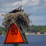
Our thanks to Ally Jenkins for these photos from Mt. Pleasant which is on the east side of Charleston Harbor and home to popular Shem Creek and Patriots Point.
Harborwalk Marina, A SOUTHEAST CRUISERS’ NET SPONSORS, is only a boardwalk away from Georgetown’s Historic District for history, entertainment, great food and shopping.
Open with dockage and fuel. Fuel dock limited due to new construction between now and October 14th. Fuel dock hoping to be ready for regular fall transients.


 us repair or replace your:


Comments from Cruisers (1)
Crept through at 30-minutes after low tide. This entire stretch between the bridges is a very challenging area. We draw 4′. Stayed in center most of the time for 5′-8′, favored the red side opposite the small inlets for double-digit depths. Just south of the high rise bridge, it is shoal on the red side. A sailboat with 5.5′ draft was aground; 50′ sportfisherman was just off center to red side and being pulled off as we approached. Much less stressful to do this stretch at mid-tide or more.