Safety Harbor Marina is in the northwest corner of Old Tampa Bay, north of St. Petersburg and the Howard Franklin Bridge. Our thanks to Larry Pritchett for this alert.
Destroyed ATON G9 Safety Harbor Marina Channel Day mark G9 in the Safety Harbor Marina Channel was destroyed by Storm ETA. Piling is below the water at high tide.
Iota is forecast to be at or near Category 5 hurricane strength when it makes a potentially catastrophic landfall along the coast of northeastern Nicaragua or eastern Honduras Monday night. As of noon Monday, Iota was moving west with winds of 160 mph!
Bahamas Chatter is produced by Explorer Chartbooks, A CRUISERS NET PARTNER, which has long been the standard navigational supplement for enjoyable, informative, and safe cruising through the beautiful Bahamian waters and island visits.
PRIME MINISTER STATEMENT ON EXUMA: INTRODUCED MEASURES TO REDUCE SPREAD OF COVID-19 IN EXUMA Prime Minister, Dr. Hubert Minnis announced the following restrictive measures for Exuma, effective Thursday, November 12:
1. There will be a 24-hour weekend curfew from 6pm Friday until 5am Mondays; businesses will not be allowed to operate during this time;
2. Weekday curfew will be from 6pm to 5am;
3. Commercial activity can continue through the week can continue save for fish frys, bars, and restaurants connected to bars;
4. Funerals are allowed at the graveside only and can have 10 people excluding the officiant; the same number of people is applicable to weddings – there will also be no repasts or receptions;
5. Church services are to be held virtually;6. Schools must be held virtually;
7. Effective tomorrow, domestic travel by air or sea is prohibited into and out of Exuma except in the case of emergency;
8. Anyone travelling from Exuma to any other island, must have a negative RT-PCR COVID-19 test;
9. No public or social gatherings are allowed.Dr. Minnis said these measures do not apply to the Exuma Cays.“I know this is short notice but this is essential after seeing what has happened on several past occasions,” he said.
The prime minister further explained that Exuma has recorded over 30 new cases in the past week.There are 79 positive cases from the island of Exuma – 28 are active, two are hospitalized and there has been one COVID-19 related death, according to Dr. Minnis. The prime minister also announced that the number of health care professionals on the island have been “boosted.”
“The measures on New Providence and Abaco have helped to decrease the spread of the virus on these islands,” the prime minister said earlier. “I assure you that we can continue to make progress if we continue to work together and wear our masks and avoid large gatherings.”He also said all positive cases are in isolation in Eleuthera and all contacts are being monitored.
My wife and I once spent a very pleasant three days in Elizabeth City waiting for the winds to drop allowing the long swing bridge to open. The 2.8-mile bridge across the Alligator River has closed several times in recent years to undergo repairs.
This excellent facility and CRUISERS NET SPONSOR, Southport Marina, was severely damaged by Isaias. See Hurricane Damage. As of November 6, they have resumed selling gasoline and diesel fuel.
We’re excited to announce that Southport Marina has resumed gasoline and diesel sales daily, from 8am-5pm. We are monitoring VHF ch. 16, phone 910-457-9900, and email info@southport-marina.com for any questions or needs. Although it will still be some time before we are able to accommodate overnight dockage for transiting guests, we would love to sell you the best quality marine fuel available while you’re in our town. Thank you for your patience while we continue to rebuild our facility! We’re looking forward to the opportunity to serve our customers again soon!
Our thanks to Phil and Karen for sharing their AGLCA Forum posting with our readers. Many of you will travel through Snows Cut at some point in your cruising lifetime. Mile long Snows Cut departs the coastal Waterway at the entrance to Carolina Beach and intersects Cape Fear River at Mile 296.
Living on the ICW, it’s amazing the number of boats we see every day heading south for the winter. 20, 30 a day perhaps, and we only see some of them. Trawlers, sailboats, large yachts and other craft, a few with looper flags but mostly snowbirds. Most loopers know Snow’s Cut, a few miles south of us, as a tricky waterway that connects the Cape Fear River with the ICW at Carolina Beach.
Though interesting, few good photos of this area exist. It’s difficult to get decent photos as you’re transiting it as you’re busy navigating a narrow, tricky channels with a 2 or 3 knot current. On a recent bike ride over the Snow’s Cut bridge, I took a few photos that might give our captains a good overview of the mile-long man-made cut.
Phil & Karen Barbalace
Helms Port
Wilmington,NC
Gold Loopers
Phil Kent and Karen Barbalace
Phil Kent and Karen Barbalace
Phil Kent and Karen Barbalace
Share:
Comments from Cruisers (1)
Winston Fowler- November 6, 2020 - 3:39 pm
Thanks for the great photos… Pictures are certainly worth a thousand words.
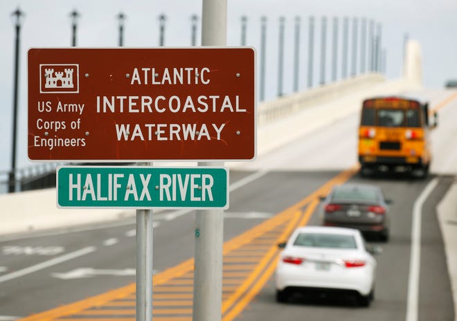
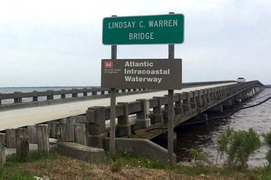
Cruisers Net is proud to be a member of the Atlantic Intracoastal Waterway Association whose lobbying work is crucial to keeping the Waterway navigable. Your membership dollars directly support their vital work. Please join and encourage your boating neighbors to do likewise, regardless of their homeport.
Thursday, November 19, 2020 ~ AIWA Virtual Annual Meeting
The Atlantic Intracoastal Waterway Association Annual Meeting is only three weeks away! Please make plans to join us on Thursday, November 19th for this virtual, collaborative event bringing together our members and stakeholders to connect with the federal and state agencies who have leadership roles in managing the waterway.
This year’s one-day schedule will include sessions led by our industry’s leaders and practitioners covering a series of topics for all waterway users. Shifting to an online virtual platform has its advantages. Even though we all would like to see one another in person, we have the opportunity for increased participation and invite you to share this meeting with your colleagues as this is our annual opportunity to learn more together!
Sessions will include:
State of the Waterway – Management & Maintenance Project Updates from USACE Districts
Updates from our Recreational Boating Community – Boat US, NMMA, MRAA, and others
Beneficial Use of Dredge Materials – New Applications and Directions
Updates to Charting and Mapping efforts along the AIWW from NOAA
Marine Industry and Commercial Operators, Port Authority, Contracting Corporations, and Engineering Design
Registration is available here for only a $75 investment. For those who have attended our meetings in previous years, you’ll know we fill our days with content, but we’ll be sure not to induce screen “burnout!” Also, all sessions will be recorded and made available to participants for one year.
Thank you for your support and active participation, and we look forward to seeing you on November 19!
Sponsorships and group rates remain available. Pleaseemailus for more information.
Don’t forget to Vote! As a non-partisan Association, please don’t be alarmed by the headline of this article. This is a good news story. The AIWW maintenance funding is supported on both sides of the aisle! In this time of uncertainty, we want to affirm that both Democrats and Republicans have a history of supporting waterway infrastructure, and especially our waterway.
Just this year, we had 19 U.S. Representatives from six states come together to ask for AIWW funding for the upcoming fiscal year. While the FY21 appropriation process is currently stalled, maintenance work is continuing and we are excited to see how we might fare once Congress resumes the appropriationa process after the election. As you vote, rest assured that waterway funding isn’t an issue that should effect your choice. Thank you to all of our waterway supporters and champions in Congress.
AIWA The Unified Voice of the Waterway ~ Over 20 Years of Advocacy and Education
The AIWA is a national non-profit organization with the mission of securing funding and support for the maintenance of the Atlantic Intracoastal Waterway. We are the only organization dedicated to ensuring the future of the AIWW and proudly represent all stakeholders of the waterway.
Contact: 5A Market, Beaufort, South Carolina 29906 (843) 379-1151
Bahamas Chatter is produced by Explorer Chartbooks, A CRUISERS NET PARTNER, which has long been the standard navigational supplement for enjoyable, informative, and safe cruising through the beautiful Bahamian waters and island visits.
Bahamas Chatter: “New 9th edition Explorer Chartbook Near Bahamas” plus 1 more
Lewis Offshore Ltd. is announcing the publication of the latest edition in the Explorer stable of chartbooks for the Bahamas: The EXPLORER CHARTBOOK NEAR BAHAMAS 9TH EDITION, which covers Biminis, Berrys, Abacos, Grand Bahamas, Andros and New Providence.
There are 80 charts in the new book. All charts have been updated with variation on compass roses for 2020, plus much new hydrographic data.
This revision includes four brand new charts:
Victory Cays to South Riding Rock
Great Isaac
Mangrove Cay
Carter Bank (larger scale)
Plus Walkers Cay (new drawing of the marina basin)
Also, you will find the most recent Post-Dorian updates on the Abacos and Grand Bahama facilities and services.
All Need-to-Know Info for each community has been updated, including many new cell phone numbers for local businesses. Land lines are still down in many areas hit by Hurricane Dorian.
Tide Tables are updated for 2021-2022.
The Table of Marinas (spreadsheet of current status of marinas) has been revised as well.
Our new Print on Demand protocol will allow us to make more frequent changes in the future.
The Islands of The Bahamas are currently open and looking forward to welcoming visitors from all countries. There are no restrictions on commercial international travel from any jurisdiction, nor are there restrictions on private planes or boats.
It is recommended that all travellers interested in visiting The Bahamas review requirements applicable to each member of their party at Bahamas.com/travelupdatesbefore booking a trip, to determine what steps need to be taken to be granted entry.
Those who booked travel under the former protocols that required an RT PCR test taken seven (7) days prior to travel will be permitted to enter The Bahamas with their Bahamas Health Travel Visa and negative COVID-19 RT-PCR test result, through November 6, 2020 only.
Travellers planning to visit The Bahamas should also be prepared to:
Monitor business websites (airlines, hotels, attractions, etc.) for changes in protocols.
Avoid travelling when they feel ill.
Follow The Bahamas’ “Healthy Traveller Campaign” which includes the ongoing practice of:
Physical distancing measures
Regularly washing hands
Wearing PPE such as face masks when appropriate
Frequently Asked Questions as of 10.31.20
ENTRY REQUIREMENTS: TESTING, INSURANCE AND HEALTH VISA
PRE-TRAVEL TESTING:
Is a COVID-19 RT-PCR Negative (Swab) Test required to enter The Bahamas?
Yes. All persons travelling to The Bahamas must first obtain a negative COVID-19 RT-PCR (swab) test taken no more than five (5) days prior to the date of arrival. The name and address of the lab where the test was performed must be clearly displayed on the test result.
Upon arrival, any person presenting a test older than five (5) days will notbe allowed entry into The Bahamas.
Children age ten (10) and under, as well as pilots and crew of commercial airlines who remain overnight in The Bahamas, are exempt from obtaining the RT-PCR test.
Is this also true for domestic inter-island travellers?
Persons travelling inter-island from New Providence to other islands are required to undergo a RT-PCR test no more than five (5) days prior to travel and produce a negative result.
Persons travelling from a Family Island to New Providence do not need to take a RT-PCR prior to travel; however, will need to undergo a RT-PCR before returning to the Family Island from New Providence.
Where can I get a COVID-19 RT-PCR (swab) test prior to travel?
Contact your health care professional to receive a COVID-19 RT-PCR Test.
Can I use my Antigen or Antibody Test to enter the Country?
No, only a negative RT-PCR (swab) test from a referenced lab will be considered a VALID test to be granted entry into The Bahamas.
COVID HEALTH INSURANCE
Does The Bahamas require separate COVID Health Insurance?
Beginning November 14, all visitors entering The Bahamas will be required to opt into the Health Insurance coverage when applying for their Bahamas Health Visa (More details on Bahamas Health Visa below).
The COVID Health Insurance will cover visitors for the duration of their stay in the event they become ill with COVID-19 while in The Bahamas.
What is included as part of the COVID Health Insurance?
Coverage includes:
Medical expenses incurred on-island due to COVID-19, up to $50,000 (USD)
Trip interruption/delay for necessary quarantine or isolation due to COVID-19, up to $500 (USD) per day/$7,000 (USD) max
Medical evacuation and/or repatriation of remains due to COVID-19, and subject to medical necessity, up to $100,000 (USD)
How much does the COVID Health Insurance cost?
The cost of the required COVID Health Insurance is included in the Bahamas Health Visa and paid in advance of travel.
HEALTH VISA
Who needs to complete an electronic Bahamas Travel Health Visa?
All travellers arriving via commercial flights, as well as by private planes, private boats, yachts or pleasure craft, are required to apply for a Bahamas Travel Health Visa at travel.gov.bs by selecting the International option and completing all required fields.
It is mandatory that a negative COVID-19 RT-PCR test result be uploaded to complete the Health Visa application.
Beginning November 14, travellers must also opt in for Health Insurance coverage.
Name of applicant must exactly match name on applicant’s valid passport.
Households are encouraged to use one email address per family/household to receive responses. Groups may opt to use the same method of collecting responses through one email facility.
Is a Health Visa required for domestic inter-island travellers?
Yes, all those travelling inter-island – both residents and visitors – will be required to complete an electronic Travel Health Visa, via the domestic or international sections, as appropriate.
Is there a fee for the Bahamas Travel Health Visa?
Yes, there is a fee for the Travel Health Visa, which will be dependent on length of stay. Fees include costs for required COVID insurance, as well as the rapid antigen tests for those staying more than four (4) nights, five (5) days. (More details on rapid testing below)
$40 – Visitors staying up to four (4) nights and five (5) days
$40 – Citizens and returning residents
$60 – Visitors staying more than four (4) nights
Free – Children ten (10) years and under
How do I upload my COVID-19 RT-PCR test results to my electronic Travel Health Visa?
Each applicant will be required to upload their individual negative test results. Please ensure each application is submitted with the corresponding test result.
Travellers should upload ALL pages of the test results report, even if there are multiple pages.
Please ensure your test results state clearly the following information:
Name of Applicant (must match the name used on the application form)
Confirmation of a negative result
Type of test – RT- PCR (not an antigen test nor an antibody test)
Date the test was administered (collection date of swab), not to exceed five (5) days prior to the date of arrival
Name and address of the accredited lab where test was performed
For travellers from other countries, labs that have been accredited by the local medical health officials should be used.
Children age ten (10) and under are exempt from requiring a negative COVID-19 RT-PCR test; they will, however, be required to have their application submitted by a parent/guardian.
Proof of age must be uploaded (applicable passport page, birth certificate and/or other government-issued ID).
When will I receive a response about my Bahamas Travel Health Visa?
Health Visa applications take up to 72 hours to process so they should be completed with adequate lead time.
Applicants will receive an automated response within 1 hour of submission indicating the application is being processed. Travellers should not apply again unless they do not receive the automated response within the hour.
An approved Health Visa will receive a green code, and proof of confirmation should be presented at check-in and upon arrival in the destination.
If a Health Visa application is pending, visitor will receive a yellow code which means it requires additional review.
If a Health Visa application is denied, visitor will receive a red color code and will not be permitted entry to The Bahamas.
Travellers shouldnotsubmit more than one application per person travelling (per trip). Do NOT submit multiple applications.
For all questions regarding the Travel Health Visa process, or to check on the status of your application, contact healthvisa@bahamas.com.
Is a print version of my electronic Travel Health Visa required?
Yes, please ensure you print your Approved (Green) Bahamas Travel Health Visa Response issued electronically by the Bahamas Ministry of Tourism and the Bahamas Ministry of Health.
What if I do not complete the electronic Travel Health Visa application form?
Travellers who fail to complete an electronic Travel Health Visa application form or provide a negative COVID-19 RT-PCR Negative (Swab) Test from an accredited lab will be denied entry to The Bahamas and are subject to fines and possible imprisonment.
How long are Health Visas valid for? Will visitors and residents be required to get a new Health Visa each time they travel?
Travel Health Visas are valid for the duration of each individual traveller’s trip. Because a negative COVID-19 RT-PCR test result be uploaded to complete the Health Visa application with test date no more than five (5) days prior to the date of arrival, it is necessary for all travellers to apply for a new Health Visa with each trip.
POTENTIAL FOR CHANGES TO REQUIREMENTS
What is the plan for the tourism industry should The Bahamas see a dramatic rise in cases?
Due to fluidity of the COVID-19 situation, both in The Bahamas and worldwide, protocols are subject to change.
The Bahamas is an archipelago with more than 700 islands and cays, spread over 100,000 square miles, which means conditions and instances of the virus can be different on each of the 16 islands available to welcome visitors.
Travellers should check the status of their island destination before travelling by visiting Bahamas.com/travelupdates.
Will persons wishing to travel from an island with a higher number of cases be permitted to enter an island with a low number of cases?
All travellers must follow appropriate testing, visa and insurance protocols to be granted entry to any island.
Per the current Emergency Orders, there are restrictions for persons travelling from an island with mandatory lockdown orders in place.
A person should not be permitted to travel from an island for which notice has been given of an impending lockdown order or for which additional measures and restrictions have been imposed.
Travellers should check the status of their island destination before travelling, by visiting Bahamas.com/travelupdates.
ARRIVAL PROCESS: TESTING PROCEDURES (AS OF NOVEMBER 1)
INSURANCE, CONTACT TRACING AND RAPID ANTIBODY TESTS (NOV 14 AND LATER)
Do I need to quarantine upon arrival in The Bahamas?
Beginning November 1, The Islands of The Bahamas will have streamlined entry protocols that will remove the Vacation-in-Place requirement and enable visitors to better and more seamlessly enjoy The Bahamas vacation experience.
What are the updated travel and entry protocols?
Specifics of the new protocols, which go into effect on November 1, are as follows:
·
Prior to Travel:
o COVID-19 RT-PCR Test: All persons travelling to The Bahamas must obtain a negative COVID-19 RT-PCR (swab) test taken no more thanfive (5) daysprior to the date of arrival. The name and address of the lab, where the test was performed, must be clearly displayed on the test result.
· Children age ten (10) and under, as well as pilots and crew of commercial airlines, who remain overnight in The Bahamas, are exempt from obtaining the RT-PCR test.
o Travel Health Visa: Once in possession of a negative COVID-19 RT-PCR test, all travellers will then be required to apply for a Bahamas Travel Health Visa at travel.gov.bs (click on the International Tab) where the required test must be uploaded.
· Beginning November 14, all visitors will be required to opt in to mandatory COVID-19 health insurance when applying for their Health Visa.
o The insurance will cover travellers for the duration of their stay in The Bahamas.
· A fee for the visa will be dependent on length of stay (ranging from $40-60 USD) and includes expenses for COVID Health Insurance and rapid antigen testing as appropriate.
o Children age ten (10) and under will be covered at no extra charge and are exempt from taking a rapid antigen test. (more on visa pricing above)
· Upon Arrival
o Rapid COVID-19 Antigen Testing (if applicable): all persons who are staying in The Bahamas longer than four (4) nights and five (5) days will be required to take a rapid COVID-19 antigen test.
· All visitors departing on or before five days will not be required to obtain this test.
· The rapid tests are easy, quick and will yield results in 60 minutes or less with results being provided electronically via SMS text message and email.
· Many hotel properties will provide relevant information on testing arrangements, while others will facilitate the required rapid test for their guests.
· All persons on yachts and other pleasure craft will be able to make arrangements for their required rapid tests at the port of entry or via the relevant website.
· All other visitors, returning residents and citizens – those staying or returning to private residences or rental properties such as Airbnb – will be able to make arrangements for their required rapid tests at the port of entry or via the relevant website.
o Any visitor who exhibits COVID symptoms upon arrival or at any time during their stay will be required to take a Rapid Antigen Test and receive a negative result before being permitted to continue with their vacation.
· If a person tests positive they will be required to follow up with a COVID-19 RT-PCR swab test.
Who has to take a rapid antigen test?
All persons who are staying in The Bahamas longer than four (4) nights and five (5) days will be required to take a rapid COVID-19 antigen test.
Children age ten (10) and under are exempt from taking rapid antigen tests.
Where can I make arrangements to take a rapid test if I’m staying longer than four (4) nights and five (5) days?
Many hotel properties will provide relevant information on testing arrangements, while others will facilitate the required rapid test for their guests.
All persons on yachts and other pleasure craft will be able to make arrangements for their required rapid tests at the port of entry or via the relevant website.
All other visitors, returning residents and citizens – those staying or returning to private residences or rental properties such as Airbnb – will be able to make arrangements for their required rapid tests at the port of entry or via the relevant website.
How much does the rapid test cost?
The cost of the rapid antigen test is included in the Bahamas Health Visa and paid in advance of travel.
How long until rapid test results are ready?
The rapid tests are easy, quick and will yield results in 60 minutes or less with results being provided electronically by SMS text message and email.
What if I have a positive result on my rapid antigen test?
All positive test results are reported to the Ministry of Health who will conduct additional clinical screening per their own mandates.
If an on-island rapid test returns positive, that person will be required to follow up with a COVID-19 RT-PCR swab test.
With a positive result, the traveller may either:
Leave the destination via approved medical transportation (using either insurance or personal resources)
Quarantine at their booked place of stay
There is no mandatory government facility where visitors will be sent.
How will the Ministry combat the risk of asymptomatic persons?
The Ministry is implementing these new protocols to mitigate the risk by ensuring multiple testing touch points which include testing prior to arrival as well as tracking, monitoring and an additional test 5 days upon arrival.
ON ISLAND EXPERIENCE: TOURISM PROTOCOLS
Restaurants, Businesses and Attractions
Are on-island businesses, restaurants and attractions operating normally?
Notwithstanding any public health restrictions that may be implemented from time to time, all travellers abiding by these new protocols will be permitted to move about and explore the beauty and vibrant culture of The Bahamas beyond the confines of their hotel or other accommodations.
Conditions and instances of the virus can be different on each of the 16 islands available to welcome visitors.
The current situation in Grand Bahama Island,Nassau & Paradise Island and Abaco requires increased restrictions.
Travellers should check the status of their island destination before travelling by visiting Bahamas.com/travelupdates.
What are the requirements for travellers who are staying on an island that has curfew or lockdown measures in place?
Visitors will be required to adhere to all island restrictions, including curfew and lockdown measures, applicable to the island where they are staying .
Hotel guests must stay within hotel grounds for the duration of the lockdown or curfew period, however, are permitted to move about the property and access all available amenities.
What is the status of beaches?
Beaches are operating normally, with a few exceptions:
New Providence and Abaco are abiding by weekend lockdown orders, and so beaches and parks on these islands will be closed for the weekend, from 8 p.m. on Friday until 5 a.m. Monday (excluding Green Turtle Cay, Grand Cay, Man-O-War Cay and Elbow Cay).
When do I have to wear a face mask?
All travellers must wear a face mask in any situation where it is necessary to enforce physical distancing guidelines, such as:
When entering and transiting air and sea terminals
During security and customs screenings
At baggage claim
When checking in and boarding aircraft, vessel or other form of transportation
When travelling in a taxi
When standing in lines
When entering any establishment
While checking into a hotel
Do I have to wear a face mask at the beach?
Face masks are not mandatory on the beach but must be worn in all other public spaces that surround the beach and while entering and exiting the beach.
Social distancing is mandatory on the beach
What if I don’t wear a face mask?
All persons, including Bahamian residents and visitors are subject to a new fine of $200 or a penalty of one month imprisonment, or both, if they are found not wearing face masks in areas where it is required.
What is the “Clean & Pristine”Certification?
A Certification Agency has been established – representing a collaboration between the Ministry of Tourism & Aviation, Ministry of Health, and other regulatory agencies – to enforce a “Clean & Pristine” Certification Program.
All tourism related, customer-facing entities in The Bahamas must verify they have in place and are adhering to the Government approved health and safety guidelines to receive Clean & Pristine certification. Adequate signage outlining policies will be clearly displayed at all locations, helping to guide staff and visitors.
What are the safety measures in place for front line staff and those that work in the tourism industry at all points of entry?
All tourism related, customer-facing entities in The Bahamas must verify they have in place and are adhering to the Government approved health and safety guidelines outlined by the Clean & Pristine certification (more on Clean & Pristine certification below).
All visitors, staff and residents are required to practice social distancing and adhere to mandatory mask wearing in public places.
What does this mean for Taxis and Independent Cars?
Passengers to wear masks at all times throughout journey
Passengers should not ride in front seat
Vehicles to reduce the maximum number of people by 50%:
Sedans = 2 persons or a family travelling together
SUVs = 4 persons
What does this mean for Hotels, Resorts and Vacation Rentals?
Extensive health and safety protocols enforced; details will be clearly stated by specific institutions
Enhanced cleaning for guest rooms
Hand sanitizer and disinfectant readily available
Employee health monitoring
Limiting guests in elevators
What does this mean for Restaurants, Food & Beverage Services?
Buffets discontinued until further notice
All meals must be served at individual tables where social distance is adhered to, or meals must be prepackaged
Disposable menus offered or displayed on monitors or chalkboards
Seating to accommodate for physical distancing of guests; limiting number of guests
What does this mean for Excursions, Tours, Local Attractions and Shopping?
Maximum number of guests and duration of guest visit limited
Guests to use personal gear (such as snorkeling gear) as appropriate
Guests will not be allowed to touch products unless purchasing
Cashless sales encouraged
Beach chairs to allow 6ft. physical distancing between family units; gatherings limited to 5 persons
Cleaning timetable / checklist to be maintained
What does this mean for Vessel and Ferry Operations?
Maximum passengers onboard reduced by 50%
Passenger seating assigned to ensure proper distancing
Vessel sanitizing:
Before any passenger embarks
Between all passenger exchanges
On high touch surfaces consistently during passage


Be the first to comment!